#NDwx #SDwx #MNwx #WIwx Cooler This Weekend, Heating Up Next Week. E.
Key Points: June 29, 2017
Synopsis: Good Thursday morning! We are tracking a cluster of storms across portions of the Dakotas this morning and this will push eastward sparking a strong storm threat this afternoon south and east. This system will also usher in some cooler air for the weekend, but a warm up is expected next week as an upper level ridge develops across the Plains. Drier risks also exist especially across the Dakotas which is not good news for the developing drought. Have a blessed day!
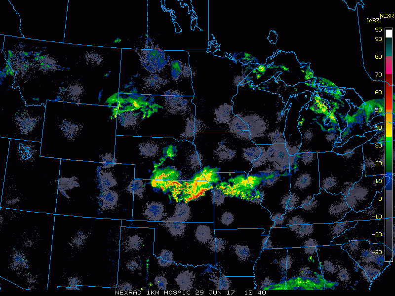
Radar shows the showers across the Dakotas.
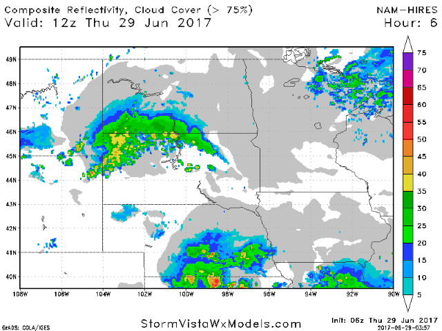
Projected radar shows the evolution of showers and storms through tonight.
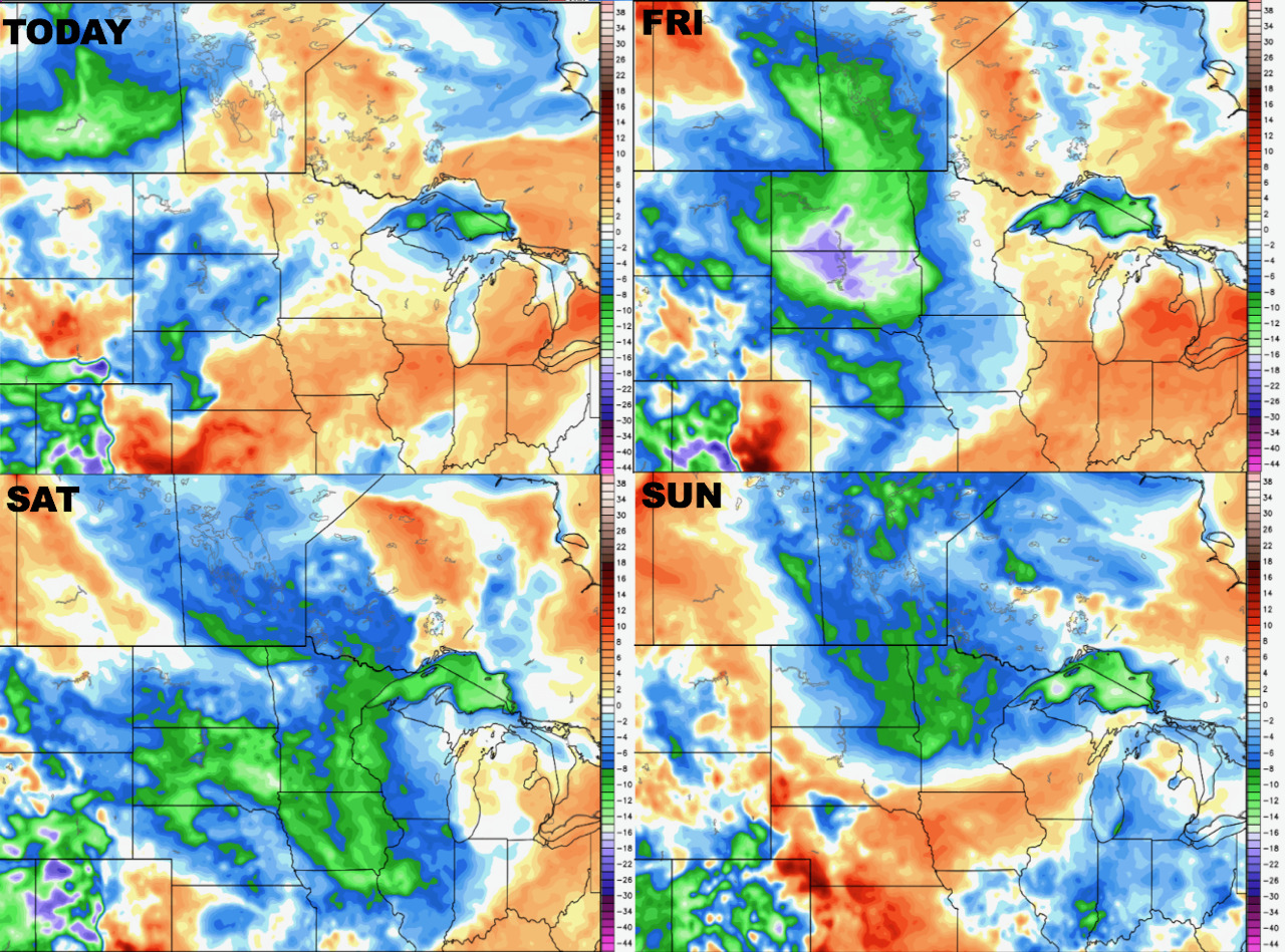
Drier air looks to come into the region behind this system for the weekend, shown well by the dew point anomalies.
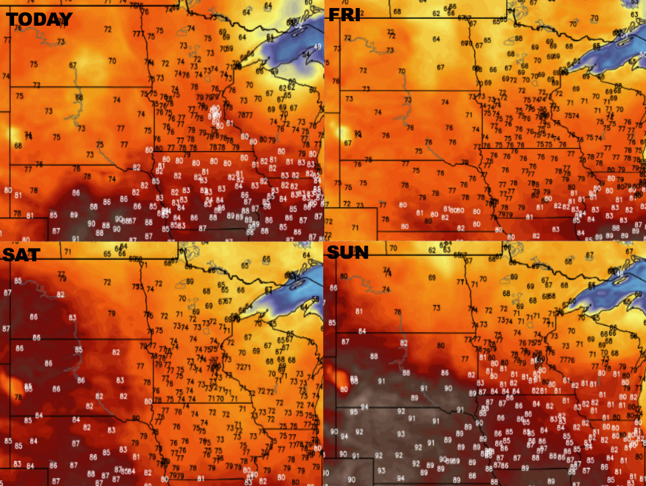
Temperatures over the next 4 days are shown below.
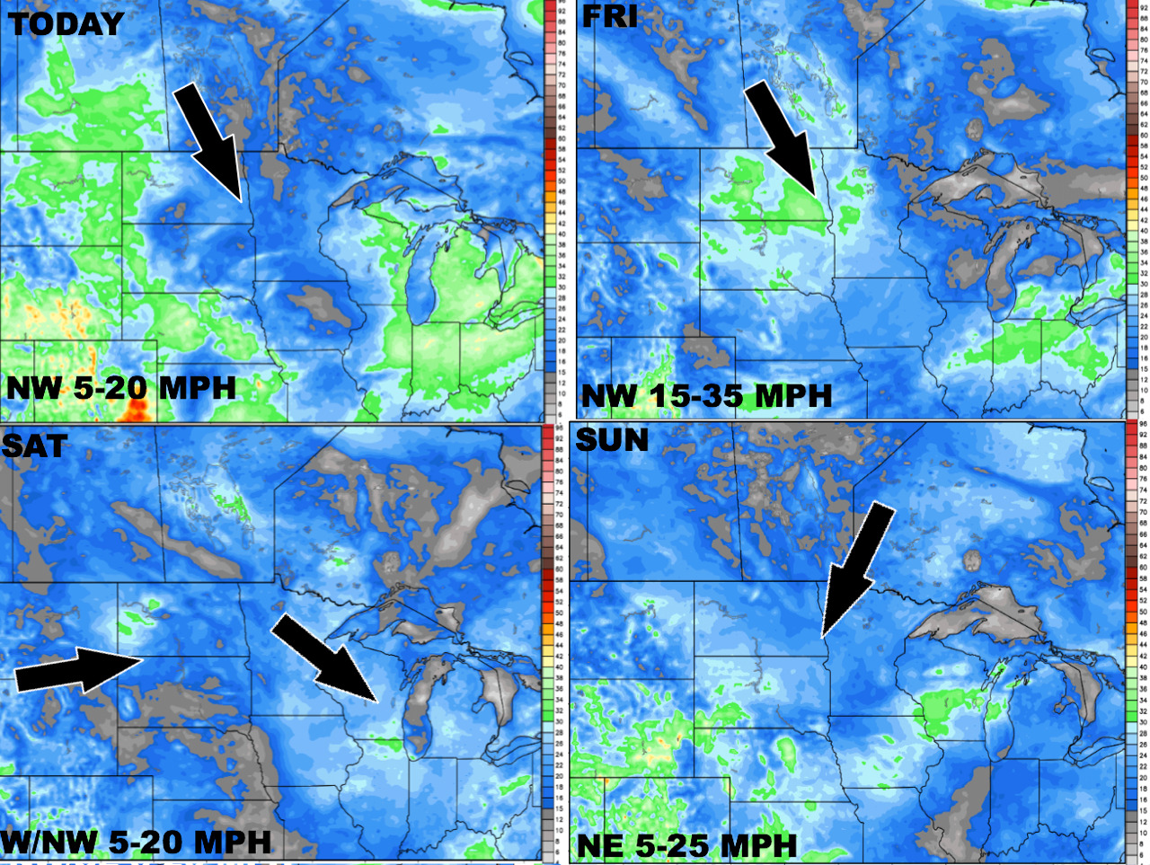
Winds over the next 4 days.
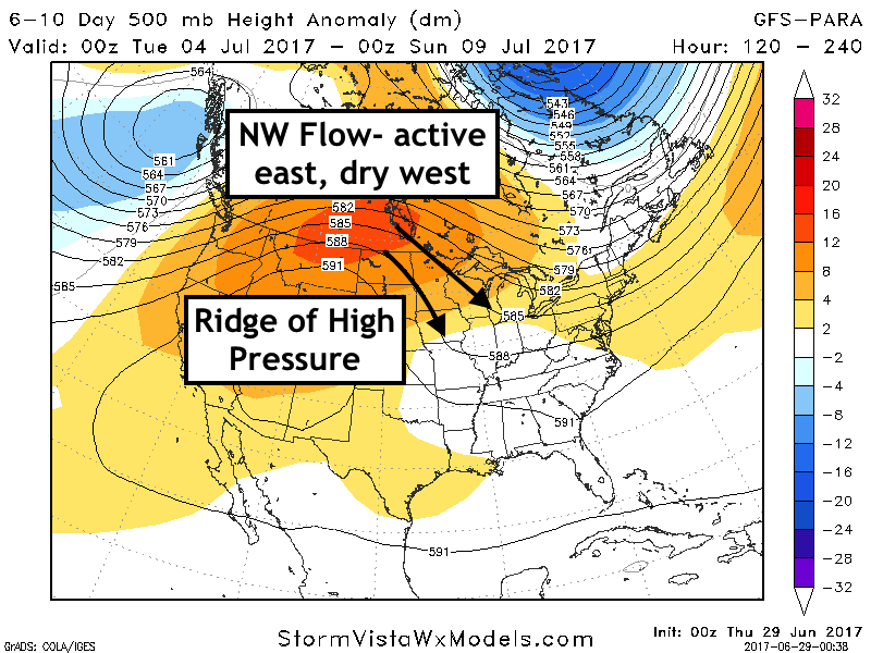
The 6-10 day pattern will feature a large ridge in the western Plains, which will help force drier risks west, and northwest flow east.
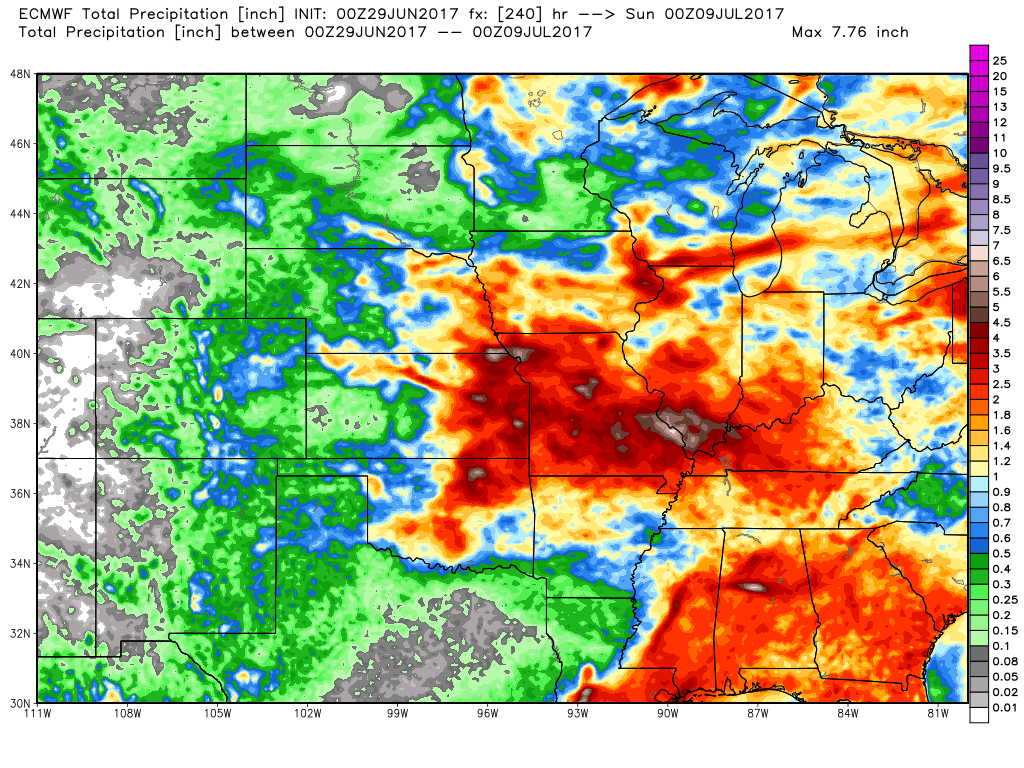
10 day precipitation from the European:
Confidence and Risk:
- Above average confidence in cooler than normal conditions this weekend, but warmer conditions returning next week.
- Above average confidence in drier risks developing across the Dakotas thanks to a developing ridge.
Today’s Video (6 minutes):