#NDwx #SDwx #MNwx #WIwx Cooler Conditions Coming, More Rain Saturday? E.
Key Points: June 14th, 2017
Synopsis: Good Wednesday morning! We are tracking an area of rain across North Dakota and another complex of storms across the central Plains. As a weak frontal boundary moves through, showers and storms will continue in eastern portions of the forecast area with some severe weather possible. Spotty storm activity is expected late this week before a more substantial threat for rain and storms Saturday into Saturday night. Cooler conditions are expected along with spotty rain chances into next week. Have a blessed day!
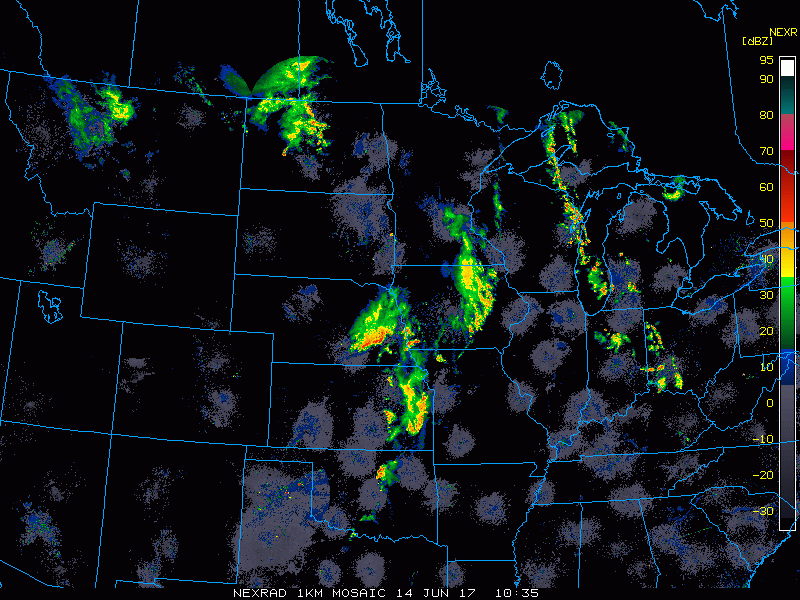
- Current radar shows areas of rain across the region.
- Additional storms will fire this afternoon, leading to a threat for severe weather across Minnesota and Wisconsin.
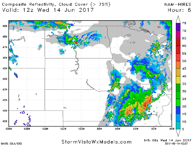
- The SPC has outlined this region for severe weather.

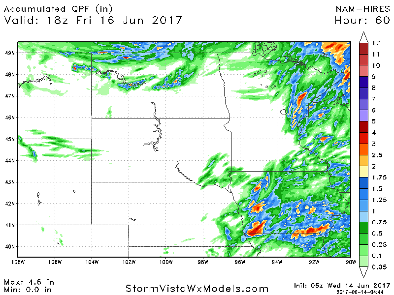
- Total rainfall through Friday afternoon will be heaviest east, where 2-4″ may occur in the most persistent storms.
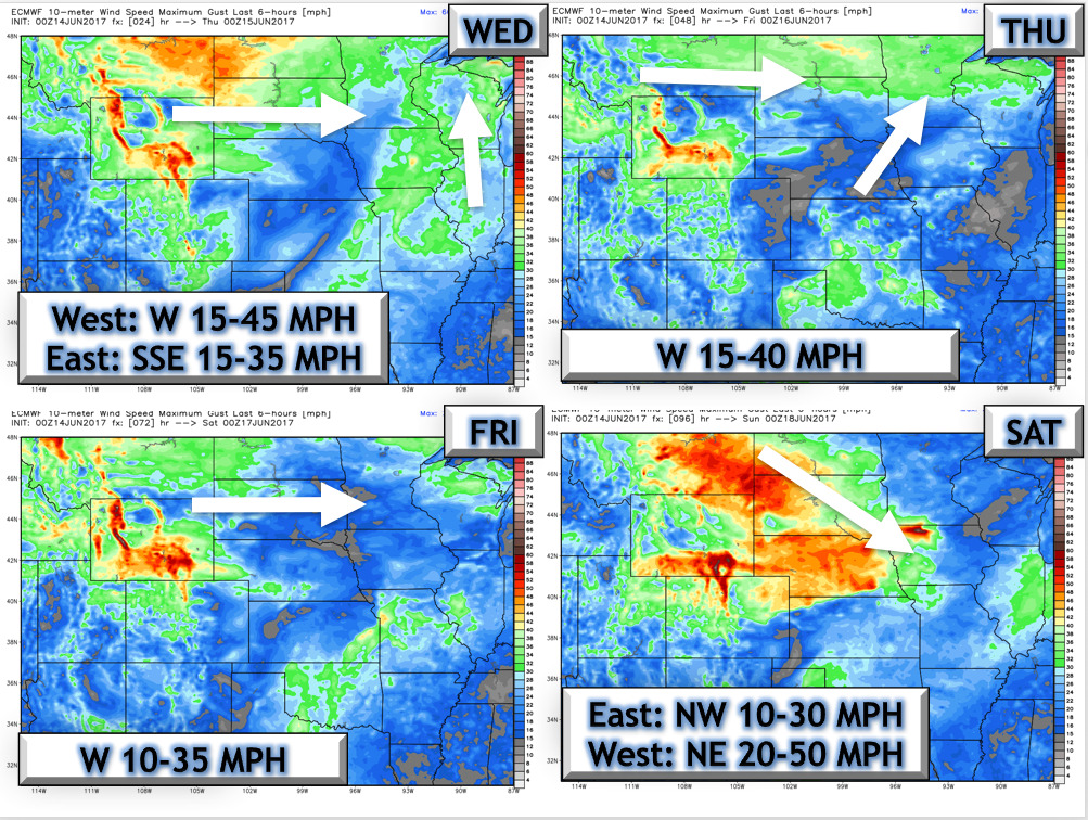
- Wind forecast next 4 days.
- A better chance for rainfall comes Saturday as shown below.

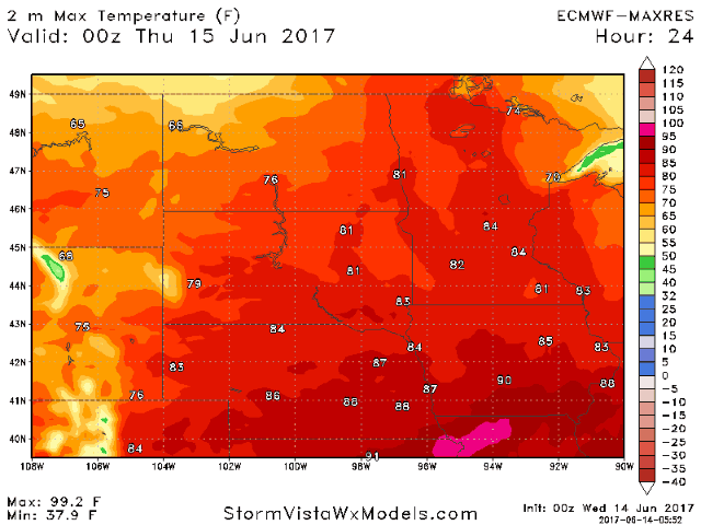
- Temperatures through the week look seasonable to slightly below normal as whole. Here’s a look day by day.
- Total rainfall through day 10 will be heavily weighted on where the Saturday storm tracks, so stay tuned!

Confidence and Risks:
- Above average confidence in severe risk this afternoon east.
- Above average confidence in a cooling trend into early next week.
- Increasing confidence in a widespread rainfall possible Saturday into Saturday night – stay tuned for exact track.
Today’s Video ( 7 minutes):