#NDwx #SDwx #MNwx #WIwx Cool Through the Weekend, Drier and Warmer Trends Into June? E.
Key Points: May 25, 2017
Synopsis: Good Thursday morning! We are tracking an area of showers across the Dakotas, otherwise mainly dry conditions are ongoing this morning. A few spotty showers are expected through the day with variable cloud cover and temperatures mainly in the 60s and 70s. Additional spotty activity is expected across Minnesota and Wisconsin Friday with another system expected to impact southern South Dakota Friday night into Saturday. Northern areas likely stay dry these days, but a few spotty showers and storms are possible Sunday into early next week thanks to a cool pool of air aloft. Drier and warmer times still look to be in the cards later next week and beyond. Have a blessed day!
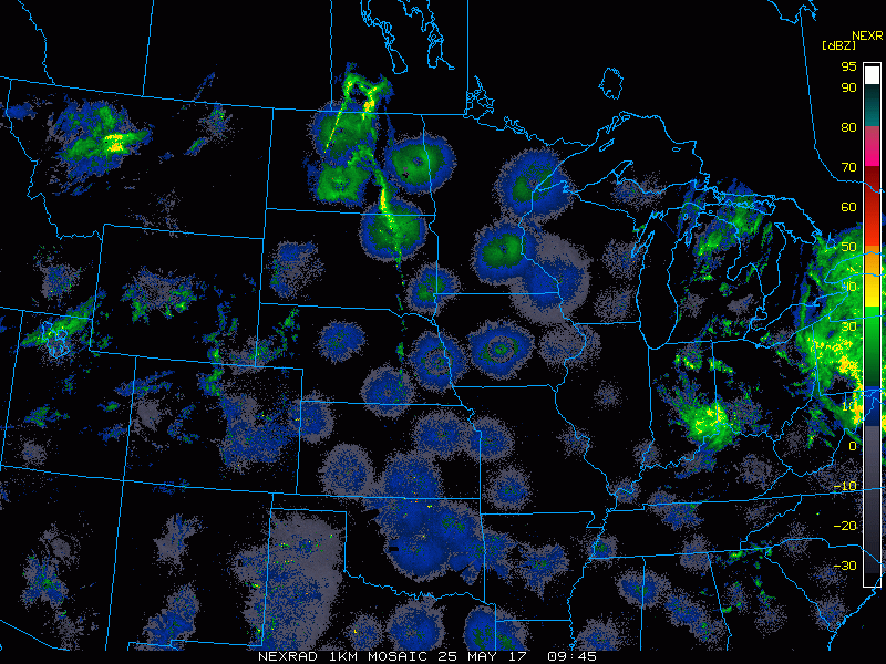
- Current radar shows the spotty activity in the Dakotas this morning.
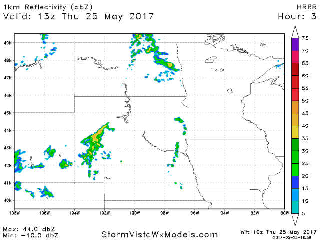
- Forecast radar shows spotty activity through the day today into this evening, especially south and east.
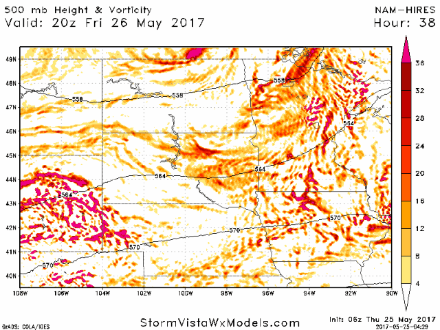
- Another disturbance looks to move into southern portions of the region Saturday morning with some showers in southern South Dakota.
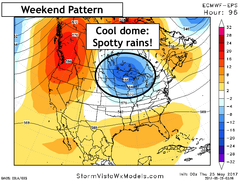
- Once this system passes, a cooler dome of air will set up shop overhead, leading to spotty rain chances through Memorial Day.
- The pattern toward the end of next week does look to shift warmer and drier thanks to an approaching upper ridge of high pressure.
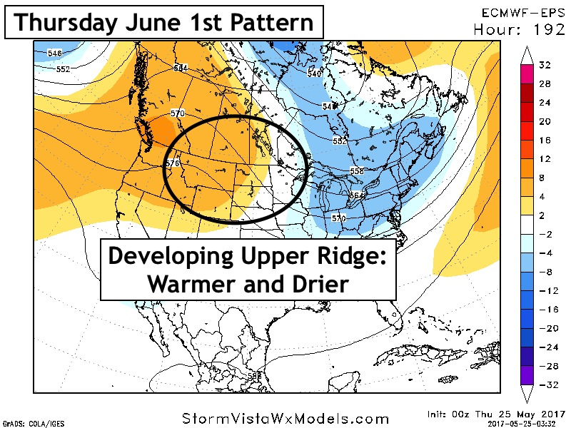
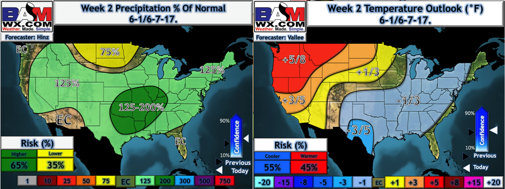
- Into the first week of June, we think this regime sticks around with above normal temperatures (especially west) and below normal precipitation chances.
Confidence and Risks:
- Above normal confidence in spotty rain chances through the weekend and into early next week along with cooler than normal temperatures.
- Increasing confidence in warmer conditions developing later next week and continuing into week 2.
- Increasing confidence in drier conditions in week 2 thanks to a developing upper ridge of high pressure.
Today’s Video (6 minutes):