Key Points – Monday, April 24, 2017:
Synopsis: Showers moving across the Dakotas this morning, we discuss in today’s video the quiet weather pattern ahead much of this week, yet our concern for the consistent colder than normal temps expected as we head into May. We also discuss our chances for some wintry precipitation mixing in early to mid-week as well as our next rain chance later next weekend that also has some wintry concerns. Have a blessed week.
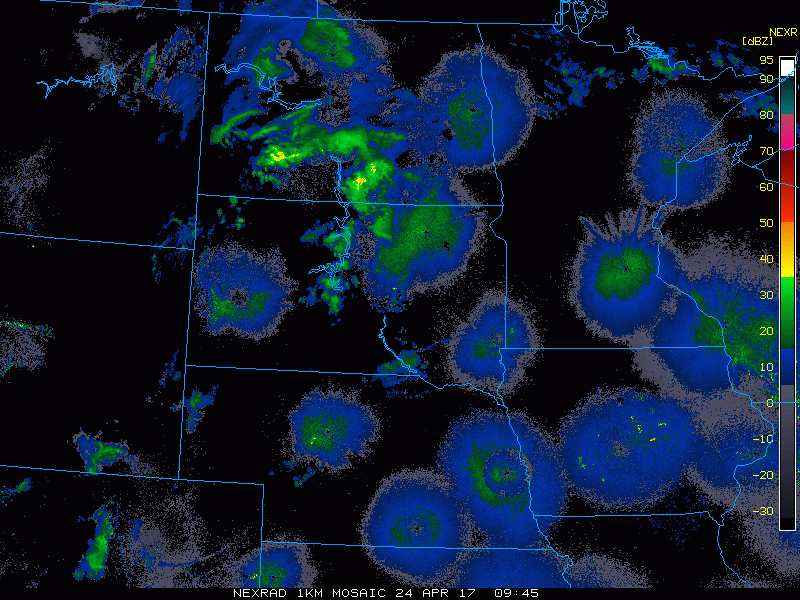
- Current Radar…showers continue across the Dakotas and will head east into Minnesota throughout the day.
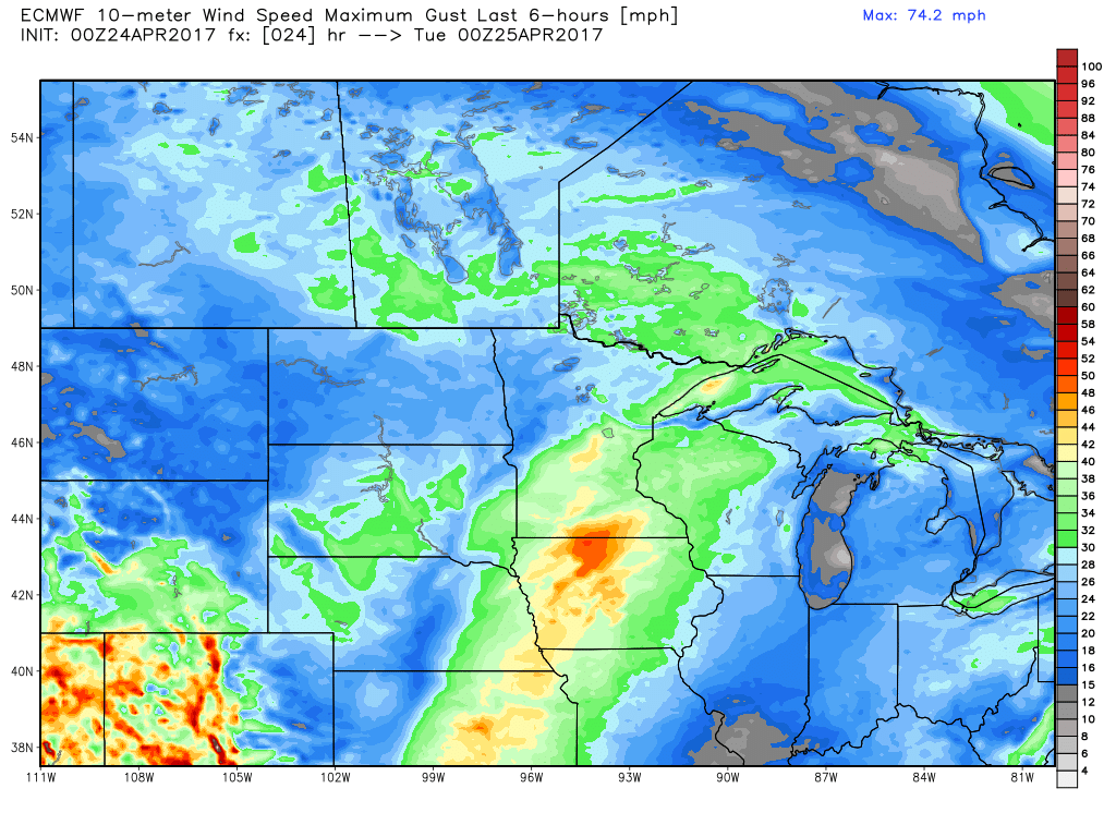
- Gust winds possible across southern Minnesota tonight out of the south to southeast gusting at times upwards of 40mph+.
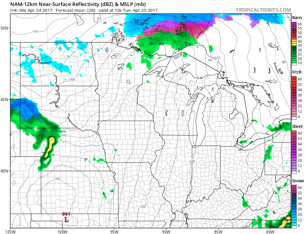
- Simulated radar showers Tuesday into Wednesday across South Dakota moving into Minnesota, maybe some snow mixing in across western Sorth Dakota and Minnesota as well into Wednesday into Thursday morning.
- It’s not really until late weekend into early Monday where our next more widespread bout of inclement weather settles in across Zone 9. We have concern for some potential accumulating snow mixing in as well as discussed in the video.
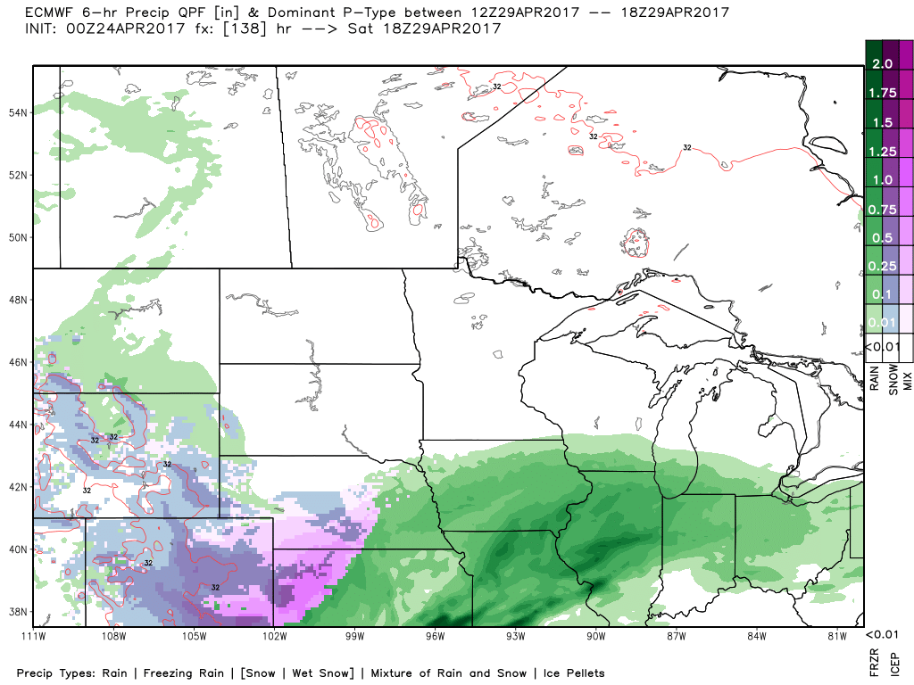
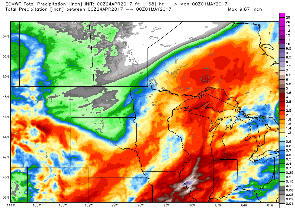
- Total rainfall over the next 7 days…1-2″ expected across Minnesota/Wisconsin into the southern half of South Dakota. North Dakota stays relatively dry over the next week.
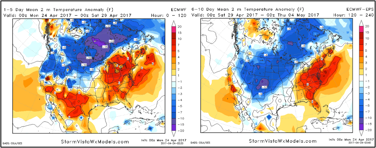
- A look at temps from normal over the next 10 days: we have an elevated risk for frost, even some freezes across the northern Plains as we get into early May…something that’s concerned as we won’t be able to evaporate much rainfall nor raise the soil temps much during this timeframe.
Confidence and Risk:
- Above Average confidence scattered showers continue across the Dakotas into Minnesota today.
- Average risk for strong winds out of the south to southeast across southern Minnesota upwards of 40mph+ at times later tonight.
- Average confidence additional scattered rain showers possible later Tuesday into Wednesday, exiting easter Thursday morning across Zone 9.
- Average risk for some wintry precipitation mixing in across South Dakota into Minnesota during this timeframe as well.
- Above average confidence temps remain overall below normal as we get into May across Zone 9.
Today’s video (6 min):