Key Points – Wednesday, June 28, 2017:
Synopsis: Good Wednesday morning! In today’s video we discuss the risks for heavy rainfall pushing east across Minnesota into Wisconsin today into tonight, as well as the additional rains forecasted as we move into late week and beyond. We also touch on the warm up forecasted to move into the northern Plains pushing more into early July, the rainfall is a little tricky because it’s all dependent on where that northwest flow sets up shop. Have a blessed day, if you have any questions please don’t hesitate to reach out!
Current Radar:
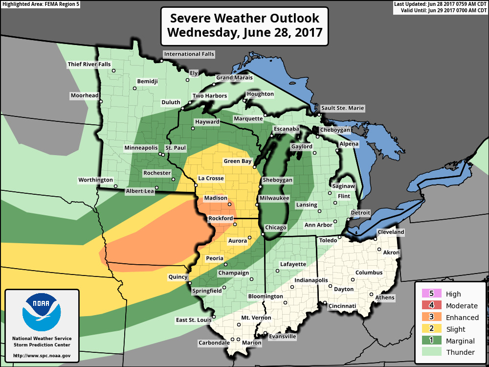
Looking at guidance for simulated radar today from the northern Plains shows the storms moving east across Minnesota into Wisconsin, some being strong to heavy at times as well. Also can’t rule out a scattered shower/storm threat across parts of western South and North Dakota later this evening ~40/50%.
Can’t rule out some stronger storms across parts of southeastern Minnesota to Wisconsin today into tonight:
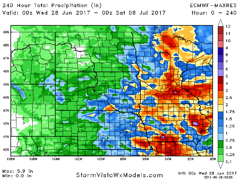
Rainfall guidance from the European model over the next 10 days shows the focus of the heavier rains across eastern Dakotas, Minnesota into Wisconsin with 1-3″, isolated higher amounts certainly on the table here. Further west the threats will be more scattered, some locations may see 0.5-1.0″ while others unfortunately stay dry.
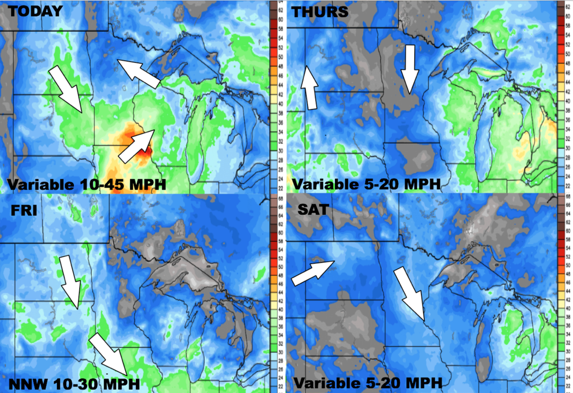
Wind forecast over the next 4 days:
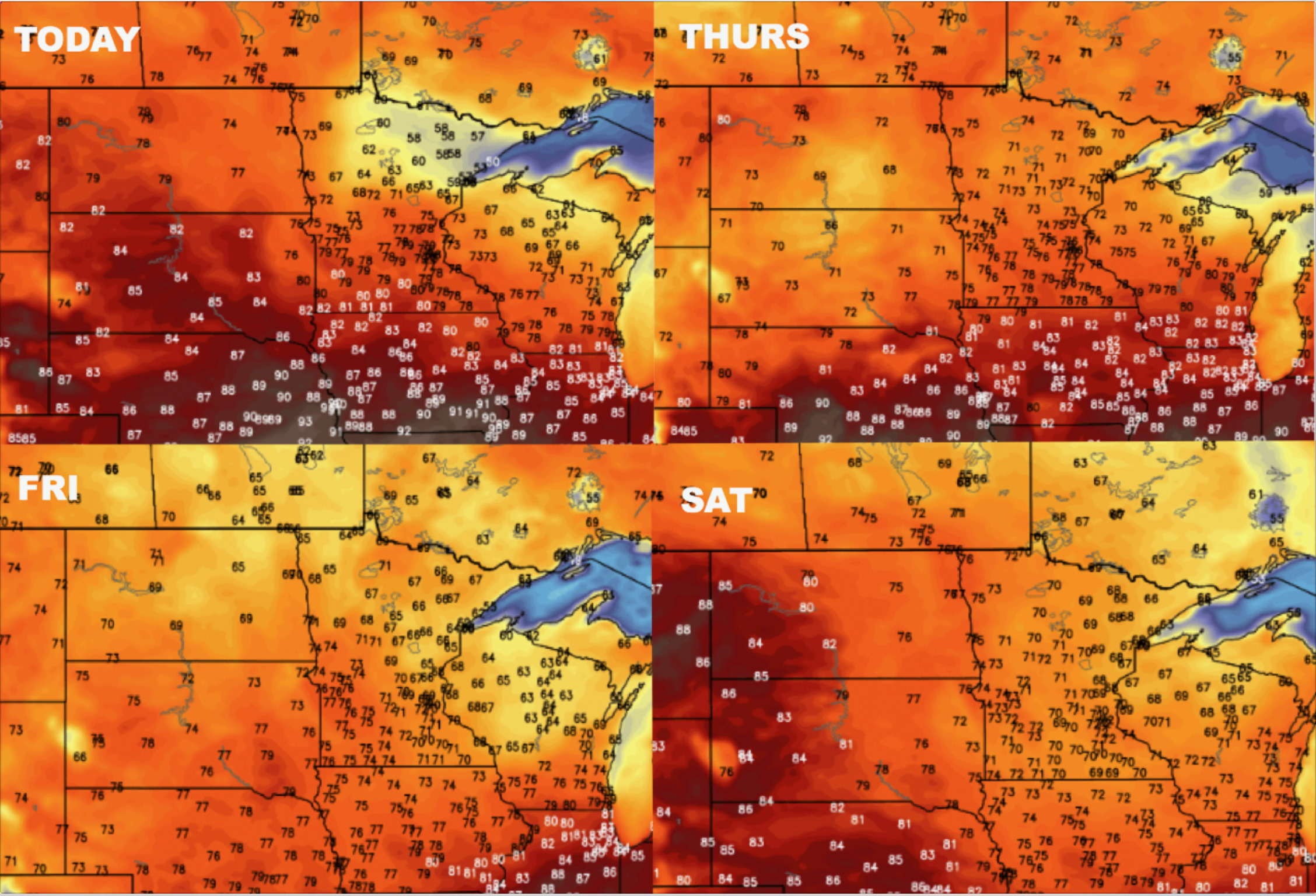
Here’s a brief glance at temperatures as we head into the weekend:
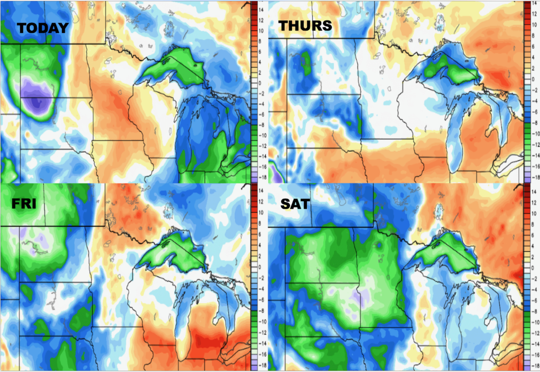
Dew points from normal here as well heading into the weekend:
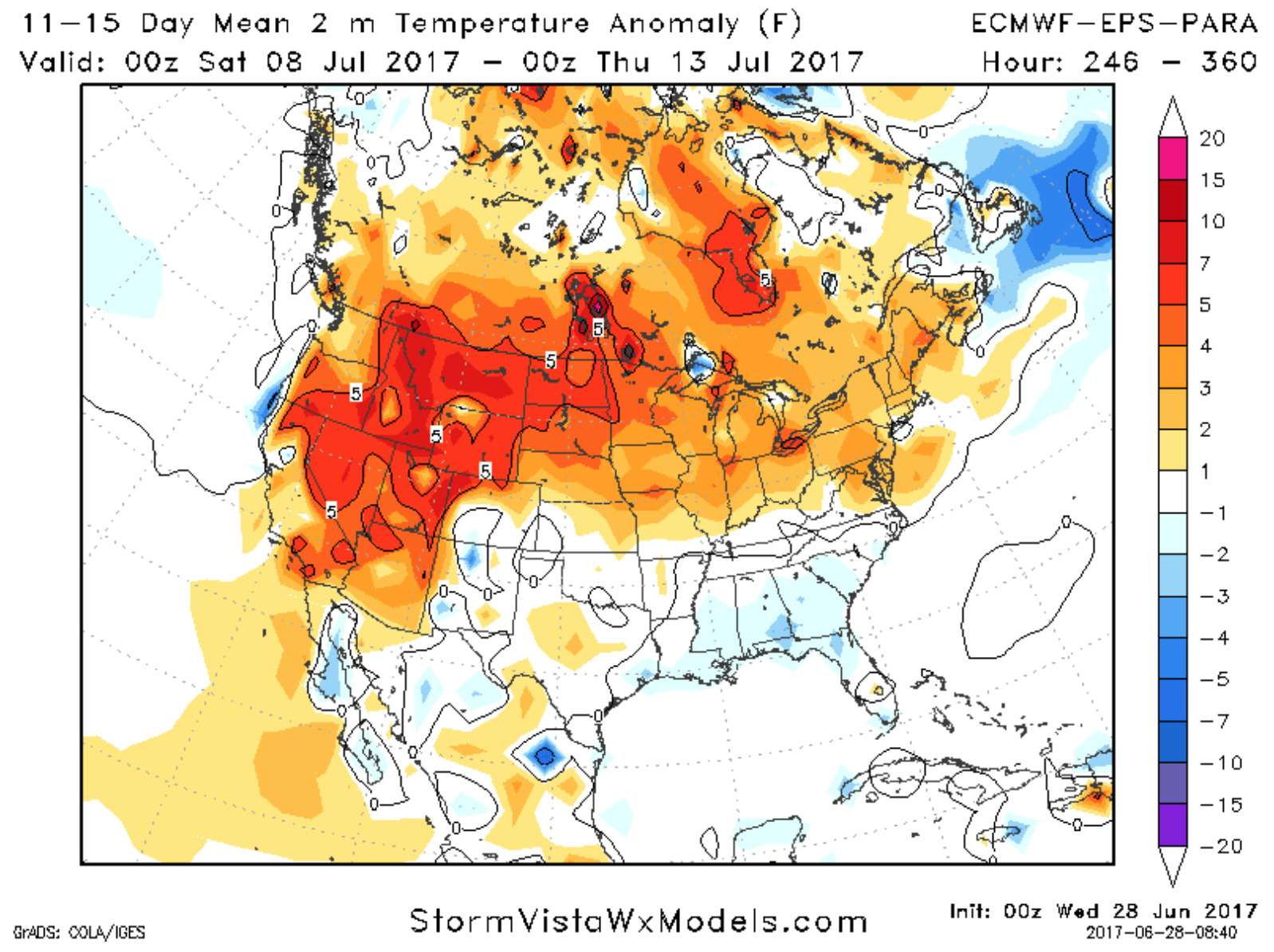
Data is also showing fairly warm anomalies moving in here in the 11-15 day (late next week into the weekend) in the Northern Plains, which fits our timing nearly to a “T”.
Confidence:
- Above average confidence additional showers/storms move east across Minnesota into Wisconsin today into tonight, some being strong with heavy rainfall.
- Average confidence in additional scattered showers/storms working across South Dakota and southern North Dakota Thursday morning heading east throughout the day before weakening.
- Increasing confidence of above normal warmth working on early July across the northern Plains.
Video (7 min):