Key Points – Thursday, August 3, 2017:
Synopsis: Good Thursday morning! Today we discuss the beneficial rainfall that has fallen over the past 24 hours across the northern Plains, and the continued storm threats as we get into the weekend as well! Temperatures continue to stay cooler and moderated as well getting deeper into August, which should help keep what precipitation that does fall in the ground longer. If you have any questions please let us know, have a blessed day!
Today’s video (7 min):
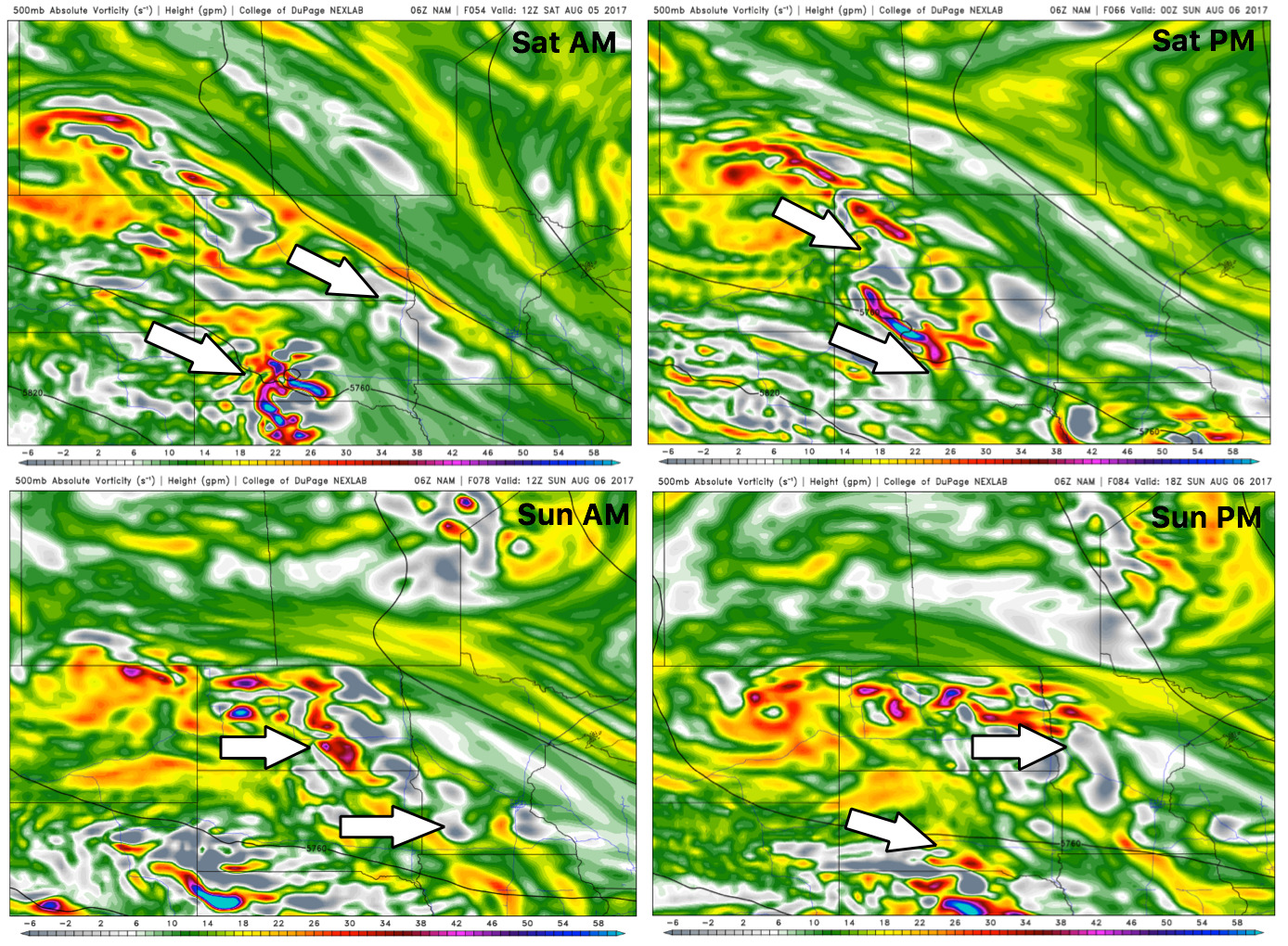
We reference this in the video, but here’s a good look at upper-level energy to help us see the storm motion as we head into the weekend below. Some of these storms may be strong to severe with localized heavy rainfall at times.
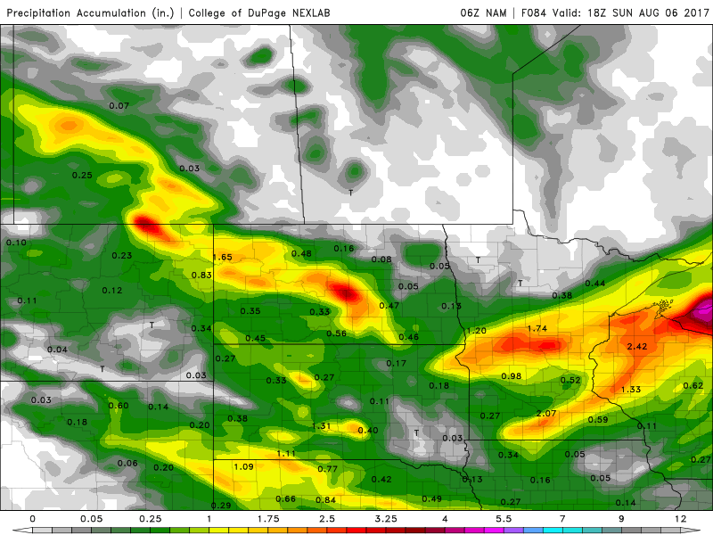
Rainfall guidance over the next 4 days shows the potential for 1-3″ (isolated higher amounts on the table here as well in some spots).
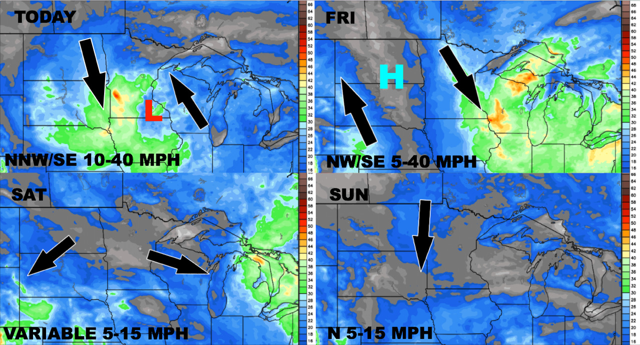
Wind forecast next 4 days:
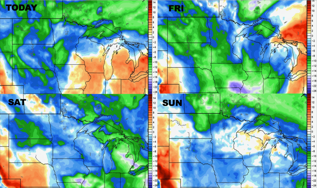
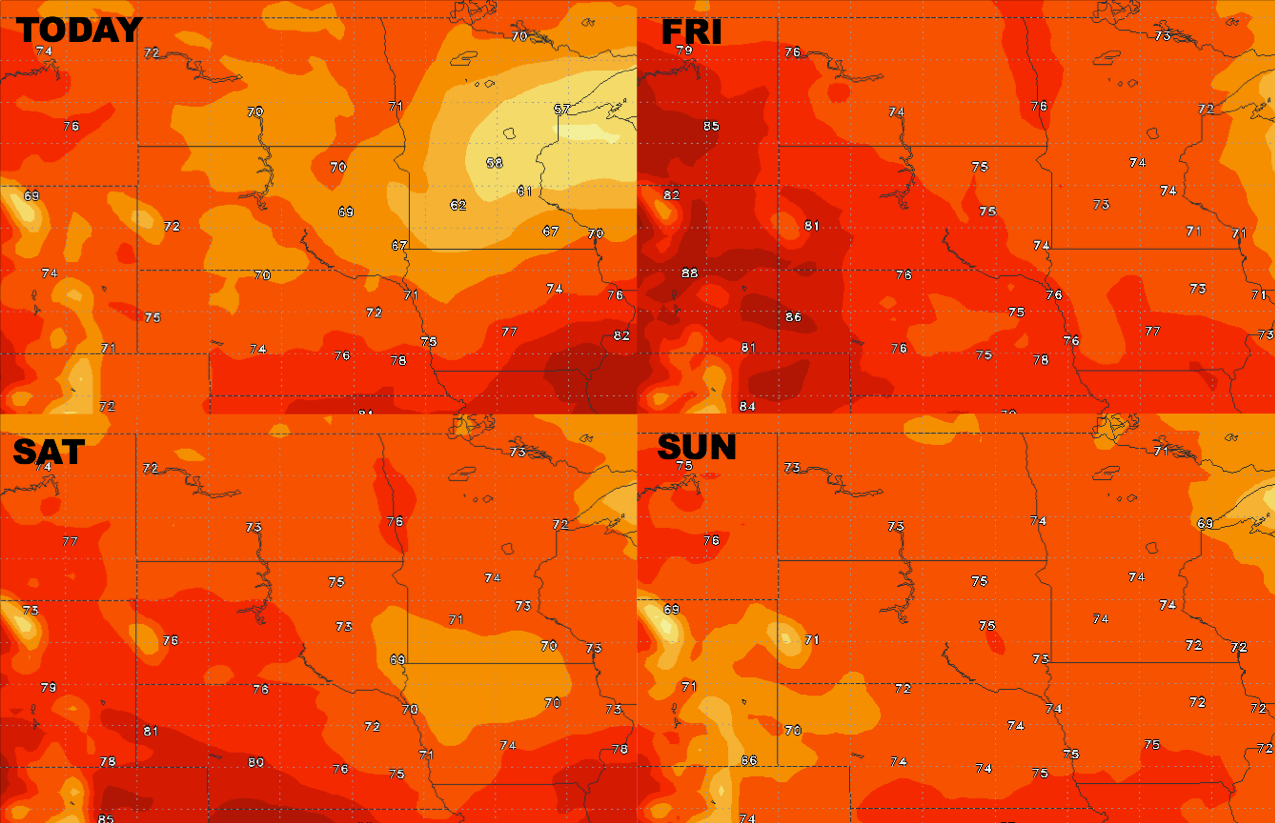
High temperature guidance through the weekend, we remain cooler with many spots staying in the 70s:
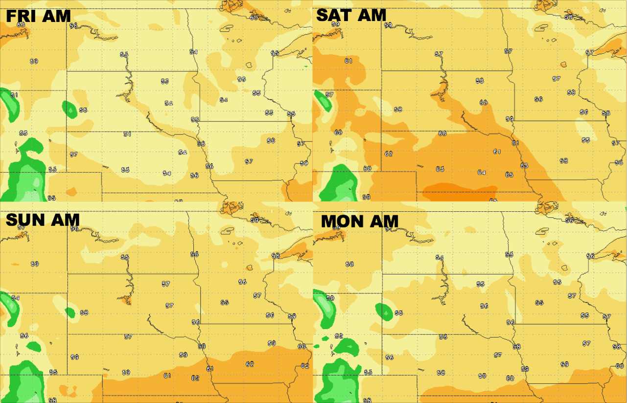
Overnight low guidance into early next week…many falling into the 50s even 40s at times:
Dew points from normal guidance: