Starting today forecasts will be issued by state. This will allow for us to focus on your area with more detail than in the past. We will be making the changes in the data base over next few weeks so be on the look out for communication from us on that.
Video forecast (6 min):
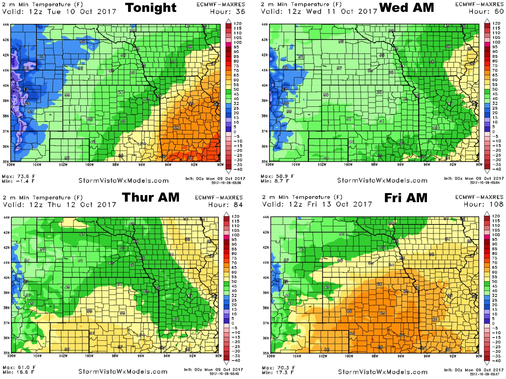
Synopsis: A frontal system will work across the state today and tonight bringing a wide range in weather from severe weather concerns and warmth in southeast Kansas, to very cool temperatures and more stratiform showers later today in western Kansas. The video covers the details on where the highest concern is for severe storms, as well as timing. This system will move off to the east on Tuesday with gradual clearing from west to east. More frost/freeze concerns on Wednesday morning, then expecting temperatures to warm again late week ahead of a front this weekend.
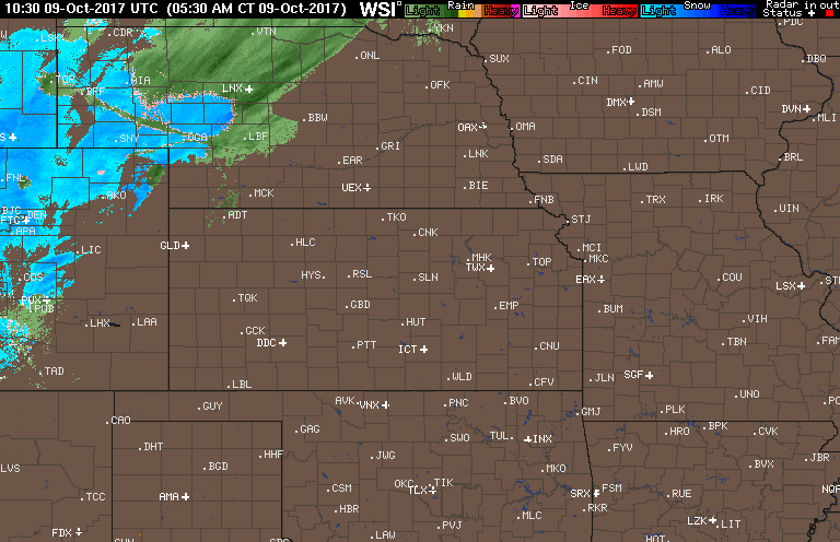
Current radar animation as of 7:30 AM CDT:
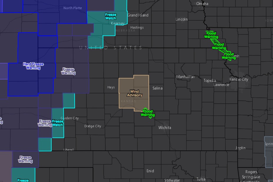
Freeze watches and warnings in western Kansas tonight:
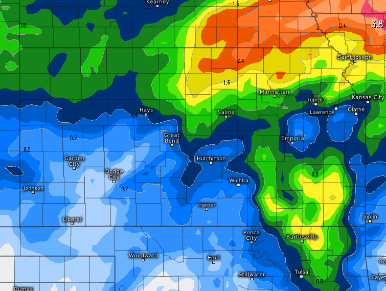
7-day rainfall numbers off the European model:
High temperatures over the next 4 days:

Low temperatures over the next 4 nights:
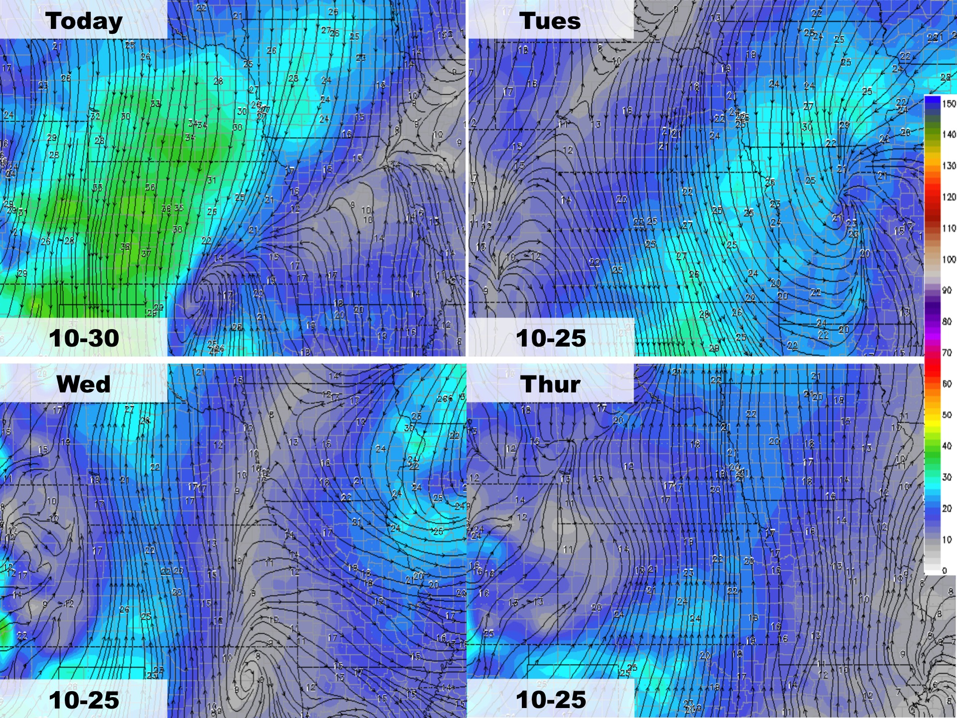
Wind forecast over the next 4 days:
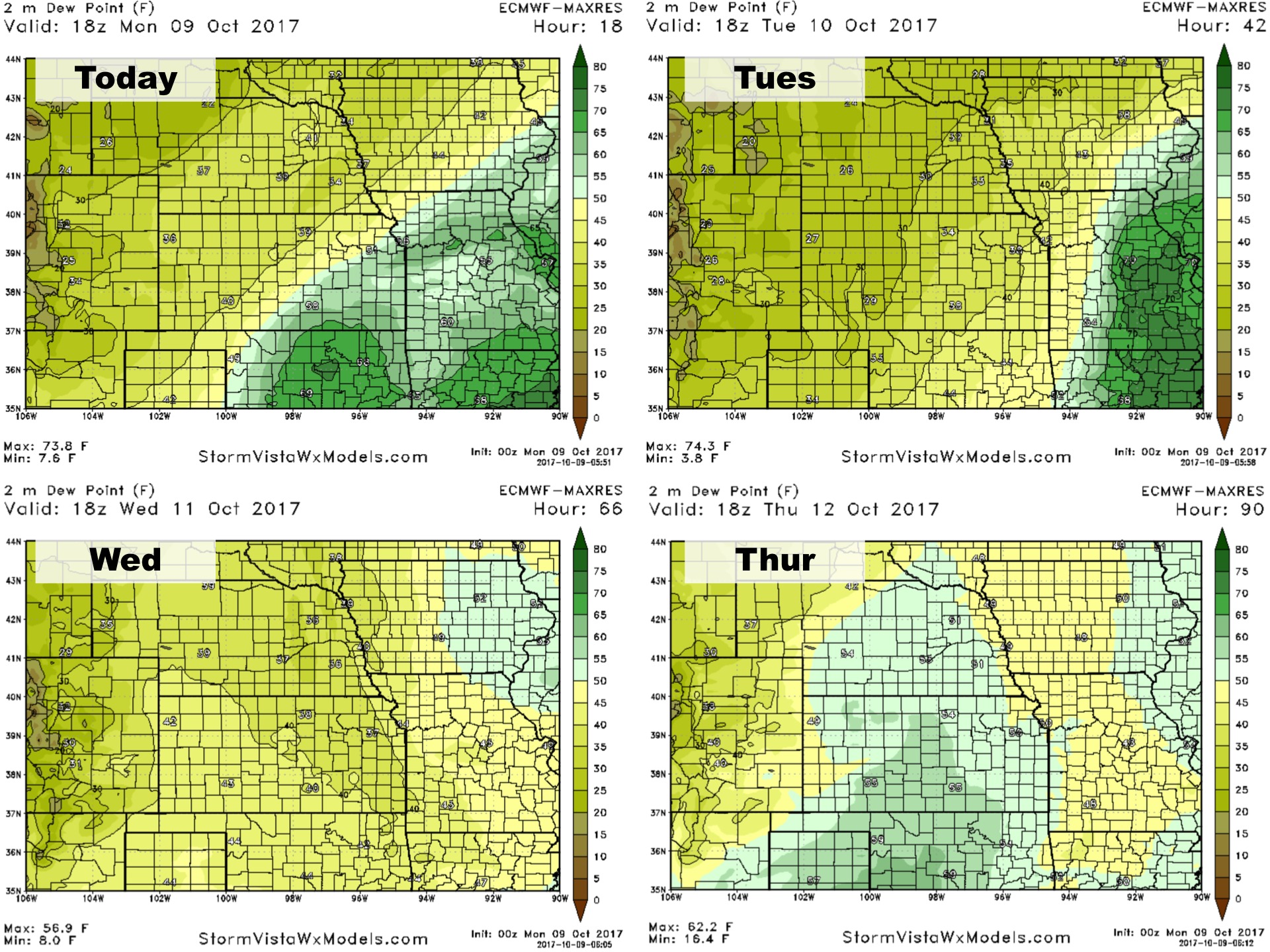
Dew points over the next 4 days: