#MNwx #WIwx #NDwx #SDwx Spotty Storms This Weekend, Heat Building Into Next Week. E.
Key Points: July 7, 2017
Synopsis: Good Friday morning! Cooler air is filtering into eastern portions of the area today as an upper trough settles into the Great Lakes. Further west, a large ridge is establishing itself across the Four Corners region and will continue to expand into the Dakotas by next week bringing significant heat. In between across eastern Minnesota and Wisconsin, some thunderstorm risks exist into next week, but overall a drier and warmer regime is expected for a majority of the forecast area. Have a blessed day!
Current radar:
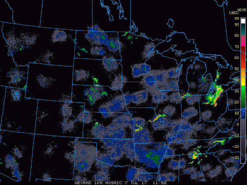
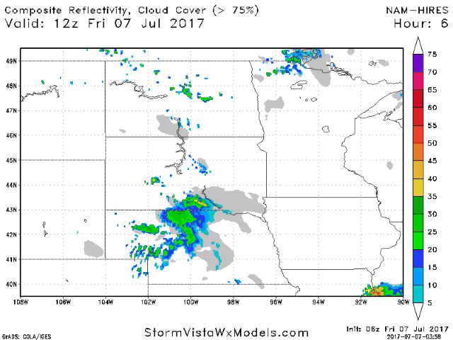
A storm risk does exists this afternoon and overnight across western South Dakota with strong winds and hail the main threats.
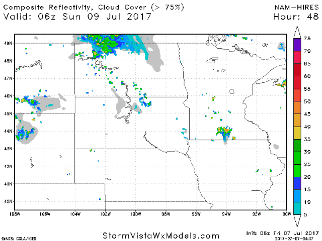
Additional storms are possible Sunday across Minnesota and Wisconsin as a disturbance moves through.
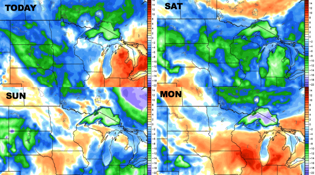
Cooler temperatures expected for today, with the heat expected to build especially south and west over the weekend into next week. Parts of the Dakotas could see triple digit heat!
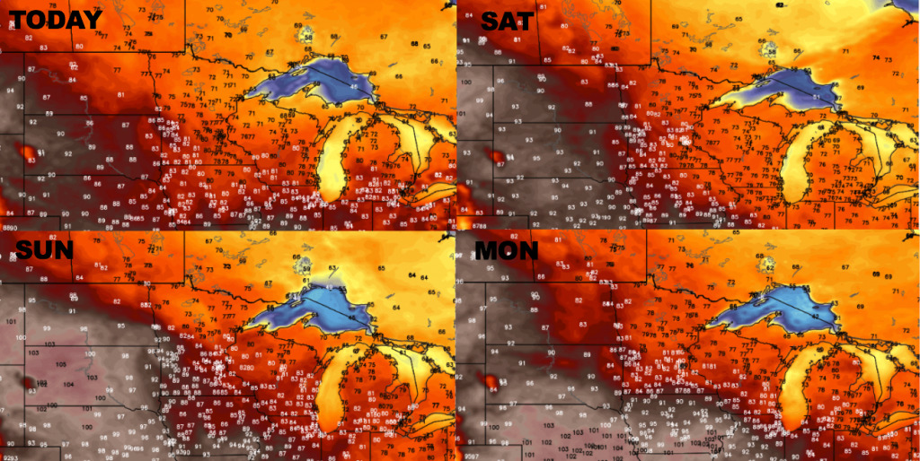
A drier air mass will take over today and Saturday with increasing humidity later in the weekend and next week.
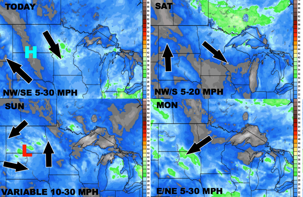
The wind forecast for the next 4 days is shown below.
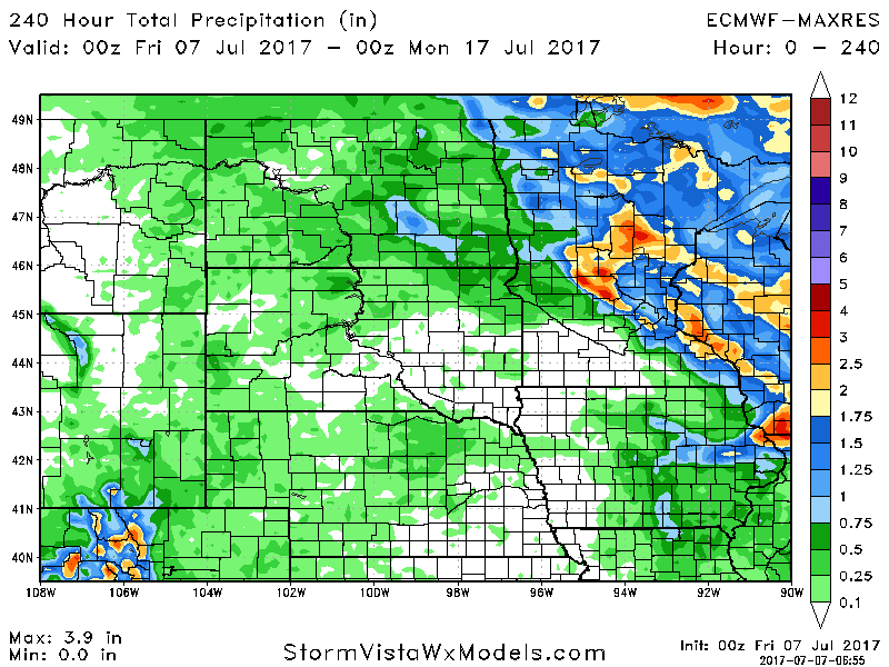
Total precipitation over the next 10 days will be heaviest east, with considerable dry risks across the Dakotas.
Confidence and Risk:
- Above average confidence in a cool start to the weekend, but heat will build into next week.
- Increasing confidence in a cluster of storms in SW SD tonight, then another cluster across MN and WI Sunday.
- Average to above average confidence in active conditions across eastern Minnesota and Wisconsin through next week, but dryness continuing across the Dakotas.
Today’s Video (7 minutes):