#MNwx #WIwx #NDwx #SDwx: Severe t’storm risk today, briefly cooler and drier air builds in mid to late week. N.
Synopsis: Active weather for today into Wednesday as an area of low pressure tracks across the region. High pressure will build in for the second half of the week bringing drier and cooler air into the region.
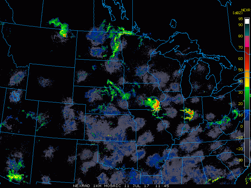
Current Radar:
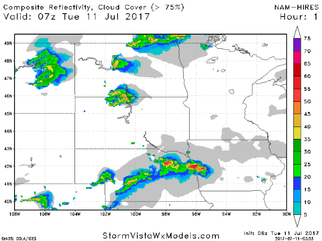
Latest hi-res NAM shows a scattering of showers and storms tracking east into the afternoon, then watch how stronger storms develop late this afternoon into tonight tracking west to east.
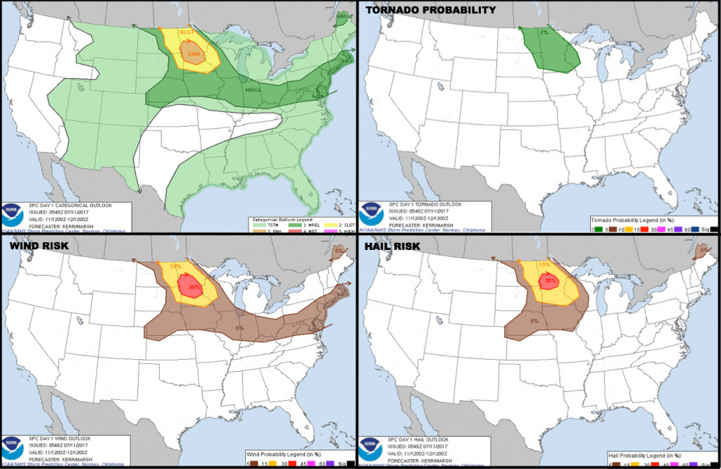
The Storm Prediction Center has placed an ENHANCED severe threat over central Minnesota, with a slight risk surrounding that. The graphic below shows the day 1 storm outlook along with the tornado/wind/hail probabilities.
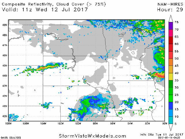
Heading into Wednesday, scattered shower and t’storms will rotate around an area of low pressure over Minnesota into Wisconsin with more activity possible over South Dakota.
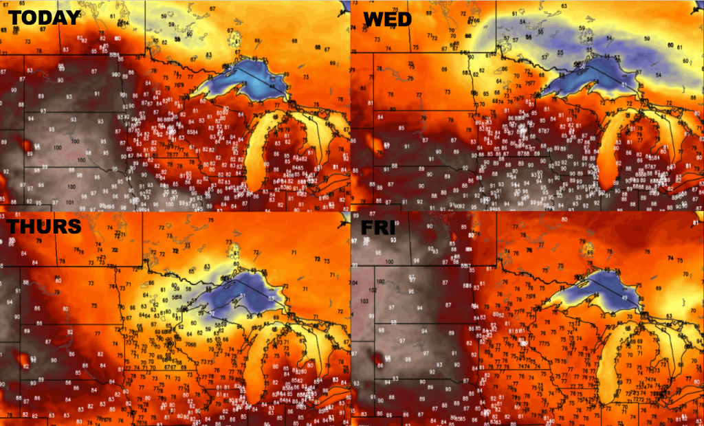
Overall Thursday and Friday are shaping up to be dry and rather nice with surface high pressure building in. Temperatures over the next 4 days are shown below. Very hot over portions of the Dakotas today, but note the cooler air building in on Thursday! Heat starts to build in from the west on Friday, and will spread eastward by the upcoming weekend.
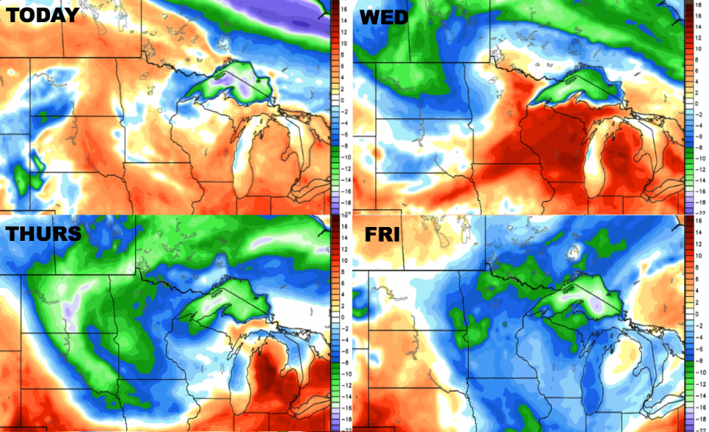
Here are the dewpoint anomalies over the next 4 days. Humidity levels will take a nice drop mid to late week.
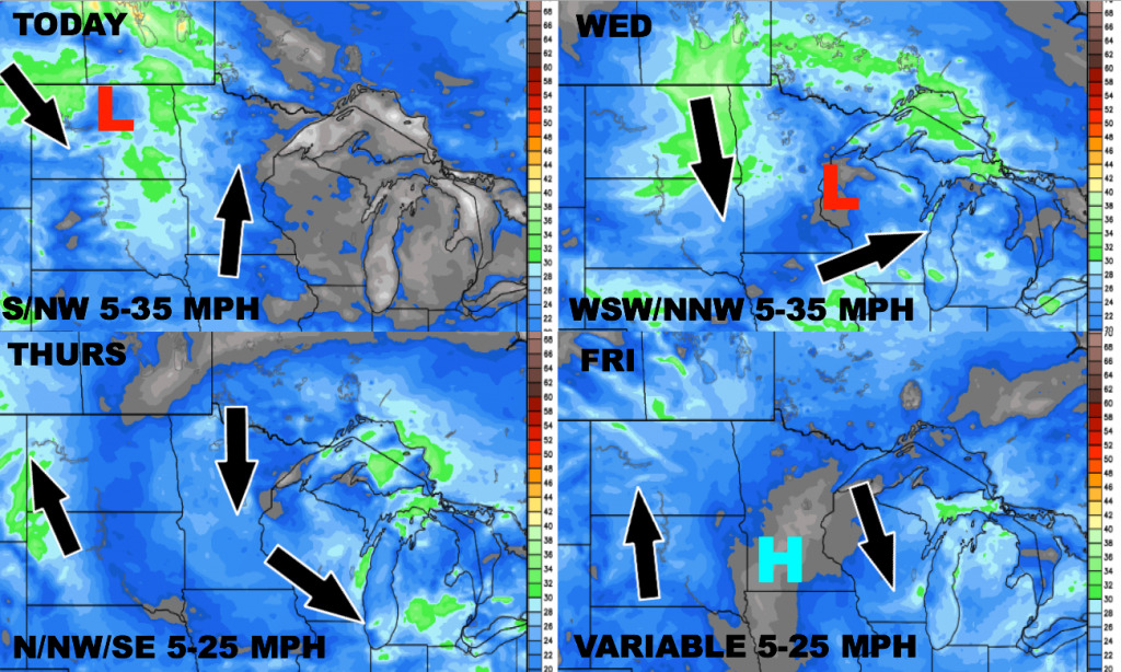
The wind forecast over the next 4 days is shown below.
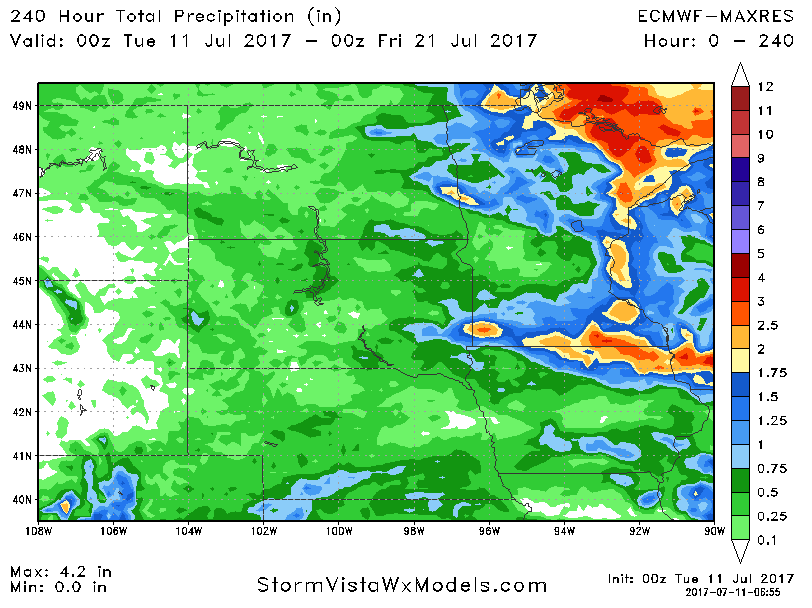
Total precipitation over the next 10 days will be heaviest to the east, with dry risks continuing over the Dakotas. At least the Dakotas do have some rain potential mainly in the short term.
Confidence and Risk:
Above average confidence in clusters of showers and storms increasing this evening into the overnight, with the risk shifting east and south Wednesday with a quieter late week.
Increasing confidence that the storms will have the risk to become severe this evening into the overnight mainly over Minnesota with damaging winds and large hail the main threats.
Above average confidence in briefly cooler temperatures filtering in mid to late week.
Today’s Video (6:29):