#MNwx #WIwx #NDwx #SDwx Severe Storms Today East, Briefly Cooler into the Weekend. E.
Key Points: July 6, 2017
Synopsis: Good Thursday morning! We are tracking a cluster of storms this morning across Minnesota and Wisconsin causing heavy rains and some damaging winds. These will dissipate this morning, but additional severe risks will erupt this afternoon and evening along a cold front in Minnesota and Wisconsin. The main threats with these storms will be damaging winds and large hail along with heavy rains. Cooler, drier air briefly comes back into the region this weekend, before more heat establishes itself next week, especially across the Dakotas. Have a blessed day!
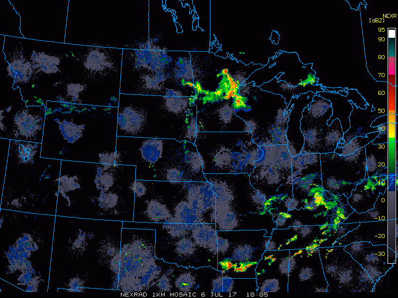
Current radar shows the storminess ongoing in eastern areas.
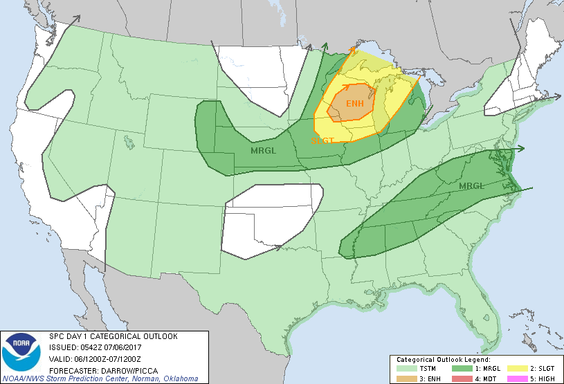
Additional storms erupt this afternoon and evening. The SPC has issued an enhanced risk because of this.
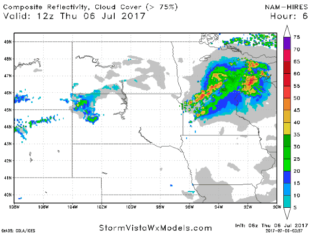
Projected radar shows the evolution of these storms.
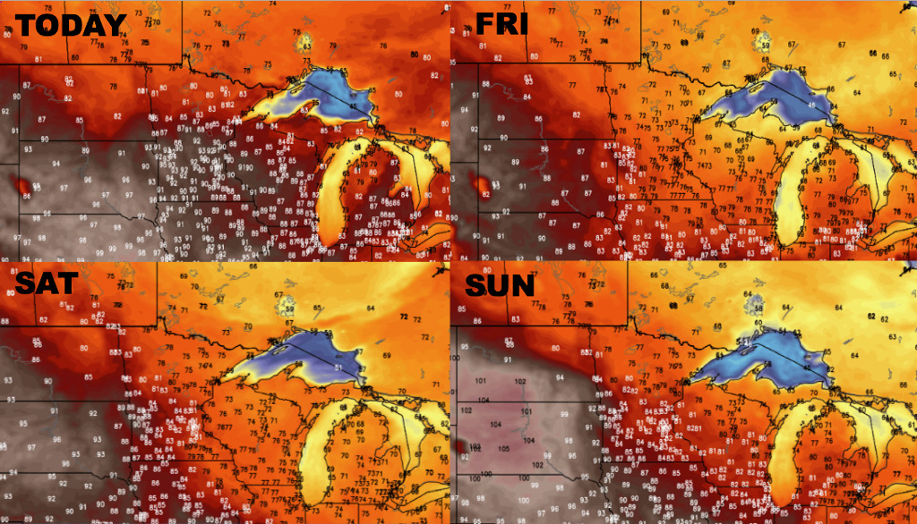
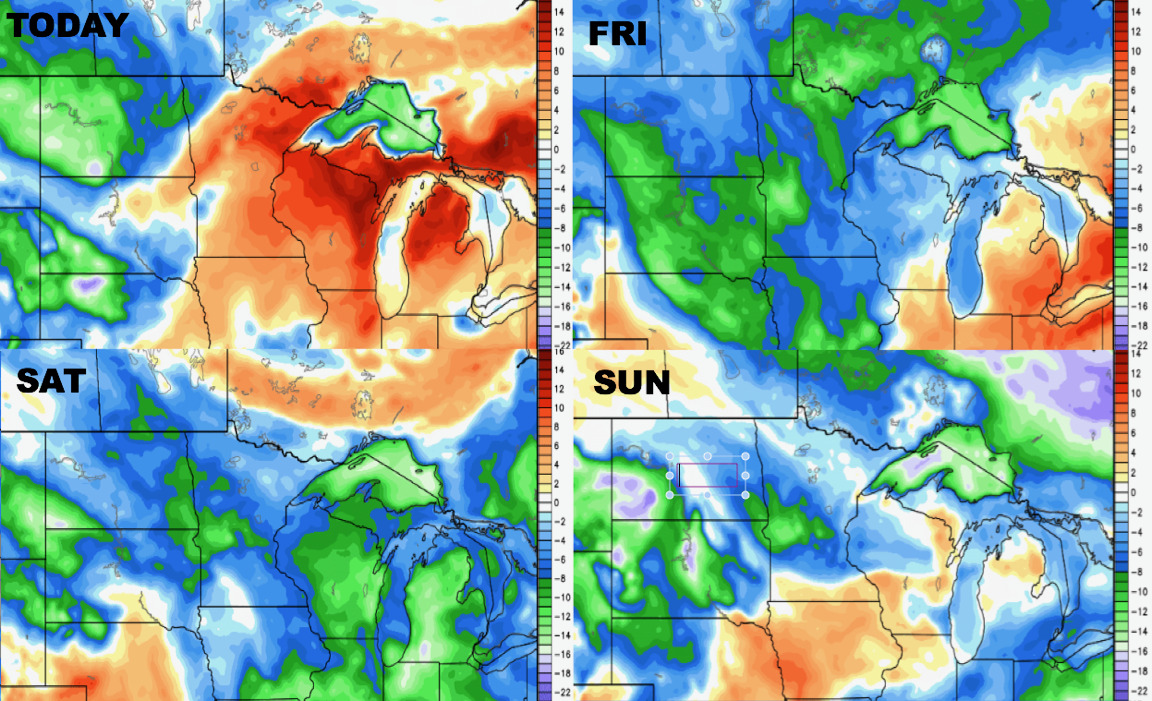
Cooler temperatures will return to start the weekend before more heat next week.
Humidity follows a similar pattern into next week.
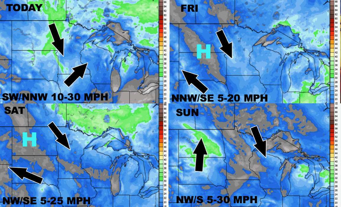
The next 4 days of wind are shown below.
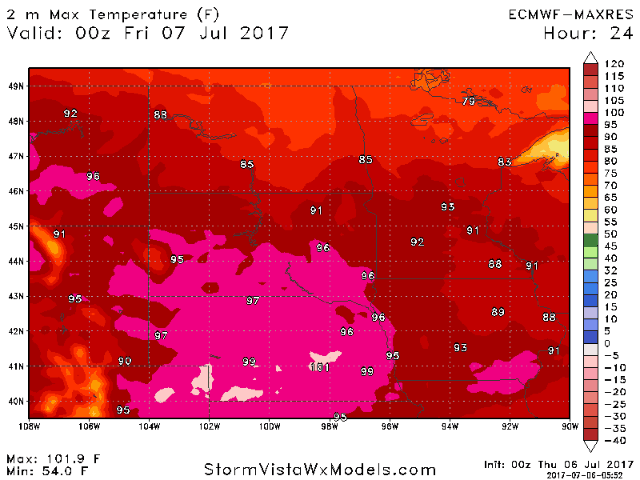
As we move into next week, a significant upper ridge looks to impact the western portions of zone 9 while eastern areas see northwest flow and more active conditions.

Under the ridge, the Dakotas will see more heat stress and dry conditions. Next 10 days of high temperatures shown below.
Confidence and Risk:
- Above average confidence in severe risks today across Minnesota and Wisconsin.
- Above average confidence in cooler conditions into Saturday before more heat expands especially west into next week.
- Above average confidence in drier than normal conditions across the Dakotas through day 15, with closer to average rainfall in Minnesota and Wisconsin.
Today’s Video (6 minutes):