Synopsis: It will be rather active into mid-week with rounds of showers and thunderstorms possible. More details are covered in the video at the end of the post.
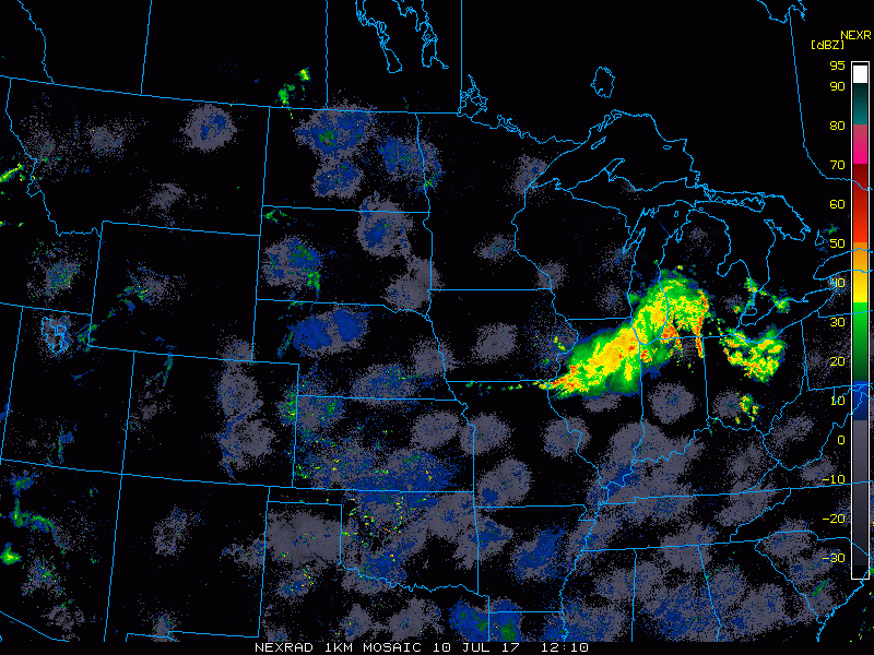
Current Radar:
Radar loop this morning shows a complex of storms pushing southeast of Wisconsin which led to the severe weather last night mainly over Minnesota and Wisconsin. More activity is starting to creep into North Dakota.
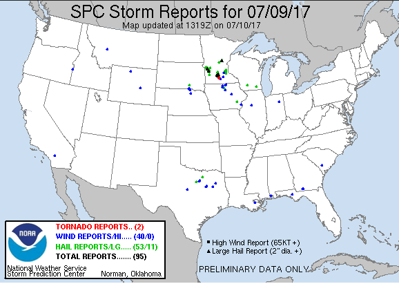
Here is a look at the storm reports from last night. There were several wind and hail reports mainly over Minnesota into Iowa along with a couple tornado reports in Minnesota.
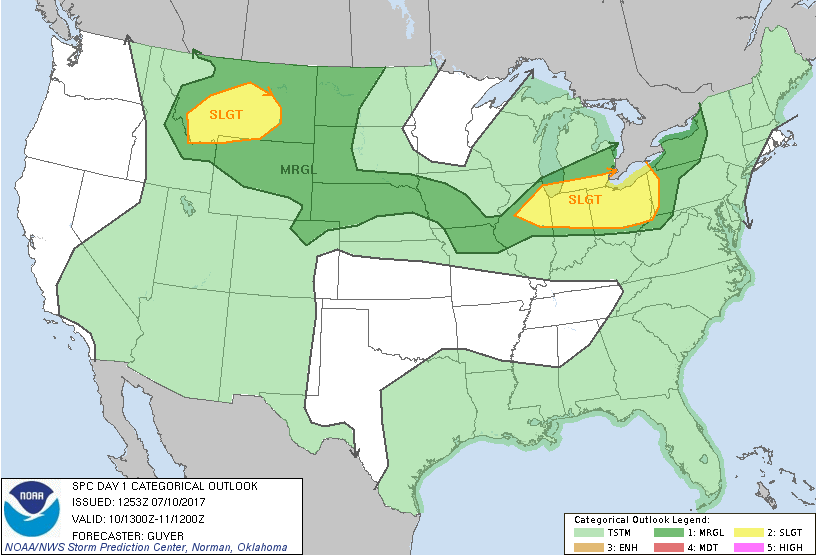
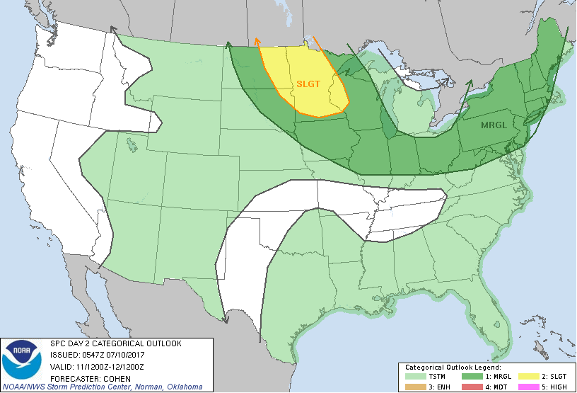
The latest outlook from the Storm Prediction Center places a MARGINAL risk of severe storms of the western half of the Dakotas today.
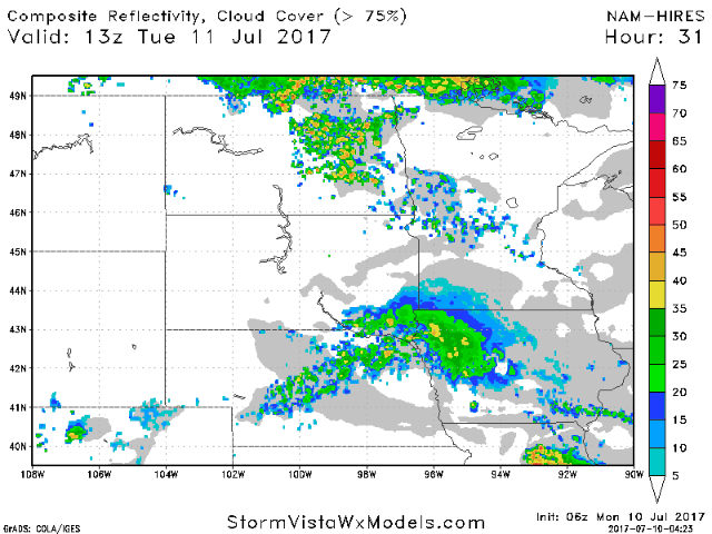
Scattered showers and storms should increase over the western half of the area as we go through the day today and into tonight. Here is a look at what radar may look like from this afternoon through 6am Tuesday.
As we head into Tuesday, the Storm Prediction Center places a SLIGHT risk for severe storms over much of Minnesota into eastern North Dakota and western Wisconsin, with a marginal risk outside of that.
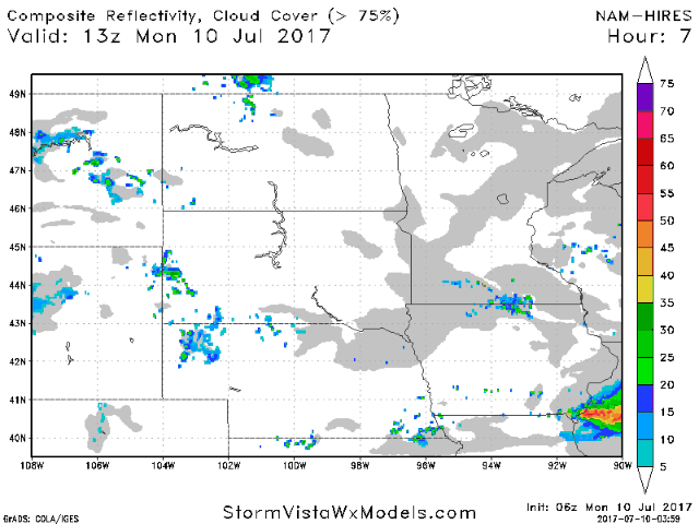
Future radar from the hi-res NAM indicates storm coverage increasing later in the afternoon and continuing through the overnight hours into Wednesday morning.
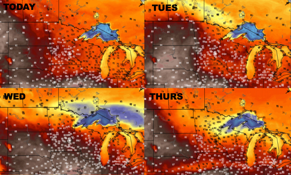
Here is a look at temperatures over the next 4 days. Hot over the western and southern half of the area into mid-week, with much cooler temperatures by Thursday over the northern half of the area.
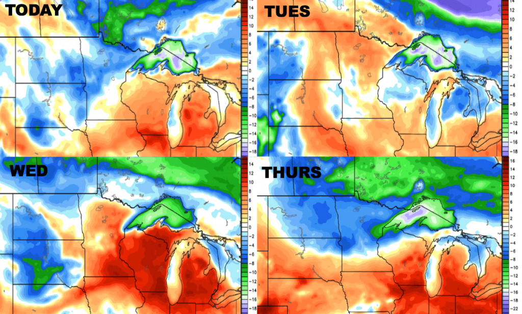
Here is a look at the dew point anomalies over the next 4 days. Overall it will be humid through mid-week, with some drier air punching in from the north on Thursday.
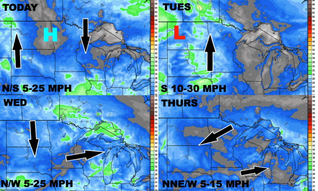
Here is the wind forecast for the next 4 days.
Today’s Video (7:12):