#MNwx #SDwx #NDwx #WIwx Severe Risks and Cooler Conditions On The Way. E.
Key Points: June 13th, 2017
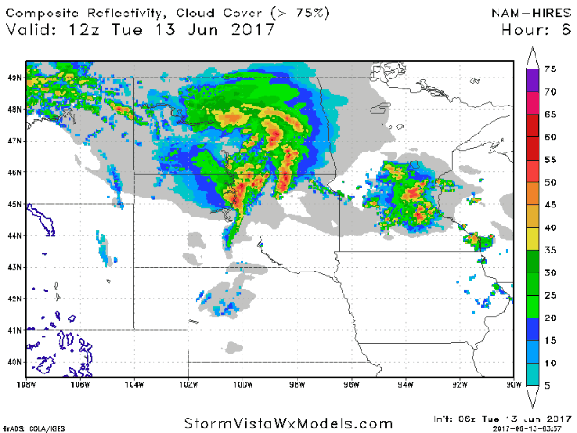
Synopsis: Good Tuesday morning! A cluster of storms is moving through the Dakotas bringing a general 1-2″ of rainfall. This same boundary will spark severe weather this evening in the eastern Dakotas and Minnesota with all modes of severe weather possible. This will push south and east Wednesday with additional severe weather possible. Behind the severe risk, cooler conditions are expected into next week along with variable rainfall chances as well. Have a blessed day!
- Current radar shows rains across the Dakotas and southern Wisconsin this morning.
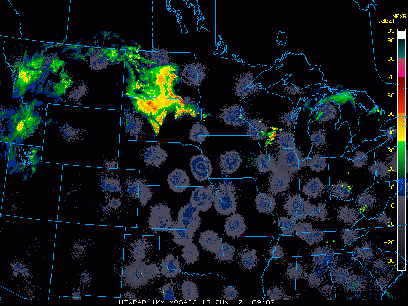
- Storms will fire up this afternoon across the eastern Dakotas and Minnesota with damaging winds, hail, heavy rain, and an isolated tornado possible.
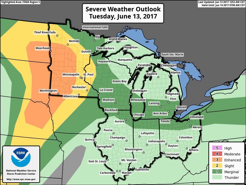
- The SPC has issued an enhanced risk for severe weather across the region discussed above.
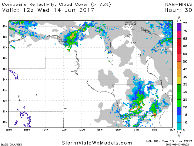
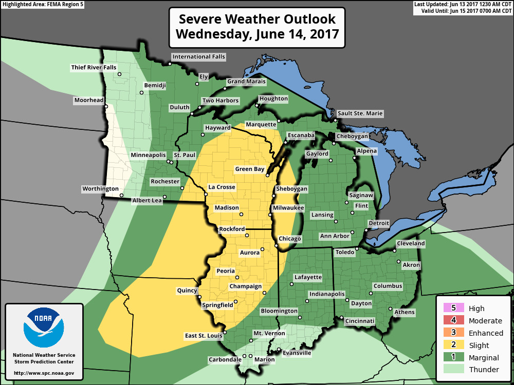
- Additional storms are expected Wednesday afternoon and evening.
- The SPC has outlined a portion of the region with a slight risk of severe weather as well.
- The next 4 days continue to look windy. The wind forecast is shown below.

- Behind this boundary, temperatures look to cool off significantly. Here’s a look at day by day high temperatures over the next week.

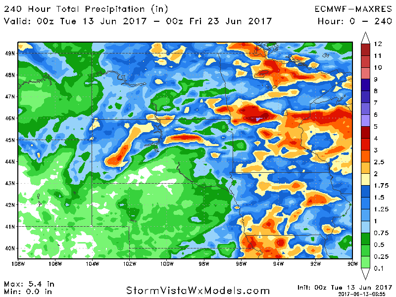
- As we head into the weekend, another threat for widespread rain will come toward to the region.
- Total rainfall through day 10 will be storm dependent, but 1-2″ is certainly on the table with locally more.
Confidence and Risk:
- Above average confidence in severe weather today and tomorrow discussed above.
- Above average confidence in cooler conditions developing by the end of the week into next week.
- Increasing confidence in a rainfall threat this weekend.
- Average confidence in cool and active conditions continuing through next week.
Today’s Video (7 minutes):