#MNwx #NDwx #SDwx #WIwx Wet South and East Through Saturday, Cool Regime Into Next Week. E.
Key Points: May 19, 2017
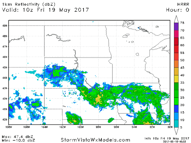
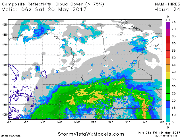
Synopsis: Good Friday morning! We are tracking some rain moving northward into southern South Dakota and Minnesota this morning. This will try to push northward today but will battle dry air- this will help central and northern areas remain dry. Another round of rain will impact central and eastern areas through tomorrow. Showers will linger into Sunday across Minnesota and Wisconsin as well. Cooler times will continue into next week along with active times, too. Have a wonderful weekend!
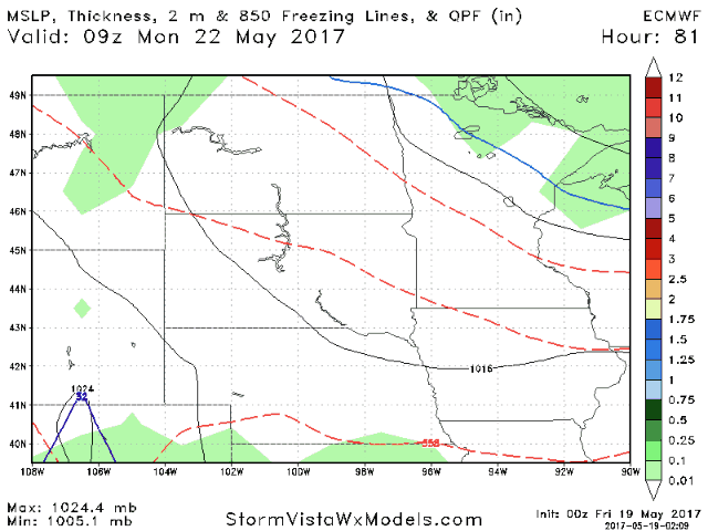
- Current radar shows rain slowly moving into southern areas this morning.
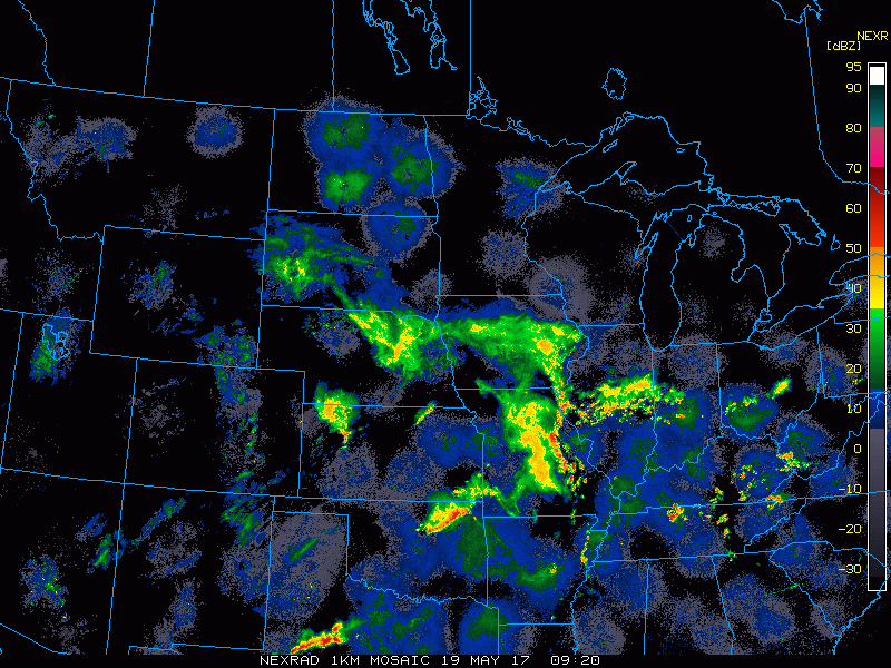
- Rain will struggle to get much farther north than extreme southern areas thanks to some dry air to the north.
- Additional rains come tomorrow as an area of low pressure passes just southeast of the region.
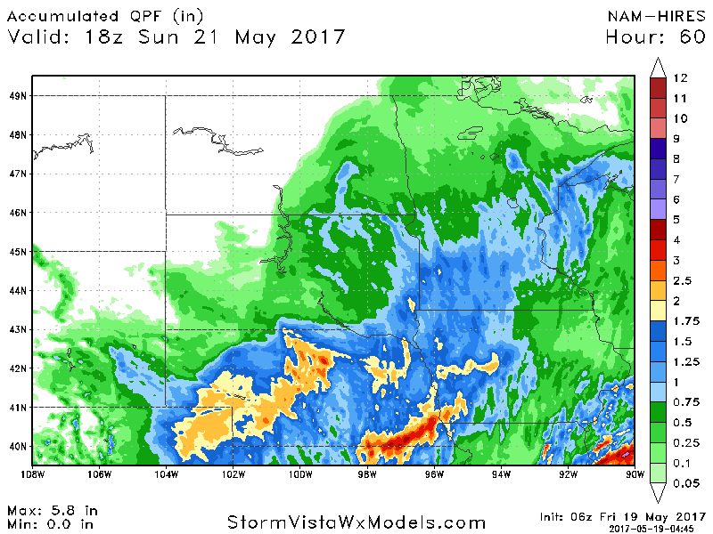
- Total rainfall through Sunday will range from 1-2 inches through eastern portions of the forecast area.
- More active times continue into early next week with widespread spotty rains.
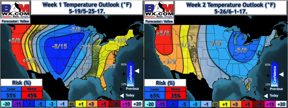
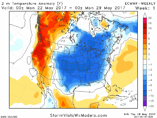
- Temperatures also look to remain on the cool side into next week. Here’s a look at our week 1 and 2 forecast.
- New data into weeks 3 and 4 also support cool conditions continuing, especially east.
Confidence and Risks:
- Above average confidence in rainfall threats today and Saturday, especially south and east.
- Above average confidence in temperatures remaining below normal through week 2 and possibly beyond.
- Increasing confidence on active times continuing next week, especially south and east.
Today’s Video (5 minutes):