#MNwx #NDwx #SDwx #WIwx Variable Pattern With Cooler Week 2 Trends. Details Here. E.
Key Points: June 19th, 2017
Synopsis: Good Monday morning! I hope you had a wonderful weekend! As we move through the beginning of the week, an upper level trough of low pressure will push eastward promoting a warming trend along with a few rain chances. The first comes this evening into tonight from the eastern Dakotas into Minnesota and Wisconsin. Another threat comes Wednesday morning west, then pushes east with a severe threat south and east. Cooler air looks to return late this week into next week as well. Have a blessed day!
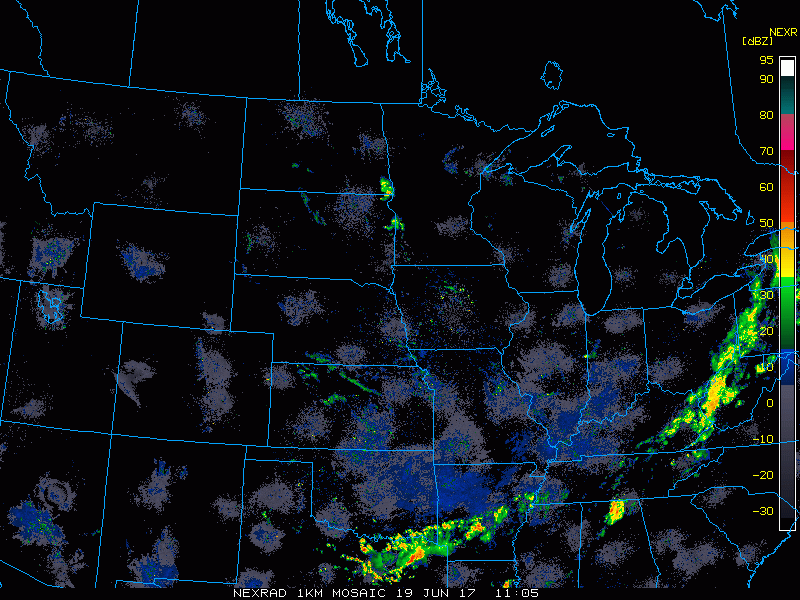
Current radar shows a few showers across Minnesota, otherwise it’s a mainly quiet morning.
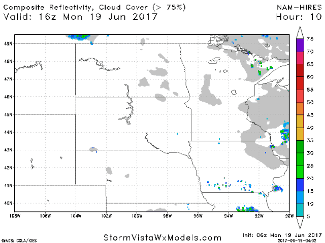
Projected radar shows the rain possible overnight well.
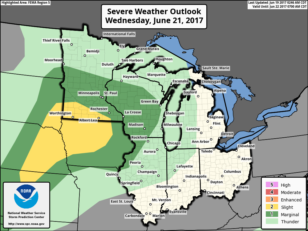
Another disturbance approaches Wednesday with showers west, then a severe threat south and east. Here’s the SPC outlook for Wednesday.
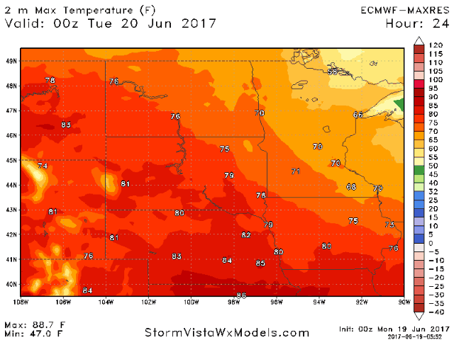
 Along with the severe threat, it’ll be a warm day Wednesday, into the 90s west. It’ll be short lived with cooler air returning by the weekend.
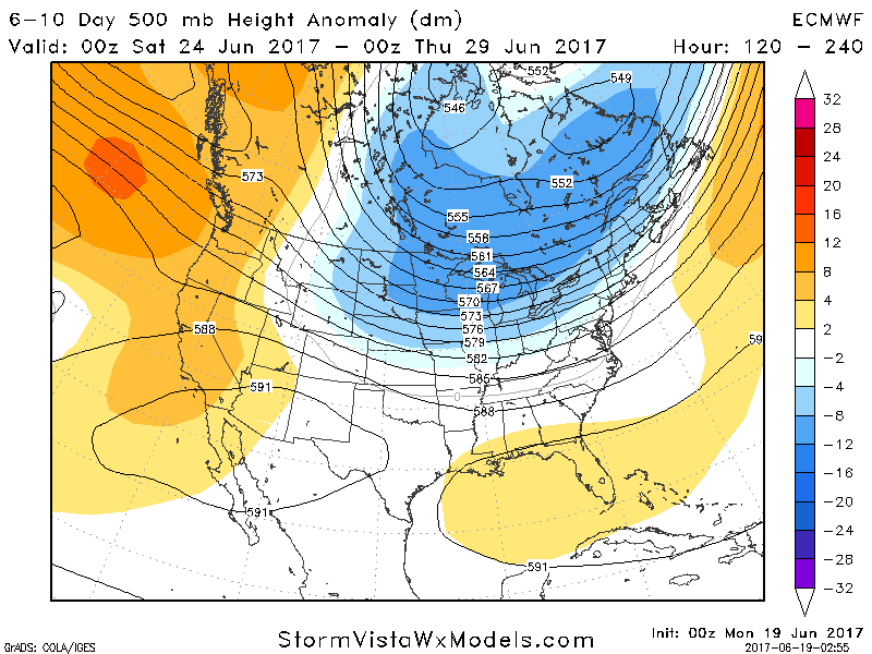
This cooler trend will last into next week as a trough of low pressure moves into the region, shown well by the blue colors below.
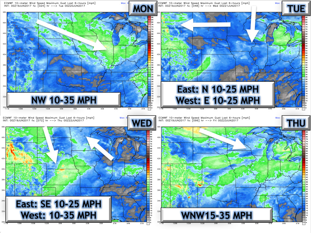
Wind forecast over the next 4 days.
Into the 11-15 day we will likely warm back up a bit, but the pattern will support additional rain chances especially east. Latest week 2 precipitation forecast is shown below.

Confidence and Risk:
- Above average confidence in brief heat this week along with periodic storm threats.
- Above normal confidence in cooler conditions returning late this week into the following week.
- Average confidence in some rainfall threats into week 2, and above normal rains possible east.
Today’s Video (6 minutes):