#MNwx #NDwx #SDwx #WIwx Stormy Few Days East. E.
Key Points: July 5, 2017
Synopsis: Good Wednesday morning! We are tracking storms moving along a cold front in Minnesota and Wisconsin today. These will pack a punch bringing damaging winds and hail risks today in Minnesota and the Dakotas and then again tomorrow across Wisconsin. Further west, most of the Dakotas look dry to end the work week as slightly cooler air works in. Northwest flow will work into the region for next week leading to increased shower and thunderstorm activity especially east. Additional heat is expected in Dakotas, leading to more heat stress along with drier than normal conditions. Have a blessed day!
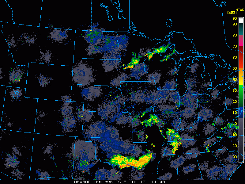
Current radar shows the storms in Minnesota and Wisconsin.
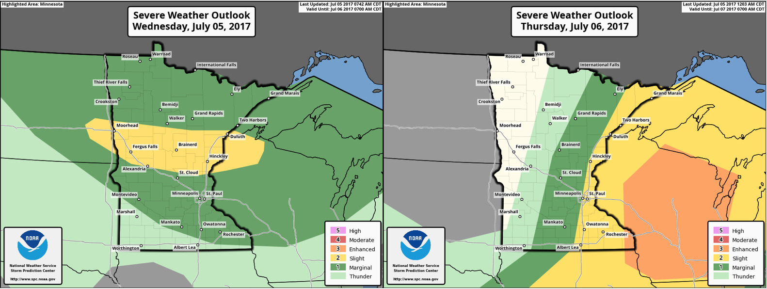
SPC has outlined portions of the region for severe weather today and tomorrow.
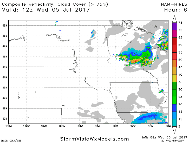
Projected radar shows evolution of storms today.
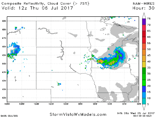
Tomorrow will be active once again as well.
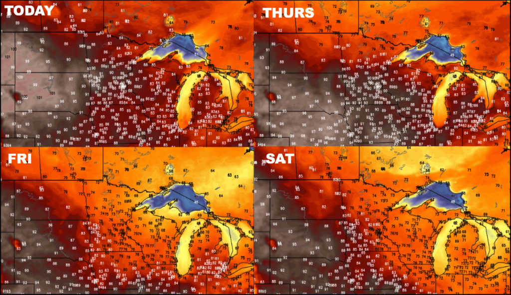
Next 4 days of temperatures are shown below:
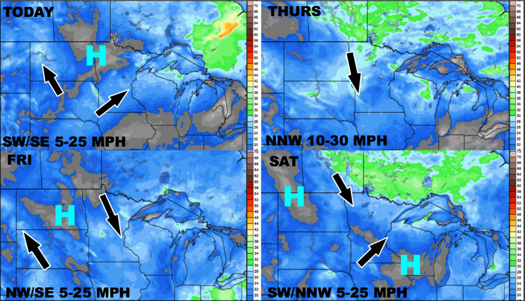
4 day wind forecast is shown below:
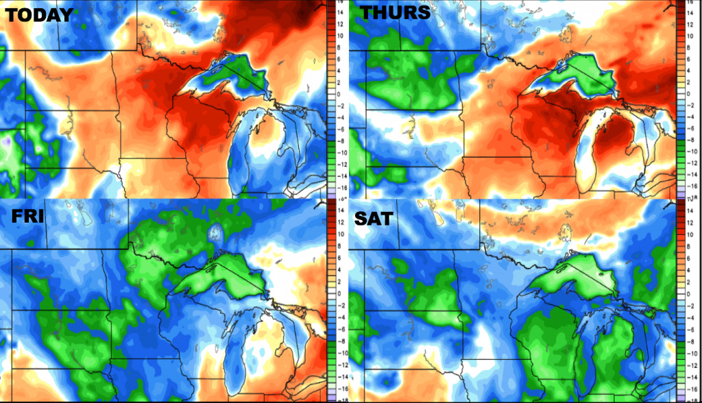
The 4 day dewpoints are shown below. Humidity stays high for many areas today, then drier air will start to take over from northwest to southeast Thursday-Saturday.
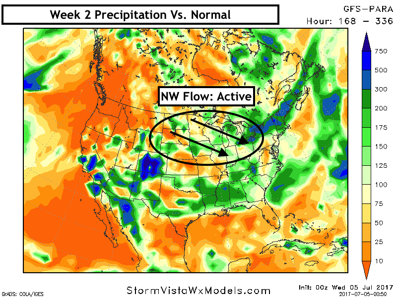
Week 2 looks to feature hot conditions west and more seasonable conditions east. Next 7 days of high temperatures are shown below.
Northwest flow will lead to active conditions east, and drier conditions west.
Confidence and Risk:
- Above average confidence in heat in the western portions of the region over the next 7-10 days.
- Above average confidence in severe risks in Minnesota and Wisconsin through tomorrow.
- Above average confidence in cooler conditions east this weekend.
- Increasing confidence in northwest flow keeping eastern areas more active through next week.
Today’s Video (6 minutes):