#MNwx #NDwx #SDwx #WIwx Severe Risk Today, Cooler Into The Weekend. E.
Key Points: June 21, 2017
Synopsis: Good Wednesday morning! We are tracking a cluster of storms southeastern areas this morning with a few showers across North Dakota as well. As this boundary moves southeast today, the threat for severe weather will increase across portions of the region. This boundary will slowly sag south this week and usher in some cooler air for the weekend into early next week. Temperatures will warm back above normal for a time later next week, but active times look to continue. Have a blessed day!
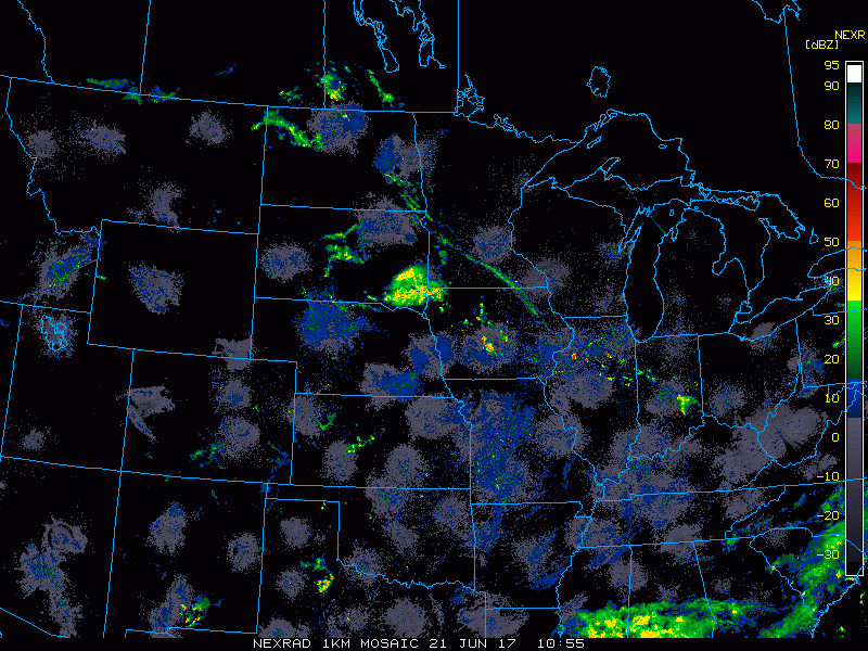
Radar shows the cluster of storms pushing southeastward this morning.
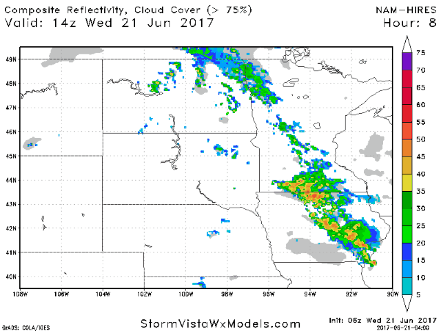
Projected radar through tonight shows storm possibilities. I get specific with respect to timing in the video so make sure to give it a watch!
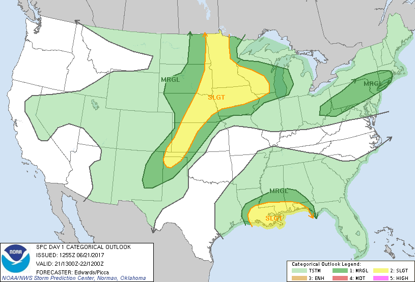
The SPC has highlighted the region for severe weather as well.
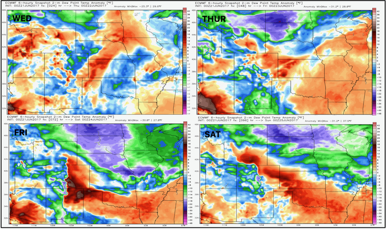
Cooler, drier air comes in behind this boundary into the weekend, shown well in dew point anomalies below.
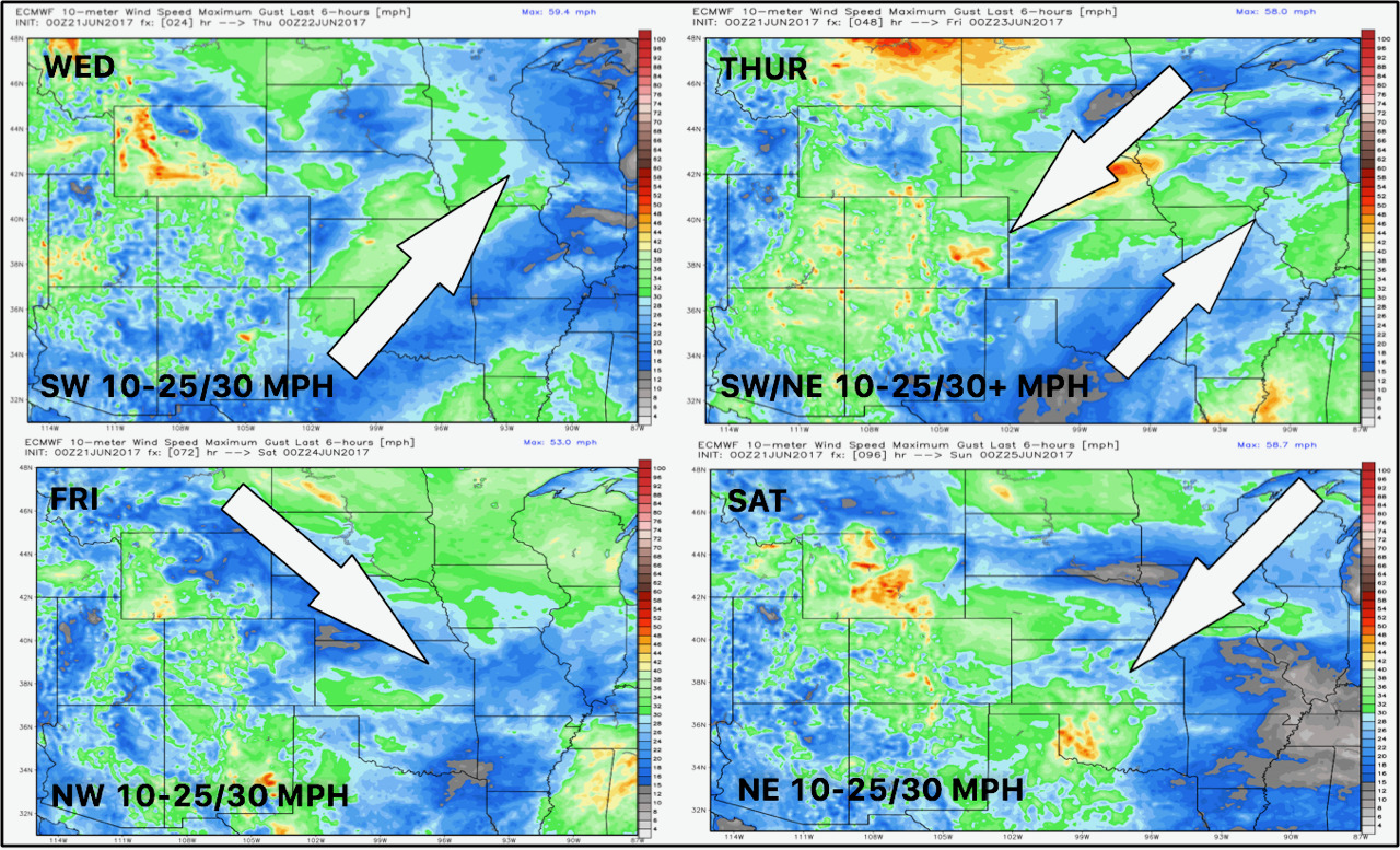
Wind forecast for the next 4 days is shown below.
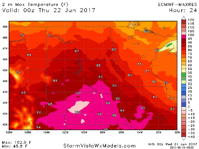
The roller coaster in temperatures over the next week is shown well below.
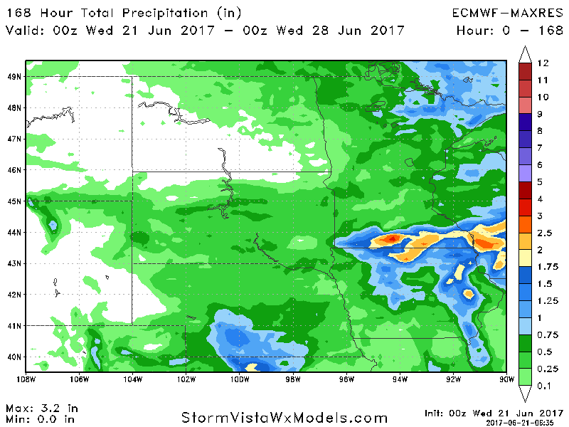
Total rainfall over the next 7 days is shown below per the European model.
Confidence and Risk:
- Above average confidence in severe weather today and tonight across much of the region.
- Above average confidence in cooler conditions into the weekend behind a cold front.
- Above average confidence in a rebound in temperatures later next week along with continued active conditions.
Today’s Video (6 minutes):