#MNwx #NDwx #SDwx #WIwx Multiple Severe Chances This Week, Turning Cooler As Well. E.
Key Points: June 12th, 2017
Synopsis: Good Monday morning! We hope you had a wonderful weekend and as we move through the week, we expect active conditions to continue with multiple severe chances. The first comes today especially across western and southern portions of the region. Another threat will rise tomorrow further east, then again on Wednesday across eastern areas. As this evolution occurs, we expect cooler conditions to gradually spread into the region by later in the week. Have a blessed day!
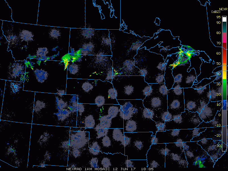
- Current radar shows a few areas of showers and thunderstorms across the region this morning.
- The next few days will feature severe weather across the region. This slide of our Ag Report highlights this set up nicely.
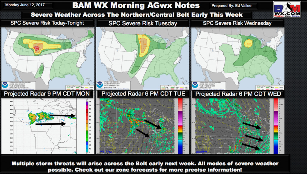
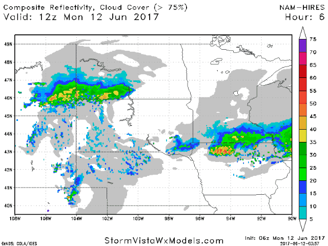
- As an area of low pressure moves into the western Dakotas, this will spark a complex of storms this afternoon, spreading eastward overnight. Additional storms are expected east as well.
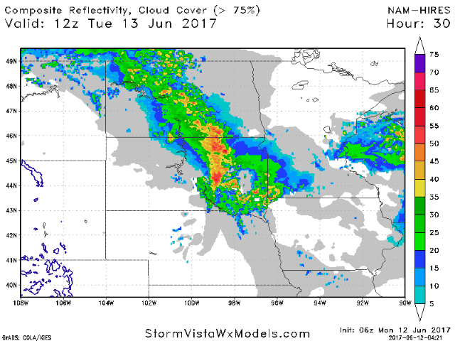
- Additional storms are expected Tuesday night into early Wednesday shown below.
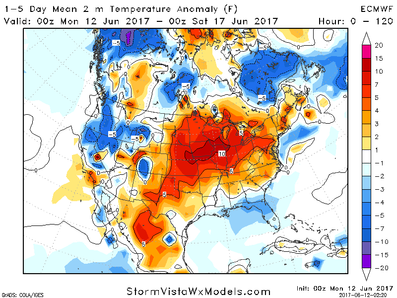
- Temperatures will be quite warm this week, especially south and east. Exact high temperatures are discussed in the video below.
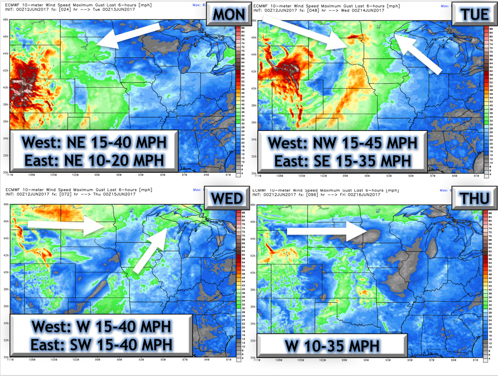
- The next 4 days look windy as well, shown below.
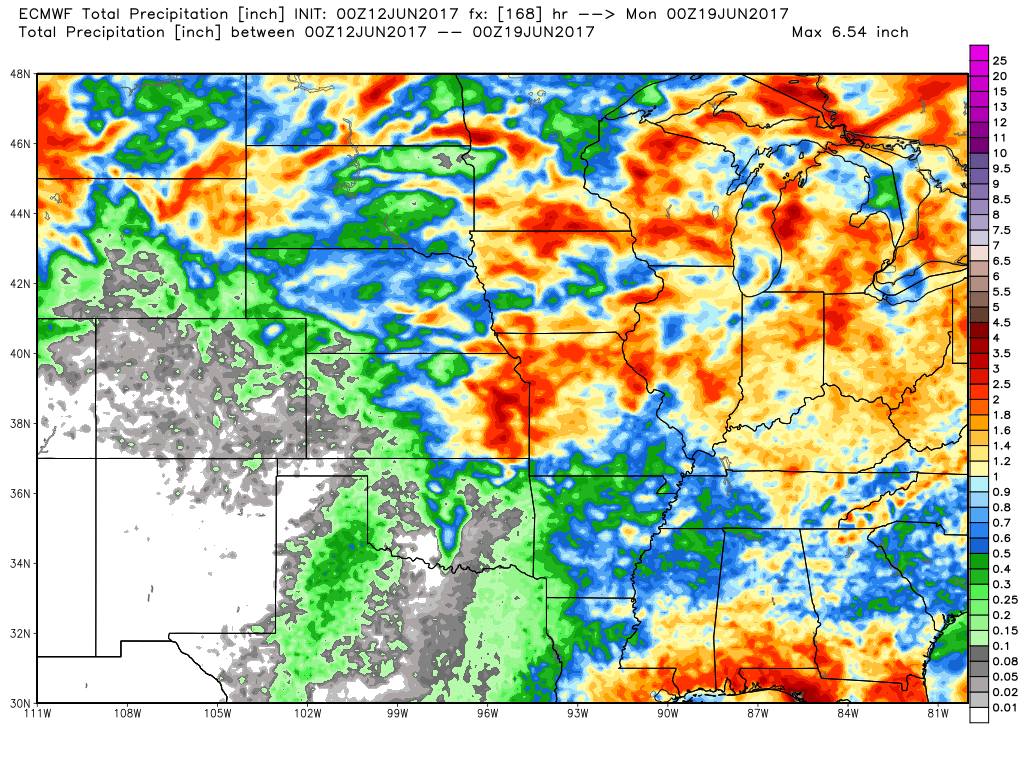
- Rainfall over the next 7 days shows the “haves and have nots” well. Some likely see 2-4″, but some may see less than 0.50″ depending on storm placement.
- Cooler conditions are looking more likely into week 2 as well. Latest temperature forecast is shown below.

Confidence and Risks:
- Above average confidence in severe risks this week across the region.
- Above average confidence in warmth to start, but a cooler trend later this week and beyond.
- Average confidence in storm placement and intensity. It is very difficult to pinpoint complexes at extended lead times – stay tuned!
Today’s Video (7 minutes):