#MNwx #NDwx #SDwx #WIwx Gusty Minnesota Storms Today? Cooler This Weekend. E.
Key Points: June 30, 2017
Synopsis: Good Friday morning! We are monitoring a thunderstorm threat as a boundary pushes south and east through the region this afternoon and evening across Minnesota and Wisconsin. Main threats with these storms will be hail, damaging winds, and some briefly torrential rains. A cooler, drier weekend is expected before warmer air returns early next week. Along with the warmer conditions will come a renewed thunderstorm threat thanks to northwest flow especially east. Some 90+ degree days are certainly on the table in the Dakotas, which will certainly not help the ongoing drought. Have a blessed day and weekend!
Current radar:
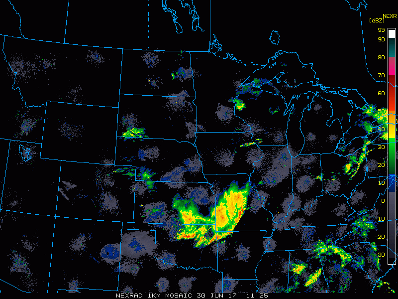
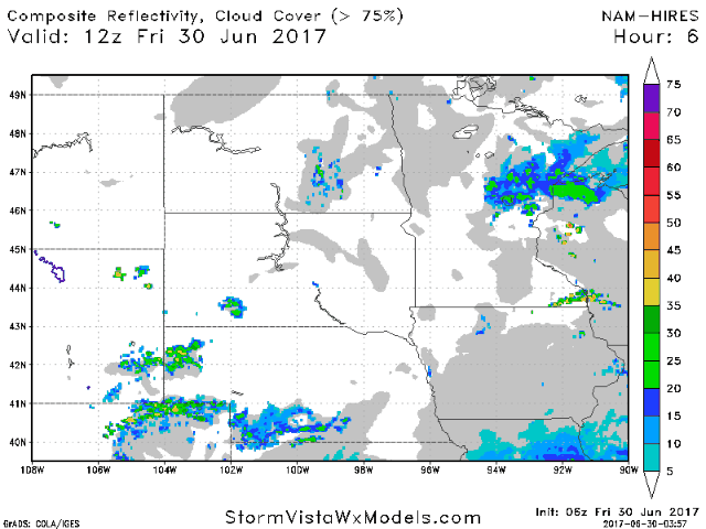
We are watching a threat for some strong thunderstorms across Minnesota this afternoon and evening. Here’s the latest projected radar.
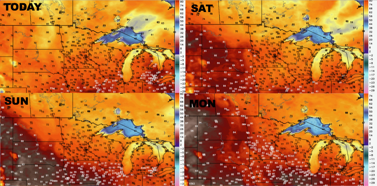
Temperatures over the next 4 day start chilly and warm into next week.
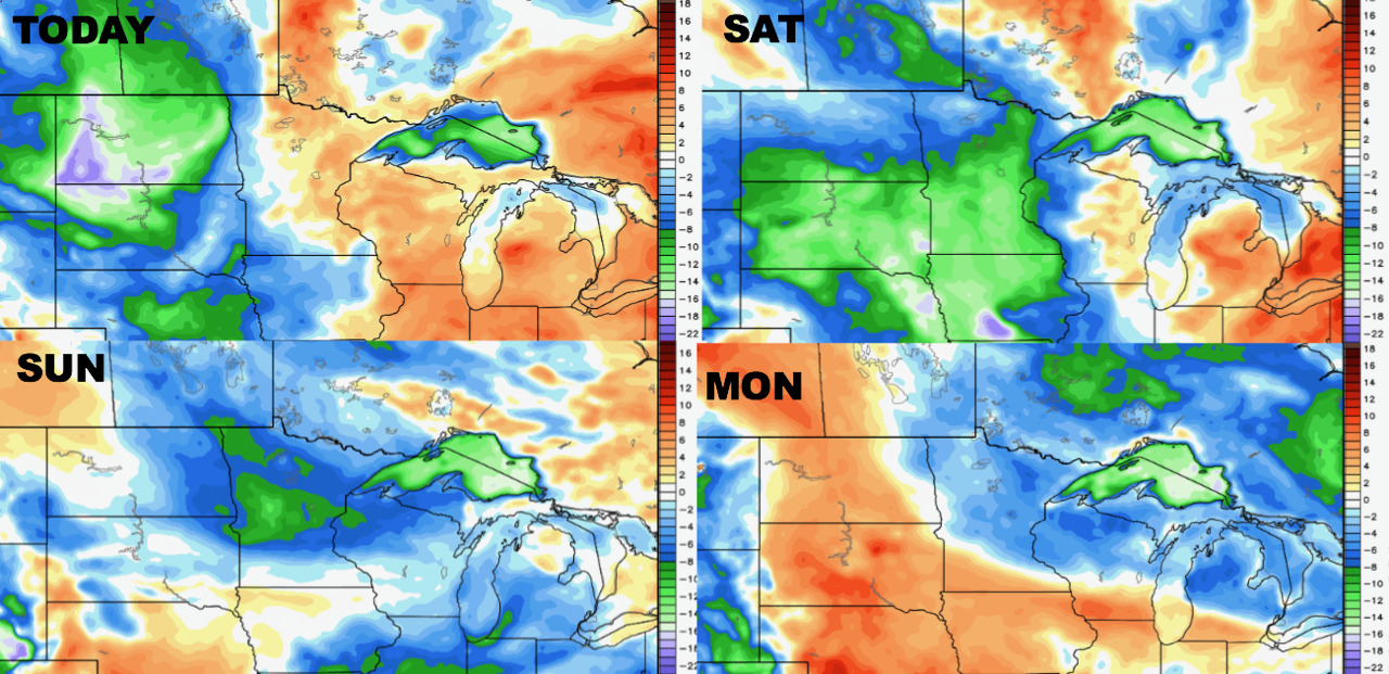
The same can be said about humidity.
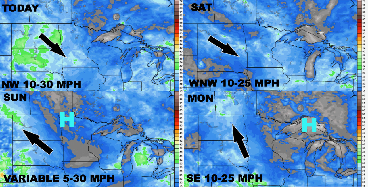
Winds over the next 4 days are shown below.
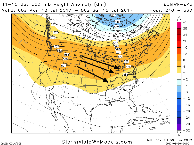
Into week 2, we foresee the region being on the periphery of a strong upper ridge to the west, leading to northwest flow across the eastern portion of the zone, but drier, warmer conditions likely across the Dakotas.
Confidence and Risk:
- Average confidence in a few gusty storms across Minnesota this afternoon and evening.
- Above average confidence in a cool start to the weekend, but a warming trend does appear likely into next week.
- Increasing confidence in a strong upper level ridge in the West leading to drier risks across the Dakotas.
Today’s Video (7 minutes):