Starting today, forecasts will be issued by state. This will allow for us to focus on your area with more detail than in the past. We will be making the changes in the data base over next few weeks so be on the look out for communication from us on that.
Video forecast: 5 Minutes
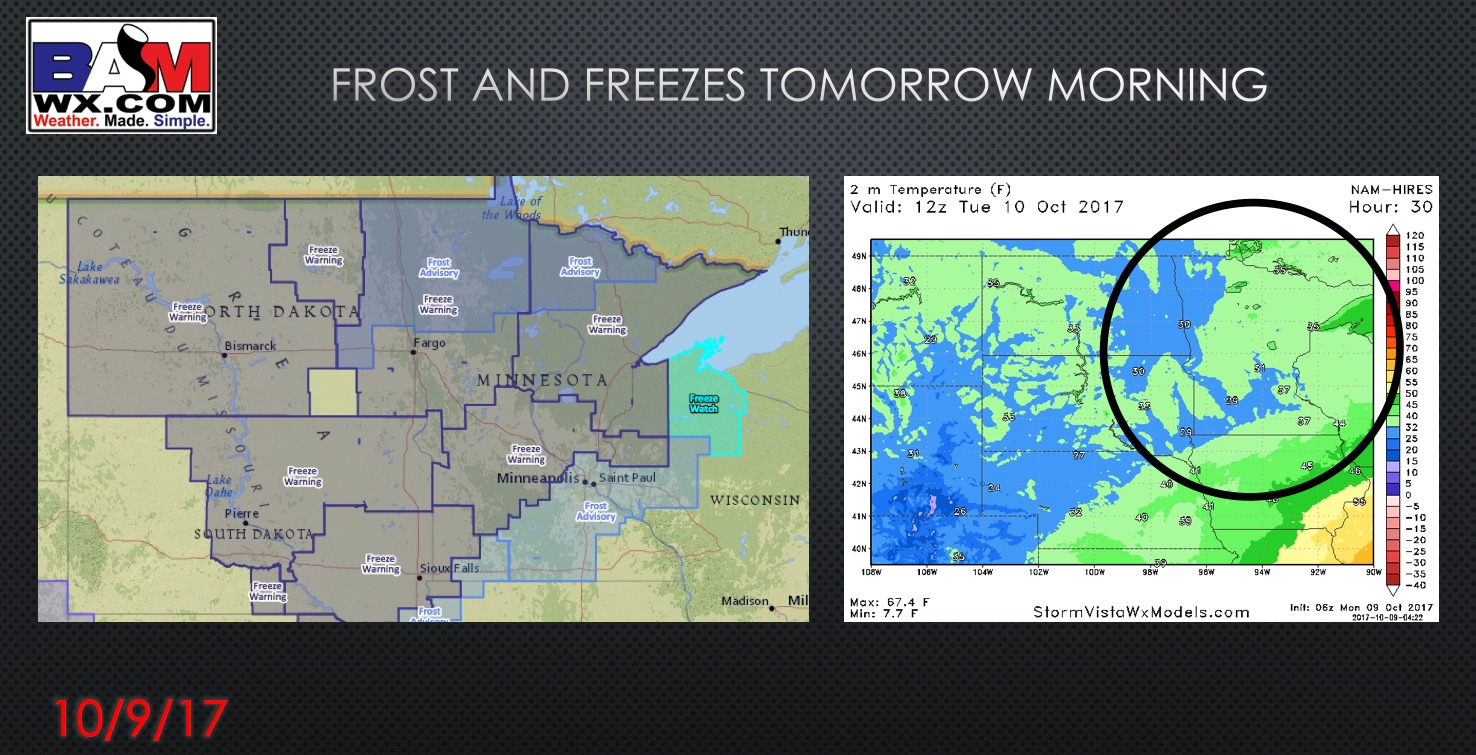
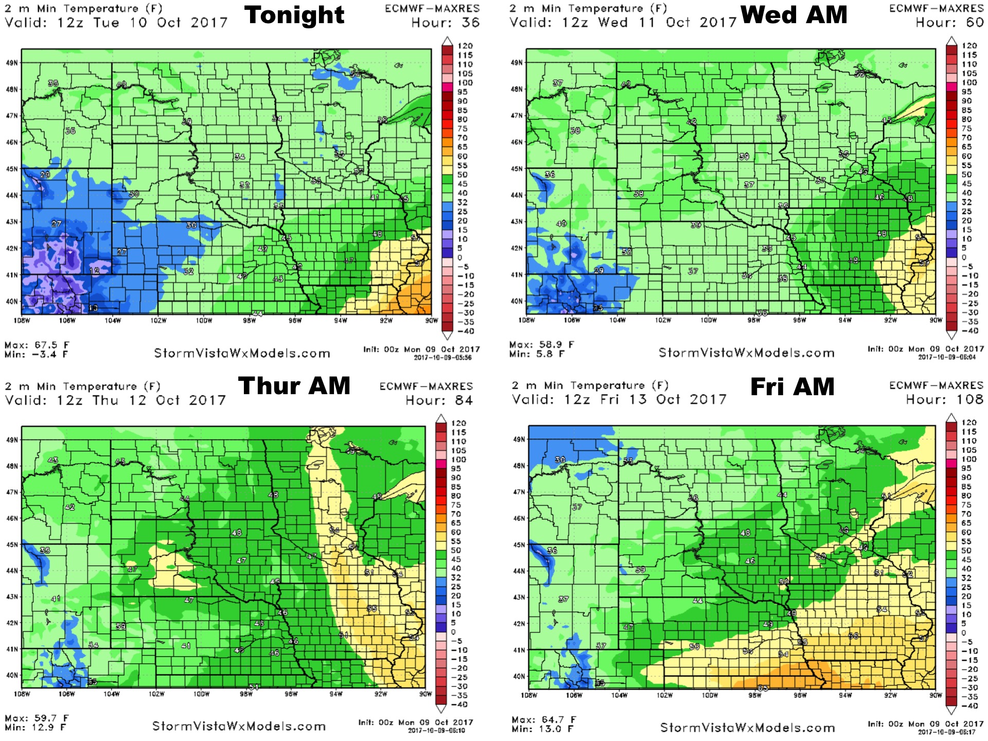
Synopsis: Good Monday morning! A storm system will pass off to the south of the region today, spreading a few showers across southern Minnesota. Frost and freeze conditions are expected Tuesday morning with low temperatures in the upper 20s and lower 30s for many. The exception may be extreme southeastern areas who will dip into the middle 30s. Some additional rains are expected in SE MN as a system passes south tomorrow afternoon and evening while most stay dry. Dry weather returns for Wednesday and Thursday before our next system approaches with some rain Friday afternoon into Saturday. Have a blessed day!
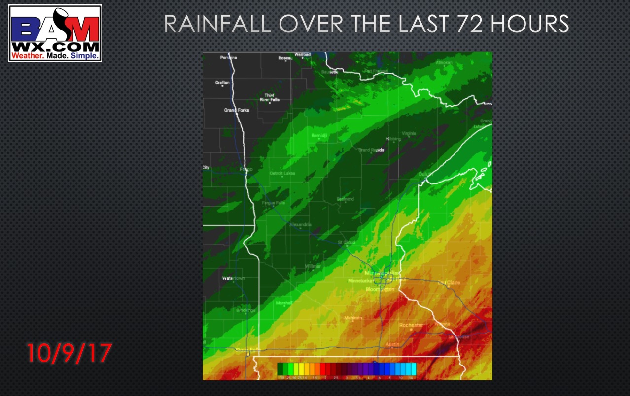
Rainfall analysis from over the weekend.
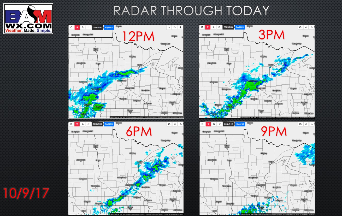
Some light showers are expected today…
Frost and freezes expected tomorrow morning especially central and north!
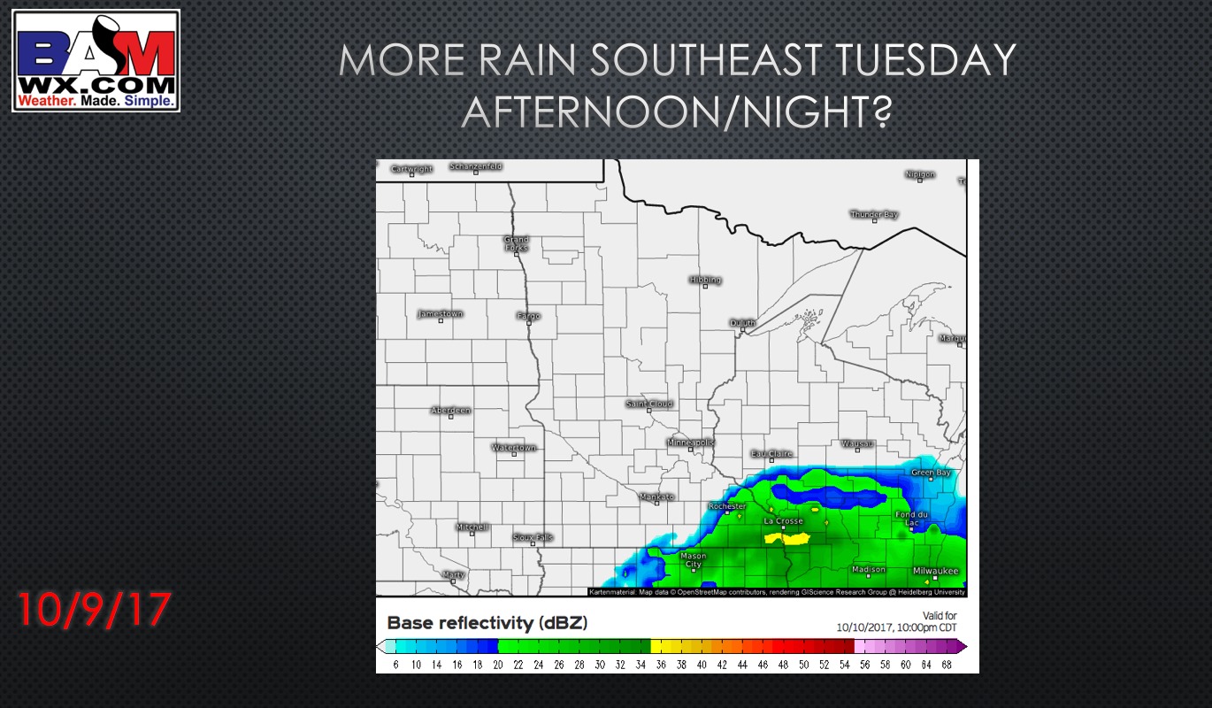
Additional rains far southeast possible tomorrow afternoon and night.
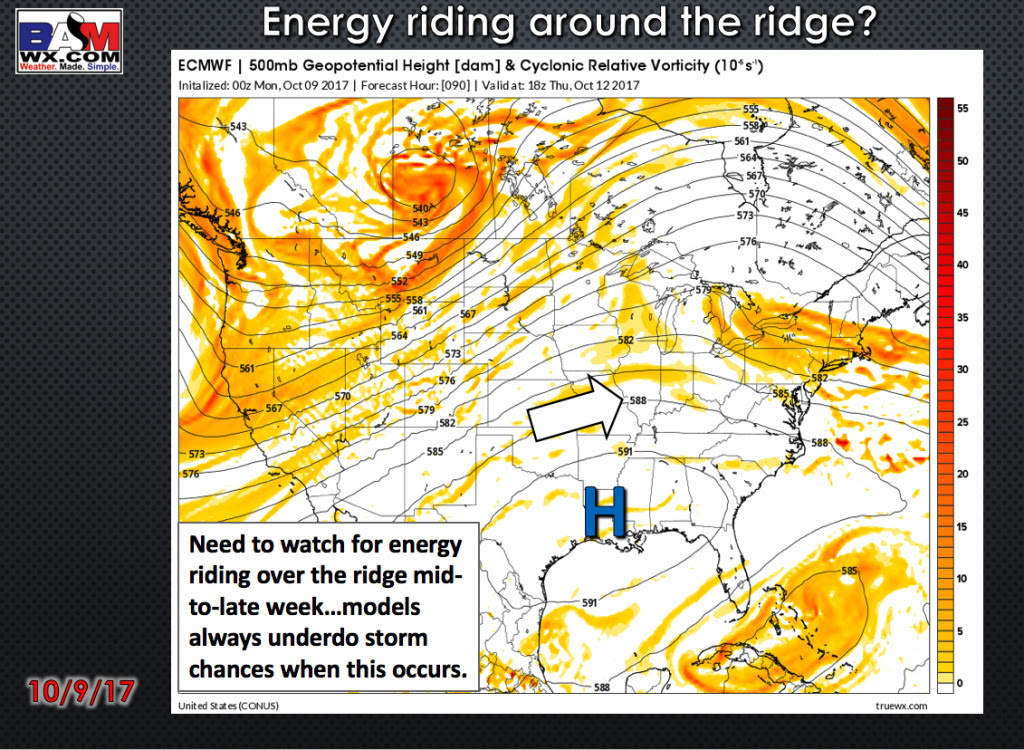
More rains coming to end the week?
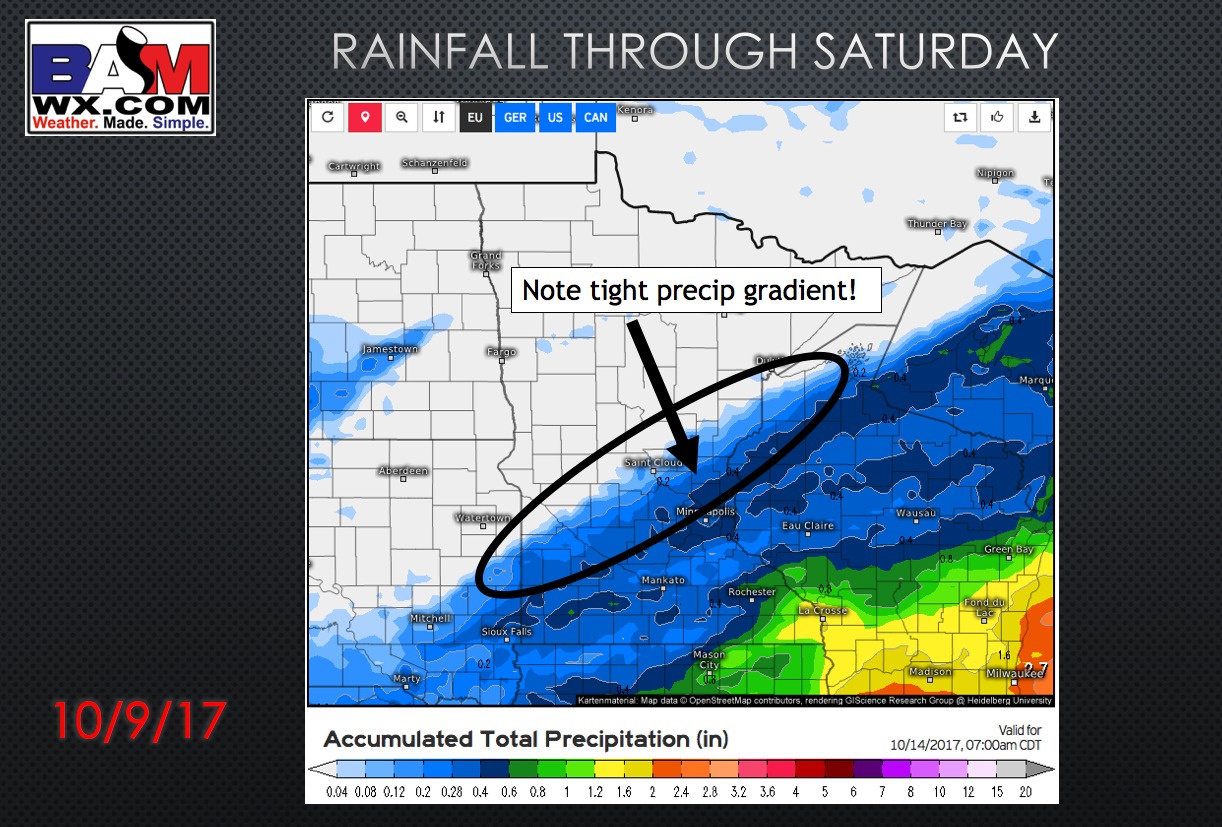
Rainfall guidance through Saturday.
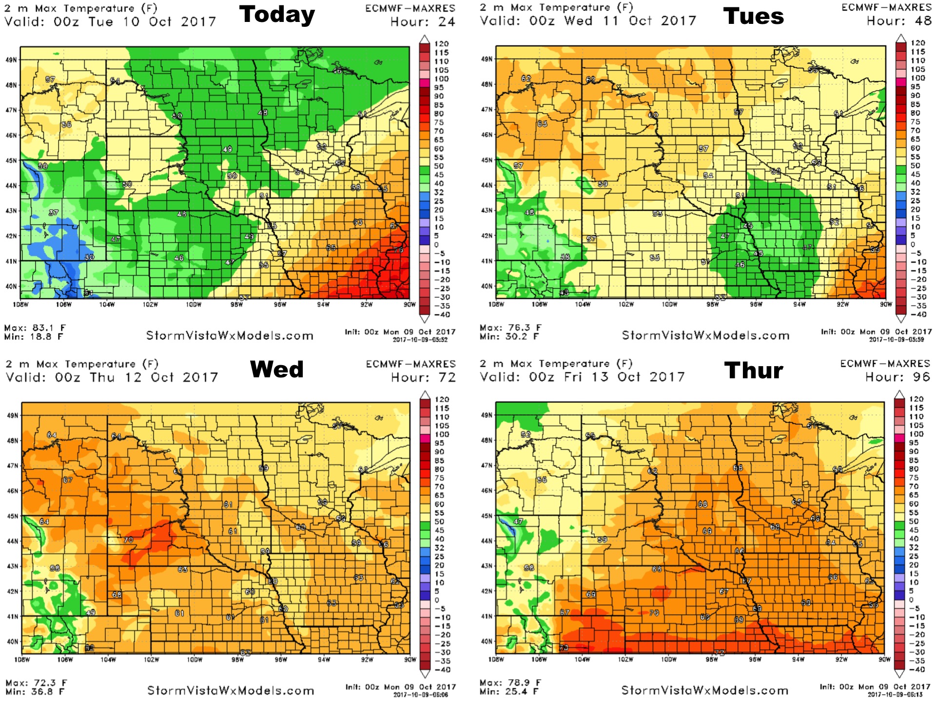
High temperatures next 4 days.
Low temperatures next 4 days.
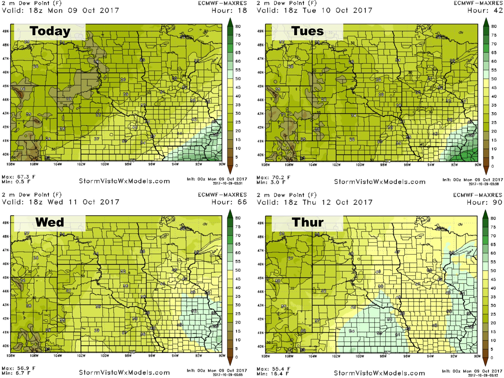
Dew points next 4 days.
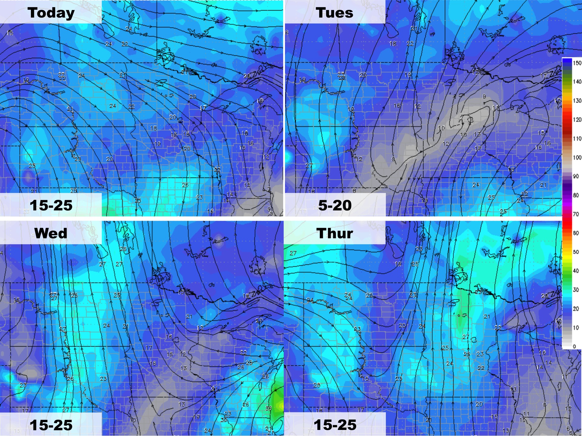
Wind forecast next 4 days.
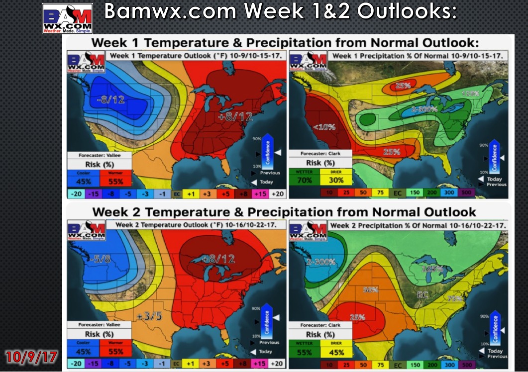
Week 1 and 2 outlooks.