#MAwx #CTwx #RIwx #NYwx #NJwx 3.31.17 Afternoon Storm Update
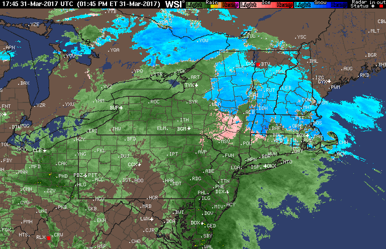
Good afternoon! Heavy rain is impacting much of the region this afternoon, but some portions of northern CT and Massachusetts are still seeing sleet and snow as of 4 PM. Here’s the latest radar.
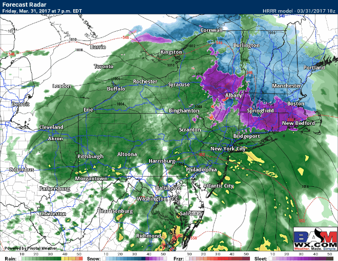
Snow and sleet will continue this evening and overnight, mainly north of I-90, with rain and sleet south of there. Here’s the latest projected radar through 8 AM tomorrow morning.
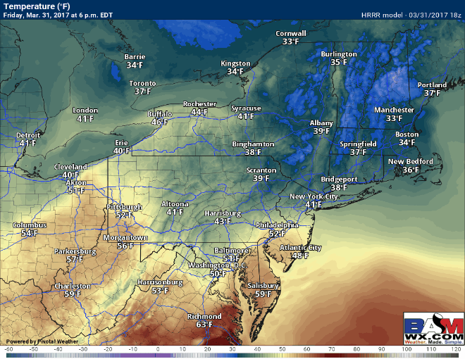
Temperatures overnight hover near 32 where it snows and sleets, and remain above freezing elsewhere. Overnight, roads likely become snow/sleet covered in northern and western MA and in the higher elevations of northern CT.
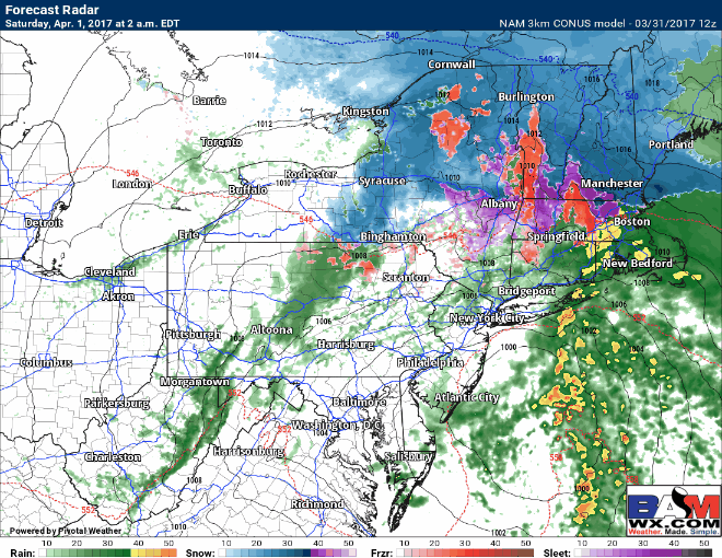
Precipitation likely ends as a burst of snow and sleet across northern CT, RI, and eastern MA before ending tomorrow during the afternoon hours. Temperatures should stay above freezing through the morning outside of higher elevations.
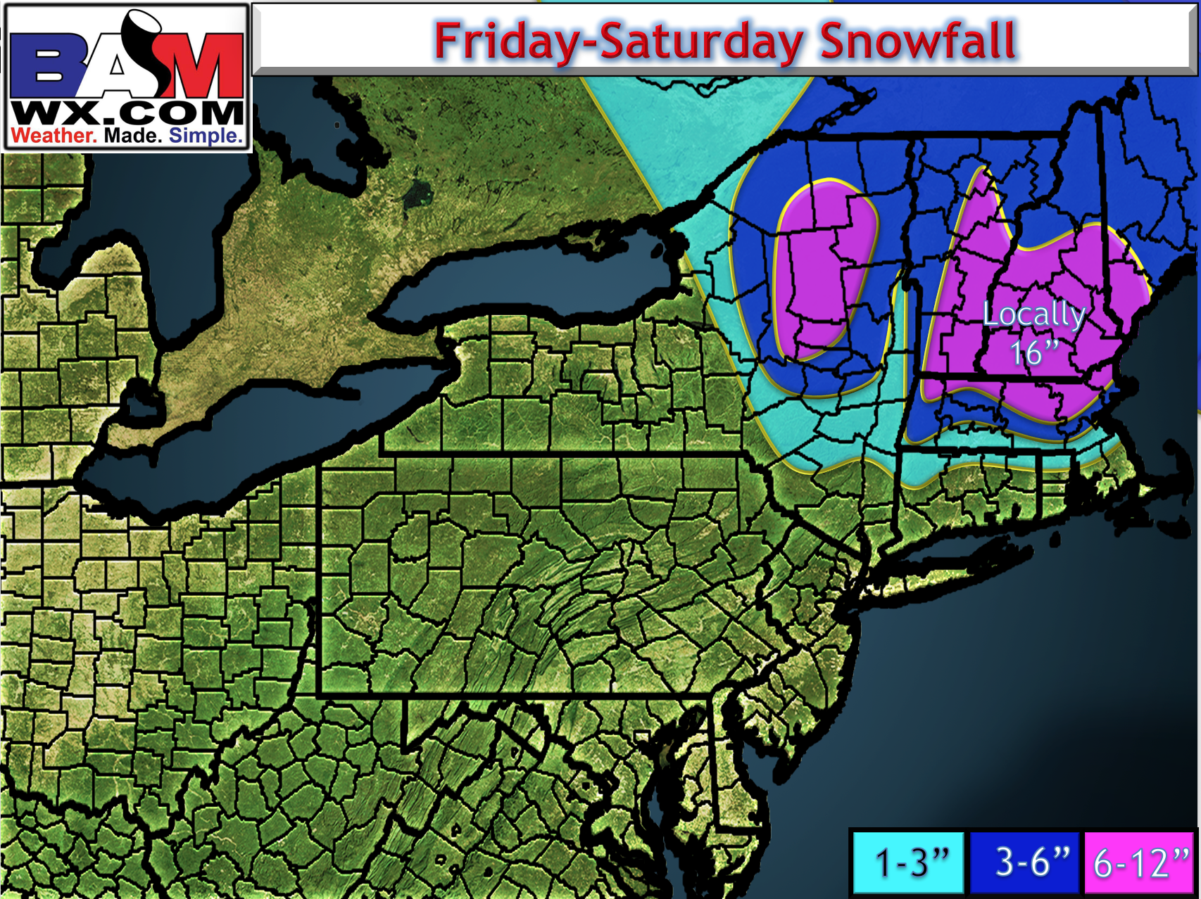
Amounts were raised slightly in northern MA, otherwise no changes to the snow map.
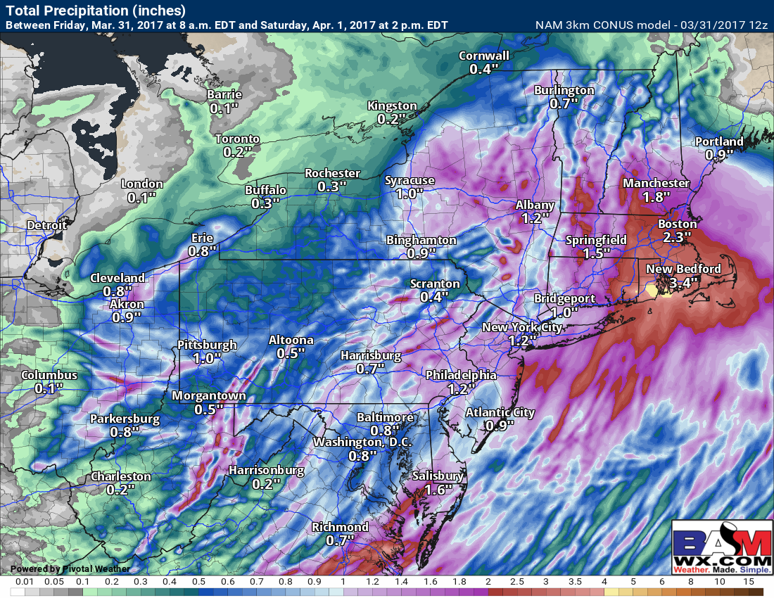
Total rainfall where it is all rain will also be impressive, with widespread 1-3″ amounts likely along with localized flooding.
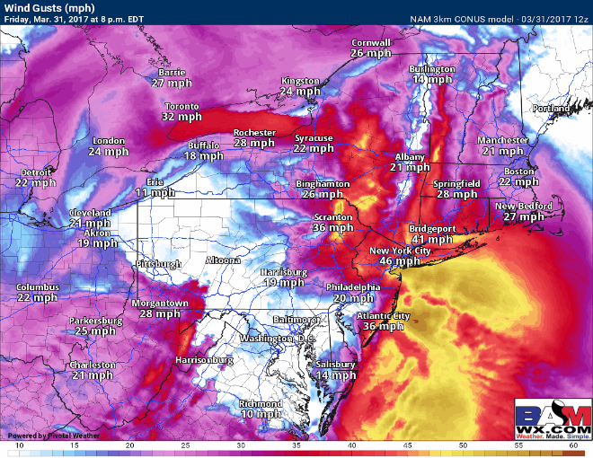
As the precipitation winds down tomorrow, winds will crank up as well past 40 mph at times. Projected gusts:
That’s the latest. If you have any questions let me know, otherwise enjoy your Friday! ~Ed