Key Points – Thursday, August 3, 2017:
Synopsis: Good Thursday morning! Continued scattered storm threat today across the forecast area, some certainly have the potential to be strong to severe (with localized heavy rain and large hail). As the cold front moves east late tonight we will see a more organized storm threat moving east across Indiana and Ohio into Friday (need to watch for a reintensification of these storms across central Ohio tomorrow too for strong storms). Behind this front much cooler air settles in Friday, windy as well with gusts topping 35mph in some spots. Watching for another storm chance Sunday into Monday across the area…more widespread rainfall as well. If you have any questions let us know, have a blessed weekend!
Today’s video (7:40 min):
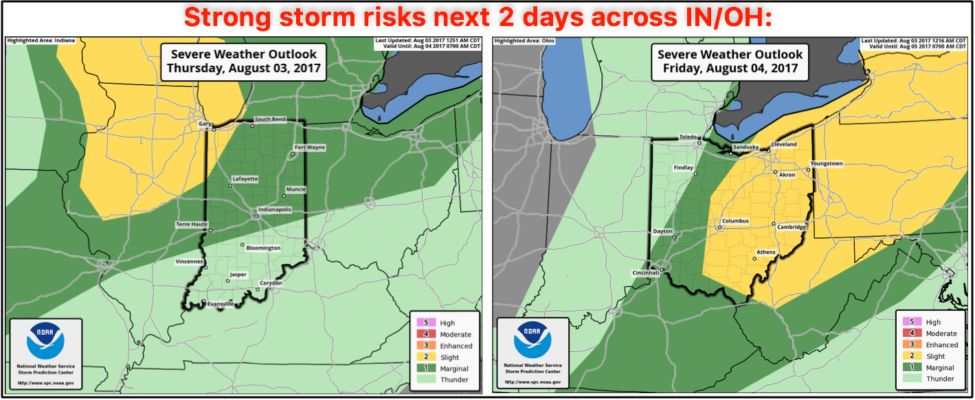
Strong storm risks next 2 days…isolated strong storms possible today across the forecast area (gusty winds, isolated large hail, localized very heavy rainfall)…as the front pushes east on Friday the risk shifts to Ohio for the same threats.
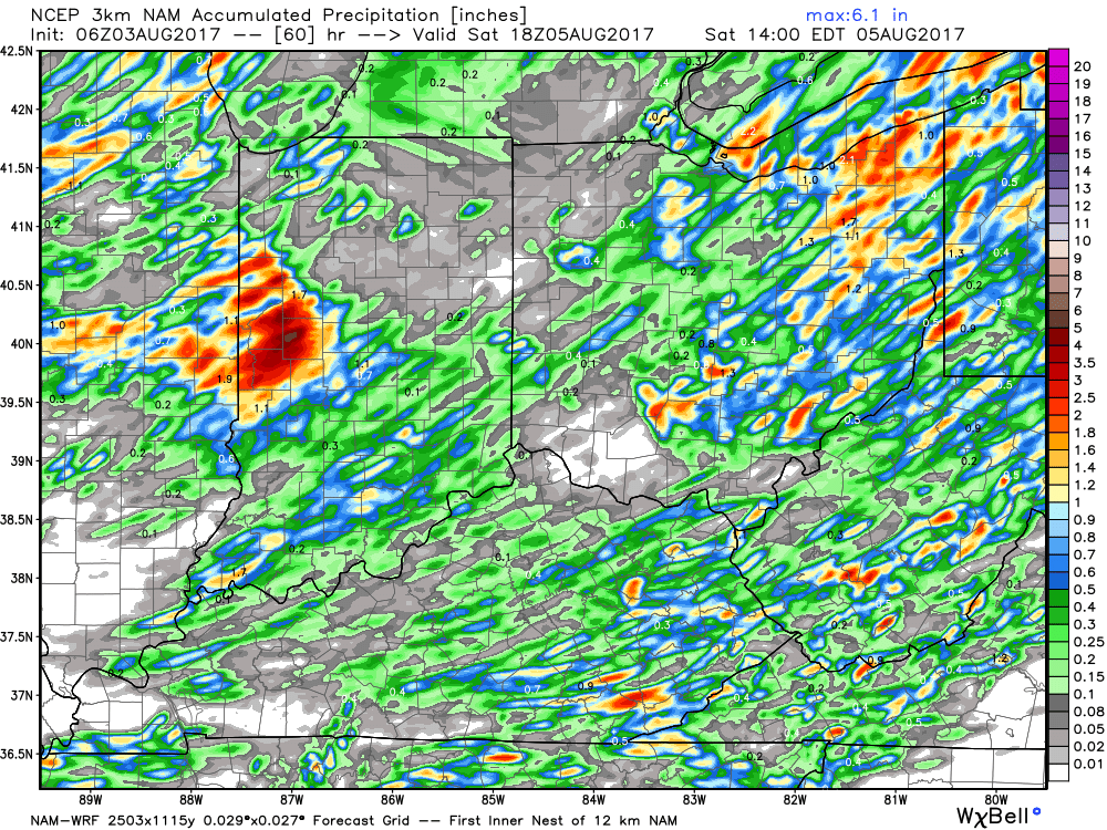
Rainfall guidance over the next 2-3 days…isolated 1-3″ on the table here:
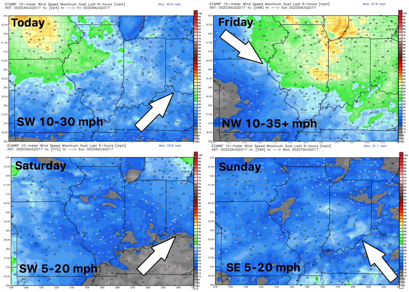
Wind forecast into the weekend…it’ll be quite the windy day on Friday with gusts topping 35mph in some locations possible.
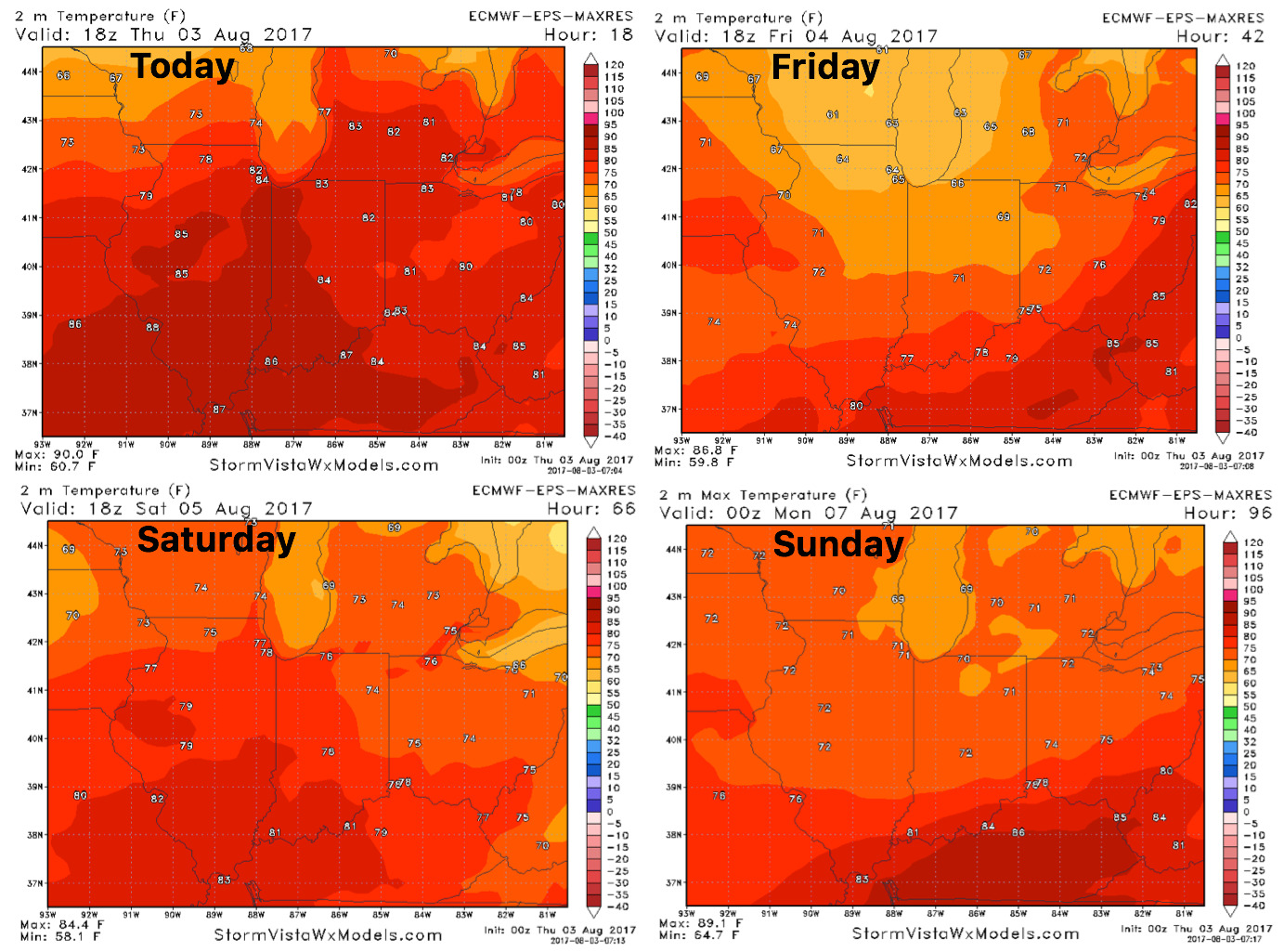
High temperature guidance next 4 days…cooling off in a big way with 70s:
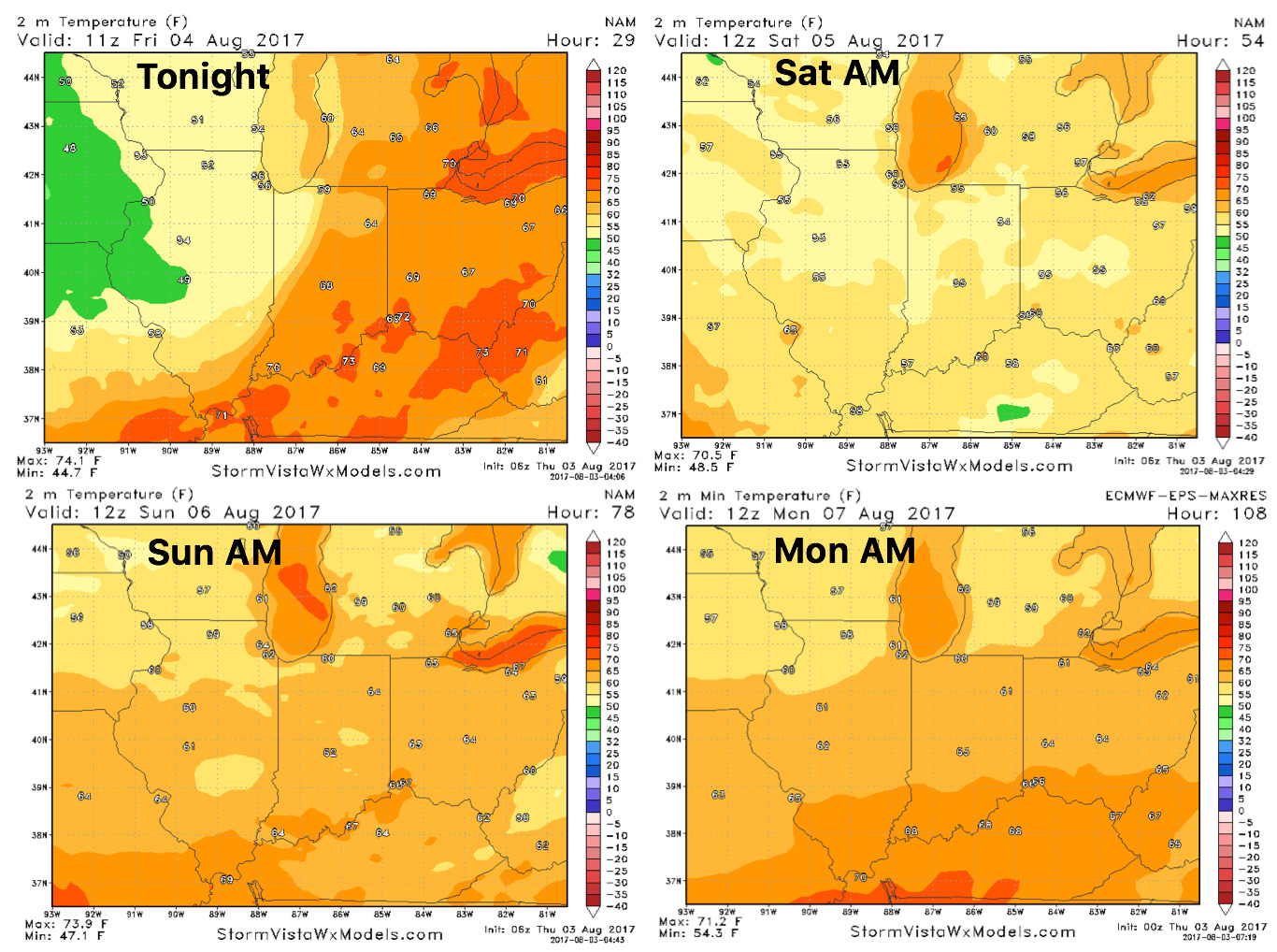
Overnight lows will take a dive over the next couple of nights:
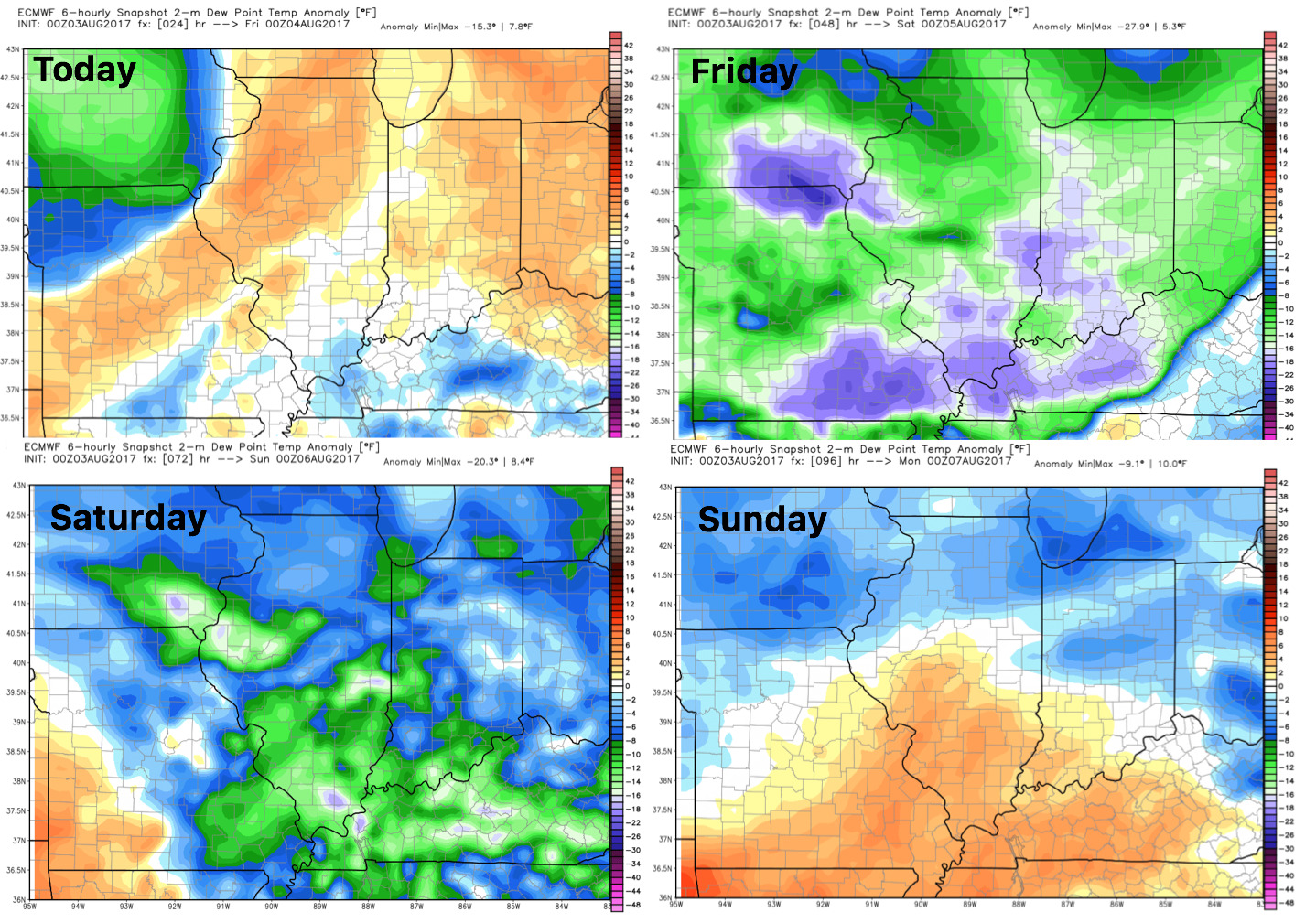
Dew points from normal, some major humidity relief expected Friday and Saturday as the cold front sweeps east: