Key Points – Monday, July 3, 2017:
Synopsis: Good Monday morning! We see a boundary hanging around north central parts of the Midwest today, watching this to be a focal point for some storms later on today to the north with another piece of energy swinging east near the Ohio River that will produce additional storm coverage into Tuesday. In the video we discuss additional storm chances on Wednesday and later on this week as well…very difficult to pinpoint exactly where the heaviest rainfall sets up as it’ll be very storm dependent…haves and have-nots continue. If you have any questions please don’t hesitate to reach out, have a blessed day!
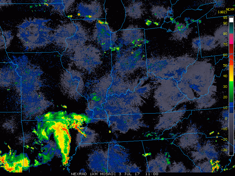
Current Radar:
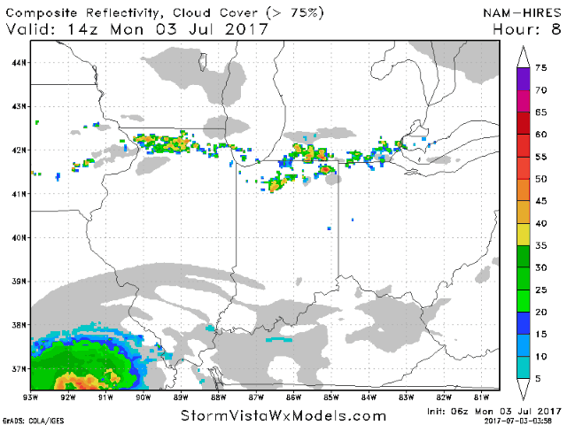
Simulated radar guidance from the WRF today…seeing storms this afternoon form along a boundary to the north as well as a disturbance push east along the River into Tuesday morning for additional storm development.
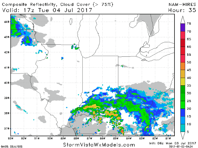
Showers/storms continue north and east on Tuesday to the south and east…it’s later on Wednesday evening we need to watch more activity moving from southwest to northeast.
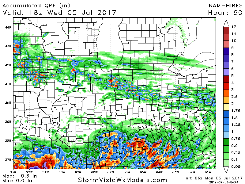
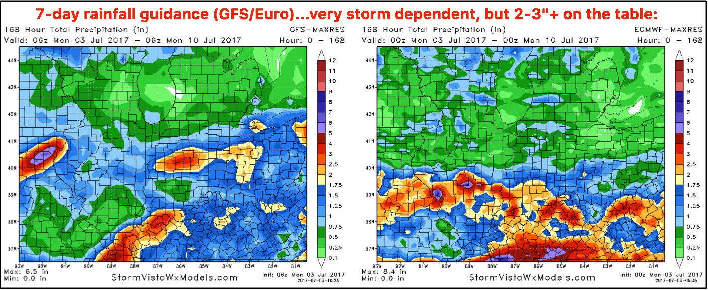
Total rainfall thoughts…hit and miss to the north where you could have locations see 2-3″ isolated, with rainfall totals down south seeing the potential of 2-3″ as well.
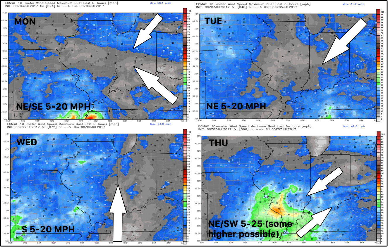
Wind forecast over the next 4 days:
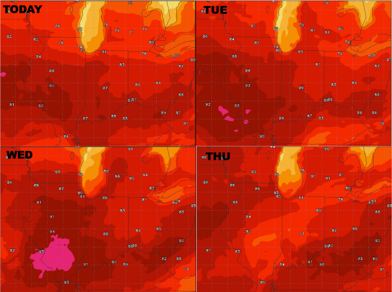
Temperatures through mid-week:
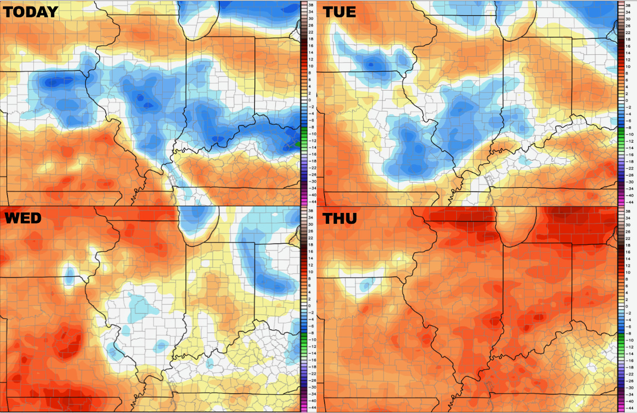
Dew points from normal here as well:
Rainfall guidance over the next 7 days says one thing: it’s all storm dependent and very difficult to pinpoint exactly where the heaviest rainfall sets up shop. But localized 2-3″ is on the table here once again.
Confidence:
- Average confidence for additional storm development today along a boundary north and a disturbance near the River.
- Average confidence for scattered showers and storms Tuesday into Wednesday as well across the Midwest.
- Lower confidence in exactly where the heaviest rainfall sets up shop this week…very storm dependent but 2-3″ on the table once again.
- Above average confidence the majority of the warmth this week will be focused across western Zone locations.
Video (6 min):