Key Points – Wednesday, July 5, 2017:
Synopsis: Good Wednesday morning! We are watching a rainmaker moving slowly northeast across the southern tier of the Midwest today that will bring scattered heavy rainfall as we go forward. We also need to watch a potential storm cluster Thursday night into Friday moving northwest to southeast for additional storms. Once the cold front moves through Friday into Saturday, a much more comfortable pattern sets in under high pressure. If you have any questions please let us know, have a blessed day!
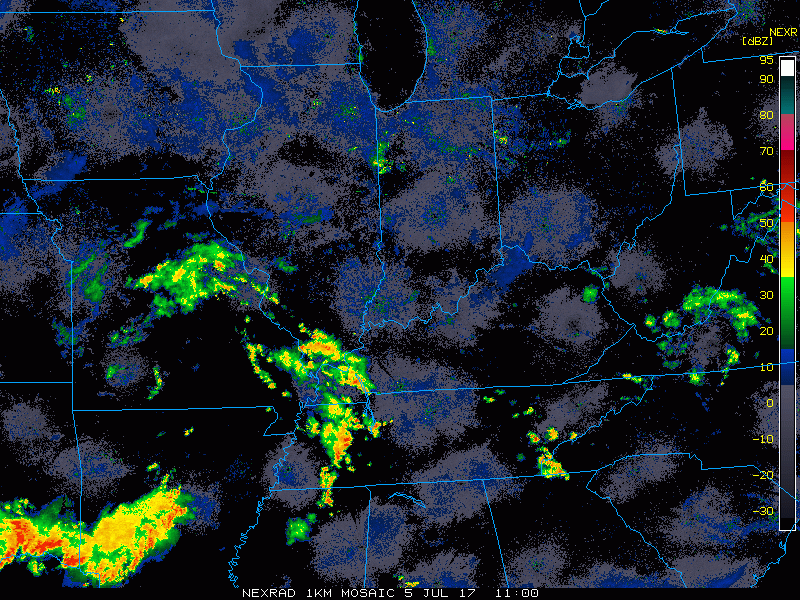
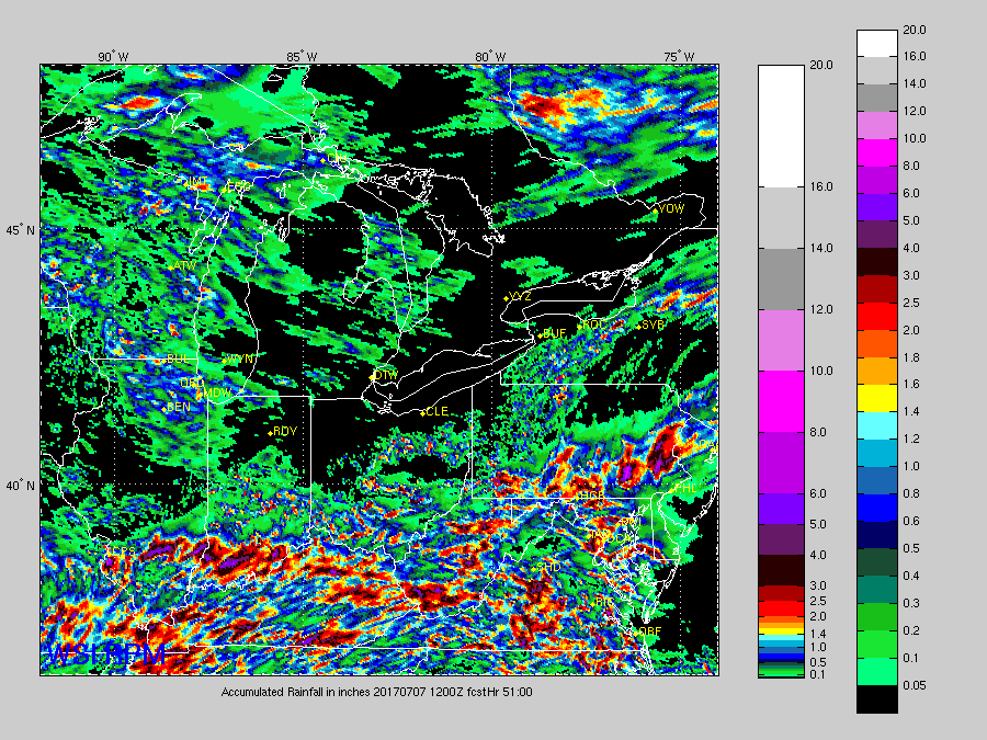
Current Radar:
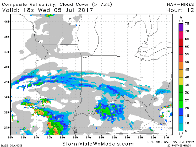
Simulated radar guidance later this afternoon into Thursday evening as the system to the south slowly works northeast bringing scattered showers and storms mainly to the southern half of the forecast area. Can’t totally rule out a strong storm here as well.
Need to watch a pulse of energy suggested by the NAM-3km moving Northwest to southeast for additional storm clusters to move into the Midwest Thursday night into Friday morning:
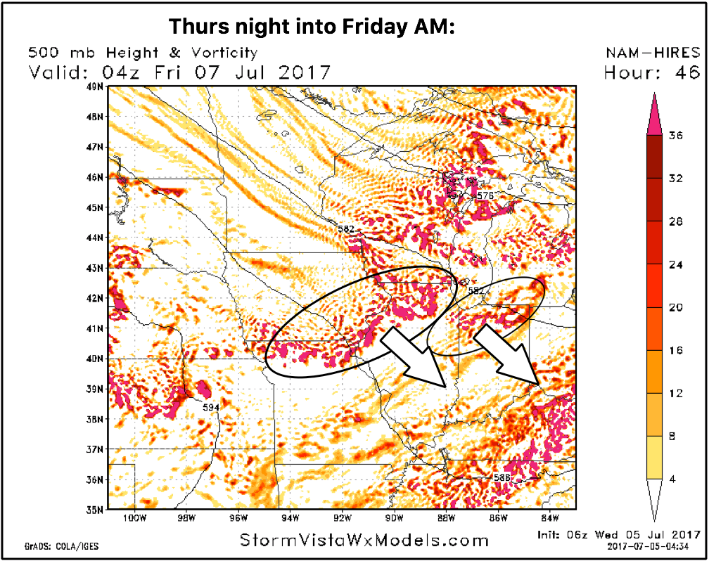
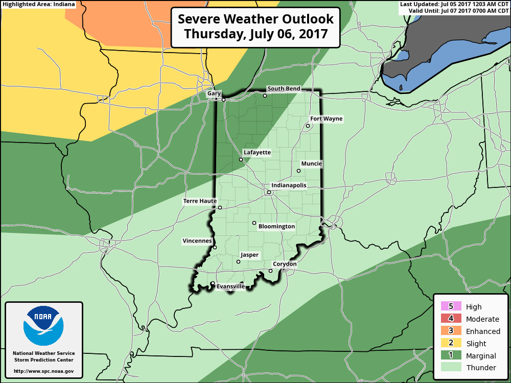
Latest strong storm risk is highlight below for Thursday night into Friday morning…if this cluster holds together more into Indiana and western Ohio we expect the slight risk to shift further east and south as well:
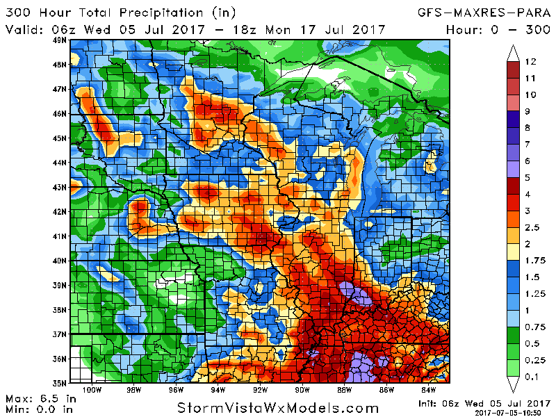
Total rainfall over the next 2-3 days…heavier rains of 1-3″ (with isolated higher amounts possible) work in across the southern tier of the Midwest, as well as the cluster we discussed above and in the video moving NW to SE across Illinois/IN Thursday night into Friday morning…if the cluster holds together, we will see an uptick across the northern half of Indiana here as well.
Over the next 10 days rainfall guidance…no model is going to nail where the precipitation sets up perfectly, especially with this northwest flow, but the overall theme here is it’s active with the potential of bringing scattered areas of 3″+.
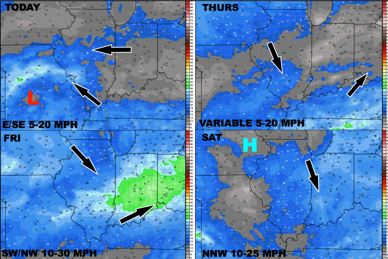
Latest wind forecast into the weekend:
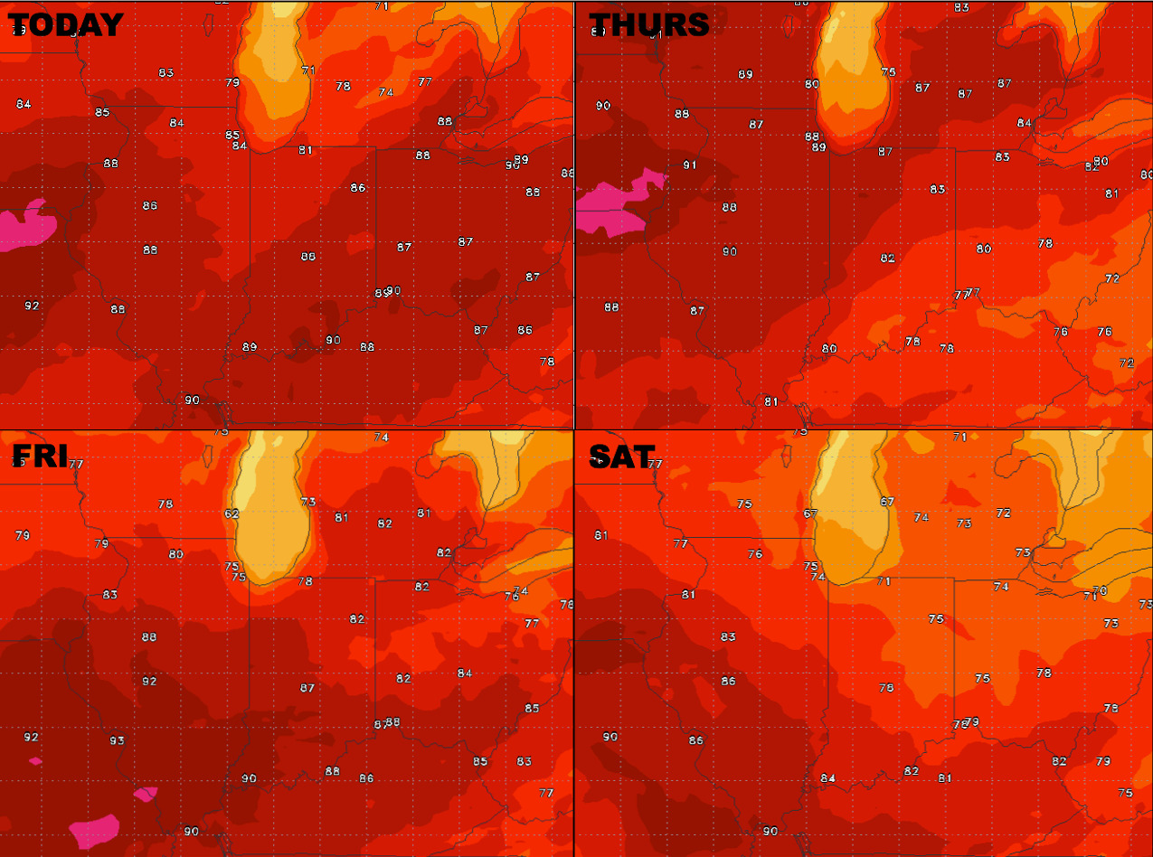
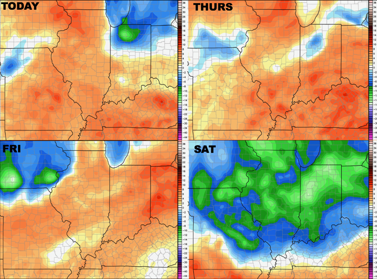
Looking at temperatures as we head into the weekend as well…once that cold front sweeps through, much more comfortable temps are in store:
Dew points from normal show a similar trend, once the front sweeps east it’ll knock down the humidity:
Confidence:
- Above average confidence a system will continue to slowly work northeast mainly across the southern half of the Midwest today into Thursday bringing localized heavy rainfall.
- Average confidence of another piece of energy working on late Thursday into Friday morning from northwest to southeast that we need to watch for additional storms…some may be strong.
- Above average confidence it’ll be a cooler than normal weekend, comfortable too, as the cold front swings through Friday into Saturday.
Video (6:40 min):