Key Points – Wednesday, July 26, 2017:
Synopsis: Good Wednesday morning! Today we discuss the very heavy rainfall and potential for a few strong storms in places that just don’t need it, unfortunately. The difficult part about this forecast is how far this piece of energy tracks north or south, which will have a major impact on exactly where the heaviest rains work in later Wednesday into Thursday; thoughts right now is we are watching for a two-wave scenario. Moving beyond today, a much nicer, more comfortable pattern works in this weekend…a drier pattern works in across the Ohio Valley as well getting into next week. All the details in the video, if you have any questions please let us know! Have a blessed day.
Today’s video (7 min):
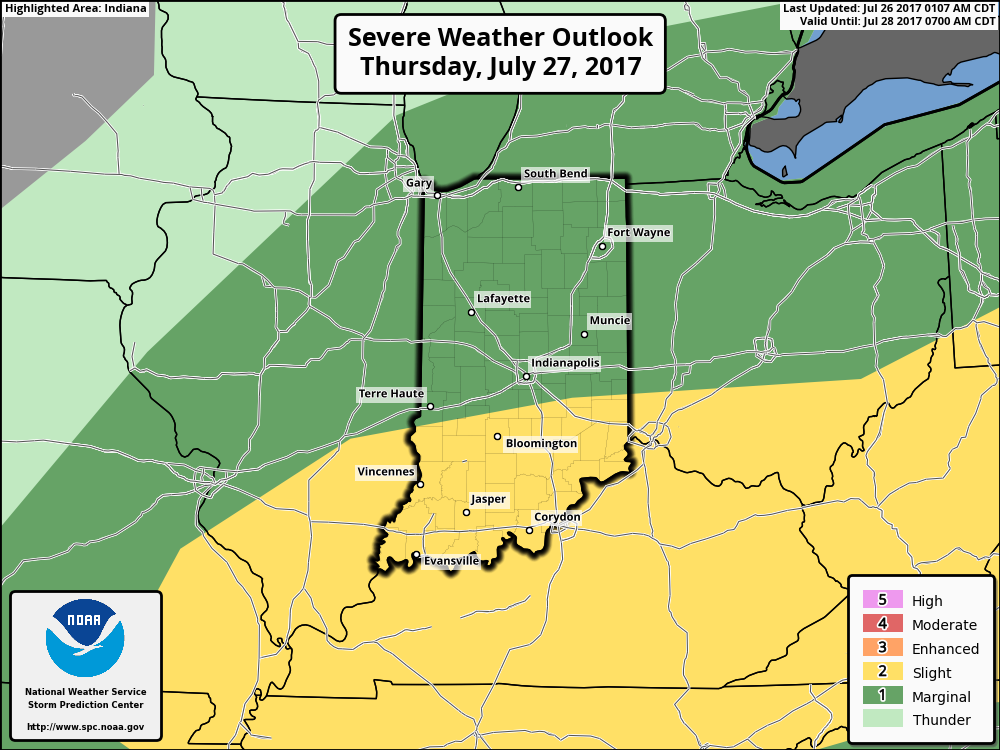
Strong storm risks on Thursday across Indiana and Ohio…the threat has shifted slightly further south than guidance yesterday…main risks being very heavy rainfall and damaging winds:
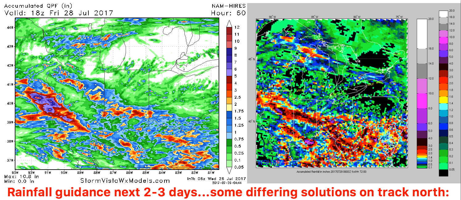
Difficult rainfall forecast over the next 2-3 days:
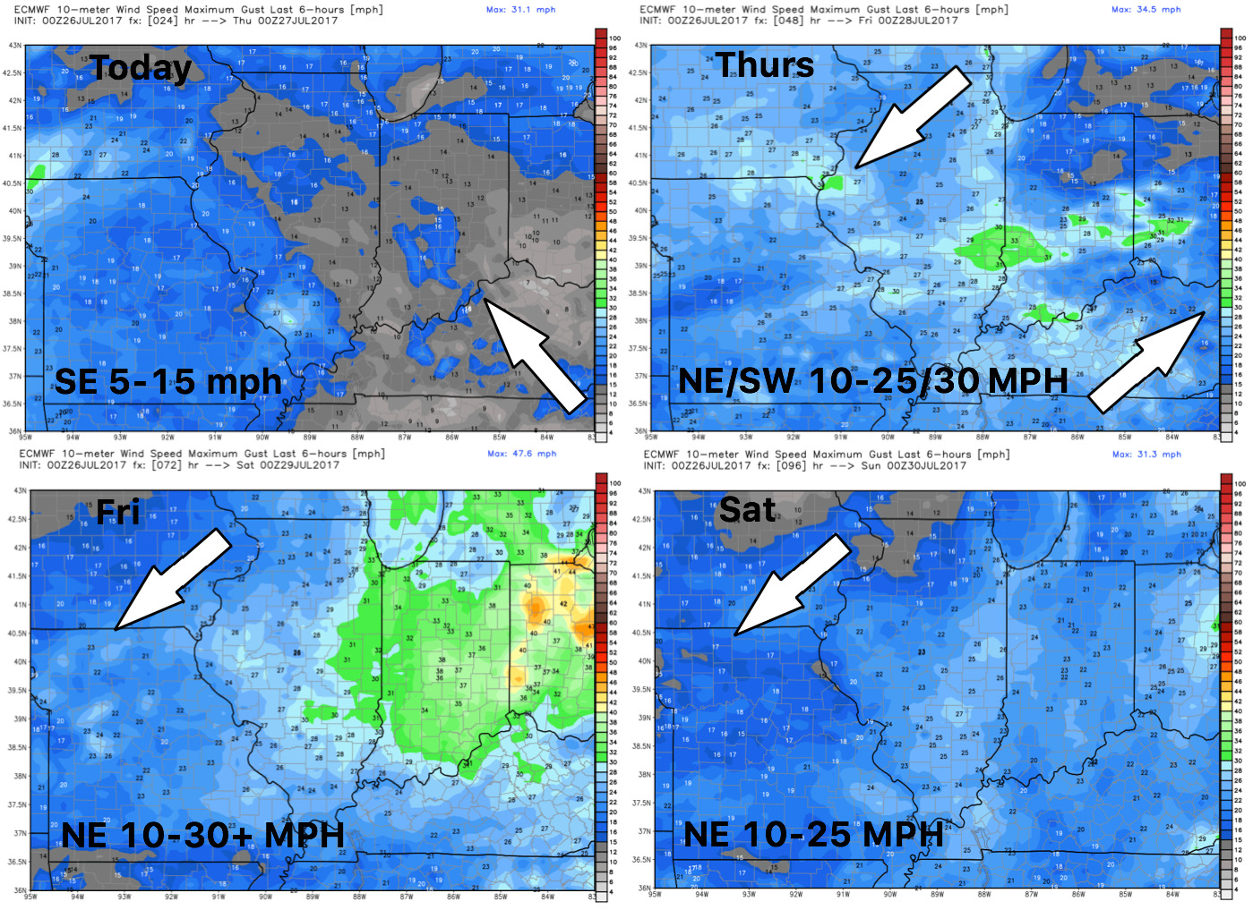
Wind guidance next 4 days:
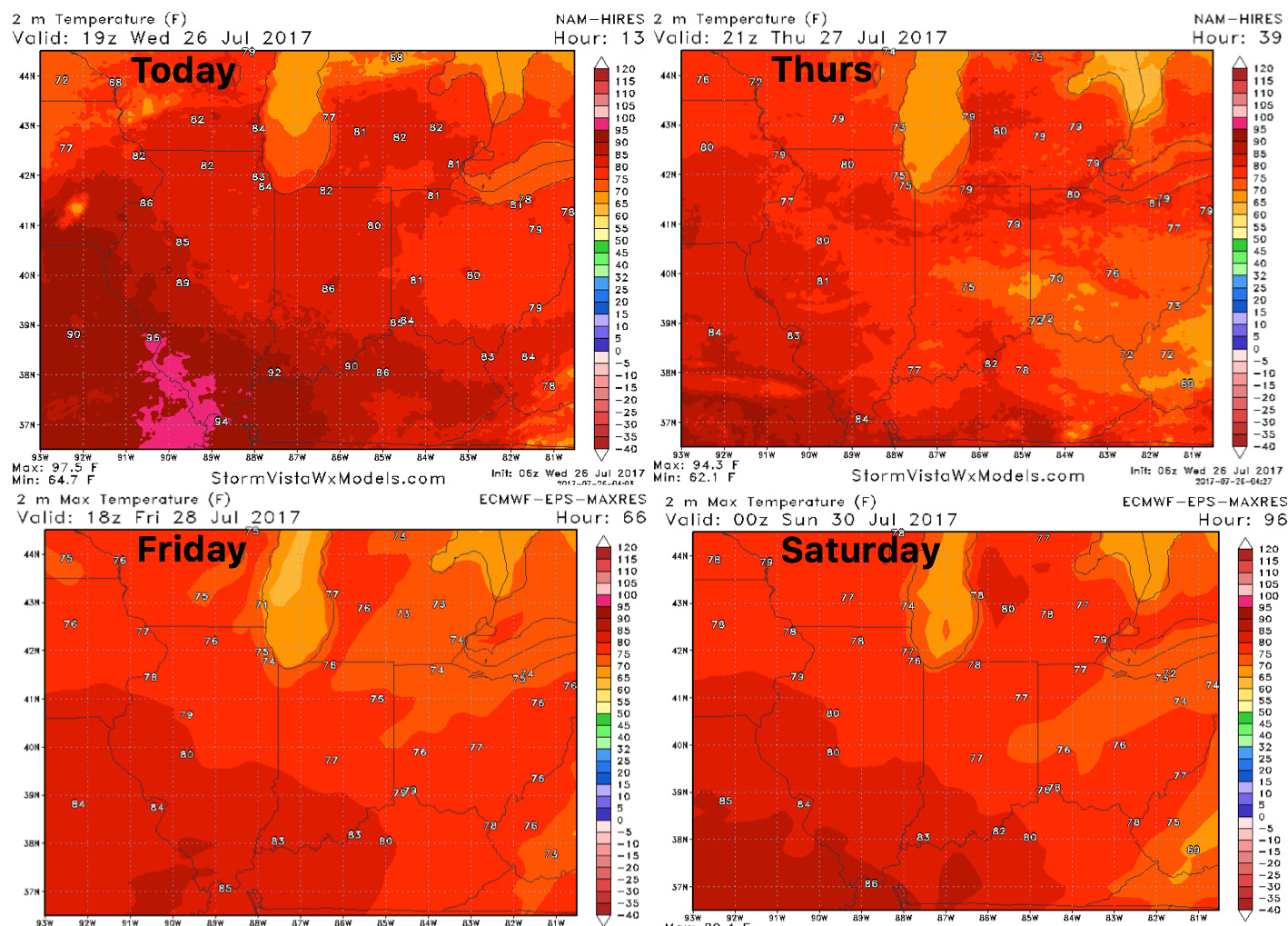
High temperature forecast into the weekend…temperatures falling well below normal as the front passes Thursday:
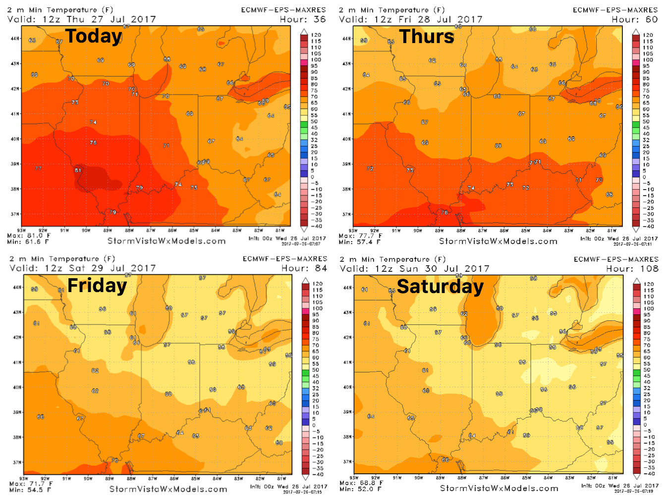
Overnight lows into the weekend as well, will feel “fall-like” in some locations!
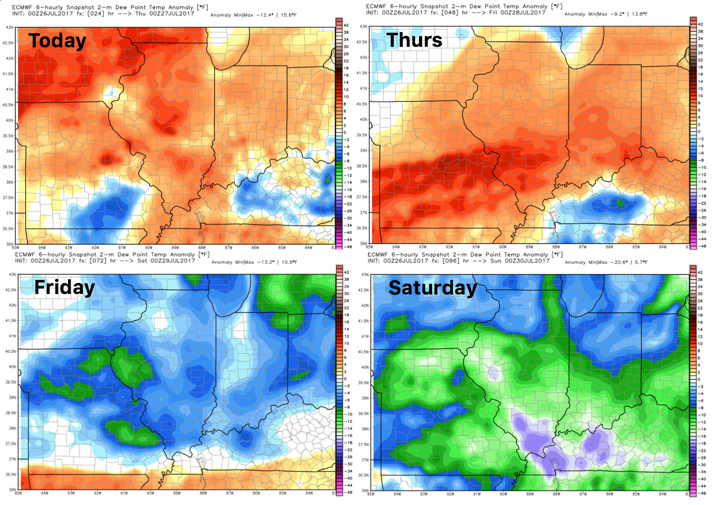
Dew points from normal: