Key Points – Monday, May 22, 2017:
Synopsis: Good Monday morning! In today’s update we target multiple storm systems moving through the Midwest this week including a potential heavy rain maker Memorial Day weekend. Furthermore, overall we will be cooler than normal for this time of year for the Midwest as well. Have a blessed week!
Next storm system looks to move through late Tuesday and for sure on the day on Wednesday into Thursday before exiting east later Thursday. A few rumbles of thunder will be possible here as well with some heavy rainfall falling at times.
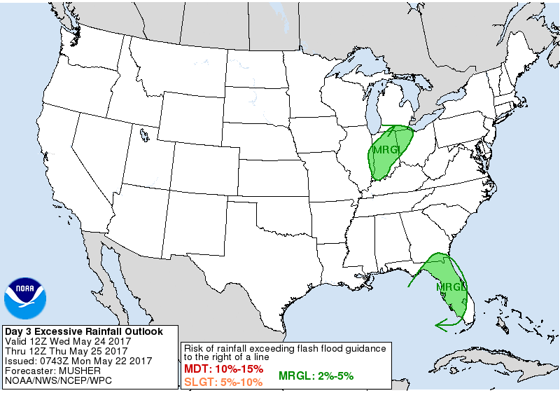
In fact, a good portion of the Midwest has been included in a marginal risk for excessive rainfall on Wednesday into Thursday morning. One thing we know as of late is models are doing a poor job at picking up on rainfall totals…with precipitable water values above normal in this timeframe we need to be watching for a trend for heavier rains here 1-2″+ on the table in some locations.
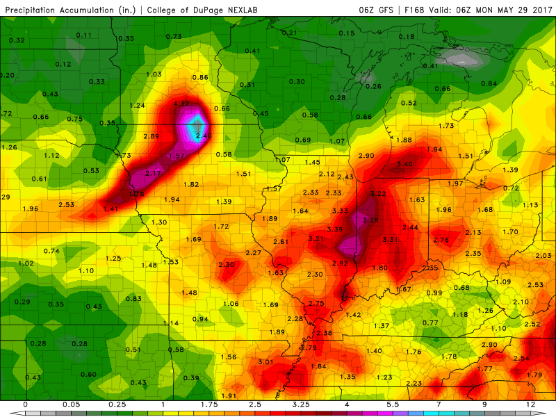
Brief break Friday into Saturday morning before paving the way for another heavy rain maker moving in from the central Plains. Saturday evening into Sunday and even on the day on Monday will feature most likely a washout. The exact track isn’t 100% set in stone, but all of our major models are picking up a heavy rain maker here, just need to fine-tune where exactly the heaviest rains fall. Check back often.
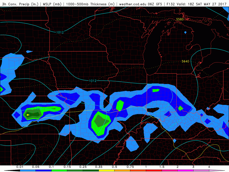
Still need to work things out over the next couple of days for the big rain maker this coming weekend as to where exactly the heavy rain sets up, but 2-3″+ certainly on the table here over the next week.
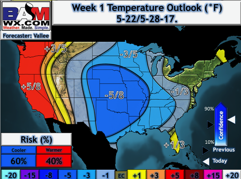
Temperatures this coming week via our updated long-range outlooks will feature slightly cooler than normal temps overall across the Midwest.
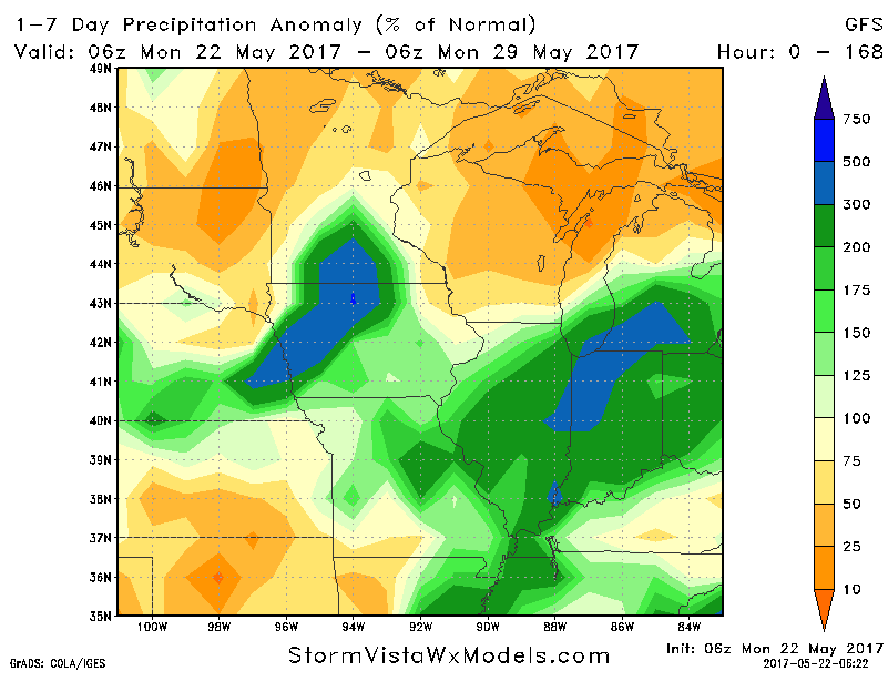
Glancing at precipitation from normal overall this week ahead will feature once again above normal precipitation across the Midwest. Take these percentages with a grain of salt, but you get the idea here that we are targeting multiple rain makers that have the potential to bring a good amount of rain.
Confidence:
- Above average confidence additional showers and a few storms possible later Tuesday into Wednesday, even lingering into Thursday this week.
- Lower confidence right now to excessive rainfall, but the risk is on the table Wednesday into Thursday.
- Increasing confidence for a heavy rainmaker Memorial Day weekend as an impressive low pressure system looks to make its way east through the Plains.
- Average confidence over the next week we will be overall cooler than normal.
Today’s video (8 min):