#INwx #ILwx #OHwx #KYwx Latest update on severe storm risk into tonight. N.
Synopsis: Good Thursday afternoon! Thunderstorms will continue to increase through the rest of the afternoon into tonight as a cold front moves into the region. Storm chances will shift into Ohio and eastern Kentucky on Friday, with an unseasonably cool air mass moving in behind the front. Additional rain/storm chances arrive Saturday night and Sunday. Detailed analysis in the video.
Short-Term Video (6 min):
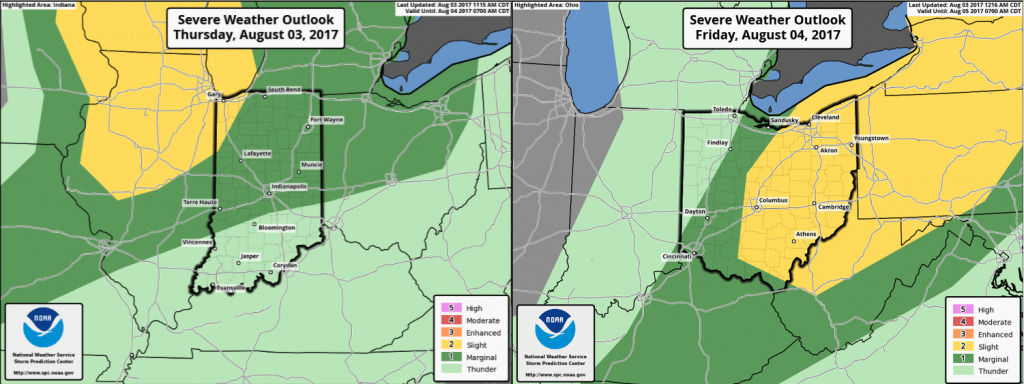
Here are the severe weather outlooks over the next two days. Best chances for severe weather today will be across the northern half of Illinois into northwest Indiana, where dynamics are more favorable for a few damaging wind gusts/hail/isolated tornadoes. Central/northern Indiana into Ohio remains under a marginal severe risk for isolated strong to severe storms with wind and hail the main threats.
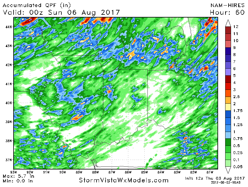
Here is a look at rainfall potential over the next 60 hours. Very hit or miss nature with some areas staying dry. Locally 1-2″+ amounts under any storms.