Key Points – Tuesday, May 2, 2017:
Synopsis: Good Tuesday morning! Spotty showers linger throughout the day with some peaks of sunshine, we will be quite windy today as well with wind gusts topping 40mph possible again today. The story continues to be the heavy rainfall threat Wednesday through Friday morning this week…can’t rule out some localized flash flooding as well. Continuing into the weekend, another cool shot emerges as the low pressure moves off to the east…overnight lows look to dip into the mid-30s, giving potential for a hard frost. We also cover new long-range data suggesting a continued cooler than normal month expected ahead.
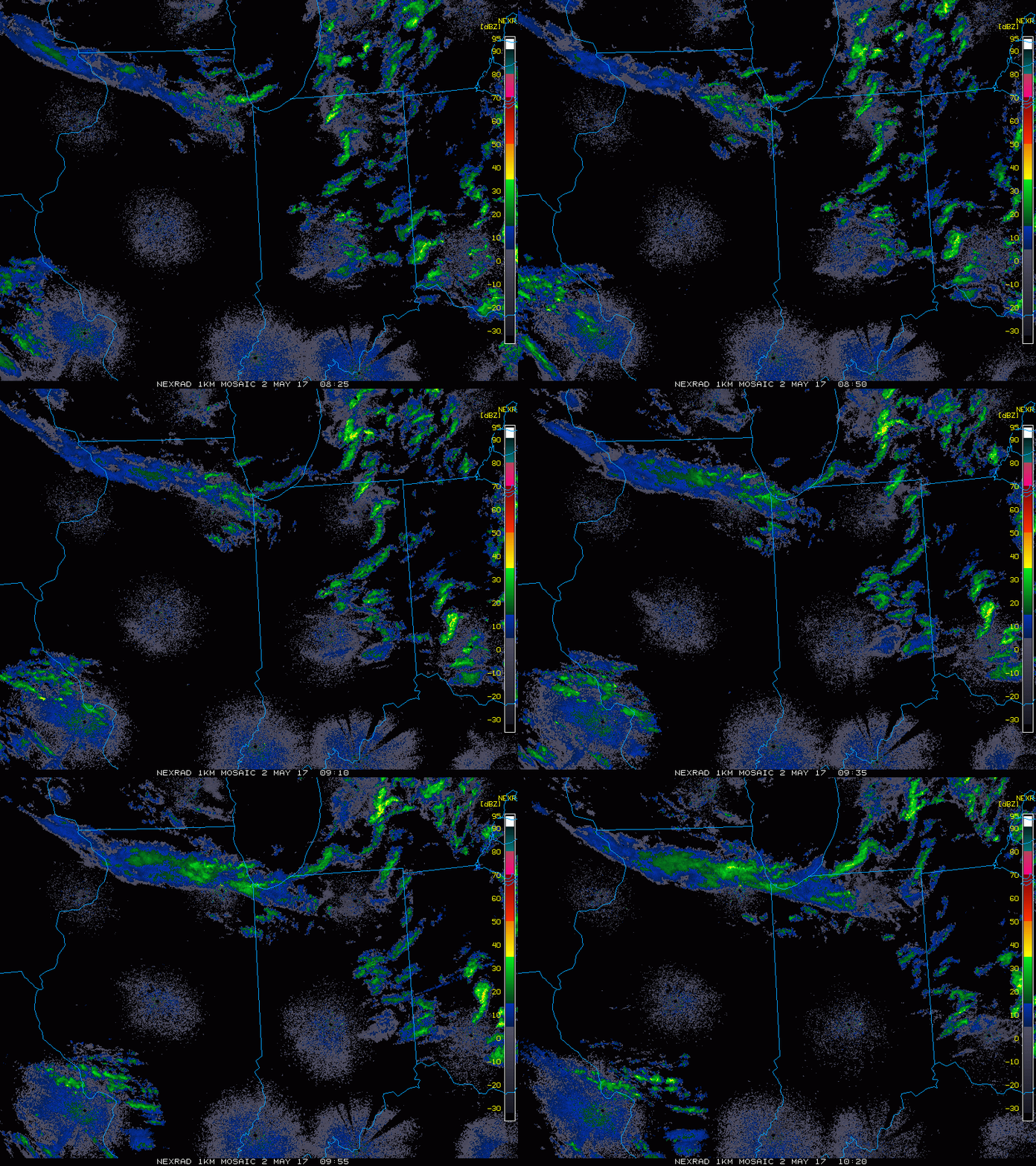
Current Radar:
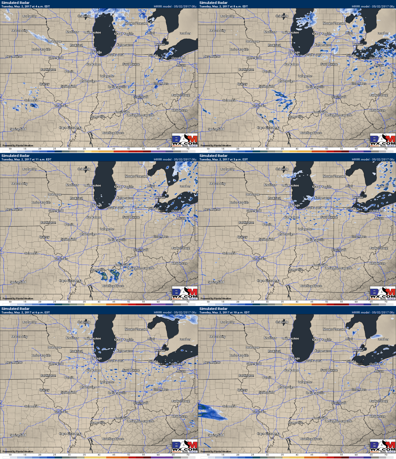
Simulated radar today…some spotty showers will be possible due to an upper-level low pressure kind of lingering around before moving off to the east. Some peaks of sunshine will also be possible.
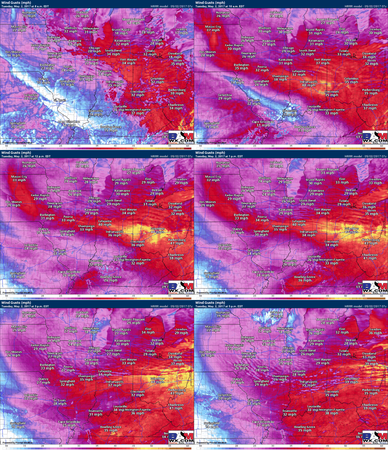
Very windy today…wouldn’t be shocked to see the high wind advisories expand to cover more of the Midwest today as well with gusts topping 40mph possible. Winds calm down into Wednesday.
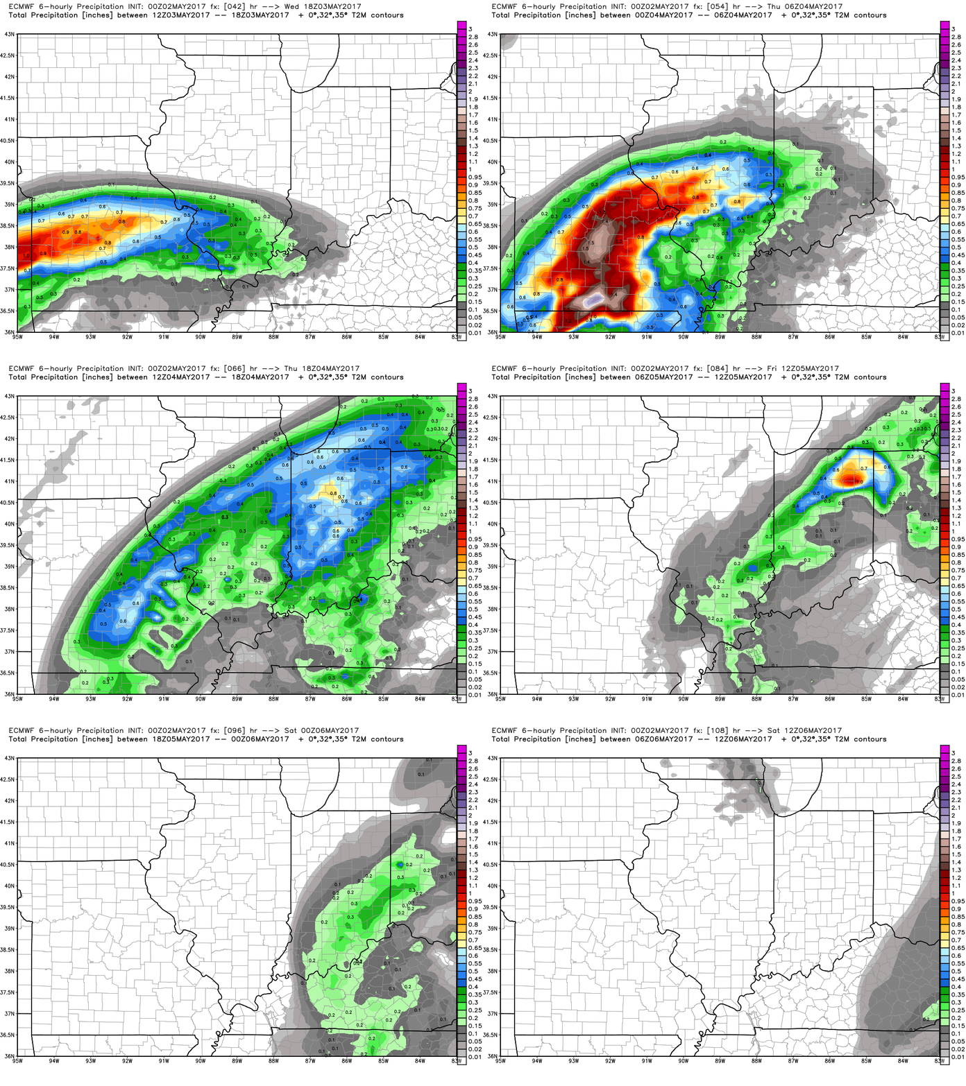
Another heavy rain maker moves into the Midwest Wednesday ~5-8pm and hangs around Thursday before exiting east Friday morning. Wouldn’t be shocked to see some isolated flash flooding on Thursday as well.
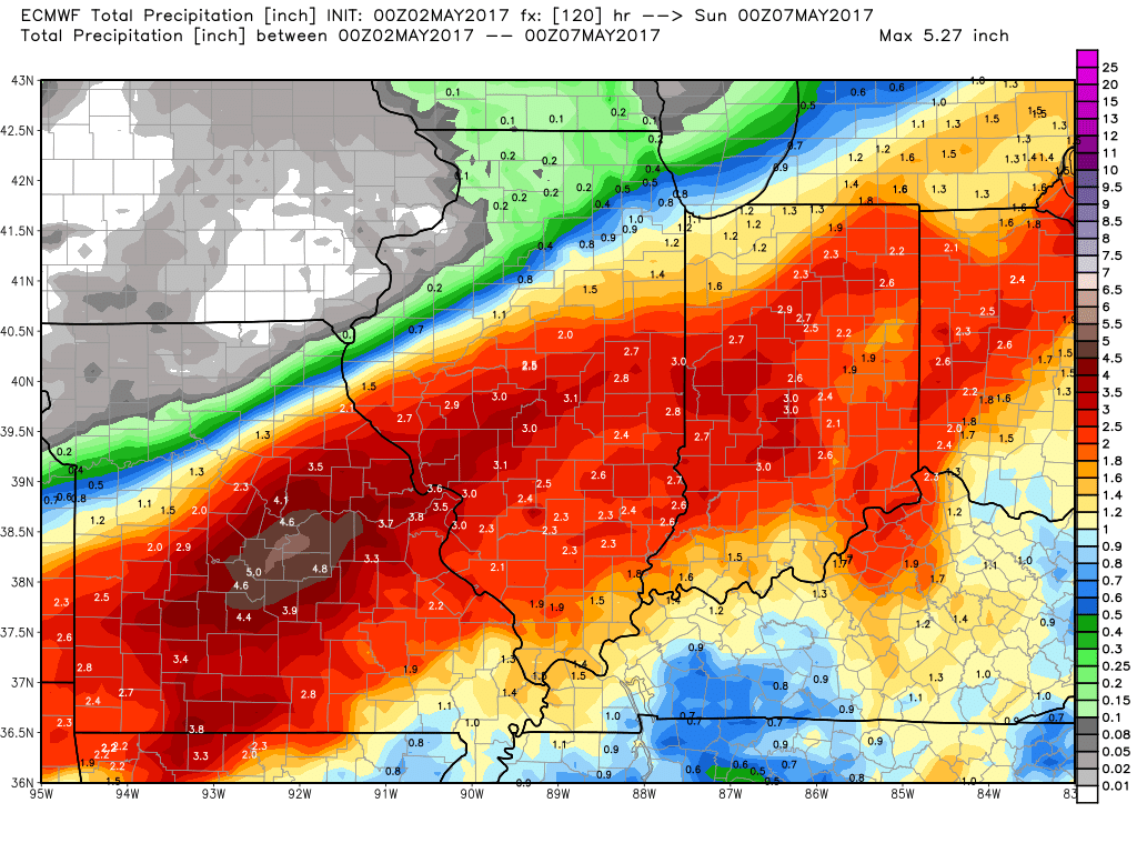
Latest thoughts on rainfall totals…a 1-3″ swath of heavy rainfall in areas that are already heavily saturated…couple that with chilly weekend temp and this rain isn’t going to go anywhere anytime soon.
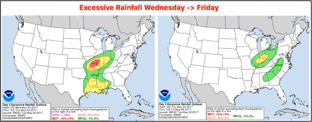
A slight risk for excessive rainfall risk has been issued for flash flooding Wednesday through Friday:
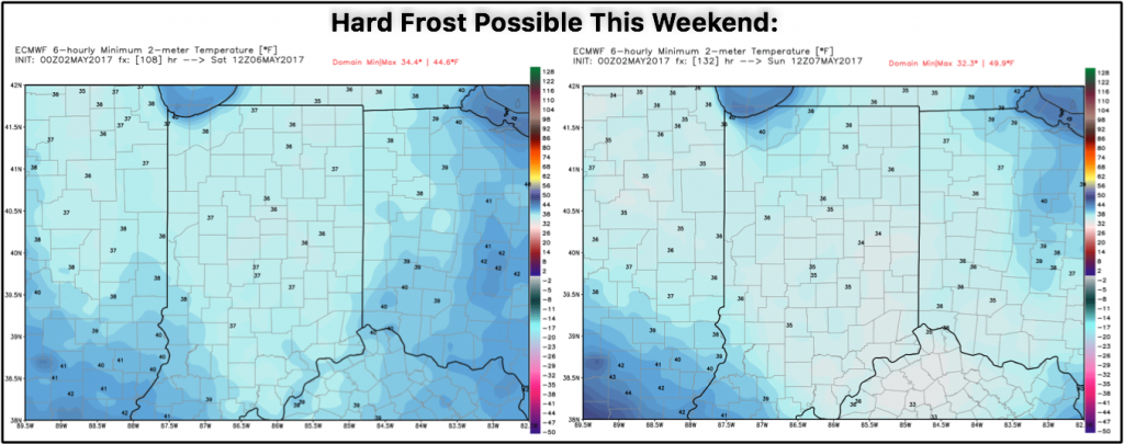
Hard frost this weekend? Latest data suggests mid-30s possible for overnight lows Saturday and Sunday mornings.
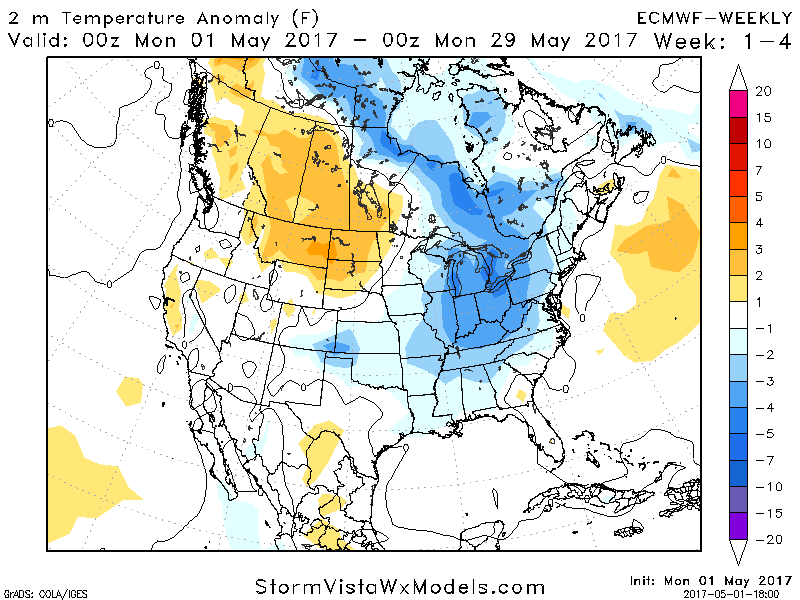
New European Weeklies have come in with a similar look to our May outlook…quite chilly overall which we’ve been mentioning for quite some time if you’ve been paying attention.
Confidence and Risk:
- Average confidence of some spotty showers today due to an upper-level low pressure system hanging around before pushing off to the east today.
- Above average confidence of additional rainfall Wednesday night through Friday morning across Zone 1/2.
- Average risk for localized very heavy rainfall, even flash flooding possible here as well.
- Average risk for a hard frost Saturday and Sunday mornings this coming weekend.
Today’s video (7 min):
