6:00PM-ET Update
Snow Removal Video: https://youtu.be/PW8T1r_auQ8
Impacts Map:
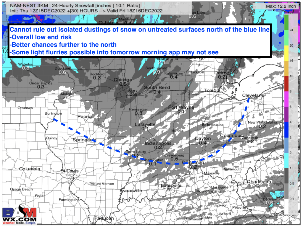
BOTTOM LINE: If you are receiving this notification, your area either runs the risk or is close to risk areas where a dusting of snow can’t be ruled out. Winds and marginal temperatures will limit most widespread impacts. However, light snow showers/ flurries as temperatures drop below 32 F will lead to the opportunity in spots, especially areas well sheltered to SW winds. In addition, some light flurries will be possible into tomorrow morning that the app may not be able to see.This is a low end risk, with a greater likelihood across northern areas. Widespread slick spots/ issues are NOT anticipated.Let us know if you have any questions. -Matt