#ILwx Summer Heat and Storm Chances This Week. Details Here! E.
Key Points: May 15, 2017
Synopsis: Good Monday morning! We hope you had a great weekend and happy belated Mother’s Day to all the moms out there! A warmer, more active period is expected this week with showers and thunderstorms periodically throughout the week, starting tonight across northern Illinois. We will stay predominantly on the warm side of the temperature battle zone developing this week across the middle of the country, but some cooler signals are beginning to show themselves for next week as warmth shifts east. We continue to think things stay somewhat active into week 2 as well. Have a wonderful day!
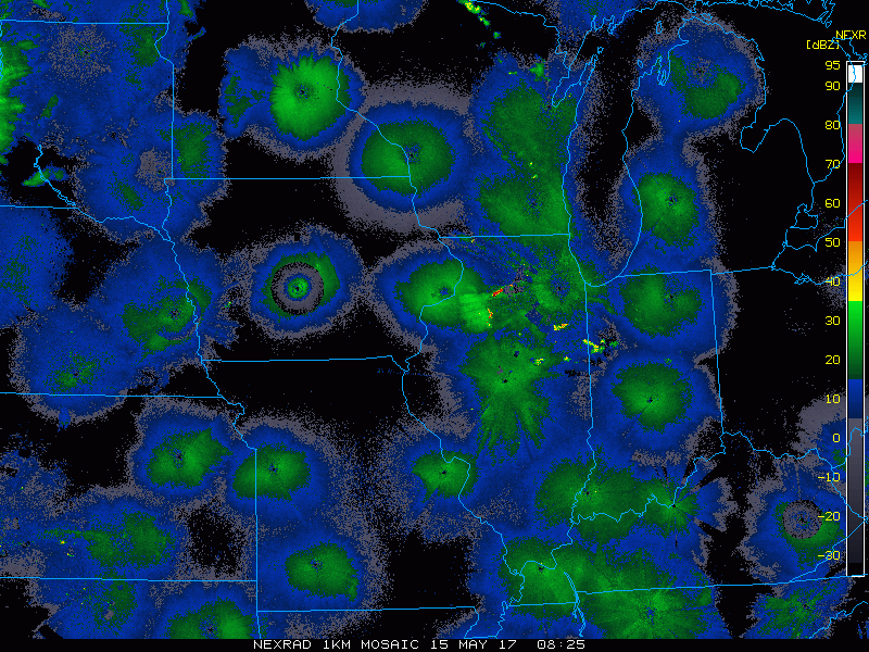
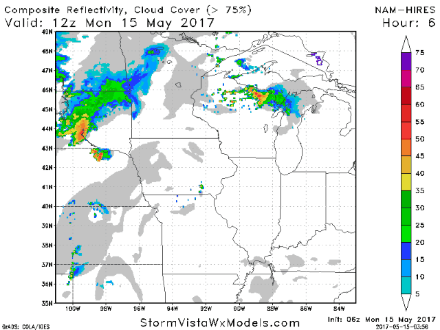
- Latest radar is mainly quiet this morning, but you can already see our next threat for storms coming tonight over South Dakota.
- A complex of storms will dive through Iowa and get into northern Illinois this evening with some rain and gusty winds. Southern and central areas likely stay dry.
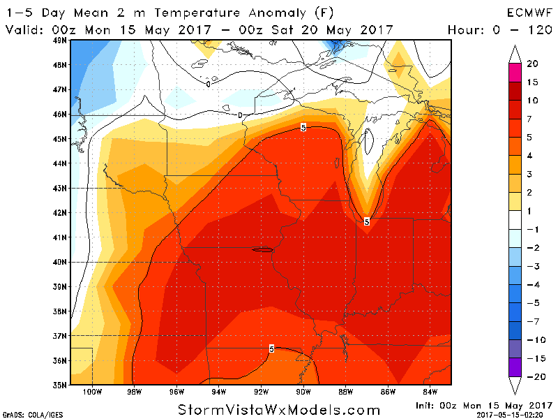
- Temperatures this week will be quite warm, averaging 7-10 degrees above normal across the state.
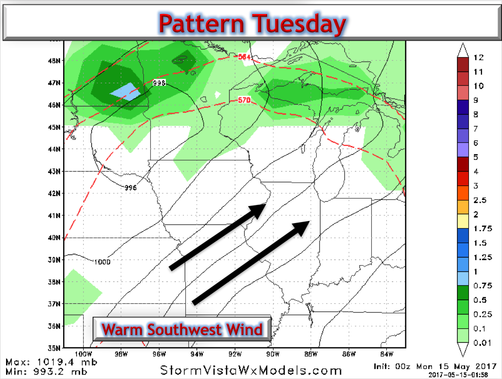
- Tuesday looks warm and dry with a breezy southwest wind.
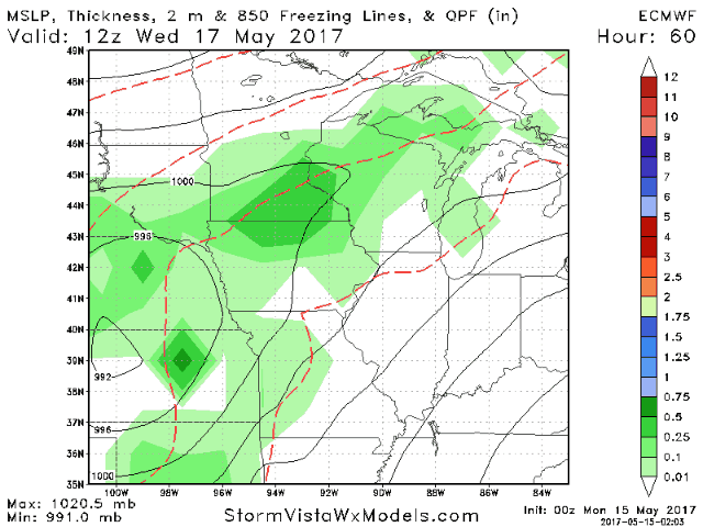
- An area of low pressure will pass to our west Wednesday and Thursday bringing some renewed chances for showers and thunderstorms. This likely lasts into Friday as well.
- Additional showers and storms are expected this upcoming weekend as we trend cooler into next week.

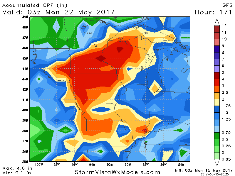
- Total rainfall will be hit or miss based on storms, but here’s a general idea.
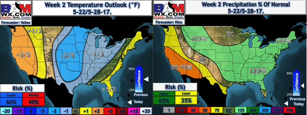
- Our week 2 forecast maintains the active possibilities, but note we do trend cooler across the region.
Confidence and Risks:
- Above average confidence in a complex of storms diving through Iowa into northern Illinois tonight. Central and southern areas likely stay dry, but will be dependent on the exact track of this complex.
- Above average confidence in a dry but warm day Tuesday.
- Average to above average confidence in scattered storms Wednesday through Sunday. Timing and exact placement remain uncertain. This will also dictate total rainfall amounts.
- Increasing confidence in a cooler pattern developing into week 2 along with continued at or above average rainfall chances.
Today’s Video (6 minutes):