#ILwx Severe Weather and Flooding Through Saturday: Breaking Down The Details Here! E.
Key Points: May 19, 2017
Synopsis: Good Friday morning. A lot to discuss this morning as heavy, drenching storms are moving through central Illinois as we speak. Additional storms will push into western areas early this morning and move northeastward through the state through the morning. Additional severe weather and heavy rains are expected overnight into the day tomorrow as a cold front moves through. The video breaks it all down for you! Beyond Saturday, some cooler, dry time is expected Sunday into Monday ahead of yet another rain maker for Tuesday. New long range data also came in last night, suggesting more cool, active times as we move into June. Have a wonderful day and be safe!
- Current radar shows very heavy rains across central Illinois this morning. More storms approaching from the southwest as well.
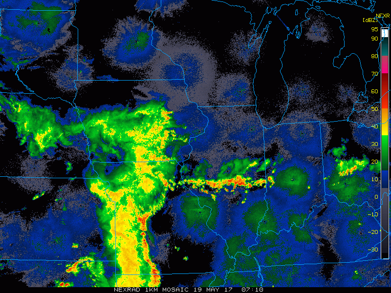
- Showers and storms (some severe) will continue to push northeastward through today. Heaviest storms are likely through early afternoon.
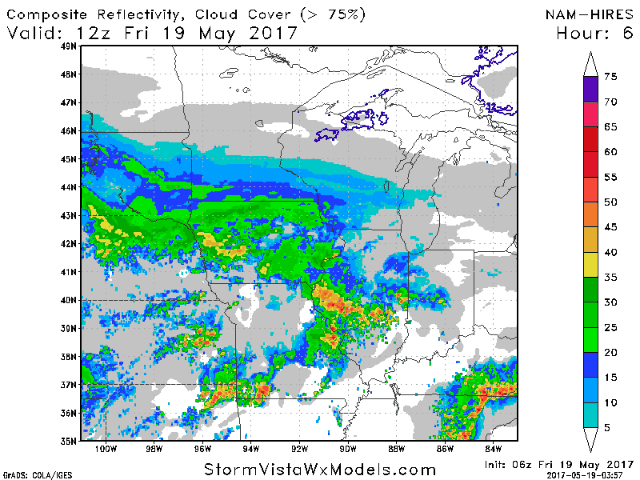
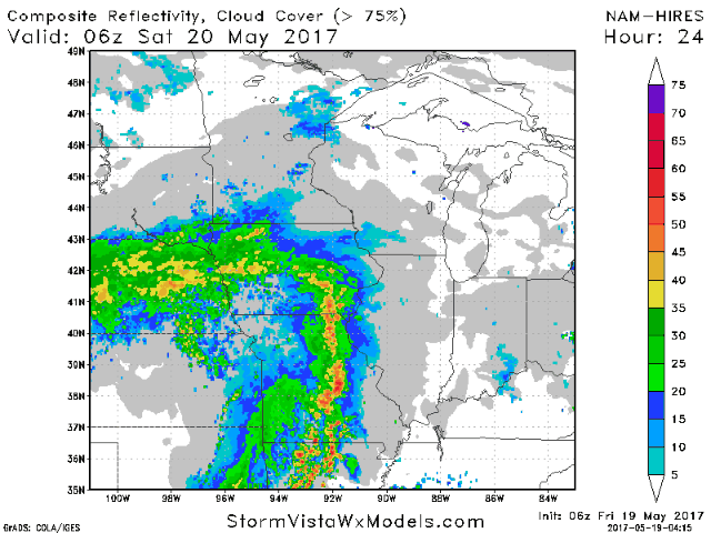
- More storms are expected late tonight into tomorrow morning, similar to this morning. We then shift attention to some severe storms possible tomorrow afternoon into tomorrow night with a cold front.
- Because of these threats, the SPC has issued a slight risk for today and tomorrow, shown below.

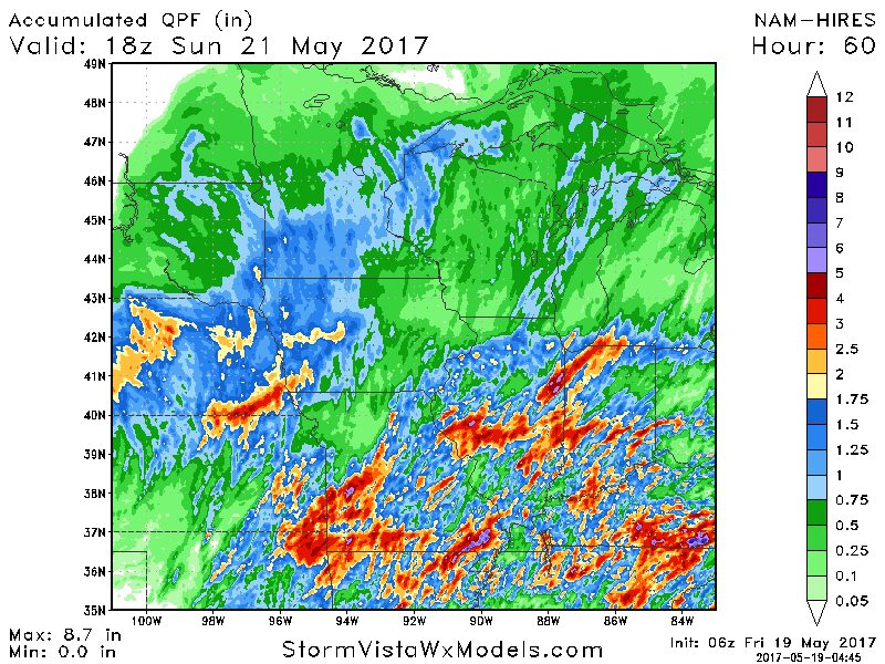
Rainfall will be excessive across portions of the state depending on storm placement. Some places may see 6-10″ rainfall by Sunday, but there will be “haves and have nots”.
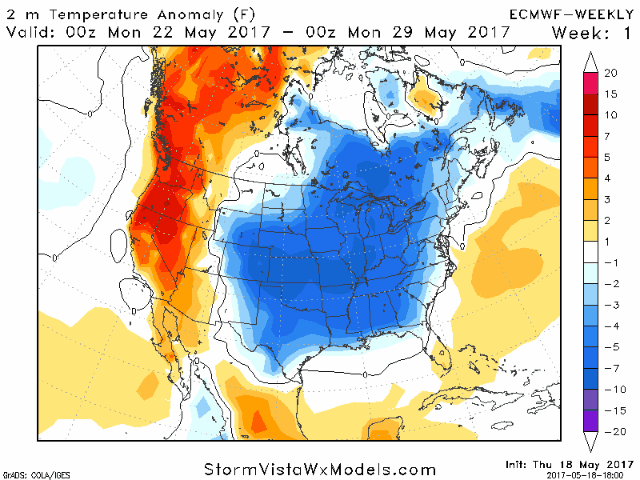
New long range data came in last night, continuing to suggest cool conditions lasting into June. Here’s a look at the week-by-week forecast through June. Notice below normal temperatures continuing.
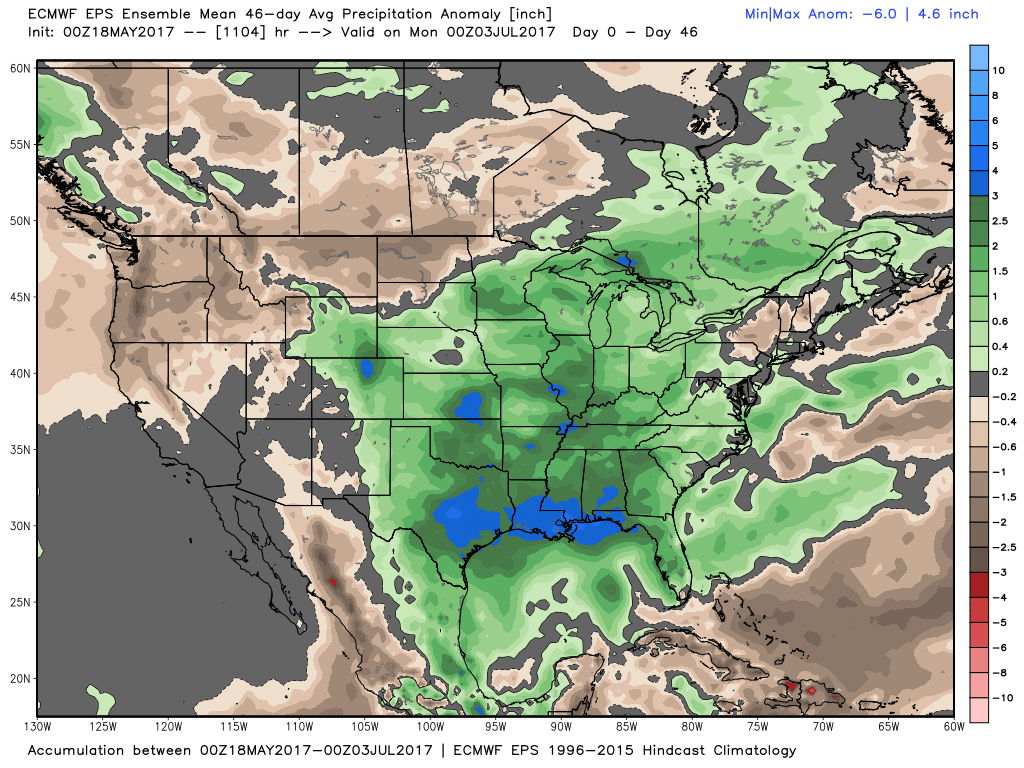
Rainfall also looks above normal through June. Here’s a look at rain compared to normal from today through early July.
Confidence and Risks:
- Above average confidence on flooding rains through tomorrow with some seeing 6-10″ rain by Sunday. VERY storm dependent, so keep tabs on the radar!
- Above average confidence in severe threat (wind, hail, isolated tornado) today and tomorrow as noted above.
- Above average confidence in some cooler, but dry times developing Sunday into Monday.
- Average to above average confidence in more rain coming late Monday into Tuesday.
- Above average confidence in above normal rains and cooler than normal temperatures persisting into June.
Today’s Video (8 minutes):