#ILwx Severe Thunderstorm Threat Today Into Thursday, Warmer Times and Brief Dry Stretch Coming? Details Here! E.
Key Points: May 10, 2017
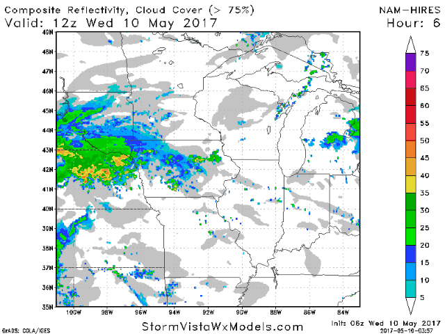
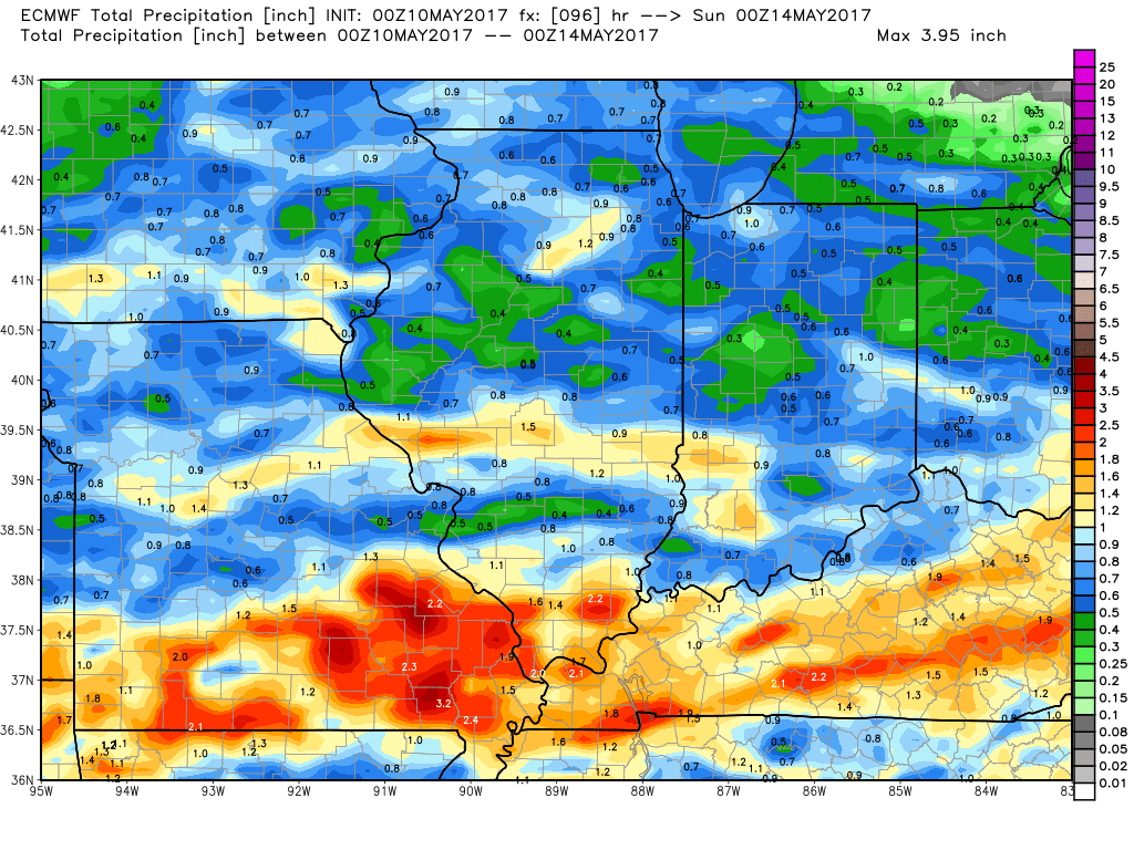
Synopsis: Good Wednesday morning! We are tracking showers and thunderstorms developing along a frontal boundary across Iowa and Nebraska this morning. These will push eastward through the day today bringing more rainfall to much of the state. Along with the rain threat, a severe thunderstorm threat will exist across northern Illinois today, shifting south during the day tomorrow as the front sags south. The main threats from these storms will be large hail and damaging winds, but an isolated tornado can’t be ruled out. By Friday, the rainfall threat shifts south into far southern Illinois, with improving conditions expected further north. This will set up a dry, warm weekend into early next week before more active times return toward the middle and end of next week. Have a wonderful day!
- Current radar shows showers and thunderstorms pushing through Iowa. These move east through the day.
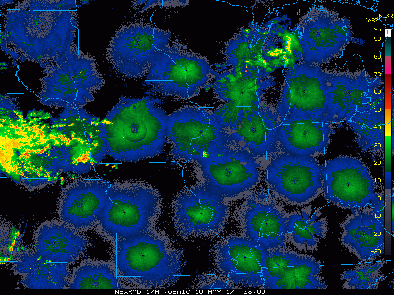
- It looks to be a very active next 36 hours with showers and severe thunderstorms moving the region. Timing is discussed in more detail in the video below.
- As discussed above, the severe threat starts today north, then shifts south for Thursday.
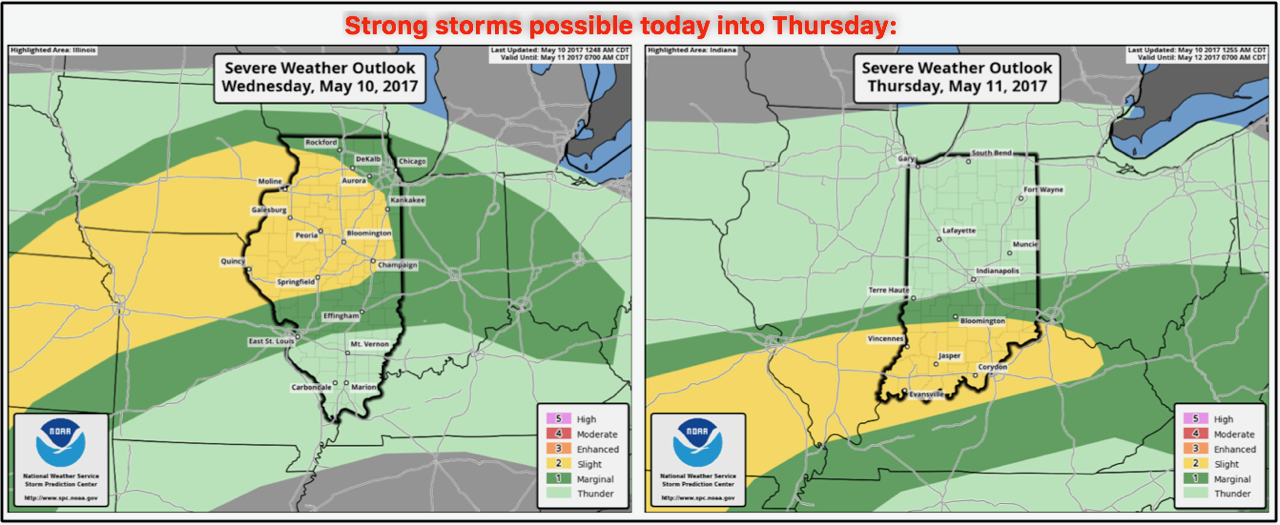
- By later Thursday into Friday, the front sags further south and pushes east, leaving much of central and northern Illinois dry. Southern areas likely deal with rain for one additional day before drying by the evening Friday.
- Total rainfall through the end of the week will vary depending on exact placement of storms, but a general 0.50-1.50″ is expected with locally higher amounts possible.
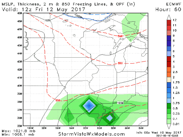
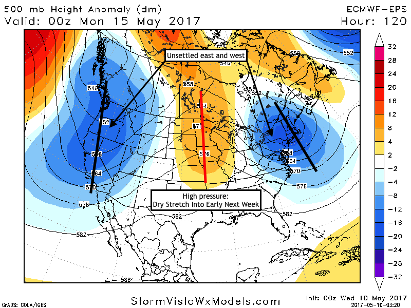
- As an upper level ridge of high pressure moves into the region this weekend, a dry stretch of weather is expected through early next week with warm temperatures.
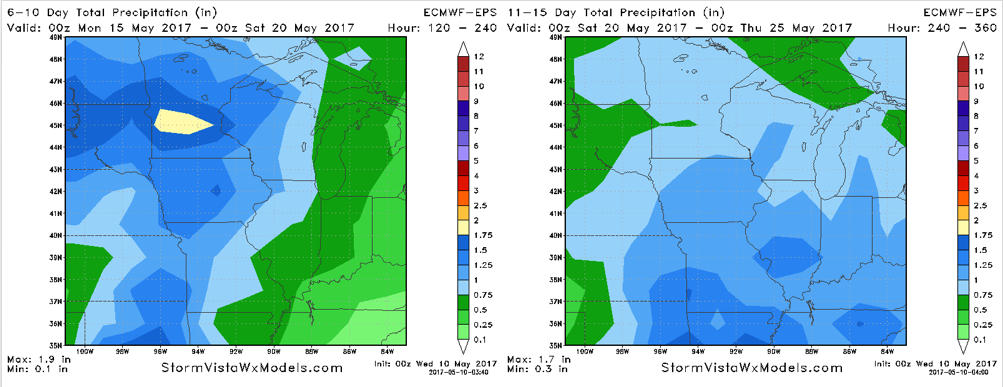
- While warm temperatures likely continue in week 2, a more active pattern will develop as well. Here’s a look at 6-10 and 11-15 day rainfall numbers from the European Ensemble.
Confidence and Risks:
- Above average confidence in a severe threat along with locally heavy rainfall today into tomorrow across the region.
- Increasing confidence in a drier stretch from Friday (north) and Saturday (south) through mid-week next week.
- Increasing confidence in an active regime returning later next week and beyond across the region.
- Average to above average confidence in warmer than normal temperatures next week.
Today’s Video (8 minutes):