#ILwx Severe Risk Wednesday, Active Into The Weekend. E.
Key Points: June 26, 2017
Synopsis: Good Monday morning! We are tracking a disturbance moving through Iowa providing some showers. This will push eastward bringing spotty showers and storms across the region this afternoon. Tuesday looks like a nice day, but another more widespread shower and storm threat moves in for Wednesday as northwest flow commences. This complex will bring a severe threat with it as well – we cover this in the video. This active pattern looks to continue through the weekend as a weak boundary and northwest flow lingers. Warmer risks are arising in week 2 after the 4th of July, but we believe active conditions will persist. Have a blessed day!
Current radar this morning shows those showers across Iowa pushing southeast.
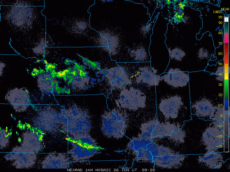
Showers and storms will push through the region with spotty coverage through the day today.
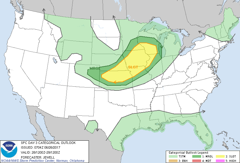
After a nice day Tuesday, a complex of storms looks to approach the region Wednesday with a severe risk. Here’s the latest SPC day 3 outlook. The main threats here will be hail, torrential rains, and damaging winds.
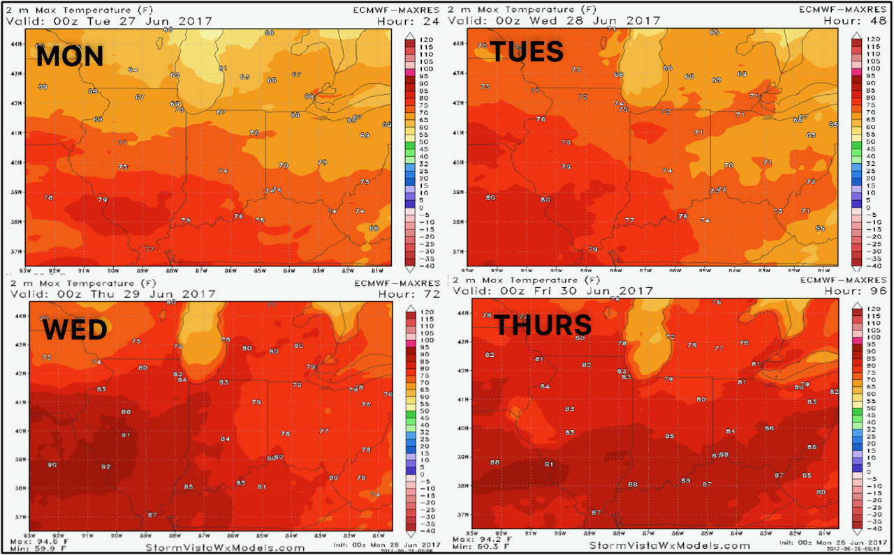
Temperatures over the coming days look to warm a bit each day.
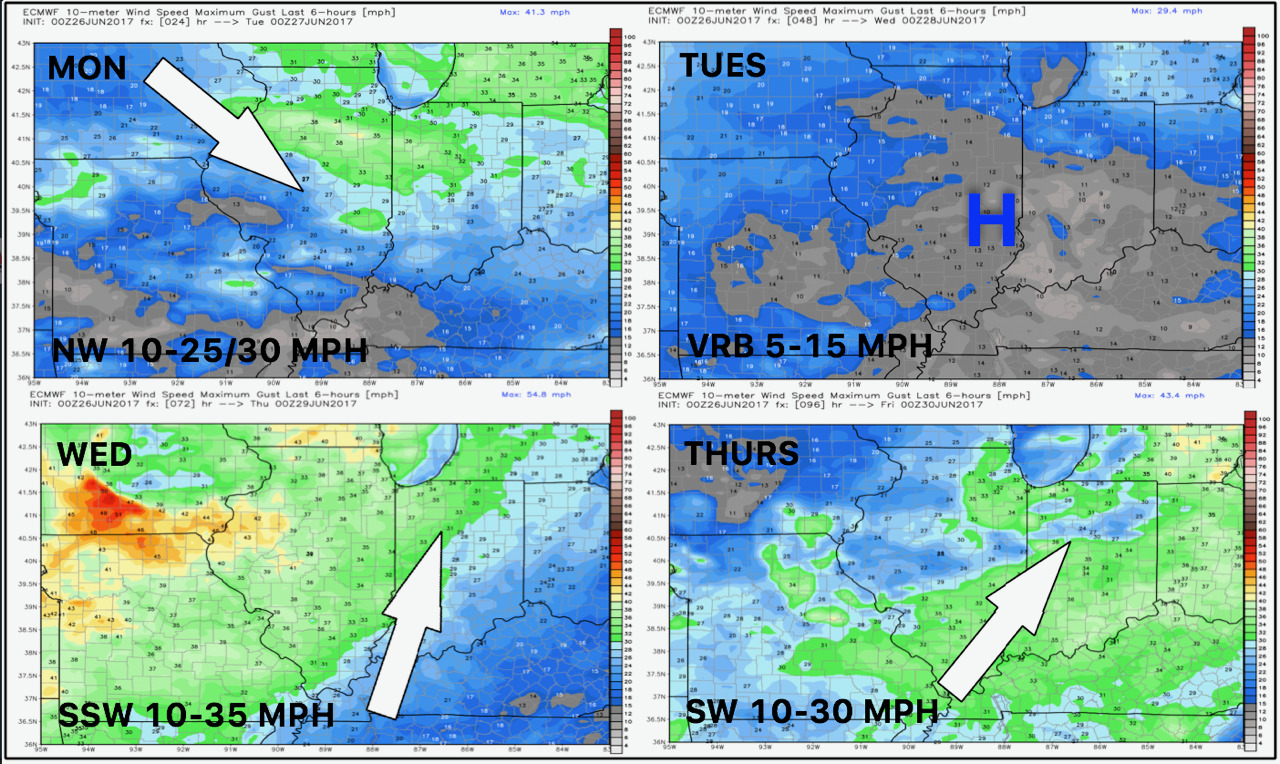
Winds over the next 4 days are shown below.
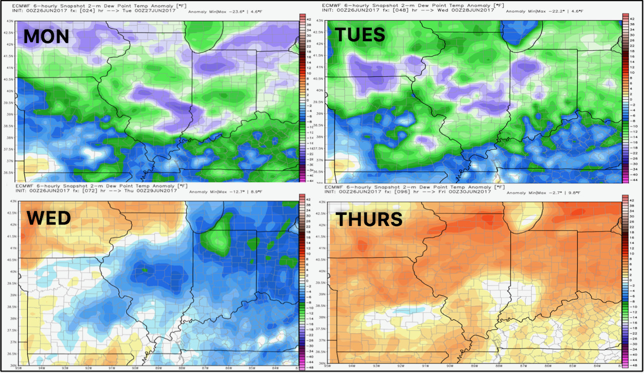
Moisture looks to slowly return to the region as well, shown below by dew point anomalies.
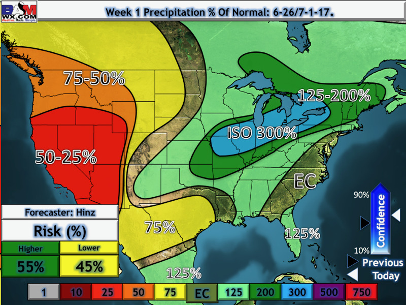
Precipitation through the weekend looks to be well above normal. Our forecast is below.
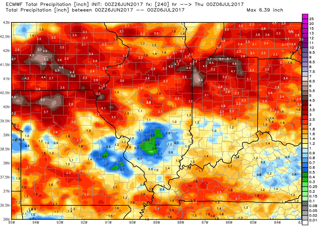
Total rain next 10 days looks heaviest north.
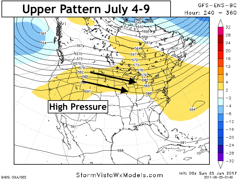
By the 11-15 day, we tracking some warmer risks. The extent of the ridge will be a huge driver in the mid-month pattern, so make sure to check back!
Confidence and Risks:
- Above average confidence in storm threat today – spotty coverage.
- Above average confidence in a nicer day tomorrow.
- Above average confidence in a severe threat Wednesday afternoon with hail and damaging winds possible.
- Above average confidence in active conditions into early July.
- Increasing confidence in warmer risks arising in the 11-15 day period with continued active conditions.
Today’s Video (7 minutes):