#ILwx #OHwx #INwx #KYwx Very Active Next 3 Days, More Seasonable Conditions Into Next Week. E.
Key Points: July 21, 2017
Synopsis: Good Friday morning! We are tracking some heavy rains from northern Illinois into central Indiana, and this regime looks to continue through the day today. There is a mesoscale convective system (MCV) in northern Illinois this morning, and additional strings of energy in the atmosphere will aid in more storms through the day into tonight. Additional complexes of storms look to impact the Ohio Valley overnight tonight and again Saturday evening. Heat also looks to continue especially south and west through the weekend before some more seasonable air returns Sunday into the beginning of next week. If you have any questions, please don’t hesitate to reach out! Have a blessed day!
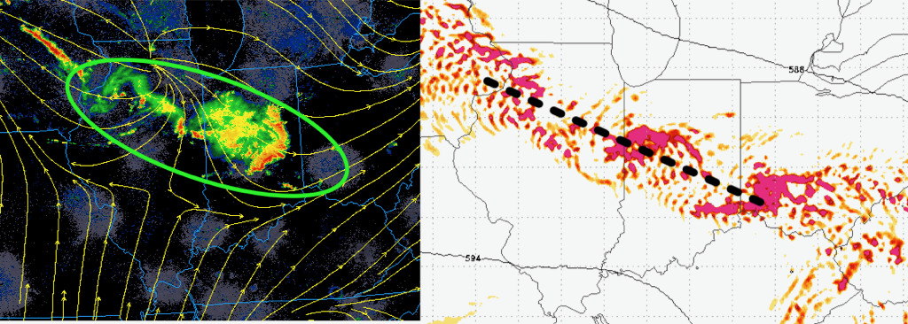
Here’s a look at the MCV and additional vorticity through this evening aiding in additional storms.
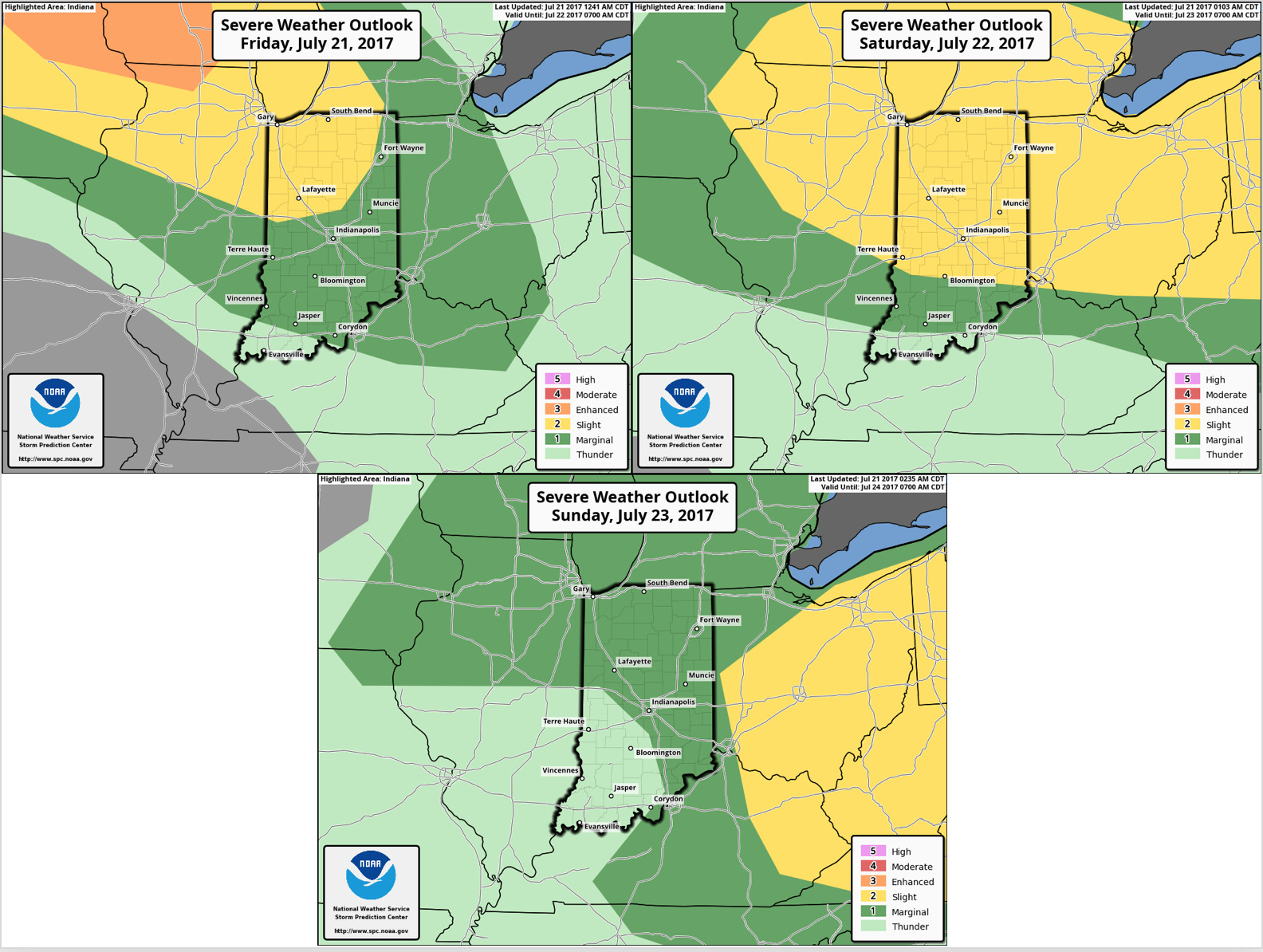
As discussed above, the next 3 days look active. The SPC severe outlooks through Sunday are below.
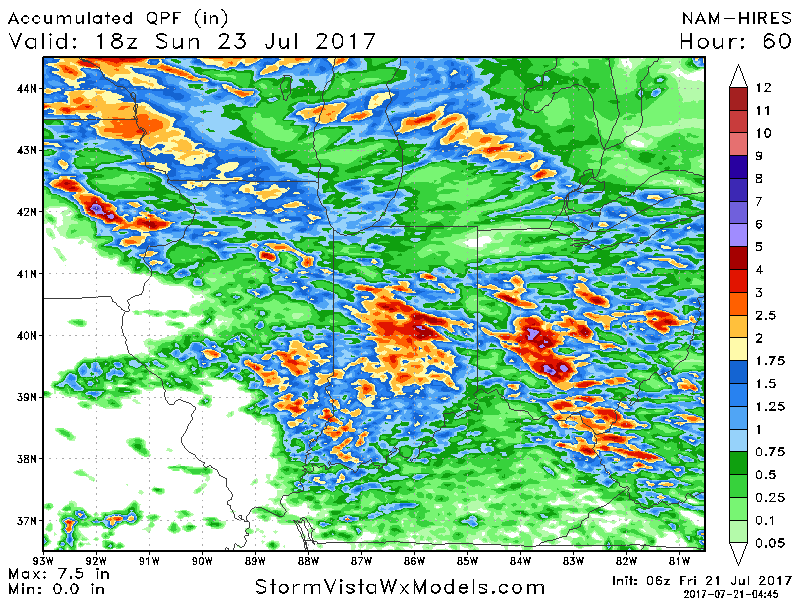
Additional heavy rains are expected across northern Illinois, much of Indiana, and Ohio. Some areas may see 3-5″! Elsewhere, southwestern Illinois looks to continue to struggle to see significant rains.
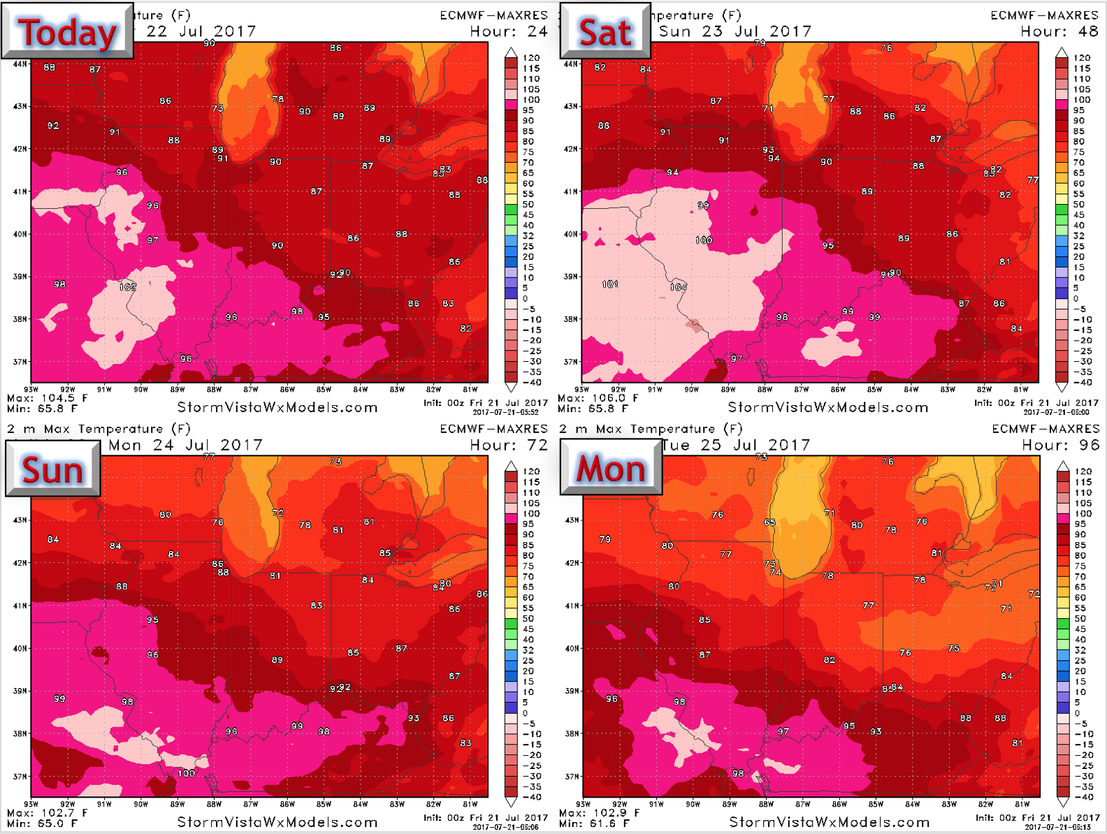
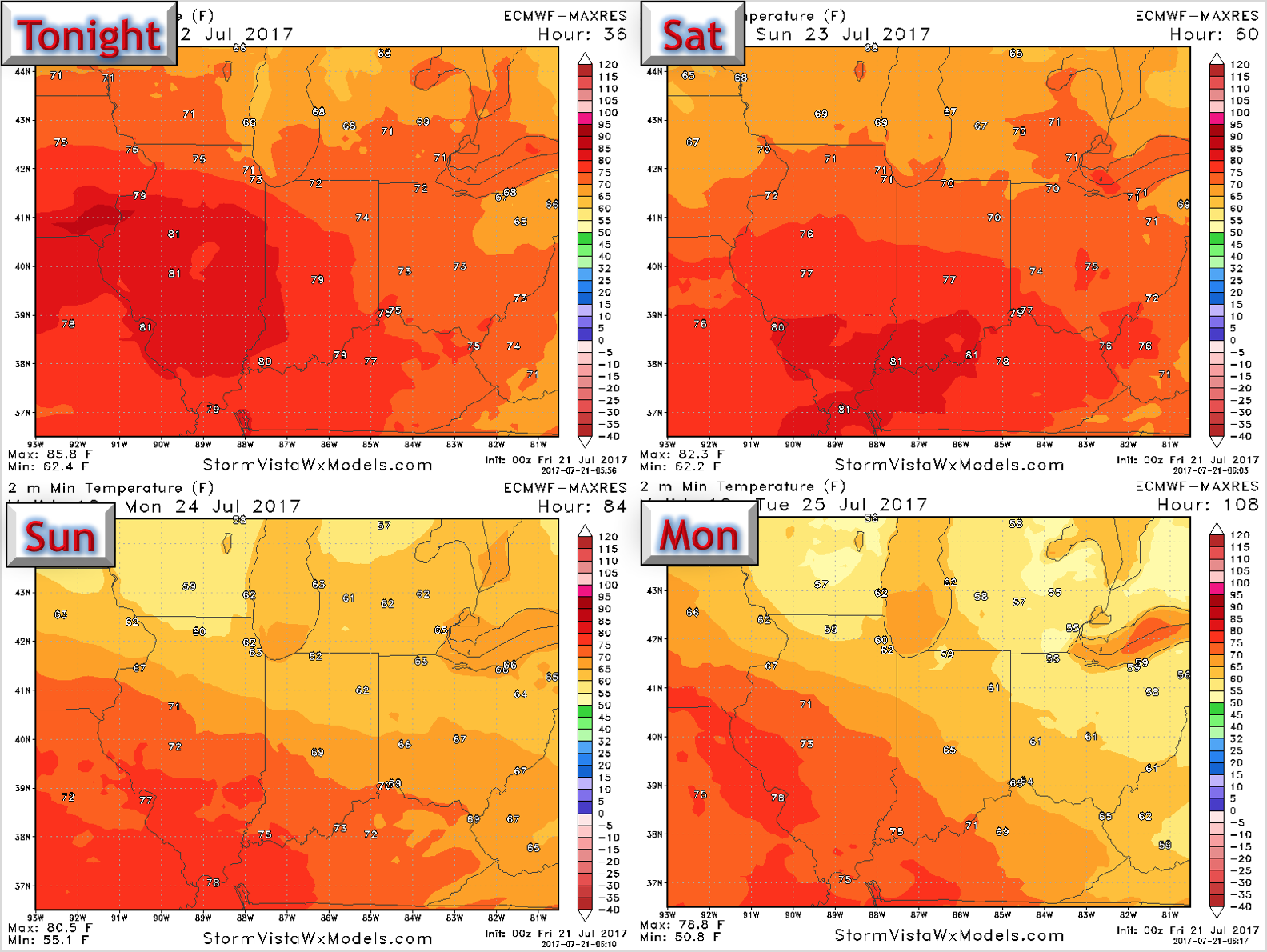
High temperatures look sultry into Saturday, especially south and west. “Cooler” conditions return into next week.
Low temperatures also look warm through Sunday morning with some in the mid-70s to near 80.
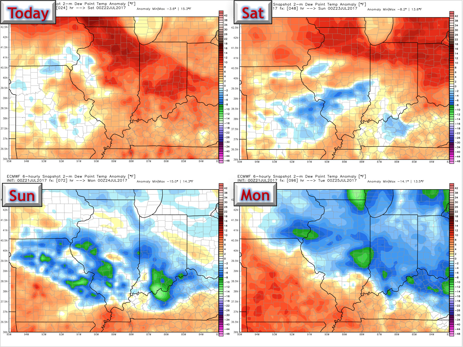
Dew points also look to return to seasonable levels into early next week after a humid start to the weekend.
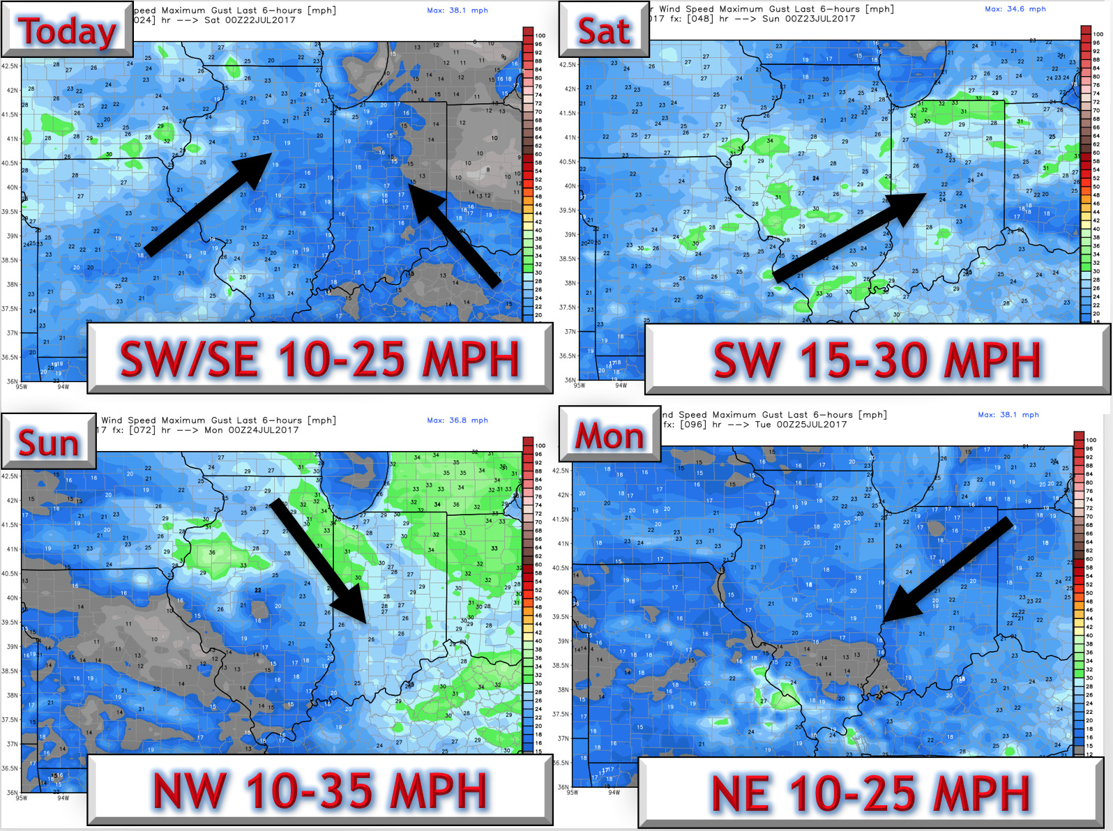
Winds over the next 4 days are shown below.
Confidence:
- Above average confidence in severe weather each of the next 3 days along with hot and humid conditions.
- Above average confidence in more seasonable humidity and temperatures next week after a sultry start to the weekend.
Today’s Video (6 min):