#ILwx Multiple Rounds of Storms Coming With A Severe Threat Growing For Saturday. E.
Key Points: May 25, 2017
Synopsis: Good Thursday morning! The area of low pressure that brought rain to the region yesterday has moved east into Indiana and Ohio, leaving Illinois dry this morning. Today is the “pick of the week” in this active pattern with largely dry conditions and temperatures into the 70s. The active pattern will return Friday into the weekend with multiple chances for showers and thunderstorms. The video goes into detail regarding the time of these threats, but in general a weakening complex looks to move through Friday morning, then another complex looks to impact the region Friday evening. A severe threat will arise Saturday afternoon into Saturday night as yet another disturbance pushes toward the region. Cooler conditions will return next week with additional spotty shower and storm chances. Have a blessed day!
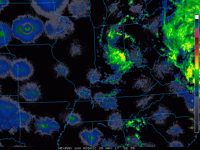
- Radar shows the spin of low pressure to our east this morning.
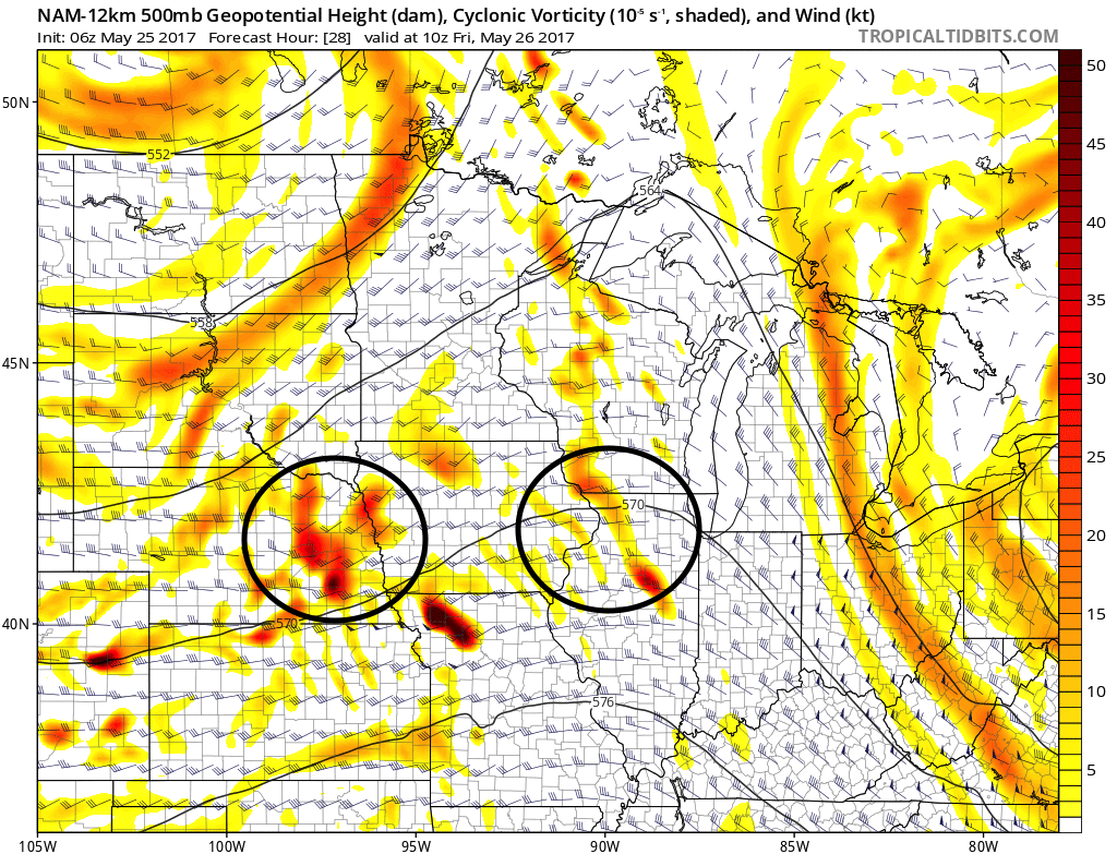
- After a dry day today with some sunshine, we turn our attention to a piece of energy moving through the flow tomorrow morning. This will introduce a shower and storm chance. The exact track of this energy will determine who sees what. Another piece of energy will move through tomorrow evening with additional storm chances. The pieces of energy are circled below.
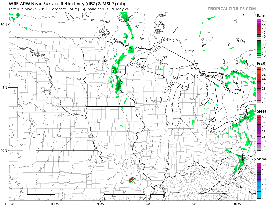
- Projected radar for this complex is showing below. Note a shower and storm chance in the morning northern, then a more widespread chance tomorrow evening.
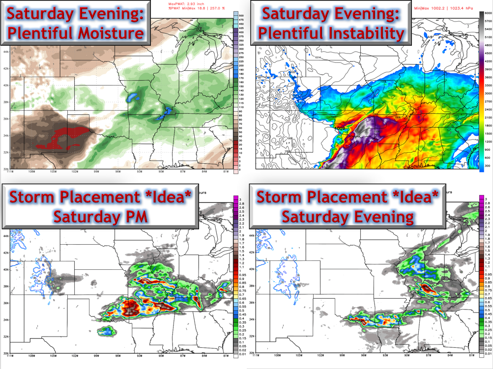
- A severe threat exists during the afternoon and evening Saturday as another disturbance moves through. Latest SPC outlook agrees with our thinking in a widespread threat, especially south and west.
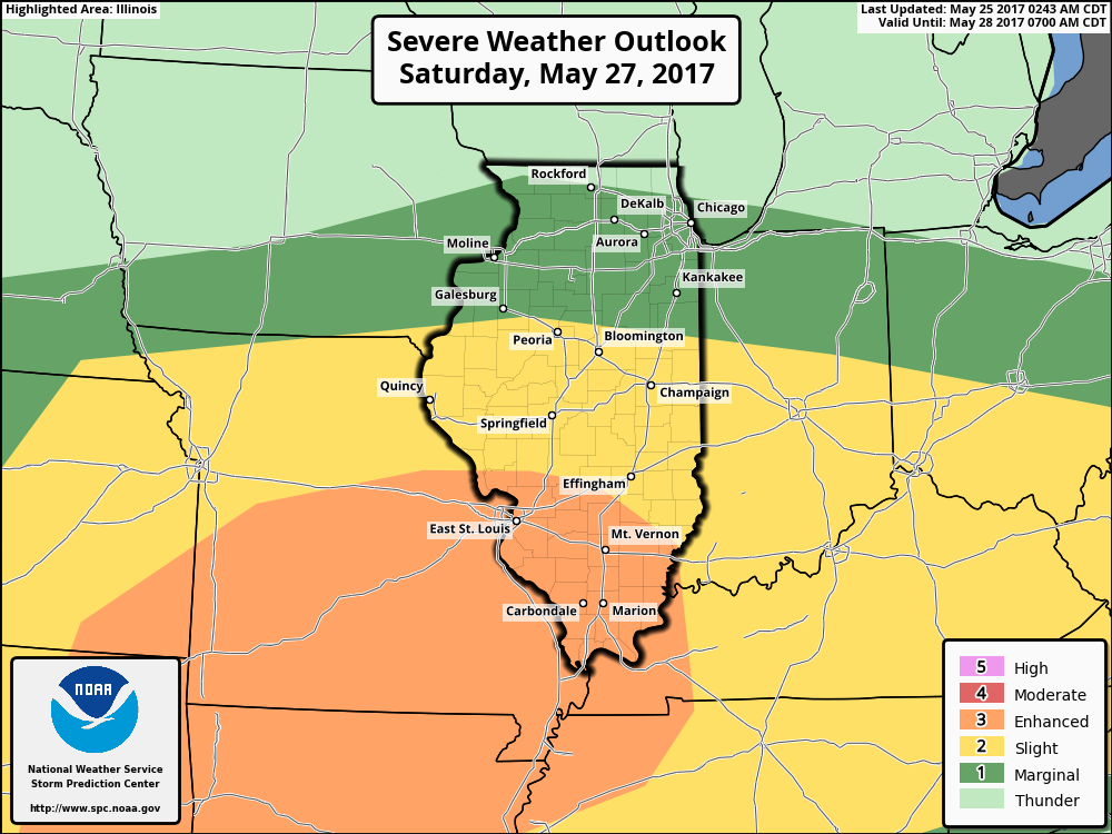
- The set up for severe weather is shown below.
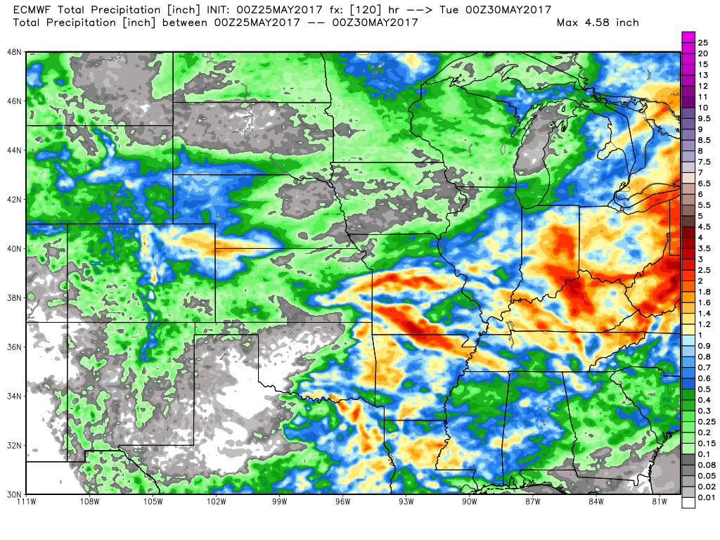
- Total rainfall through Memorial Day will be very storm dependent. Those who see persistent storms will likely see 1-3 inches of rain, while those who don’t may not see 0.25″.
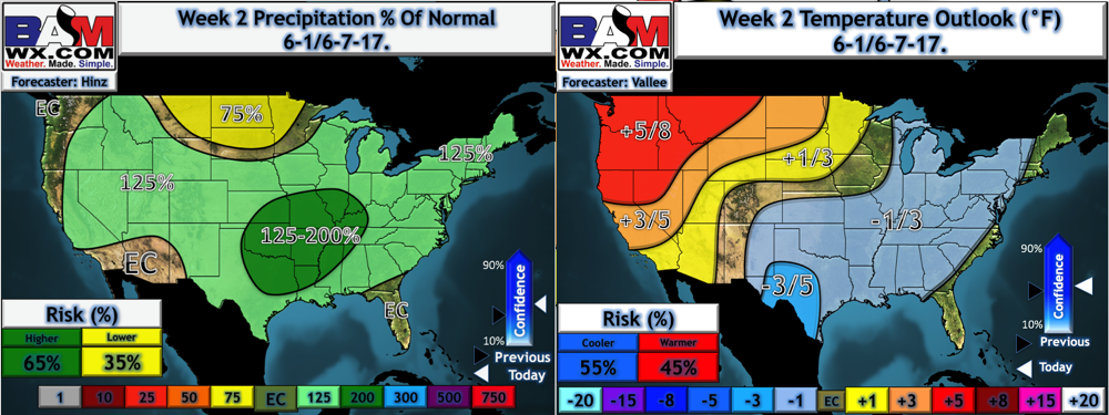
- The pattern through next week continues to look near to slightly below normal in the temperature department along with above normal precipitation chances.
Confidence and Risks:
- Above average confidence in a dry day today with some sunshine.
- Increasing confidence on a storm threat tomorrow and again on Saturday. Timing and track of these storms are still a bit uncertain – check back this afternoon and tomorrow for updates!
- Increasing confidence in an active week 2 along with cool conditions.
Today’s Video (8 minutes):