#ILwx #MIwx #INwx #OHwx Very Active Next Few Days, Cooler Into Next Week. E.
Key Points: June 21, 2017
Synopsis: Good Wednesday morning! We are tracking a disturbance off to the west this morning, which will bring some shower and thunderstorm activity to the region this afternoon and evening. A cold front will approach from the north Thursday as moisture from Tropical Storm Cindy approaches from the south. This will spark a few showers and storms late Thursday afternoon with more widespread storms possible Thursday night. At this time, most moisture from Cindy looks to stay south of the region, but the front will trigger enough lift for rains. High pressure and cooler, less humid conditions will return for the weekend. Temperatures look to stay below normal through the beginning of next week before more seasonable temperatures return later in the week. Have a blessed day!
Current radar shows the disturbance off to the west this morning.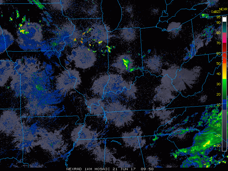
This disturbance will push southeastward through this evening with showers and storms.
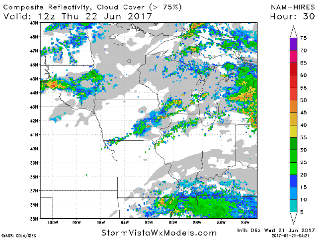
 A cold front will approach Thursday and with this, the SPC has highlighted parts of the region for a slight risk for severe weather.
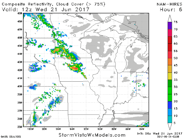
Details are discussed in the video, but projected radar for Thursday into Friday is shown below.
 Wind forecast for the next 4 days.
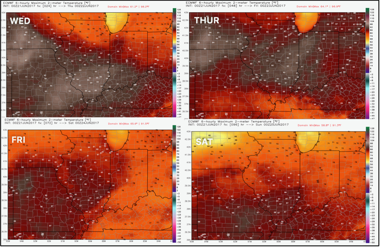
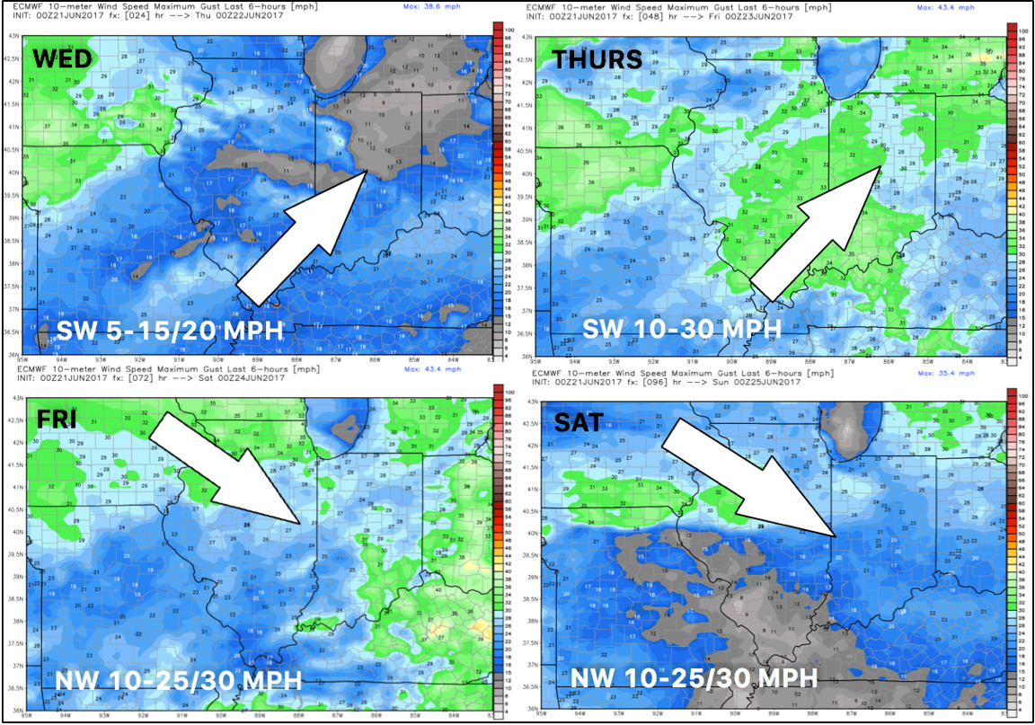 Temperatures next 4 days.
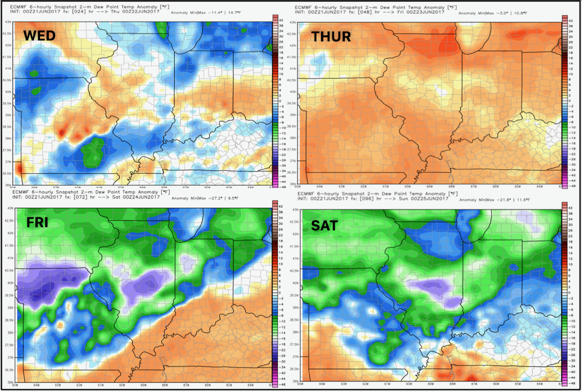
Dew point anomalies show the cooler, drier air coming in by the weekend.
Total rains will be very dependent on how far north moisture from Cindy gets. We think this could bump a bit further north, but notice some areas in Illinois and Indiana may be in between the frontal rains to the north and tropical rains to the south.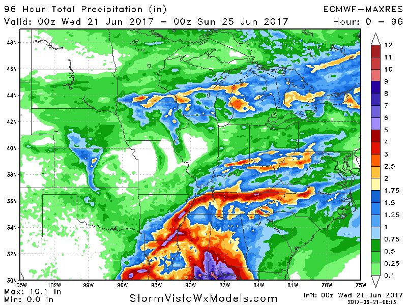
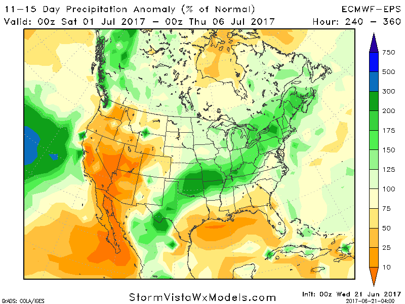
Week 2 likely will feature a slow recovery in temperatures, but overall we expect the active times to continue right into the beginning of July. Latest 11-15 day precipitation departures shown below.
Confidence:
- Above average confidence in moisture from Cindy impacting portions of the Ohio Valley, but low confidence any of this moisture reach our area.
- Above average confidence in cooler conditions this weekend into next week.
- Increasing confidence in active conditions continuing right into the beginning of July.
Today’s Video (5 minutes):