#ILwx #KYwx Wet Next Few Days Central/South, Cooler This Weekend. E.
Synopsis: Good Wednesday morning! Today we discuss the very heavy rainfall and potential for a few strong storms in places that could really use the rain in southern and central Illinois. The difficult part about this forecast is how far this piece of energy tracks north or south, which will have a major impact on exactly where the heaviest rains work in today into Thursday; thoughts right now is we are watching for a two-wave scenario. Moving beyond today, a much nicer, more comfortable pattern works in this weekend…a drier pattern works in across the Ohio Valley as well getting into next week. All the details in the video, if you have any questions please let us know! Have a blessed day.
Today’s Video (7 minutes):
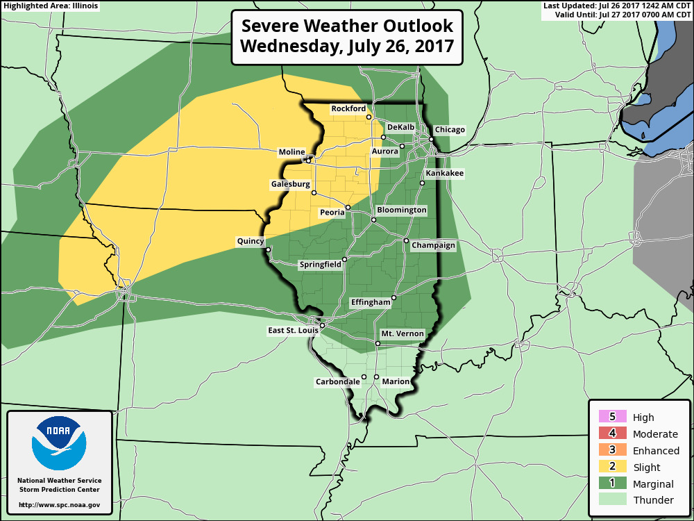
Severe weather is possible this afternoon and evening across northern and western areas.
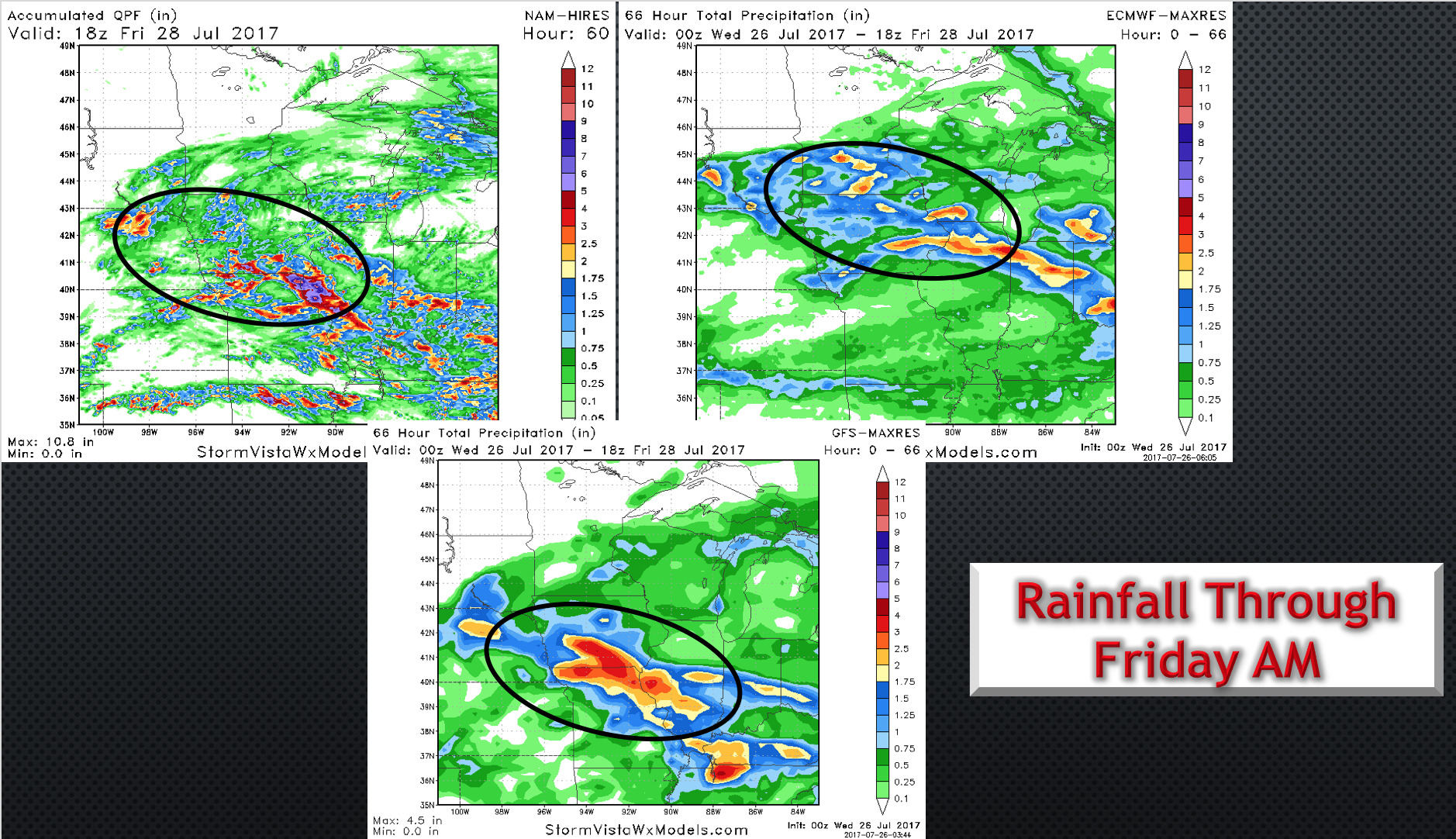
Difficult forecast with respect to rainfall to nail down the exact area of heavy rain, but right now we are favoring central and southern portions of the state.
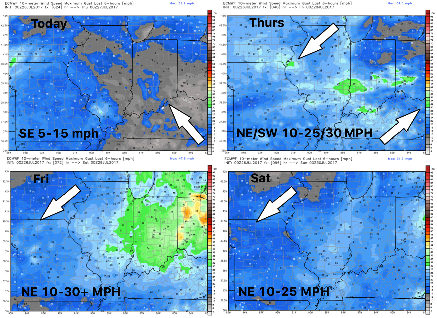
Wind forecast over the next 4 days:
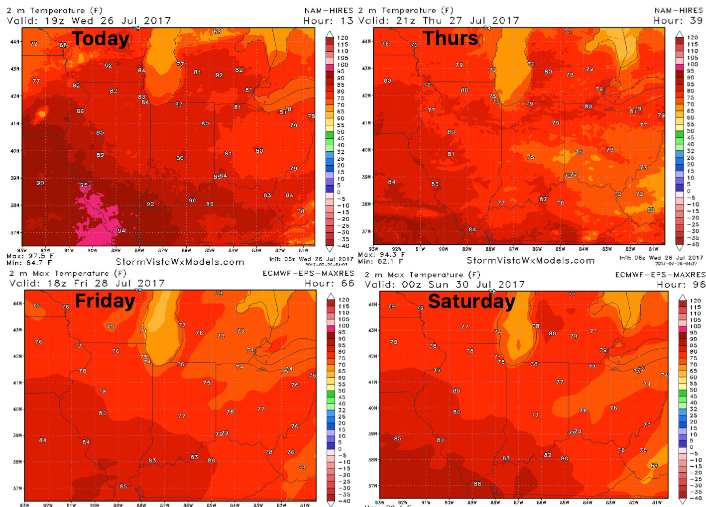
High temperature forecast shows cooler conditions into the weekend.
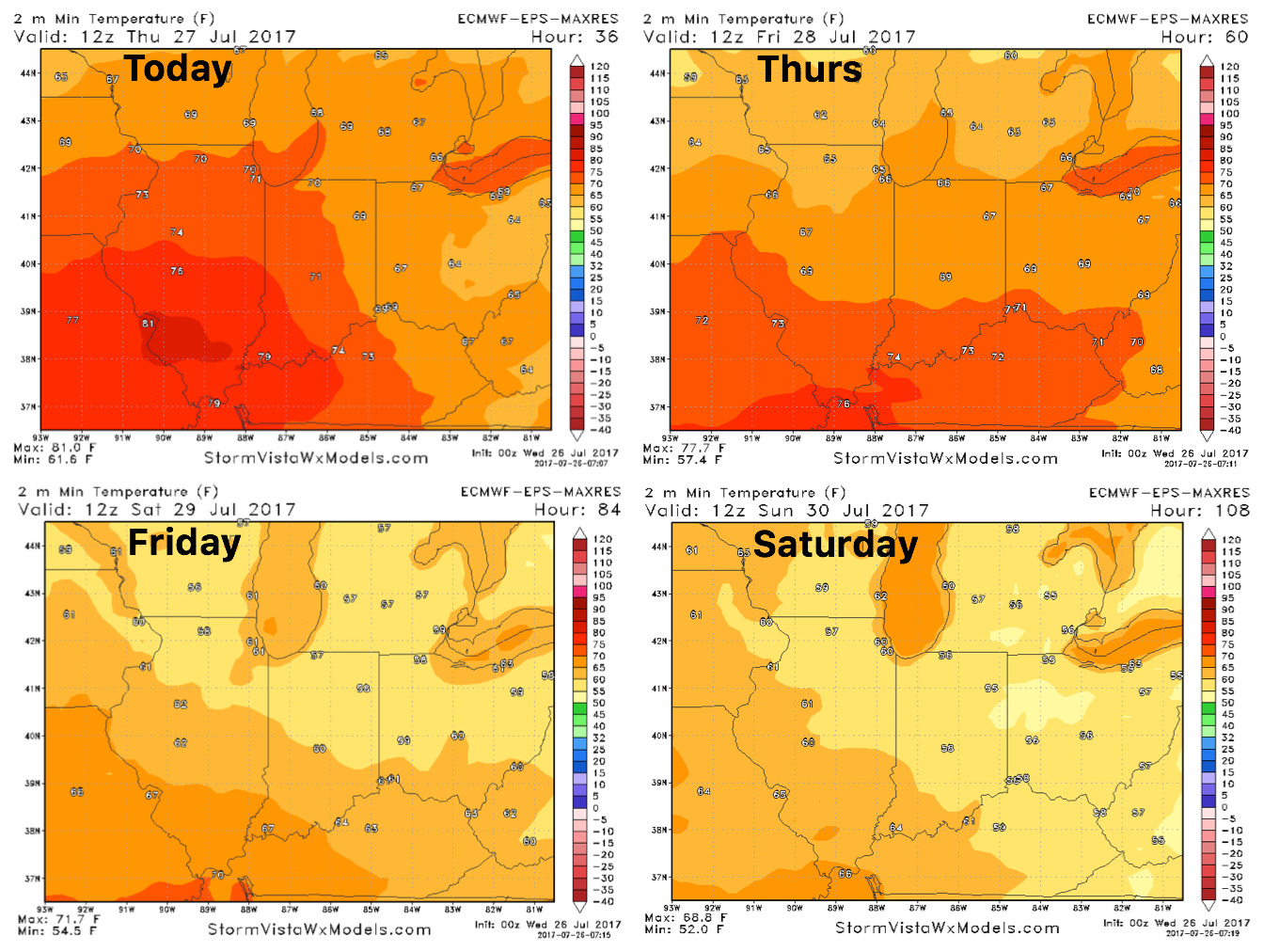
Overnight lows into the weekend as well, will feel “fall-like” in some locations!
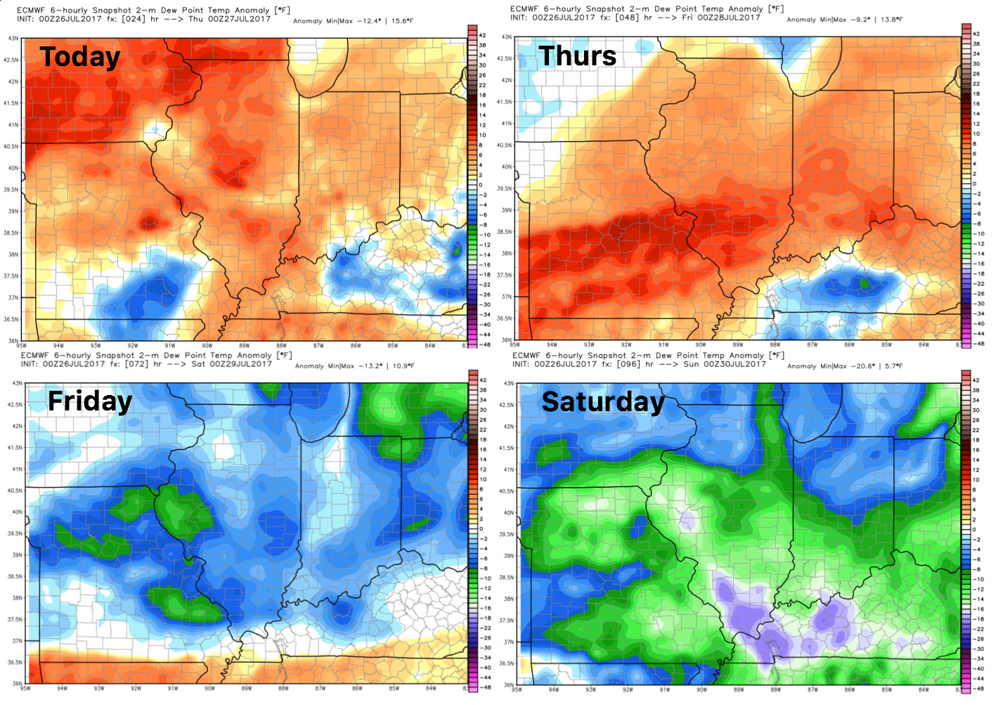
Dew points from normal: