Key Points: June 29, 2017
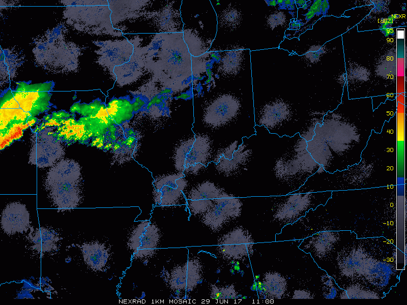
Synopsis: Good Thursday morning! We are watching a boundary pushing into the region this morning sparking some light showers in western Illinois while the remainder of the region is mainly dry. As we move through the day, heating of the day will spark additional severe weather across central and northern Illinois this afternoon. Main threats will be damaging winds, large hail, and even an isolated tornado. The boundary will sag south Friday with additional showers and thunderstorms. Cooler, drier conditions are expected this weekend with some sunshine and low winds. Northwest flow, increased humidity and temperatures, as well as storm chances return next week as a ridge builds to our west. This likely leads to some heat later next week into next weekend. Have a blessed day!
Current radar:
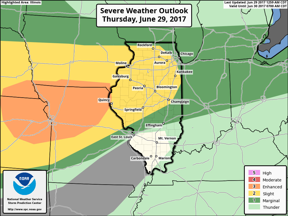
The boundary nearby will spark severe weather this afternoon and the SPC outlook for the day agrees.
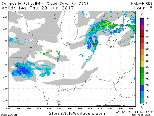
Projected radar explains timing well, and the video explains even further.
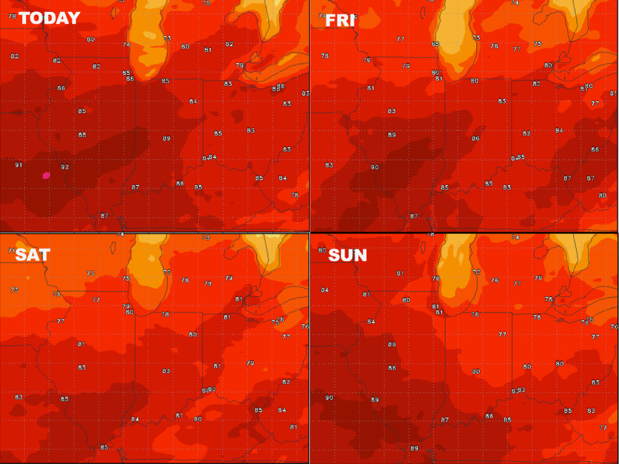
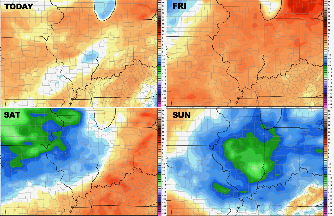
Temperatures over the coming days are shown below.
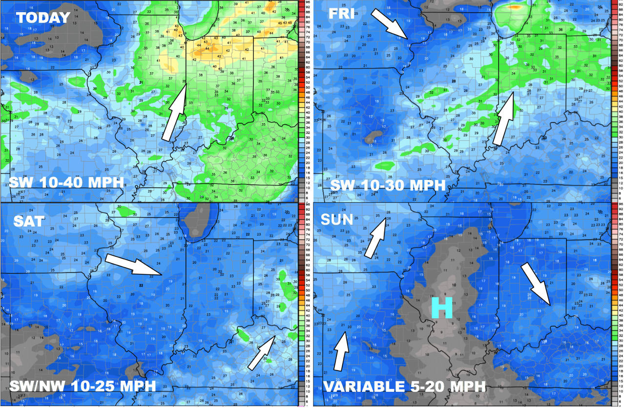
Winds over the next 4 days are shown below.
Humidity starts high, but drier air filters in for the weekend.
Northwest flow looks to continue in the 6-10 day as well…models handle this pattern very poorly.

In week 2, we continue to see a warmer look across the region, but extreme heat is not likely at this time.

Look at precipitation, we continue to look near or slightly above normal into week 2 thanks to the northwest flow.

Confidence and Risks:
Above average risk of severe weather this week with hail, gusty winds, and even an isolated tornado.
Above average risk of a drier and seasonable weekend coming up.
Increasing confidence of a warmer but still active week 2.
Today’s Video (8 min):