#ILwx #KYwx Severe Storms Expected This Afternoon/Evening Central and North! E.
Good Thursday morning! We are tracking a cold front moving southeast across the Midwest this morning. This will bring the threat for some strong to severe thunderstorms across much of the state this afternoon and evening. The main threats with these storms will be large hail and damaging winds – the video will cover timing and more detail on the threats with these storms as well. Behind this cold front, cooler and drier conditions return Friday into Saturday, but we are watching another threat for rainfall Sunday as another disturbance approaches from the west. This cooler regime looks to last through the middle of August with intermittent rainfall threats. Have a blessed day! -Ed
Today’s Video (7 minutes):
The SPC has outlined the region for severe weather this afternoon and evening, especially north of I-70.

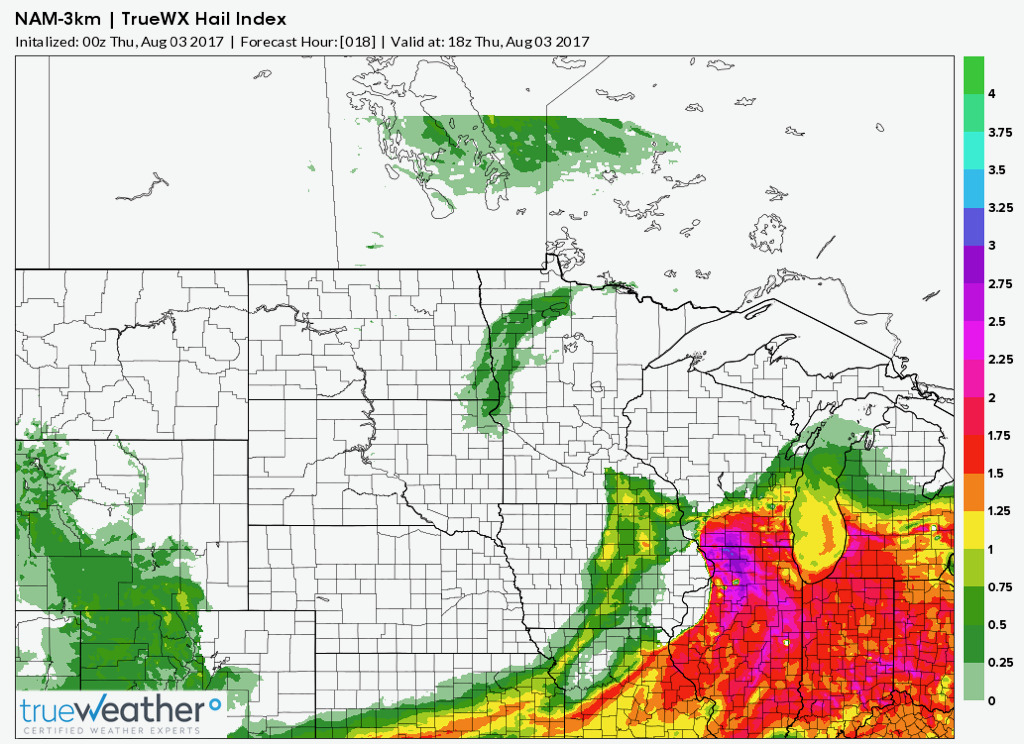
The biggest risk with these storms will be gusty winds and large hail. Here’s a look at our hail index.
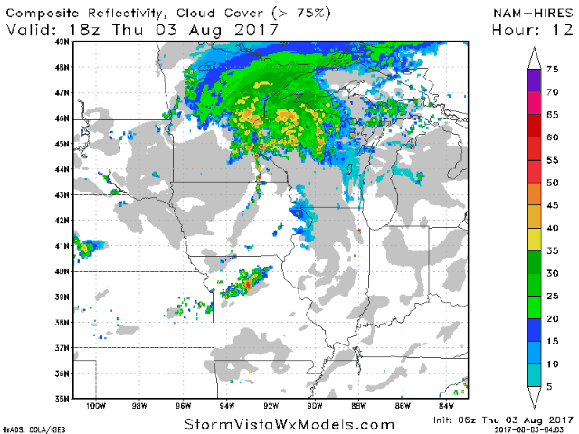
Here’s a look at the projected radar through tonight.
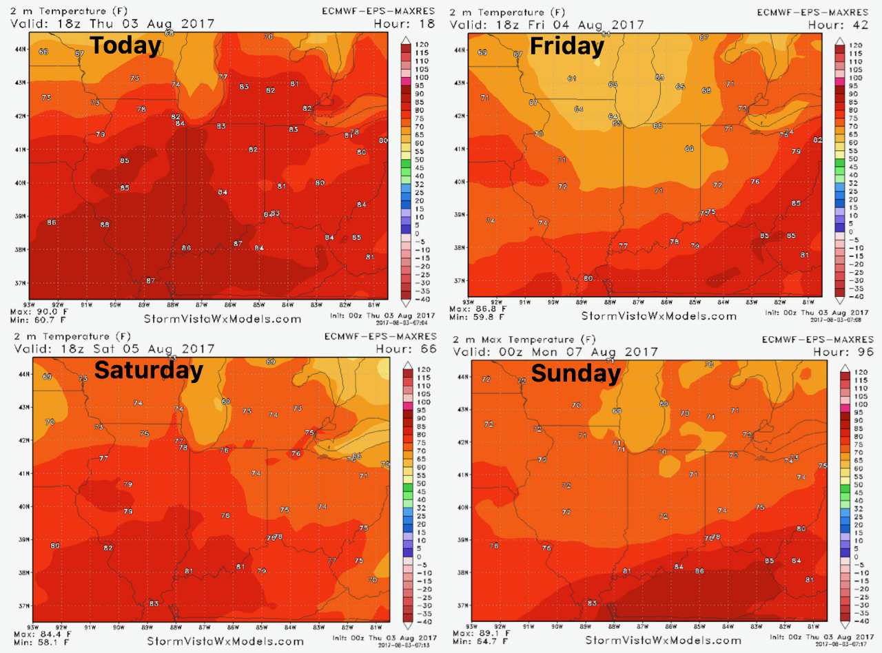
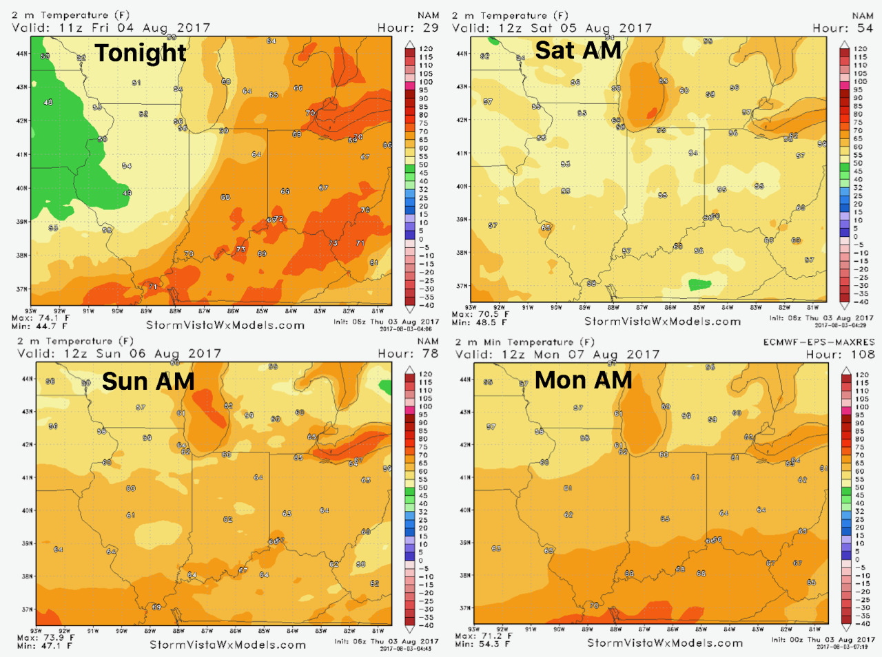
High temperatures will cool behind the front.
Overnight lows the next few days are below.
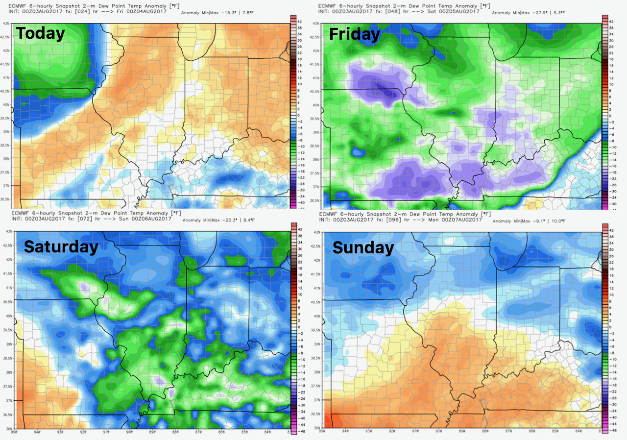
Humidity will be higher today, then lessen Friday and Saturday before rising Sunday.
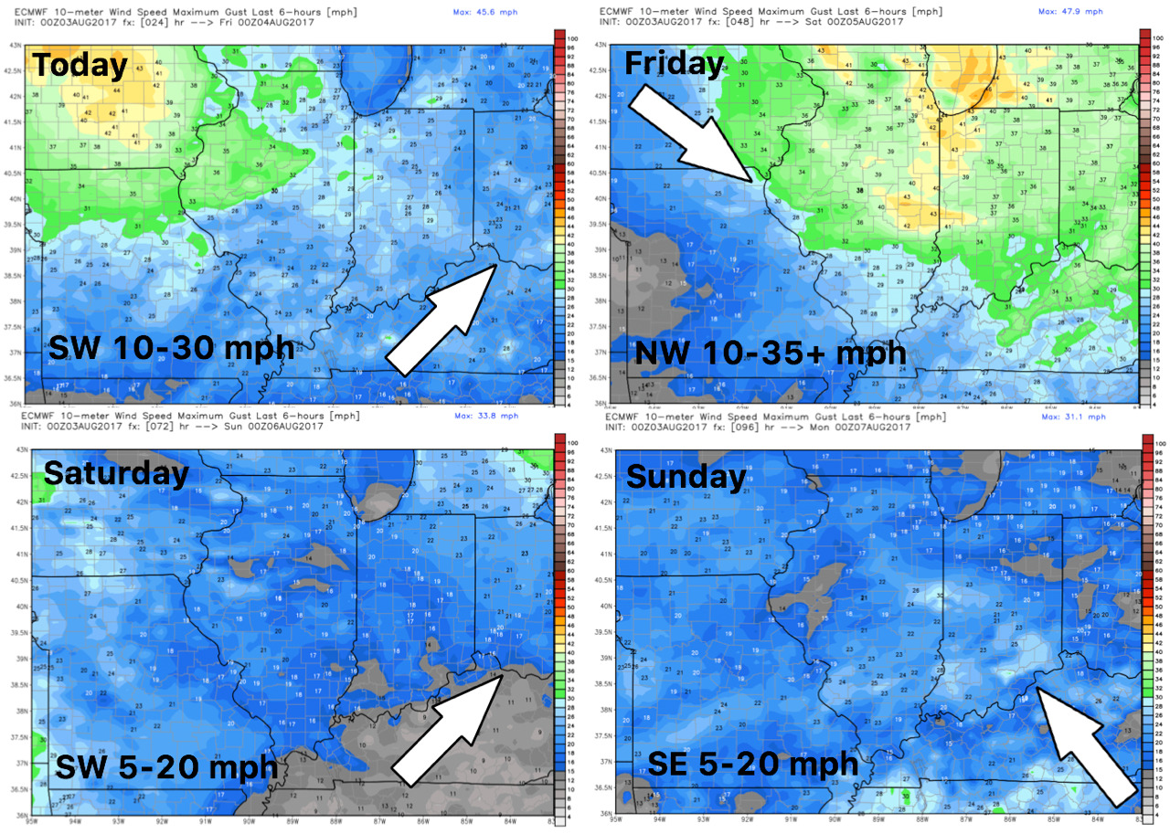
Winds the next 4 days.
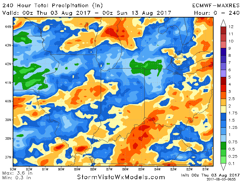
Total rainfall through day 10.