#ILwx #KYwx Severe Risks Central and North Wednesday and Thursday! Details Here. E.
Key Points: June 27, 2017
Synopsis: Good Tuesday morning! Radar is quiet and will remain quiet through the day today, but we are tracking an increased severe threat Wednesday into Thursday. A disturbance will dive along the developing northwest flow bringing the threat of damaging winds, large hail, and flooding rain especially north of I-70. Warmer, more humid air will take hold through the end of the week along with the threat of storms, but cooler conditions are expected into the weekend. More active northwest flow thunderstorm activity is expected into next week. Have a blessed day!
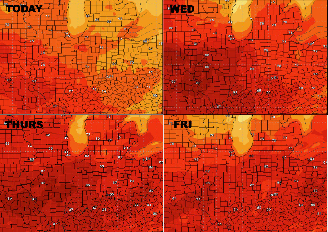
Radar is quiet and will stay quiet today, but we are tracking a warm up for the middle of the week. Here’s a look at temperatures over the next 4 days.
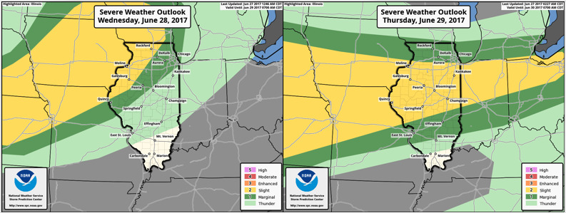
A severe threat is on the table Wednesday afternoon into Thursday, starting first in the north, then shifting southward into Thursday. SPC outlooks are below.
Here’s a look at projected radar through Thursday afternoon.
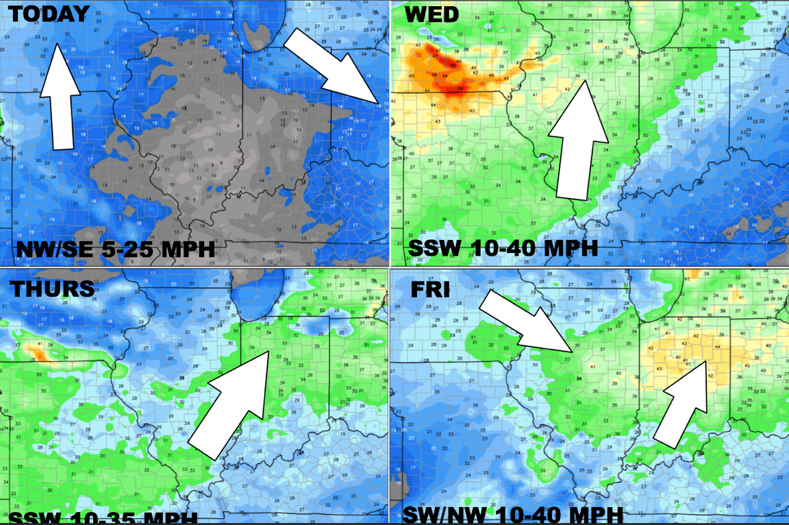
Here’s a look at winds over the coming days.
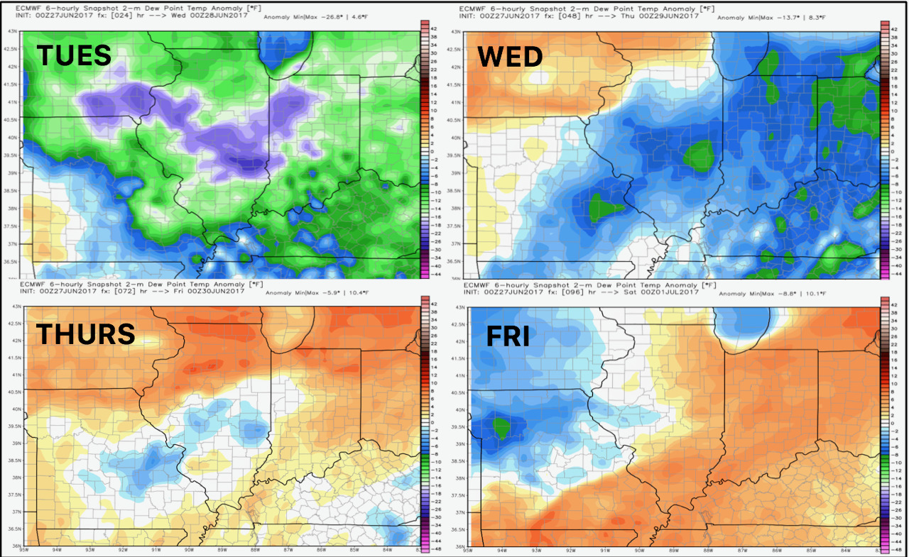
Dew point anomalies over the next 4 days.
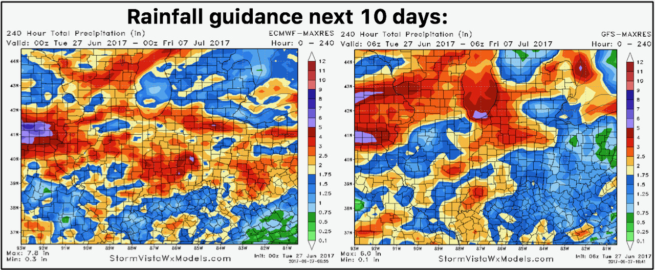
Total rainfall next 10 days is shown below.
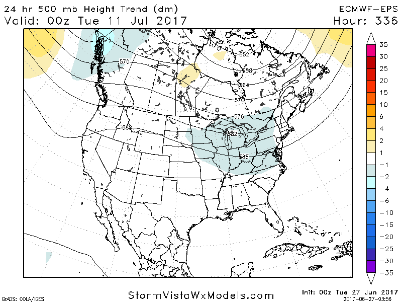
As we move into week 2, we are watching for a warmer period between the 5th and 13th, but data is already trending cooler and stormier by 15 compared to 24 hours ago noted by blue colors.
Confidence and Risks:
- Above average confidence in a severe risk Wednesday-Thursday along with warmer conditions.
- Above average confidence in cooler conditions returning by the weekend.
- Increasing confidence in a broad warmer but still active pattern in week 2.
Today’s Video (7 minutes):