#ILwx #KYwx Drenching Severe Storms Possible Today and Tomorrow But Details Are Key! E.
Key Points: July 5, 2017
Synopsis: Good Wednesday morning! We are tracking some showers and storms tracking through the Upper Midwest as well as along the Ohio River this morning. These two features will be the focal points of rainfall chances through the day today with drenching storms possible south. Additional strong to severe storms will be possible tomorrow especially north as a frontal boundary moves through. Behind it, much cooler and drier conditions are expected this weekend. Into next week, northwest flow will keep temperatures seasonable along with intermittent rainfall chances. Have a blessed day!
Current radar shows storms to our north as well as storms developing along the Ohio River.
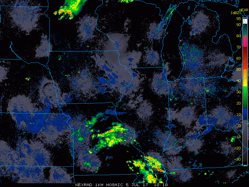
Through the day today, storms will develop south and central bringing a heavy rain and flooding threat.
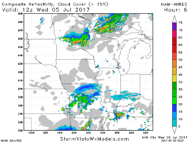
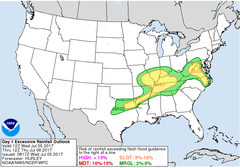
The WPC has issued a slight risk of flashing flooding today into tonight because of this.
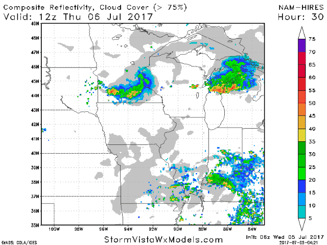
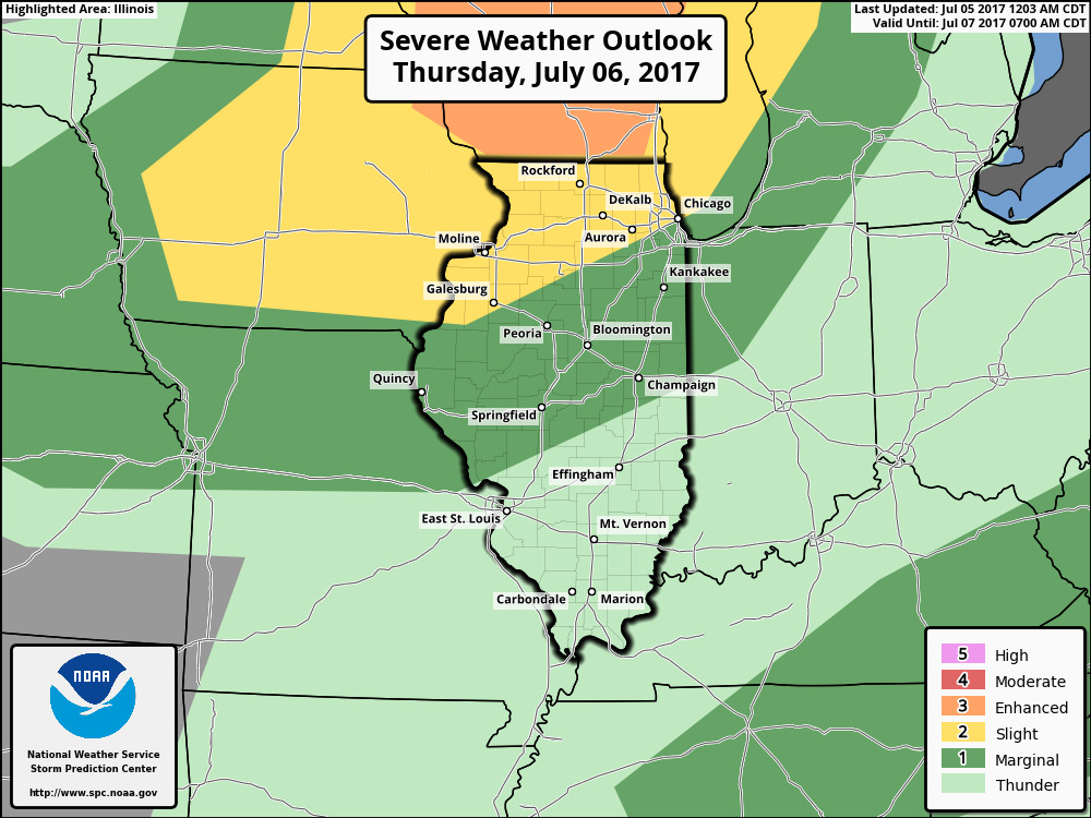
Additional severe risks exist tomorrow as a cold front moves through. Here’s the projected radar.
The SPC has issued a slight risk for northern Illinois as well.
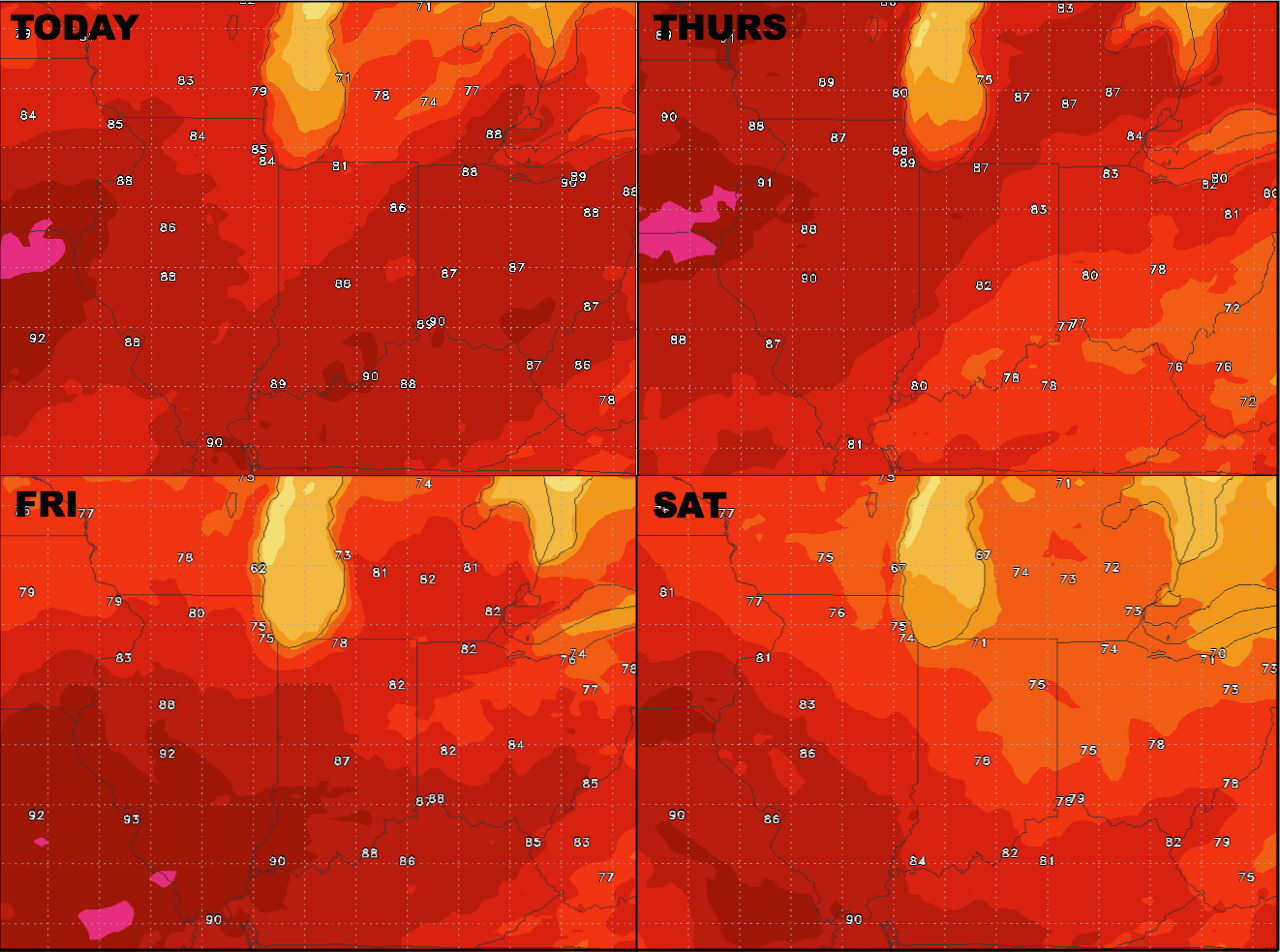
Temperatures end the work week warm, then trend cooler this weekend.
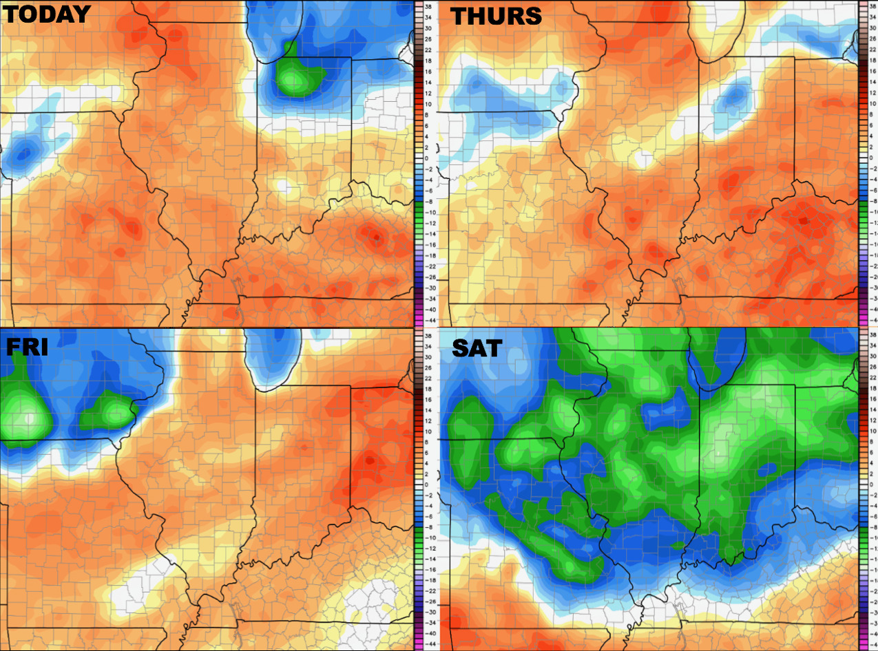
The same can be said for humidity levels.
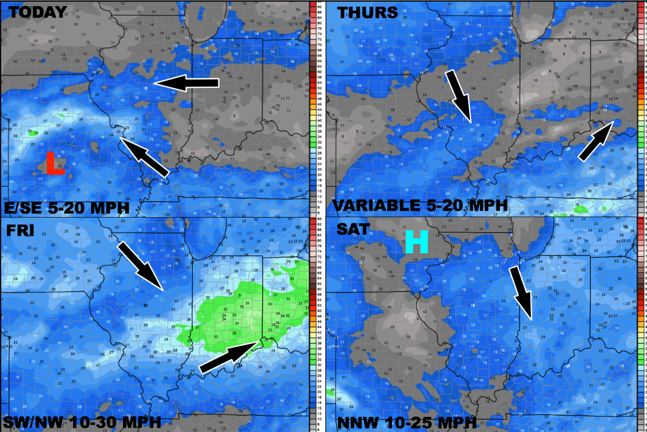
The wind forecast over the next 4 days is shown below.
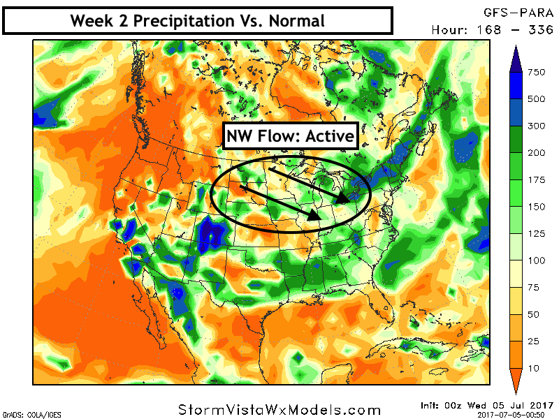
The pattern into week 2 looks to feature northwest flow and intermittently active conditions.
Confidence and Risks:
- Above average confidence in severe risks and drenching storm risks through Friday, but exact locations will be key to rainfall.
- Above average confidence in cooler than normal conditions this weekend.
- Increasing confidence in a northwest flow and intermittently active conditions across the region next week.
Today’s Video (6:45):