Key Points – Friday, February 17, 2017
Synopsis: Boy do we have a beautiful day ahead of us across the Midwest today with temperatures 20ºF+ above normal and plentiful sunshine expected as a warm front lifts north…winds will be out of the southwest at 5-25 mph. A very nice weekend continues to be the forecast with highs climbing into the 60s with plentiful sunshine…a stray shower is still possible across the southern half of our Zone on Saturday…0.10″ or less expected. The warmth continues into next week, also a few showers, maybe a couple rumbles of thunder are possible on Tuesday into Wednesday that we discuss in the video. Our main focus is still on a severe weather threat late next week (~next Friday), even some wintry weather on the backside of this system…it’s still early but all eyes are on this as we get closer. New European Weeklies came out last night as well, by week 3 we see a pretty decent shot of cold air sets back in…we are watching this cool down to last through about the first 10-15 days of March; we look at the rainfall totals over the next 46 days and it’s active, little doubt about that. We hope you all have a wonderful weekend, if you have any questions please let us know!
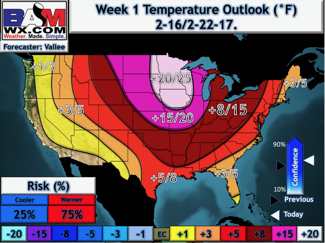
Major warmth expected today through next week…to put into perspective how warm, here’s our latest week 1 temperature departure map that we make in-house…incredible warmth given that it’s February not March or April.
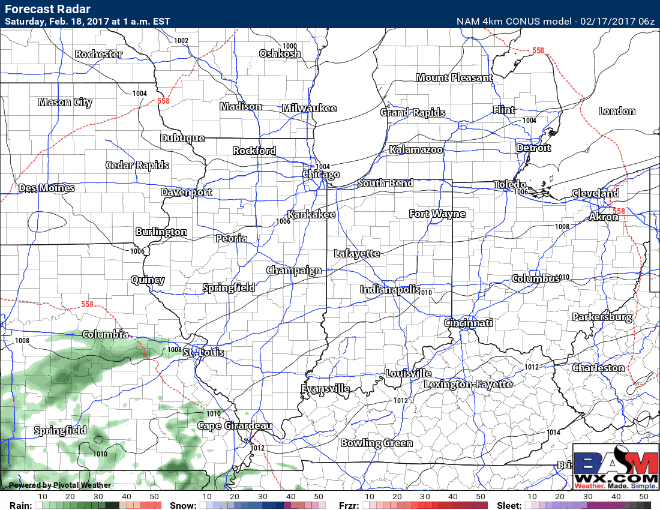
A few showers possible on Saturday across mainly the southern half of the Midwest, expected coverage to be 20-30% at best…rainfall totals ~0.1″ or less, so nothing impressive.
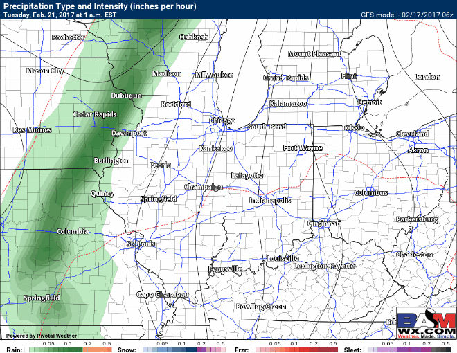
Our next opportunity for showers and a few rumbles of thunder comes Tuesday into Wednesday next week as shown well by the last GFS.
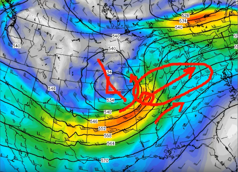
Attention then turns to a system we are watching VERY closely for severe weather late next week crossing into the Midwest…this dynamics of this system are very impressive at this point, it’s still a ways out so things can change, however we need to stay on top of this going forward. We also discuss in the video how there may be some wintry potential on the backside of this system as things cool down late month into March.
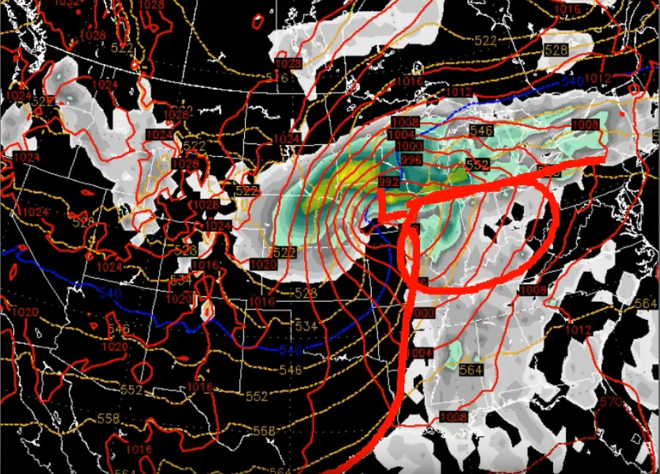
We discuss the impressive dynamics of this system, below is an illustration of this with winds above the surface at 500mb, where the Midwest to Ohio Valley is in very nice position for maximum lift in the exit region of the jet stream (in simpler terms, this look is favorable for strong to severe storms).
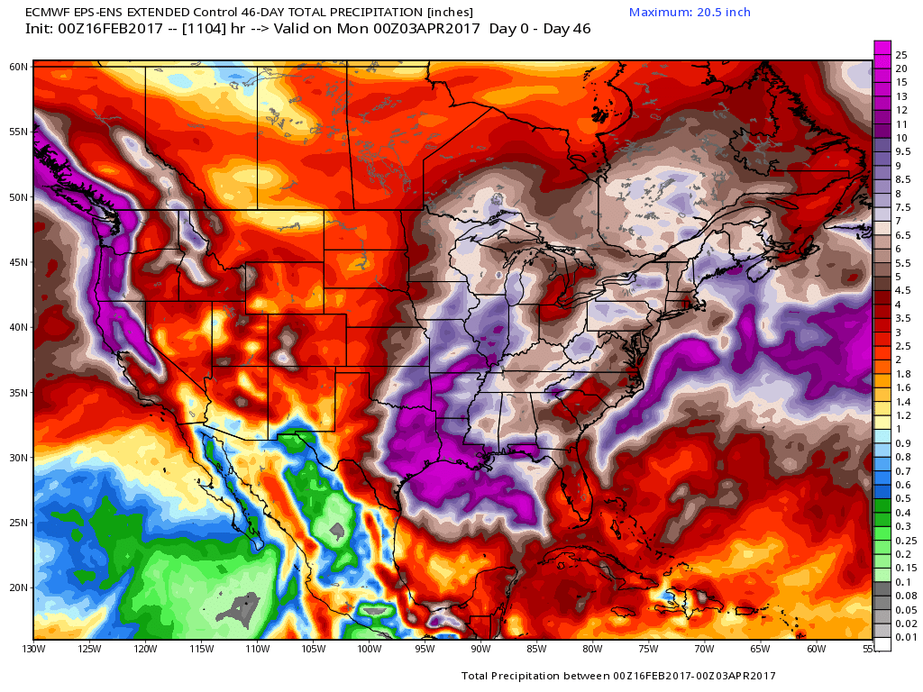
We discuss the long-range in today’s update as well as the new European Weeklies came out last night…we discuss in the video how we continue to see a cooler pattern return late month, even through the first 1-2 weeks of March; also, our latest data suggests we are very active into March, below is the European Control 46 day precipitation forecast…very wet. Exciting times ahead, make sure you stay tuned to the forecast!
Confidence and Risk:
- High confidence temperatures are very warm over the next week, at times 20ºF+ above normal.
- Increasing confidence of a few showers across the southern half of the Zones Saturday.
- Increasing confidence of showers and a few rumbles of thunder possible on Tuesday as another disturbance moves through the Midwest.
- Increasing confidence of strong severe storms late next week, and even potential wintry weather on the backside of the system.
Today’s video (~7 min):