Key Points – Tuesday, April 11, 2017:
Synopsis: Good Tuesday morning! We discuss the remaining showers to the south and east today, the pleasant conditions setting into mid-week before our next rain chances Thursday into the weekend (some gusty winds possible Saturday as well); we continue the above normal warmth trend into this weekend with temps into the 70s and even some locations hitting 80. Have a great day!
Current Radar:
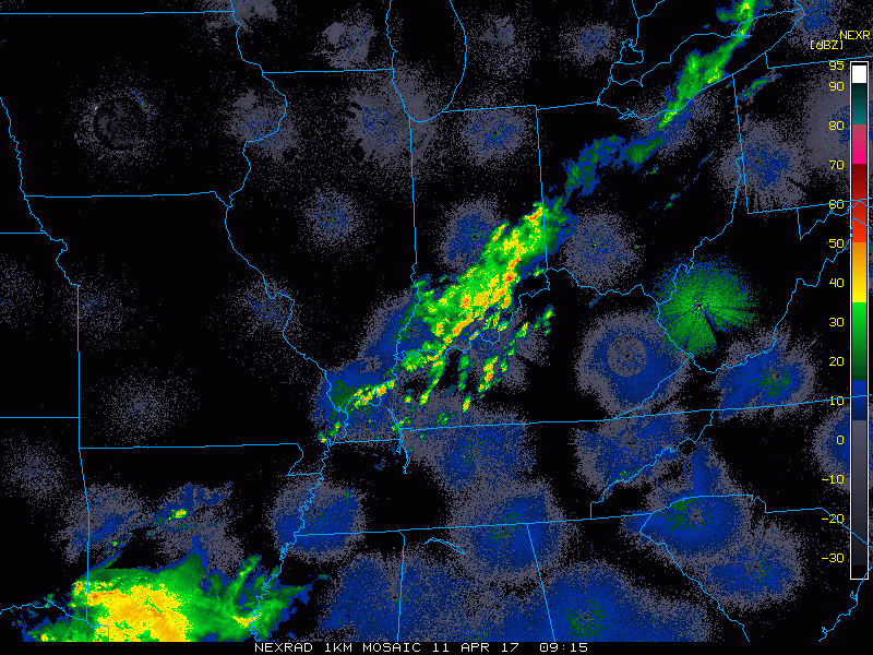
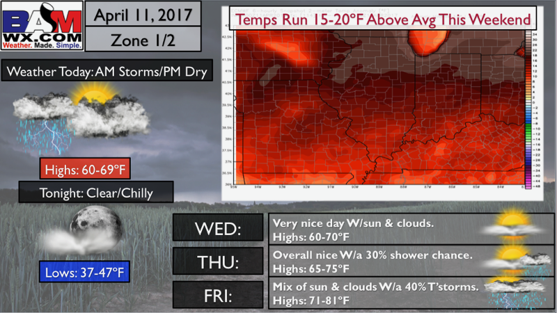
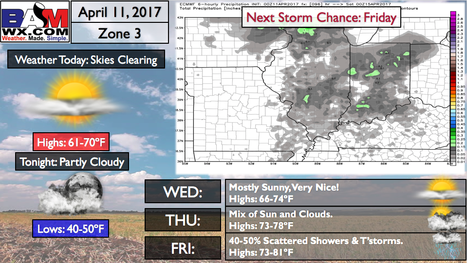
Simulated radar of showers and clouds hanging around south and east today, otherwise most of the Midwest to the north and west stay dry and see some sunshine as well.
Next chance for showers and a few rumbles of thunder comes Thursday into Friday morning mainly north of I-70, will be scattered in nature ~30-40%. We start the warming trend on Thursday as we get in on southeast winds as well.
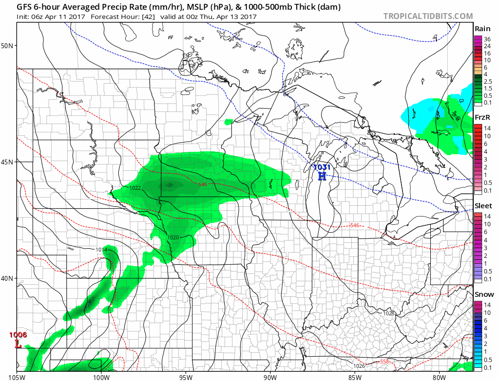
Friday the warm front moves in and lifts northward, rain and t’storms will able to breakout along that front ~30-40% from Ohio to Indiana up through Illinois and Iowa.
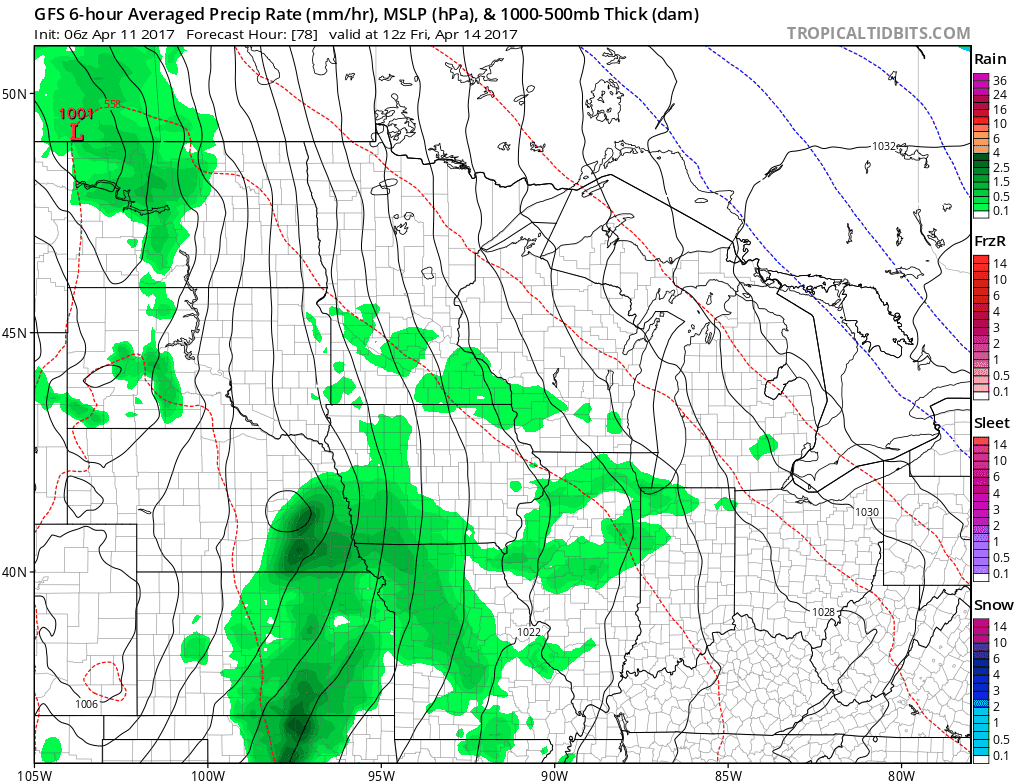
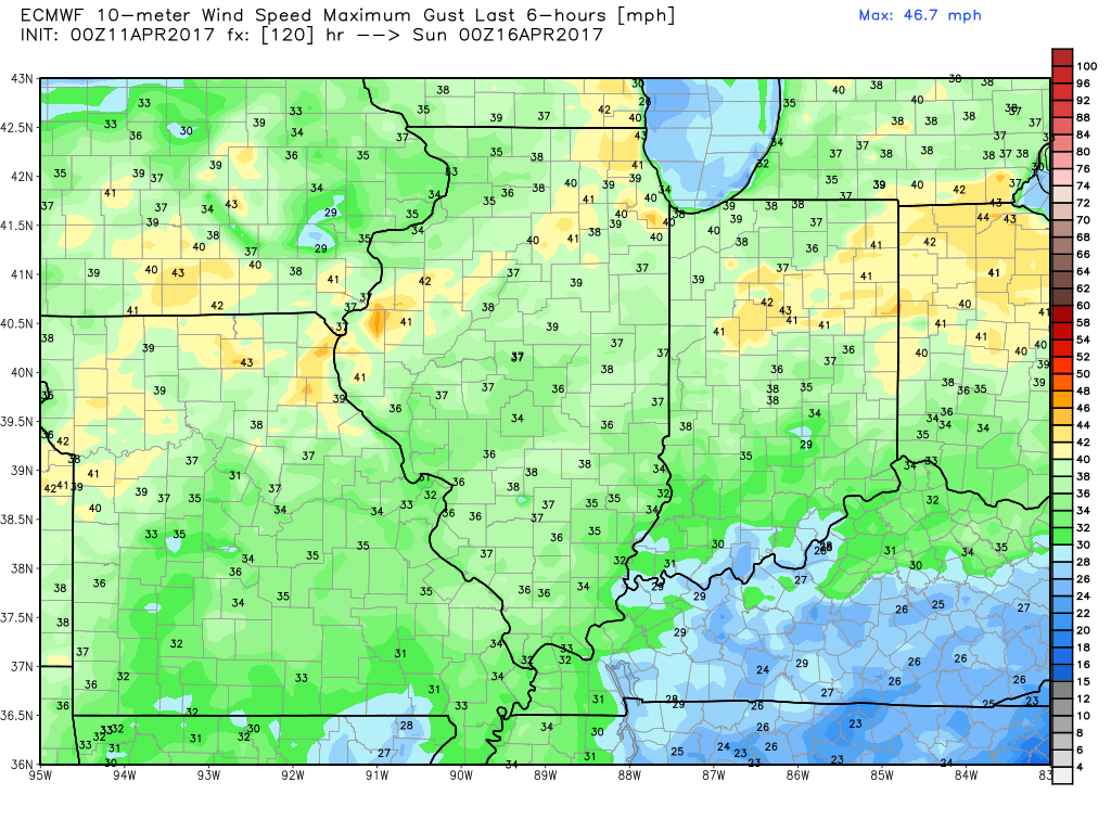
Gusty winds up to 30-40mph possible on Saturday out of the southwest as well.
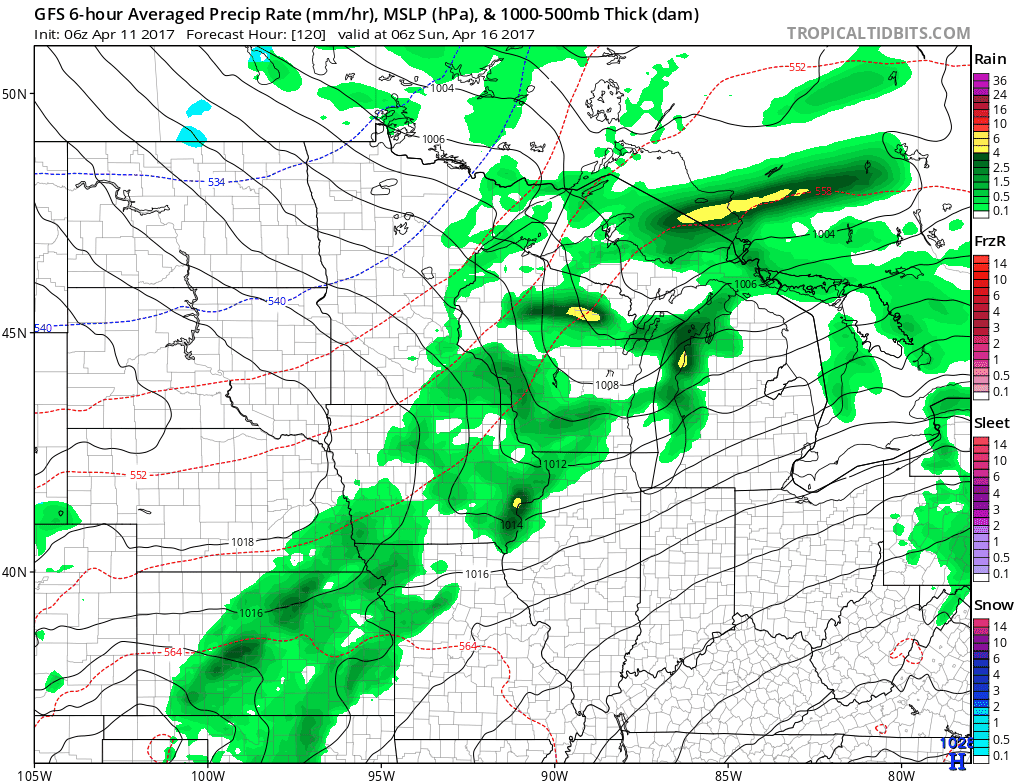
Weekend storms…Sunday like starts dry and then our next disturbance moves in throughout the day into Monday morning…watching for some moderate to heavy rainfall in this threat as well…check back.
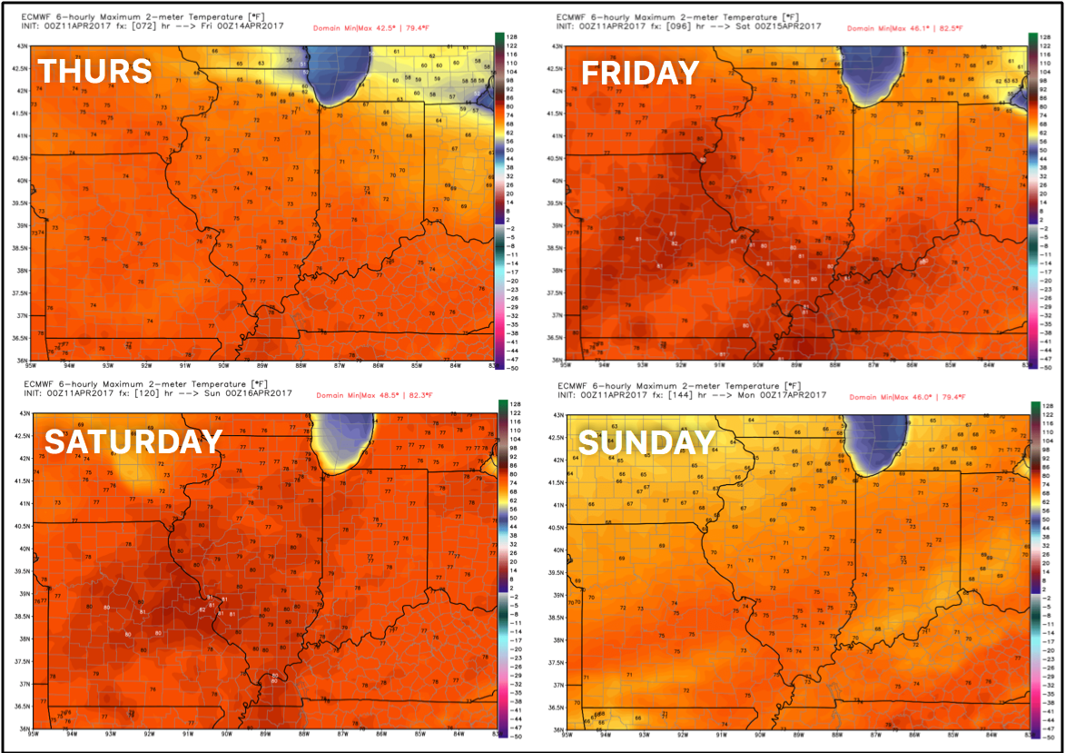
Very warm Thursday into the weekend well into the 70s and even a few 80s possible on Friday and Saturday.
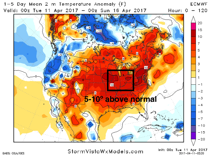
Temps over the next 5 days way above normal continue to run very warm at 5-10ºF above normal.
Rainfall next 7 days from the latest GFS run lays down a widespread 1-2″ with isolated higher amounts possible through Tuesday.
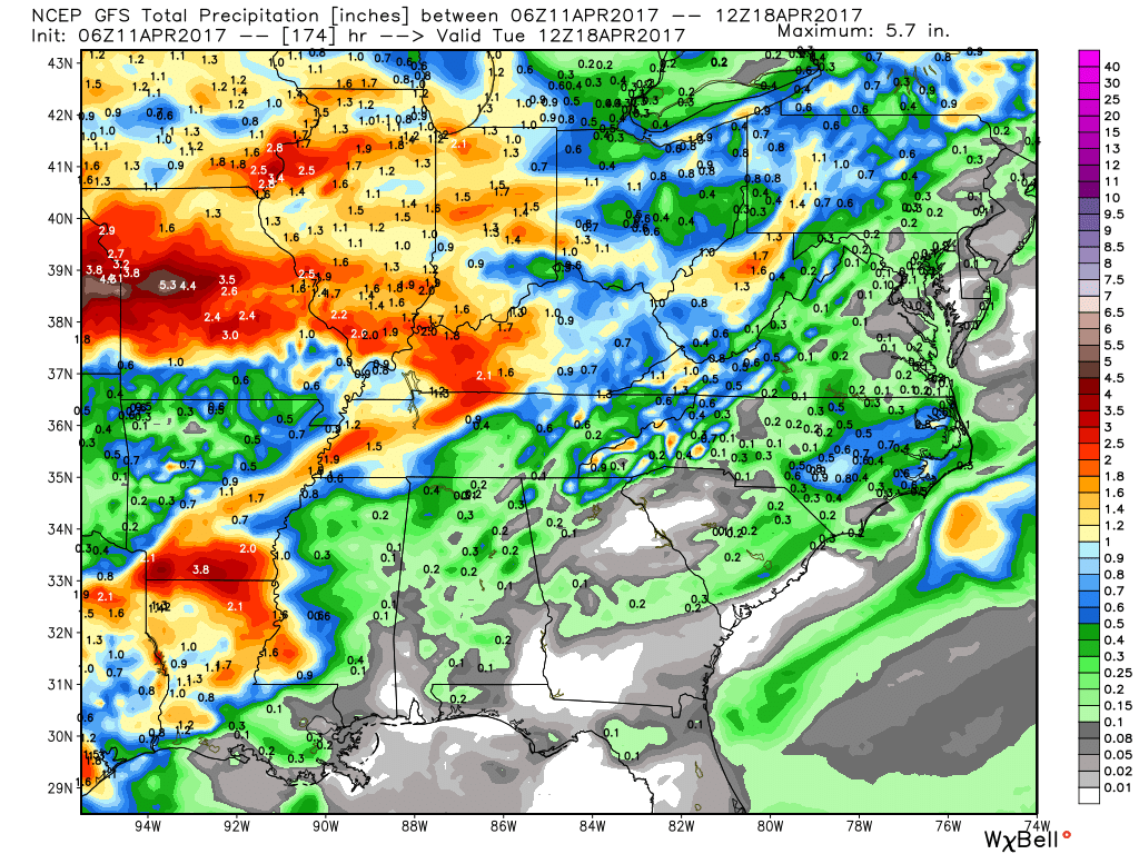
New Euro weeklies are very wet…and when compared the CFS v2 over the next 46 days, the placement of the heaviest rains are almost spot on as well into the Midwest and into the Ag Belt.

Zone 1/2 Quickest:
Zone 3 Quickest:
Zone 4 Quickcast:

Confidence and Risk:
- Above average confidence showers remain south and east today across the Zones, meanwhile sunshine pops to the north and west.
- Above average confidence our next shower chance comes Thursday especially to the west and north.
- Above average confidence we have multiple scattered rain threats Friday into the weekend with some storms possible too.
- Average risk we see some wind gusts topping 35mph+ on Saturday.
- High confidence we are overall above normal in temperatures over the next 5 days into the weekend.
Today’s video (7 min):