#ILwx #INwx #OHwx Targeting multiple waves of storms & heavy rains through the wknd. K.
Synopsis: Good Wednesday afternoon! Storms are starting to fire across the Midwest today, we time everything out in the video as we have multiple waves of storms possible through the weekend along with heavy rainfall potential…highly volatile forecast here. If you have any questions please don’t hesitate to reach out.
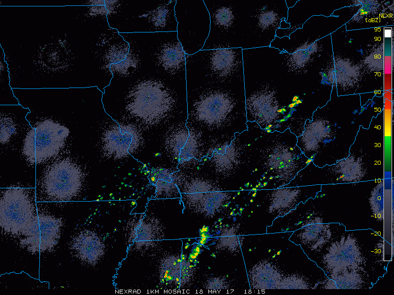
Current Radar:
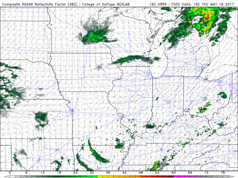
Simulated radar through tomorrow morning…coverage is ~40% for scattered storms the rest of the day, can’t rule out a strong storm as well with some gusty winds and hail.
Simulated radar from Friday morning through the weekend via the latest 3km-NAM…targeting multiple waves of storms…everything is timed out in the video.
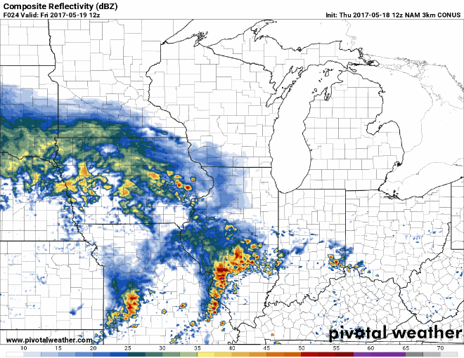
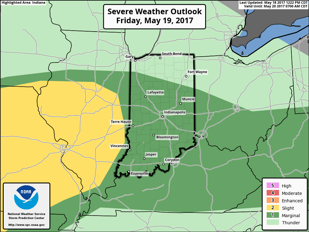
Strong storms possible on the day on Friday. Main risks will be damaging winds and isolated large hail with some heavy rainfall possible.
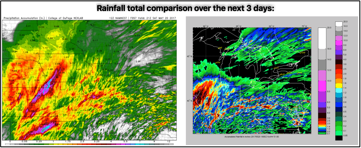
Thoughts on total rainfall…here’s a good comparison that shows scattered 2-3″+ rainfall totals over the next 3 days. It should be noted that not everyone gets in on the heavy rains as it’ll be the haves and the have-nots.
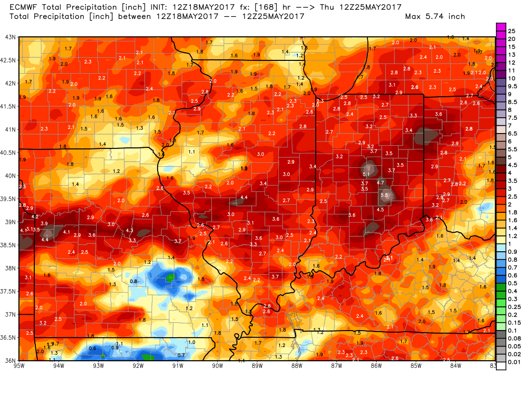
New European model data is in this afternoon with a very wet look over the next 7 days…shouldn’t surprise us as we’ve been discussing how active the pattern will be getting later in the month.
Confidence:
- Above average confidence scattered t’storms continue tonight across the Midwest, especially along a frontal boundary.
- Lower confidence on a strong storm here as well with some gusty winds and hail possible.
- Above average confidence another wave of showers and storms moves east early Friday morning and throughout the day.
- Increasing confidence on widespread heavy rains next 7 days.
Today’s video (6 min):