Key Points – Friday, March 24, 2017
Synopsis: Good Friday morning and thanks for checking out today’s forecast! Windy, warm with increasing cloud cover throughout the day today, we increase the threat for showers and thunderstorms overnight into the weekend where we remain warm as well…can’t rule out a few some heavier storms with some gusty winds. We stay warm into next week with multiple shower and storm chances…the European has widespread 2-3″ of rainfall over the next 10 days, needlesstosay we stay active…welcome to Springtime in the Midwest.
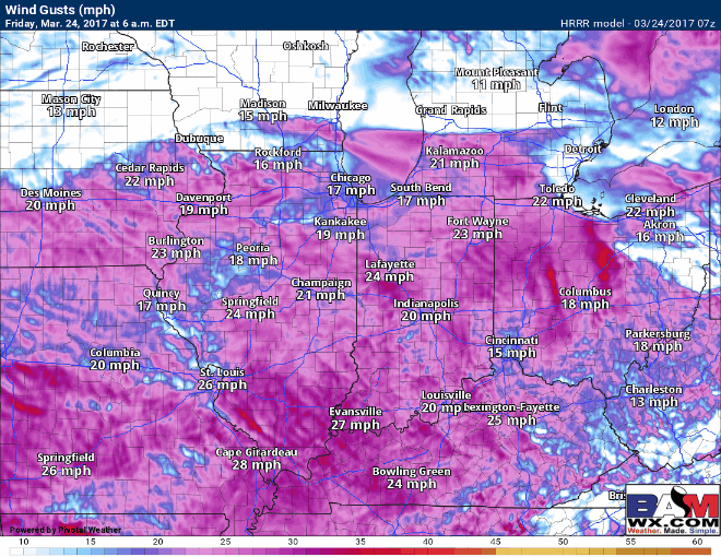
Windy today with winds out of the southwest gusting up to 40+mph at times.
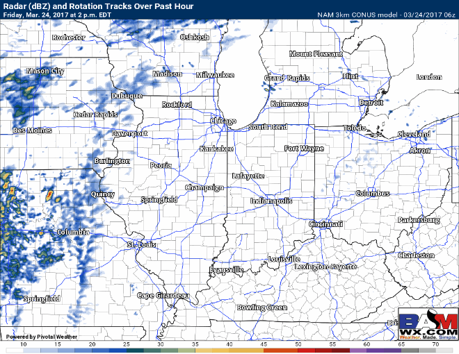
Showers increase from west to east by later afternoon into the overnight as the low pressure moves into the Midwest. We time things out in the video.
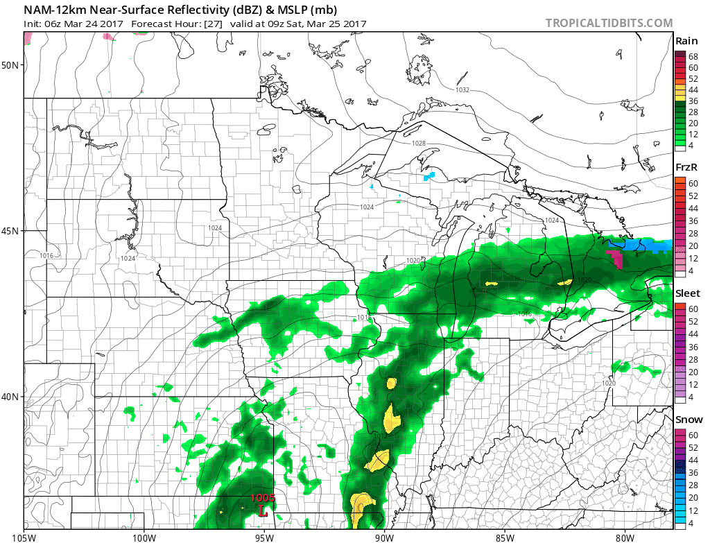
The showers and storms continue through Saturday and Sunday keeping most folks wet, some storms could be heavy at times with gusty winds. This isn’t necessarily a washout type of event, but as you can see below the low pressure hangs around the Midwest and isn’t too eager to leave which keeps coverage higher for showers.
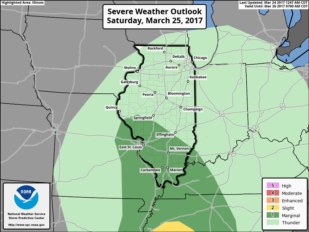
Can’t rule out a few strong storms Saturday across southern IL and southern IN as well with some gusty winds, heavy rains even some small hail.
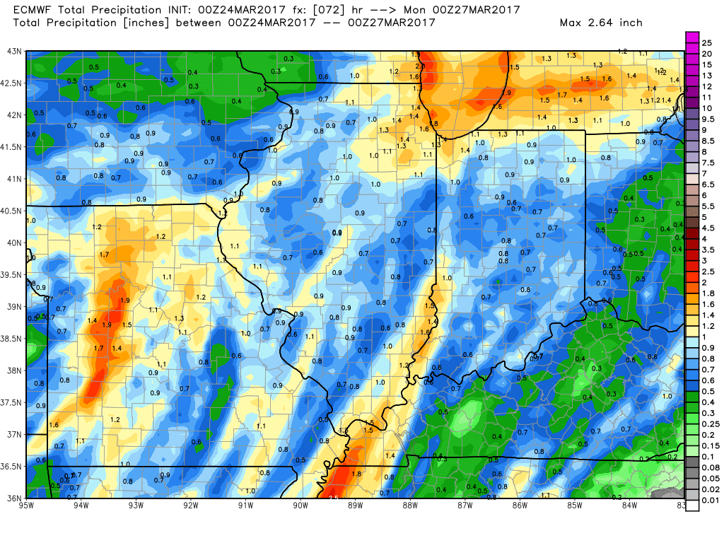
Here’s a look at total rainfall from the European model through Monday…some spots will get in on 1.0″+ of rainfall.
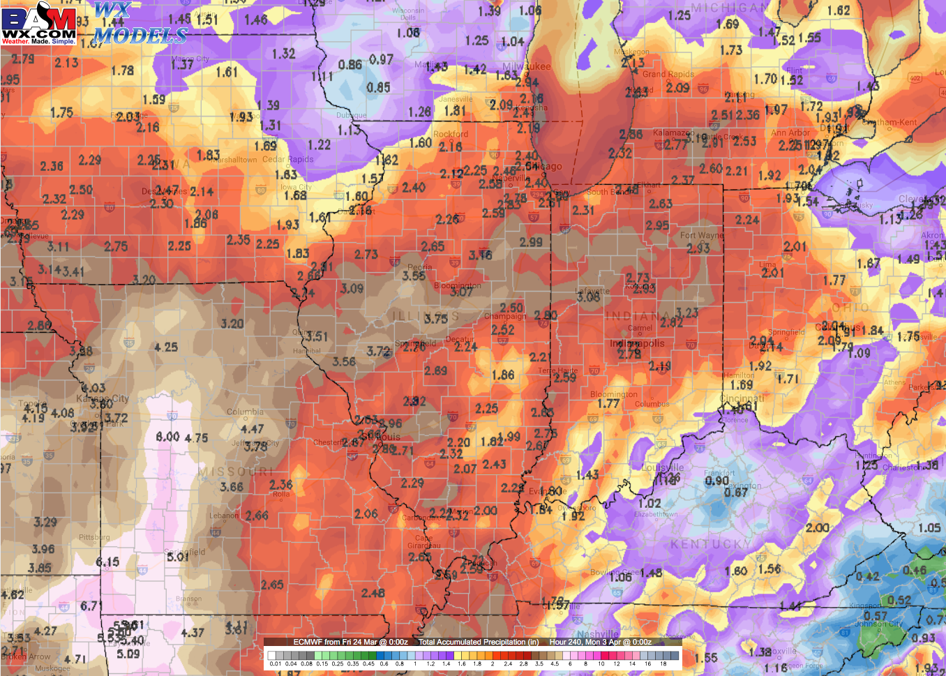
We discuss in the video multiple rain and storm chances next week every 2-3 days…this is the “very active pattern” that we’ve been into the ground. We continue to see troughs (areas of low pressure) running into ridges (areas of high pressure) through the next 2 weeks so this pattern is here to stay for a while.
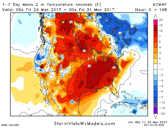
Very warm over the next 7 days on average with most of the Midwest 10ºF+ above normal which equates to a lot of 60s+ ahead!
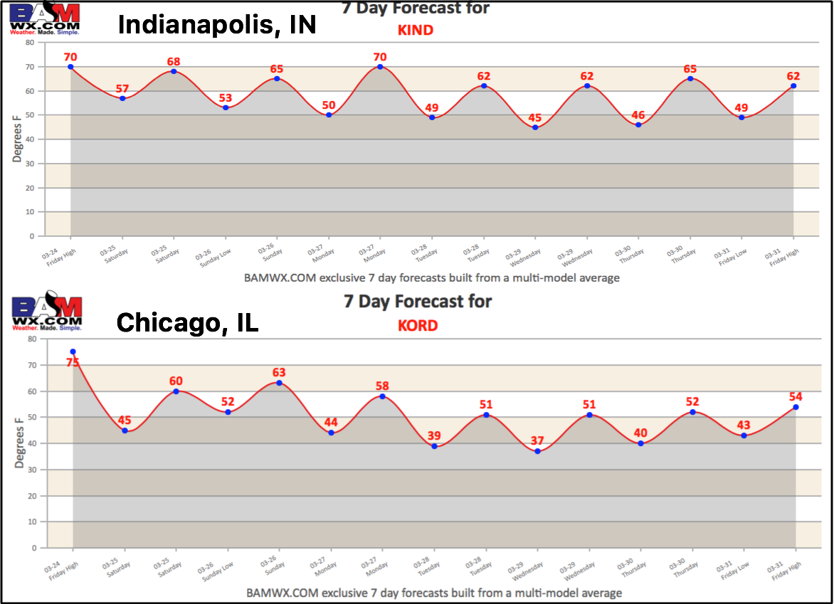
Today’s 7-day forecasts featured from Indianapolis and Chicago!
Confidence and Risk:
- High confidence we are warm and windy across the Midwest today with gusts over 40 mph out of the southwest possible.
- High confidence of a wet and warm weekend as well with showers and thunderstorms likely.
- Above average confidence we continue these rain/storm chances into next week with ~3 separate systems forecast
- High confidence we are above normal in the temperature department over the next week.
Today’s video (6 min):