Key Points – Thursday, March 16, 2017:
Synopsis: Hey good Thursday morning and thanks for checking out the latest forecast update! Today we discuss our next chance for precipitation overnight into Friday, the weekend forecast as well as a chance for multiple disturbances next week that could bring us a chance for showers and storms even.
Chance for showers increases later tonight into Friday…I discuss in the video that some initial wintry precipitation on the leading edge of this disturbance is possible, but the warm air and rain trailing right behind will overcome this as it progresses east. Can’t rule out a few slick spots, but at this time I’m not too concerned with the threat.
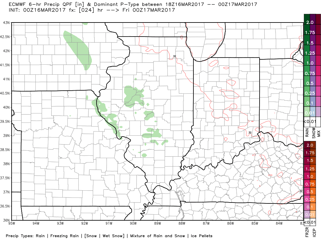
In terms of rainfall totals, we are forecasting 0.1-0.25″ will be possible.
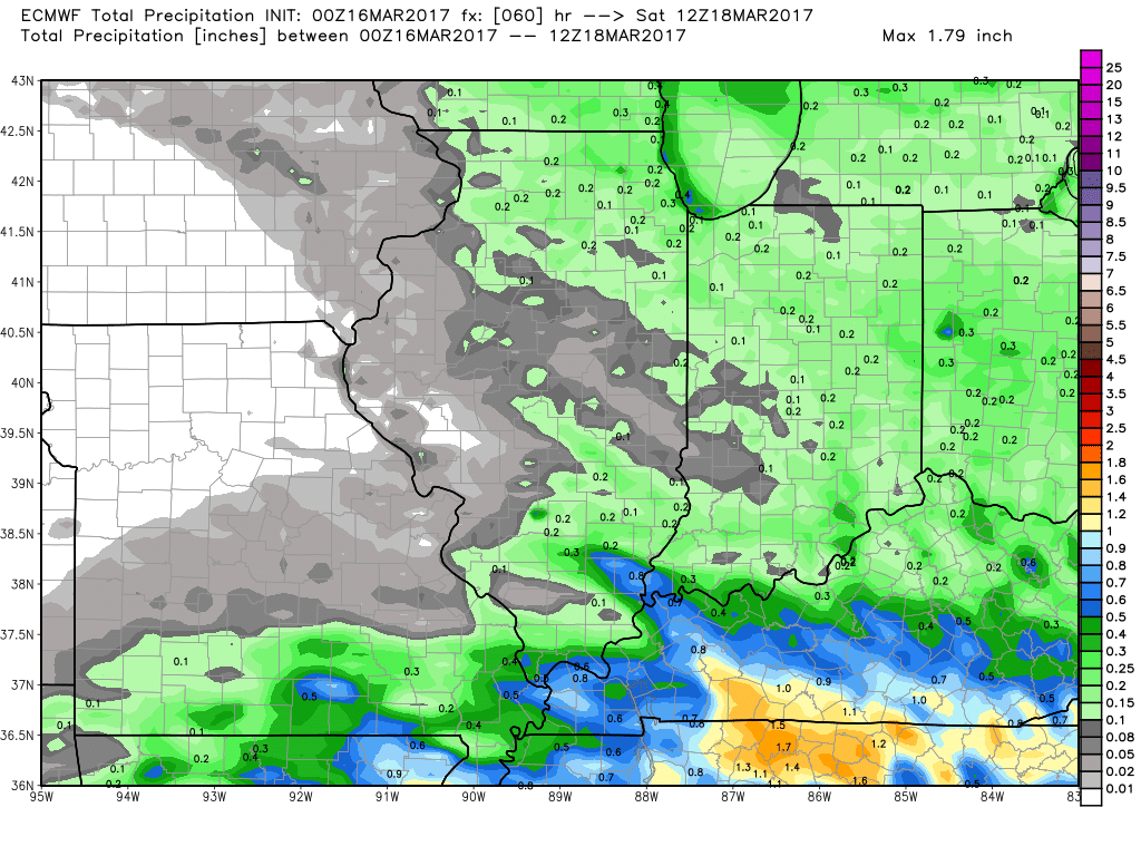
Our next chance for more widespread showers even a few storms comes early next week as a warm front lifts into the midwest.
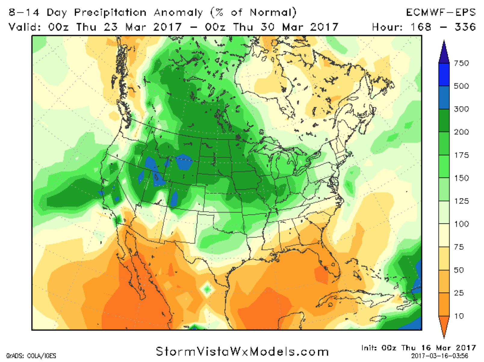
As we get more into the 6-10 day and week 2 timeframe, we can really start to see our activity and probability for above normal rainfall increase…we discuss in the video how we relate that to the pacific jet extension increasing…we will touch more on this in the long-range later this morning!
Confidence and Risk:
- Above average confidence the Midwest sees partly to mostly sunny skies today.
- Above average confidence in the timing of our showers later tonight through Friday.
- Increasing confidence of a chance for showers and a few storms lifting off of a warm front early next week.
- Average but increasing confidence the pattern gets progressively more active and wet into next week as well.
Today’s video (6 min):