#ILwx #INwx #OHwx Mon Short-term: Targeting heavy rainfall through mid-week. K.
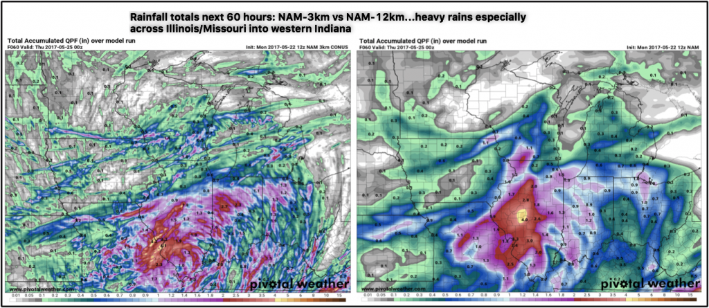
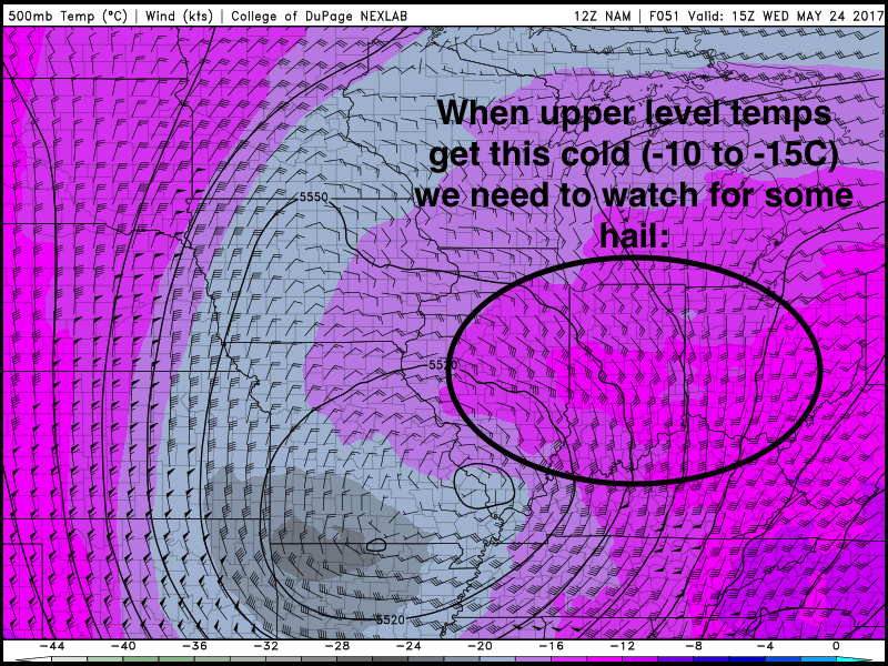
Synopsis: Good Monday afternoon! We watch rain work in across Illinois tonight through Tuesday morning before Tuesday evening into Wednesday a more widespread rain maker starts to move in. What starts to happen is the low pressure starts to sit and spin into mid-week due to the nature of an upper-level low…wouldn’t be shocked to see some small hail on the day on Wednesday which is common with an upper-level low. Some very heavy rainfall totals will be possible over the next 3 days, we think there will be areas getting 3-4″ when it’s all said and done. There is still a little variability in the data as to the exact location of where the heaviest rain sets up, you’ll need to check back often with this.
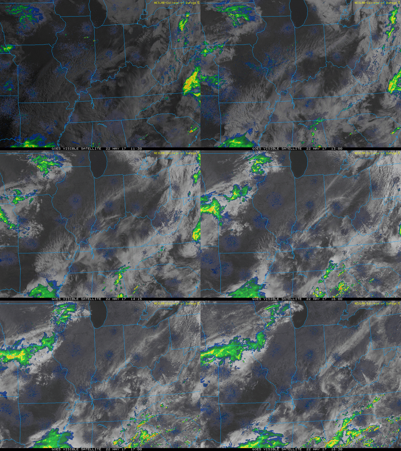
Current Radar:
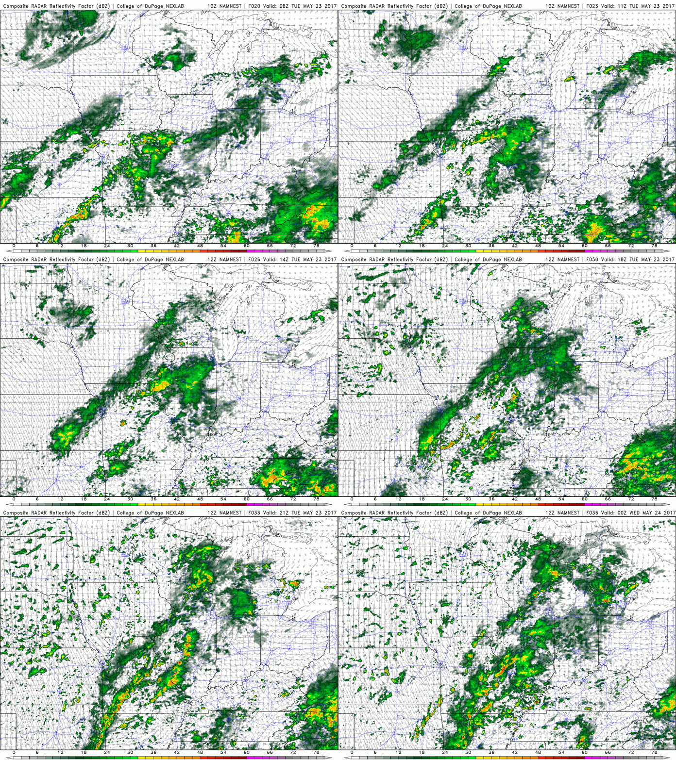
Simulated radar through Tuesday…the main focus of the rainfall will be across eastern Iowa into Illinois and then creeps into Indiana by the daytime hours on Tuesday. Locations in Ohio largely stay drier through Tuesday with some sunshine.
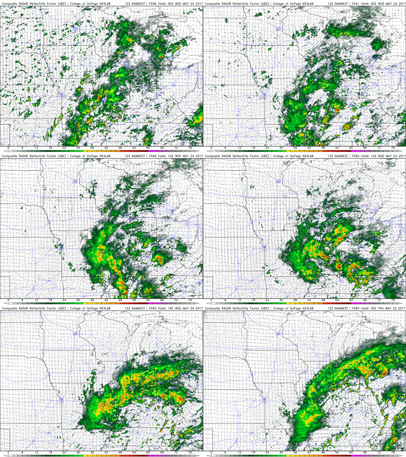
Simulated radar through Wednesday into Thursday is when we are targeting more widespread rainfall across the Midwest with some small hail possible…rainfall will likely be heavy at times as well.
Total rainfall comparison…we think when this system finally moves out of here later on Thursday that some locations will end up with 3-4″. With that being said, data is still varying on where this exactly sets up, so check back often.
Common with upper-level lows for there to be small hail, we outlined the risks below.
Confidence:
- Above average confidence showers and a few storms stay mainly across Iowa into Illinois today through Tuesday.
- Average confidence of scatters showers and storms on the day on Tuesday across Indiana and western Ohio.
- Above average confidence of heavier rains working in late Tuesday into Wednesday across the Midwest.
- Lower confidence in exactly where the heaviest rainfall sets up as data is differing slightly.
Today’s video (5 min):
