#ILwx #INwx #OHwx Mon Short-term:
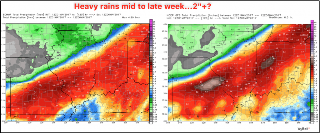
Synopsis: Good Monday afternoon! It’s quite windy out there with gusts topping 40 mph in some locations as discussed! Today’s video we mention the sizable shift in the data north and west more aligned with this morning’s GFS…bringing in a wide swath of 2-3″ across the Midwest mid-week…not a good situation for those folks who are already saturated.
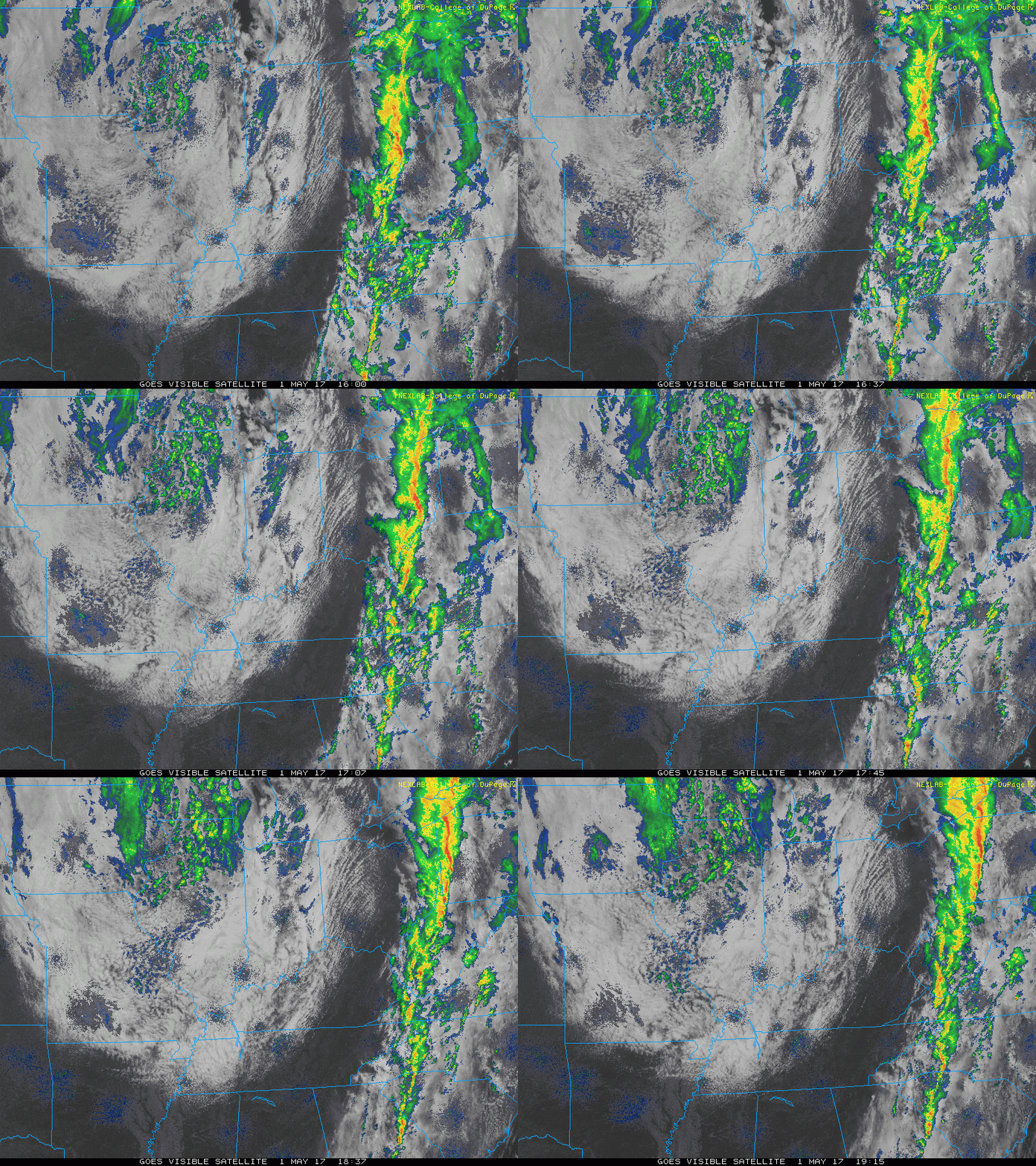
Current radar:
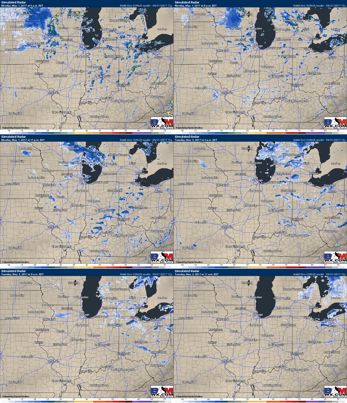
Simulated radar…expecting 30-40% coverage of showers through Tuesday morning before clearing off to the east giving way to some sunshine.
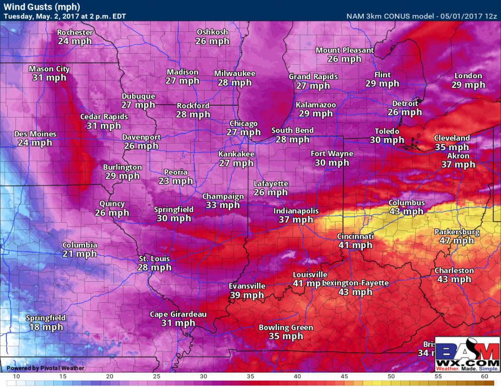
Wind gusts into Tuesday topping 40mph will be possible once again.
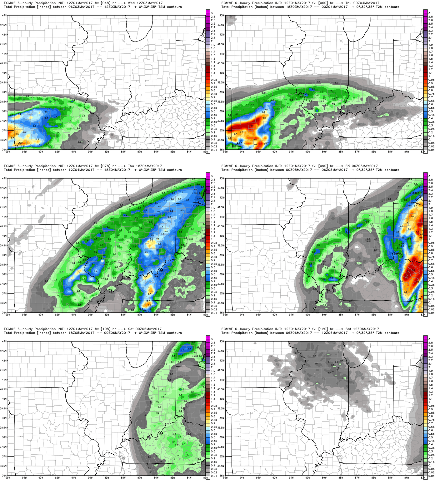
GFS and European now more aligned for Wednesday through Friday system…some embedded storms will be possible, but overall it’s another heavy rainmaker across areas that are already soaking wet.
Current thoughts on rainfall totals with a widespread swath of 2-3″…not good for folks who are currently saturated from the weekend rainfall.
Confidence and Risk:
- Above average confidence of scattered showers remaining across the Midwest through Tuesday morning before clearing east.
- Average risk of wind gusts topping 40+mph again on Tuesday.
- Average confidence now of the low pressure system track Wednesday into Friday.
- Average risk we see an additional swath of 2″+ mid to late week as well from this pressure system.
Today’s video (5 min):
