Key Points – Thursday, February 16, 2017
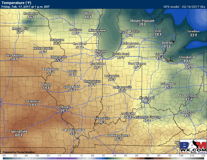
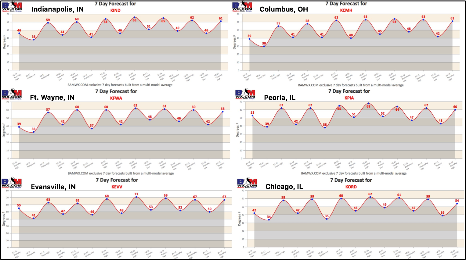
- Synopsis: Good Thursday morning and thanks for checking out the latest BAMwx.com forecast update! A mix of sun and clouds expected today, warmer especially to the west with highs in the 40s and 50s mainly…slight cooler north and east with a few locations remaining in the 30s. Winds will mainly be out of the southwest from 5-15 mph, a few gusts of ~20mph will be possible throughout the day as well. Very nice conditions settle in Friday into the weekend, with plentiful sunshine expected and highs climbing near or above 60º for many…even a few 70s wouldn’t be shocking to the south closer to the Ohio River. Models still indicate a few isolated showers possible Saturday with the main focus on our southern and eastern locations…these would be very light in nature likely less than 0.1″. We continue to forecast major above normal warmth to start the new week, our next chance for rain across the Midwest moves from west to east early to mid next week…models are still trying to sort things about so confidence right now is average. Our focus turns to a system we have been keeping very close eyes on next Friday into Saturday that has severe weather potential written all over it as discussed in the video….obviously it’s quite a ways out, things could change, but it’s a signal we have to monitor. Cooler times to end February and open up March are still on the table as well as we’ve been discussing for weeks using our organic forecasted methods. Have a wonderful Thursday, if you have any questions please let us know.
Fire up the grill this weekend, it’s going to be warm and nice!
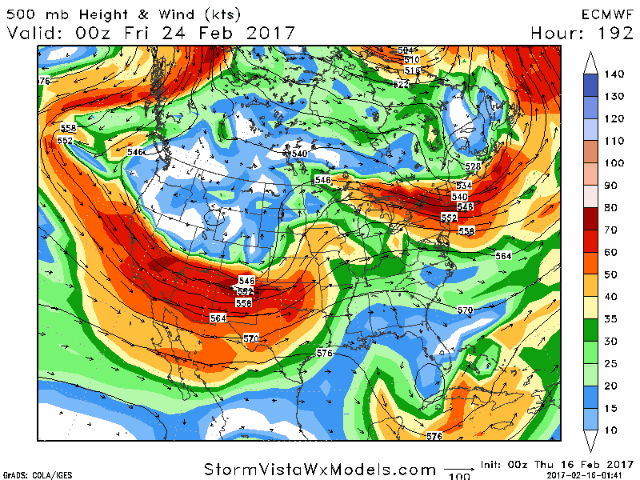
Watching for a severe weather threat next Friday into Saturday impacting Midwest locations, we discuss the impressive ingredients in the video but make sure to stay tuned to the forecast going forward.
Still watching for a cooler pattern to settle back in later February and to open up March…we’ve been discussing this pattern to return after the major warmth for quite some time, and it’s nice to see our model data to start reflecting this.

7-day forecast across the Midwest…major warmth settles in over the next week.
Confidence and Risk:
- High confidence temps begin to climb way above normal Friday through next week.
- Average confidence in a few showers across our southern Zone locations later on Saturday.
- Increasing confidence of severe weather potential late next week into the weekend.
- Increasing confidence of a return to cooler to end February and usher in March.
Today’s video (7 min):