#ILwx #INwx #OHwx Latest update on strong to severe storms today into tonight. K.
Synopsis: We are stilling watching for the potential for strong to severe storms this afternoon into tonight with a damaging wind, isolated large hail, and heavy rainfall threat.
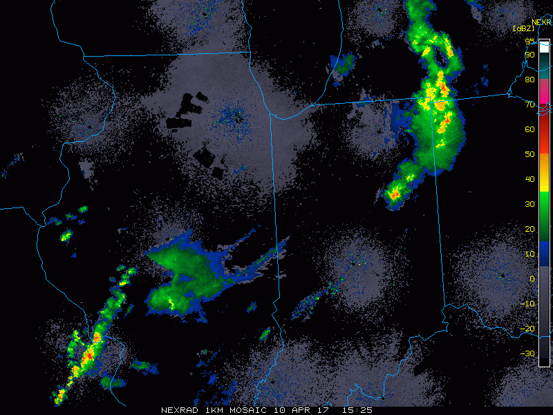
Current Radar:
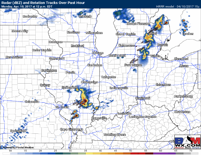
Latest simulated radar product…watching for a nice cluster of storms from ~3-5pmEDT across Illinois into western Indiana moving eastward throughout the evening. The main hazards will be damaging winds and isolated large hail, with a very small isolated tornado. Some localized heavy rainfall will also be possible.
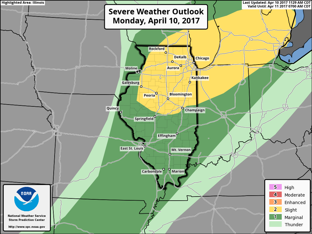
Latest SPC Outlook…overall we largely agree, although we could see storms forming outside of the slight risk (yellow) to the south well into the marginal risk (green).
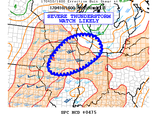
New Mesoscale Discussion…we wouldn’t be shocked to see the watch a little further south of this based on current simulated radar and data trends.
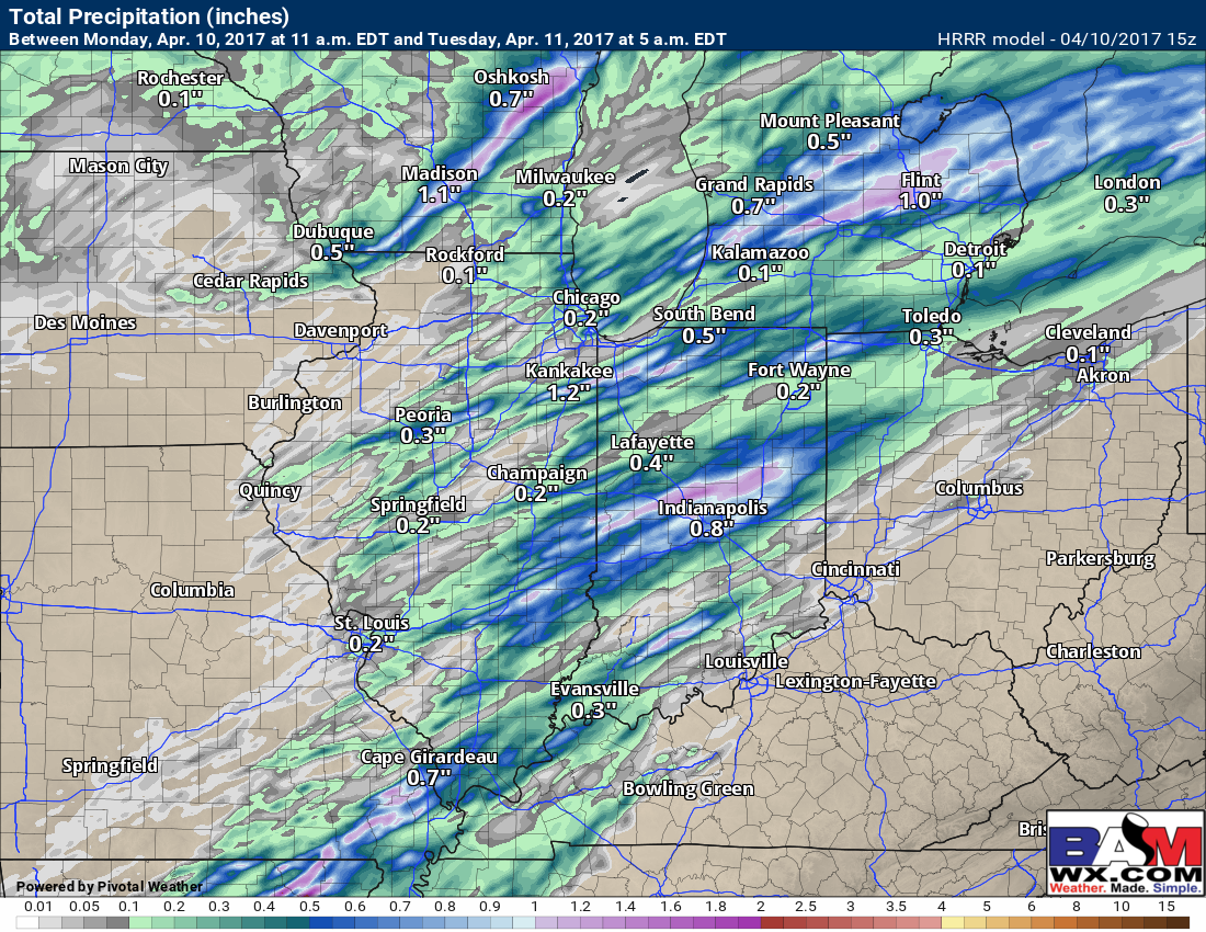
Total rainfall…from central IN through western Ohio we are watching for a swath of 1-2″ of localized heavy rainfall from this event.
Today’s video (5 min):