Key Points – Monday, July 24, 2017:
Synopsis: Good Monday morning! Today we discuss the quiet weather to begin the week, but getting into mid-week unsettled weather, including potential strong storms, moves east along a cold front we need to watch closely. Temperatures will be much cooler, overall, compared to last week…especially for the last week of July. If you have any questions, please let us know…have a blessed day!
Today’s Video (6 min):
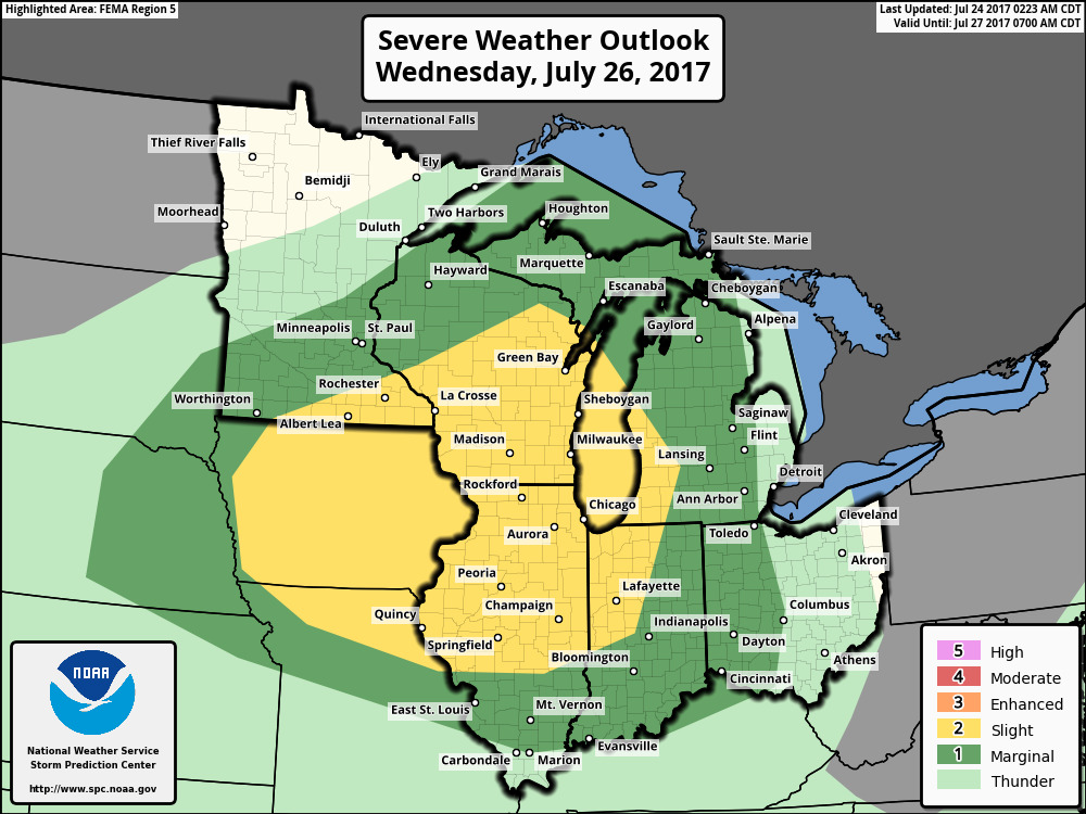
Relatively calm next couple of days, watching for some scattered storms across the far southern forecast area locations closer to the River…next more widespread chance for storms comes Wednesday evening into Thursday along along a cold front…as seen below, strong storms will be possible along with isolated flash flooding.
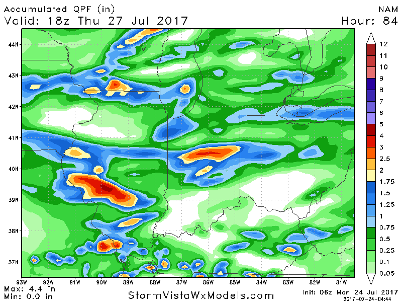
Guidance on rainfall accumulation over the next 4 days…the take away here is 1-3″ with isolated higher amounts (especially west) will be possible. With that being said, not everyone will cash in on these rains, some locations unfortunately will remain drier.
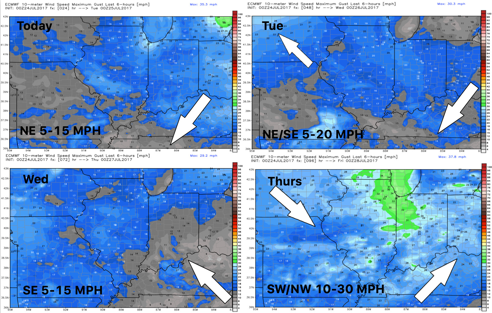
Wind forecast next 4 days:
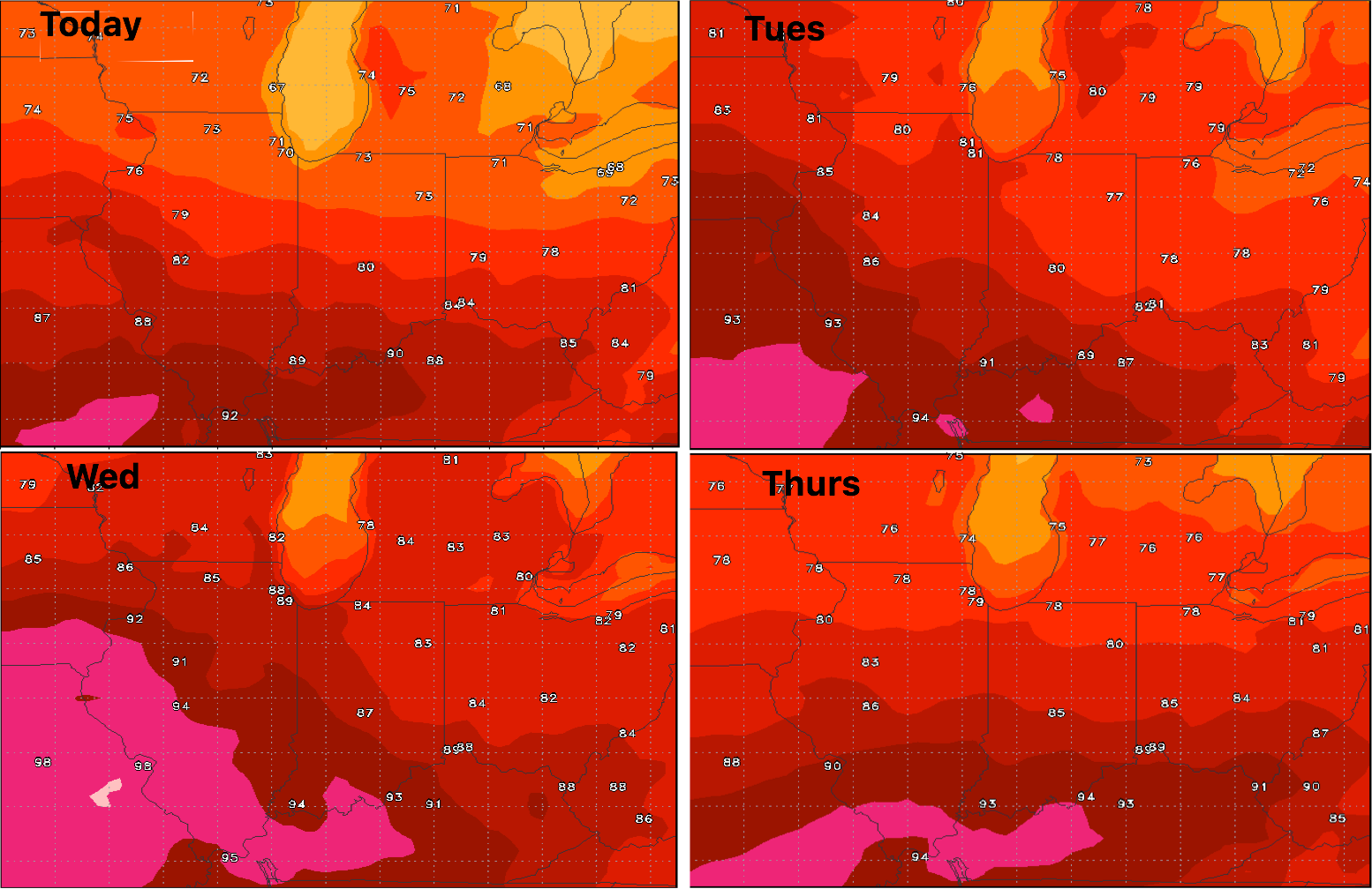
High temperature guidance into mid-week:
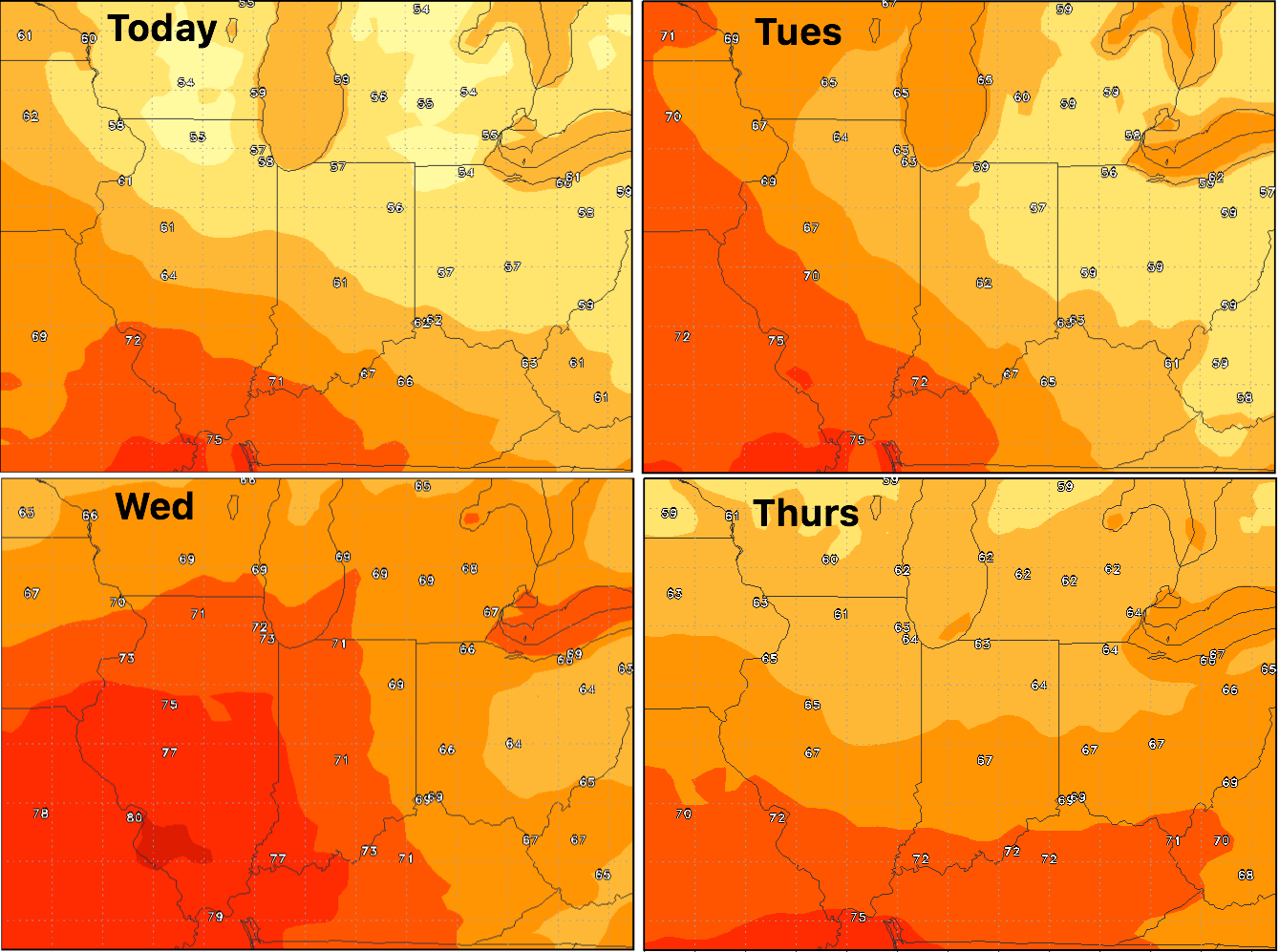
Overnight lows guidance:
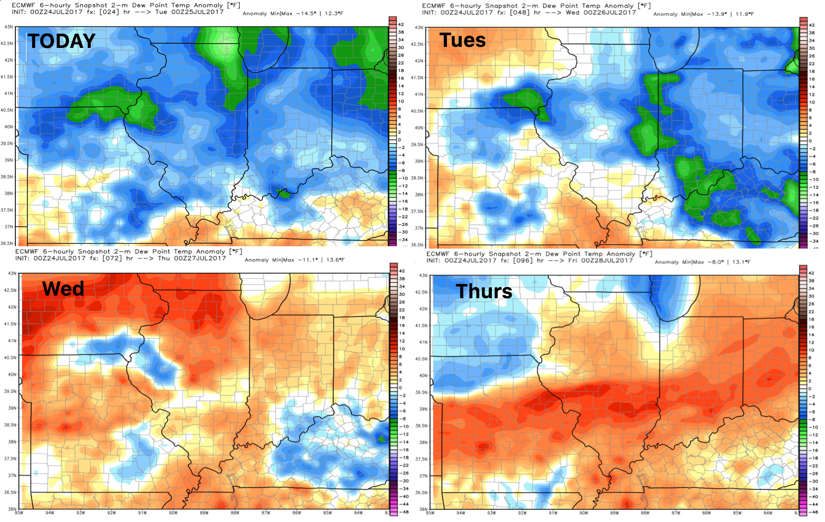
Dew points from normal: